Belcher is a village in Caddo Parish, Louisiana, United States. The population was 263 at the 2010 census. It is part of the Shreveport- Bossier city metropolitan statistical area.
| Name: | Belcher village |
|---|---|
| LSAD Code: | 47 |
| LSAD Description: | village (suffix) |
| State: | Louisiana |
| County: | Caddo Parish |
| Elevation: | 187 ft (57 m) |
| Total Area: | 1.57 sq mi (4.08 km²) |
| Land Area: | 1.57 sq mi (4.08 km²) |
| Water Area: | 0.00 sq mi (0.00 km²) |
| Total Population: | 248 |
| Population Density: | 157.56/sq mi (60.82/km²) |
| Area code: | 318 |
| FIPS code: | 2205945 |
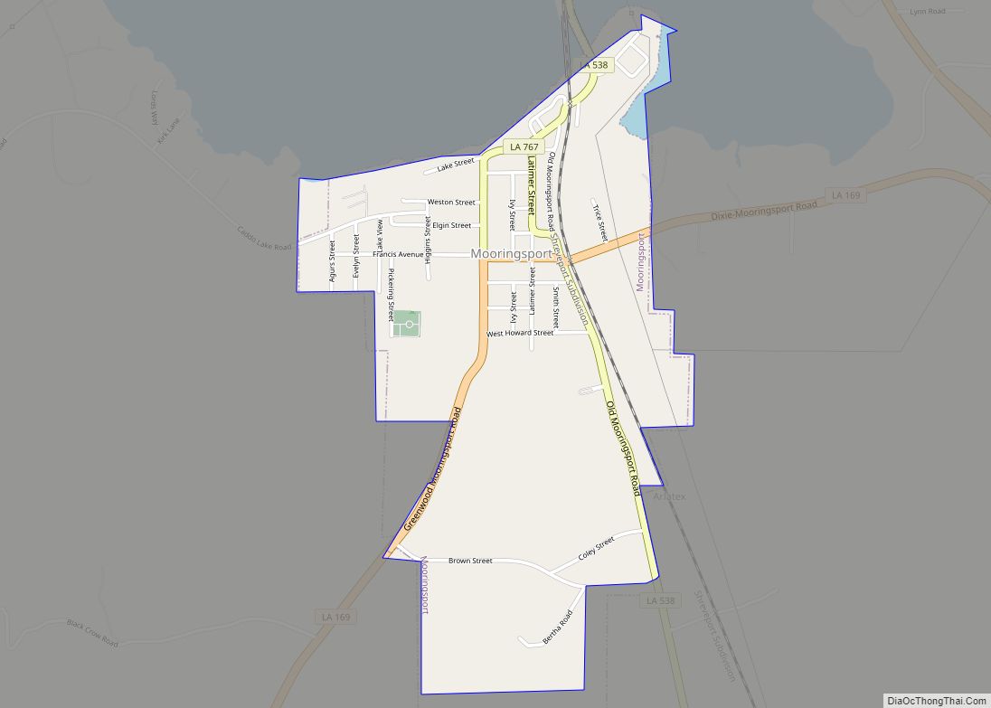
Online Interactive Map
Click on ![]() to view map in "full screen" mode.
to view map in "full screen" mode.
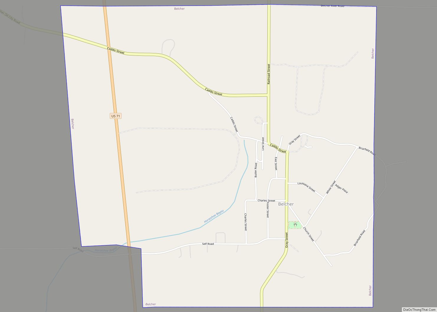
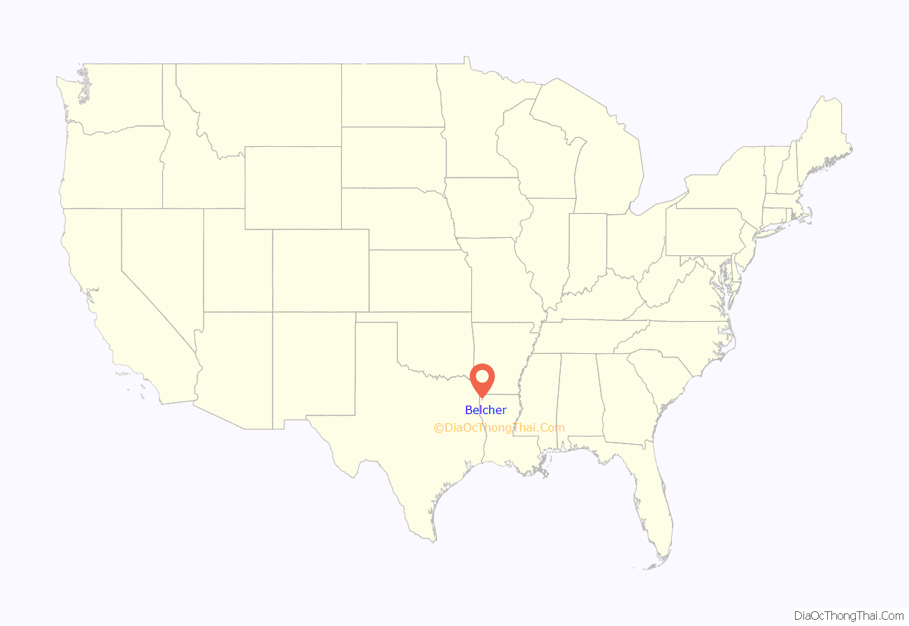
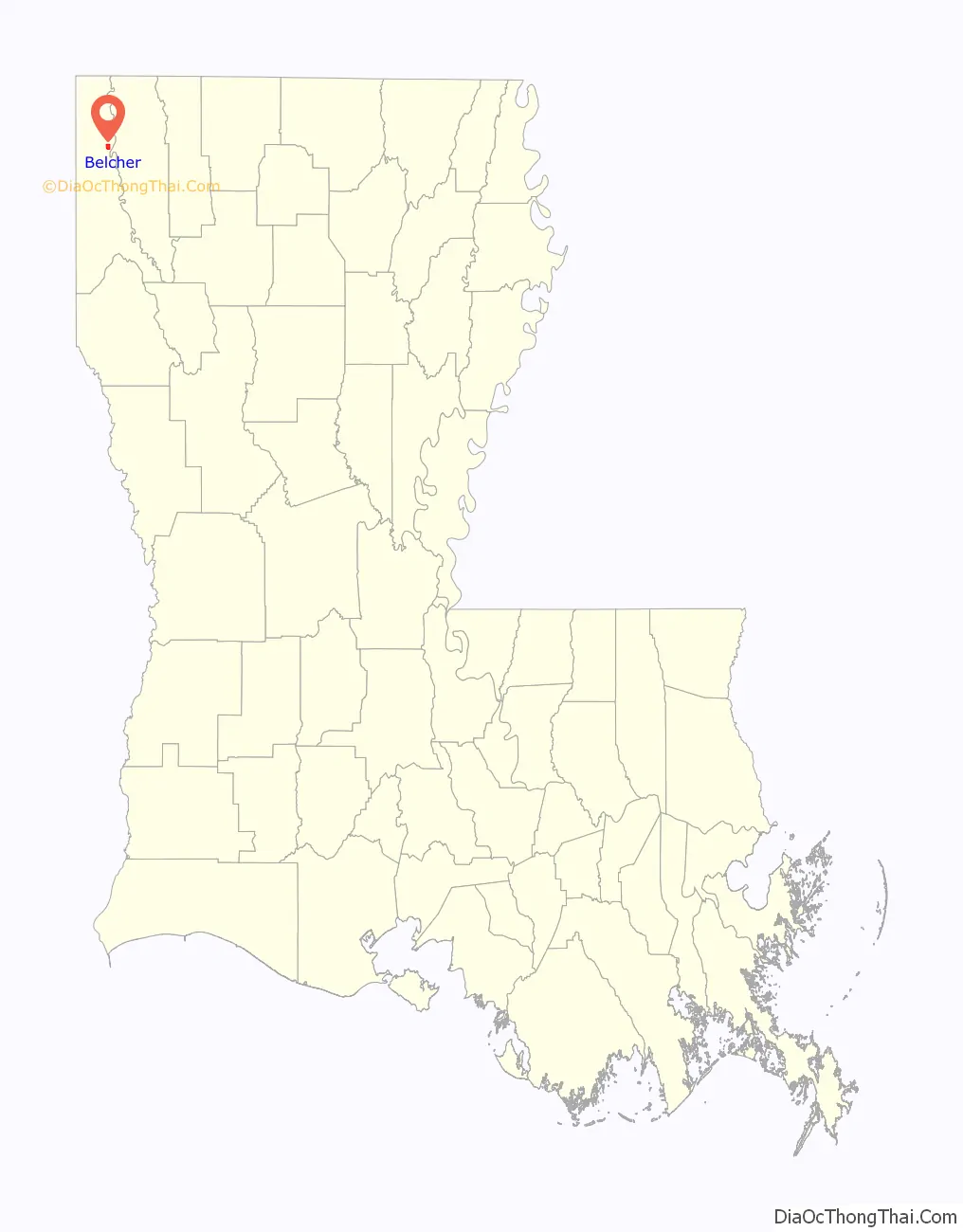
Belcher location map. Where is Belcher village?
History
Previously named Horseshoe after the bayou that runs through the town, Belcher was renamed in 1899 after James Clinton Belcher, a former confederate soldier and overseer of Wild Lucia plantation.
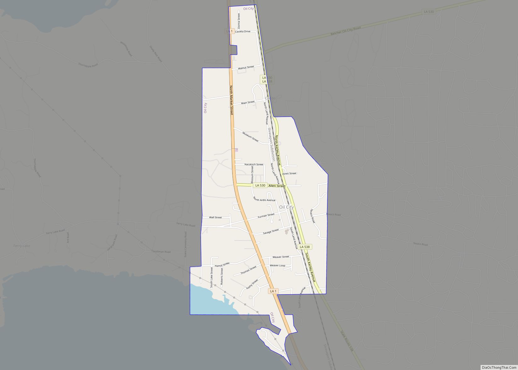
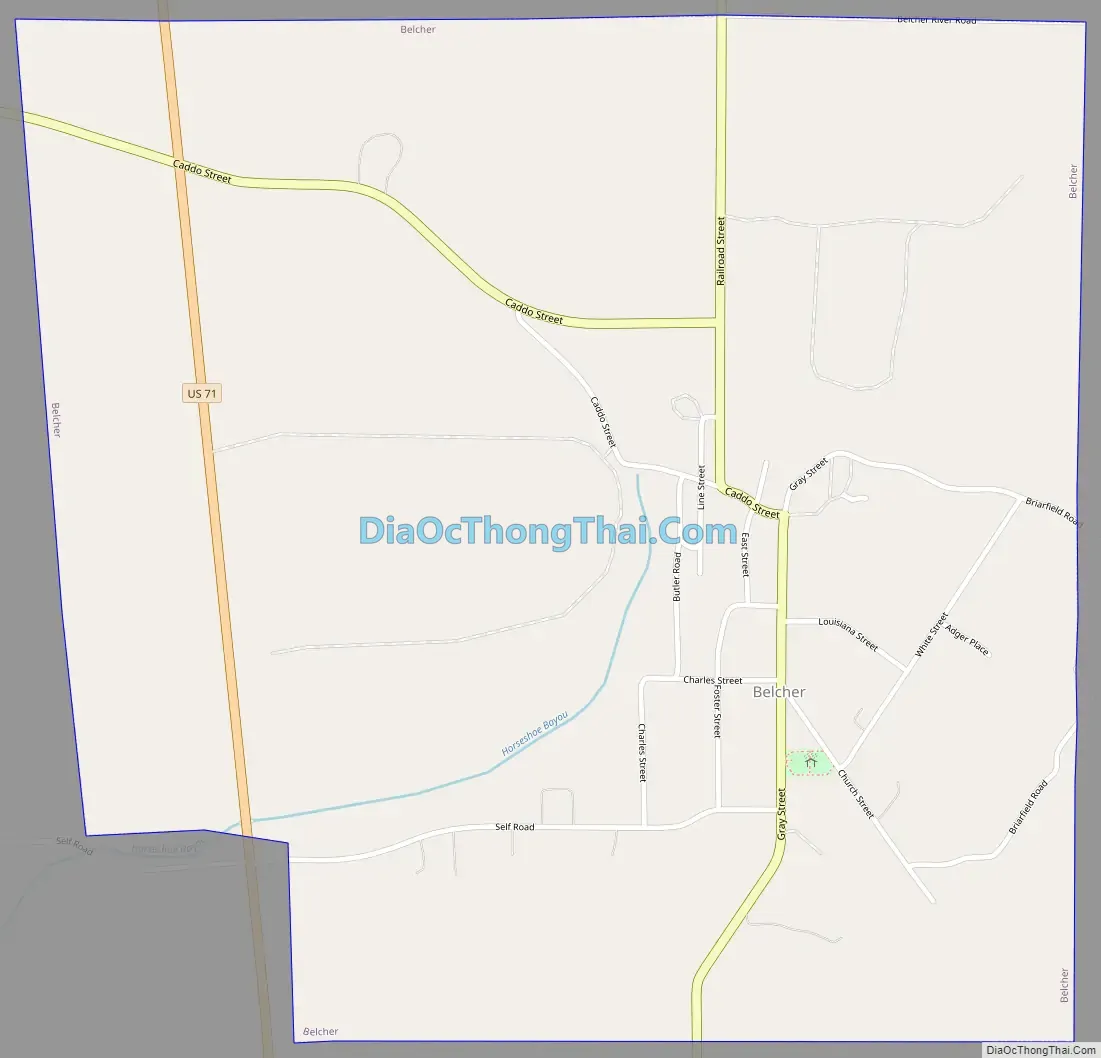
Belcher Road Map
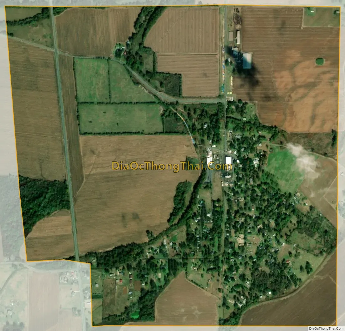
Belcher city Satellite Map
Geography
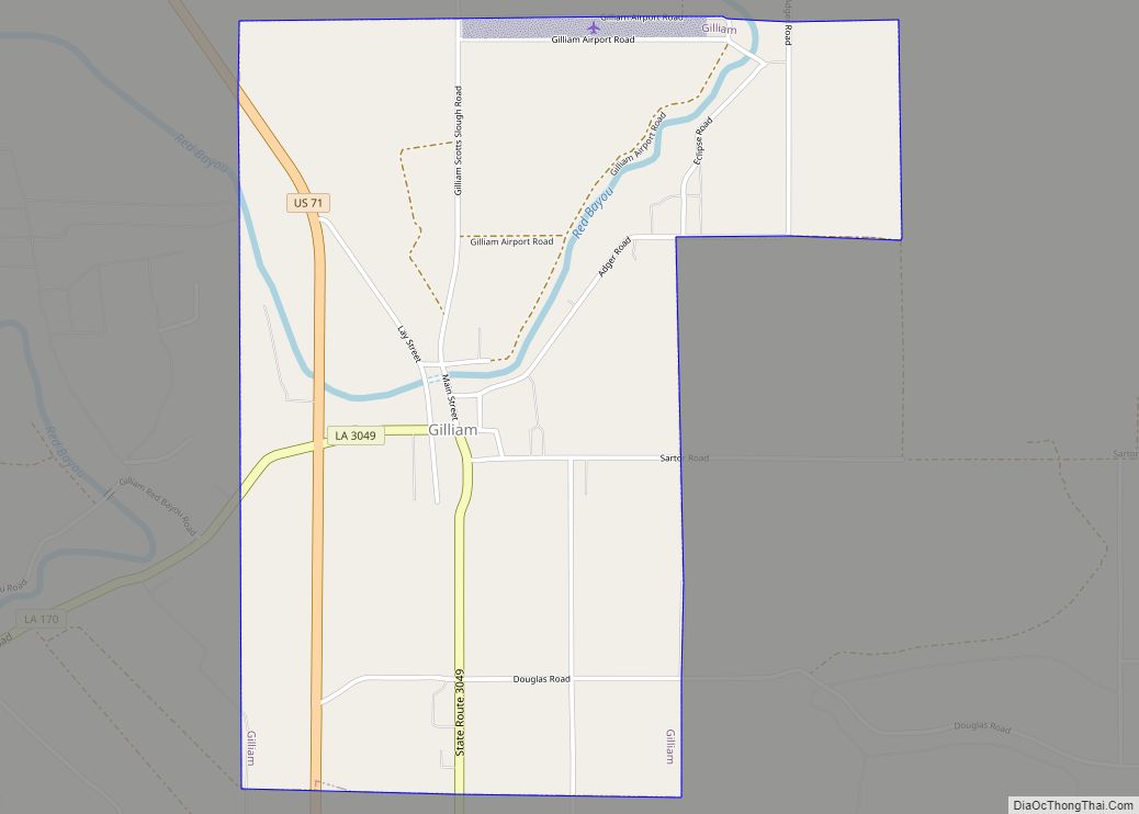
Belcher is located in northeastern Caddo Parish at 32°45′2″N 93°50′2″W / 32.75056°N 93.83389°W / 32.75056; -93.83389 (32.750518, -93.833772), less than 1 mile (1.6 km) northwest of the Red River. U.S. Route 71 passes through the western side of the village, leading north 5 miles (8 km) to Gilliam and south 17 miles (27 km) to Shreveport. Interstate 49 at Exit 228 is 3 miles (5 km) west of the center of town.
According to the United States Census Bureau, Belcher has a total area of 1.56 square miles (4.04 km), all land.
See also
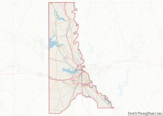
Map of Louisiana State and its subdivision:- Acadia
- Allen
- Ascension
- Assumption
- Avoyelles
- Beauregard
- Bienville
- Bossier
- Caddo
- Calcasieu
- Caldwell
- Cameron
- Catahoula
- Claiborne
- Concordia
- De Soto
- East Baton Rouge
- East Carroll
- East Feliciana
- Evangeline
- Franklin
- Grant
- Iberia
- Iberville
- Jackson
- Jefferson
- Jefferson Davis
- La Salle
- Lafayette
- Lafourche
- Lincoln
- Livingston
- Madison
- Morehouse
- Natchitoches
- Orleans
- Ouachita
- Plaquemines
- Pointe Coupee
- Rapides
- Red River
- Richland
- Sabine
- Saint Bernard
- Saint Charles
- Saint Helena
- Saint James
- Saint John the Baptist
- Saint Landry
- Saint Martin
- Saint Mary
- Saint Tammany
- Tangipahoa
- Tensas
- Terrebonne
- Union
- Vermilion
- Vernon
- Washington
- Webster
- West Baton Rouge
- West Carroll
- West Feliciana
- Winn
- Alabama
- Alaska
- Arizona
- Arkansas
- California
- Colorado
- Connecticut
- Delaware
- District of Columbia
- Florida
- Georgia
- Hawaii
- Idaho
- Illinois
- Indiana
- Iowa
- Kansas
- Kentucky
- Louisiana
- Maine
- Maryland
- Massachusetts
- Michigan
- Minnesota
- Mississippi
- Missouri
- Montana
- Nebraska
- Nevada
- New Hampshire
- New Jersey
- New Mexico
- New York
- North Carolina
- North Dakota
- Ohio
- Oklahoma
- Oregon
- Pennsylvania
- Rhode Island
- South Carolina
- South Dakota
- Tennessee
- Texas
- Utah
- Vermont
- Virginia
- Washington
- West Virginia
- Wisconsin
- Wyoming