Dixie Inn is a village in Webster Parish, Louisiana, United States. The population was 352 at the 2000 census. It is located off Interstate 20 at the old Shreveport Road, some twenty-six miles east of Shreveport. Minden, the seat of Webster Parish, is located some three miles to the east. Dixie Inn is part of the Minden Micropolitan Statistical Area.
Most of the original houses in Dixie Inn were built during World War II to serve munitions workers at the former Louisiana Army Ammunition Plant located off U.S. Highway 80 to the east.
Dixie Inn was incorporated in 1956. Clyde A. Stanley (1910–1959) became the first mayor of the village; he defeated James Whit “Tinker” Volentine (1915–1982) by a vote of 69 to 54. All but seven of the registered voters participated in the election.
In January 2016, the Dixie Inn Village Council approved an ordinance, 109-A, which doubles speeding fines on residential streets. The move was initiated to stop motorists from using the back streets to avoid the traffic light at the intersection of Highways 80 and 371. Violations will henceforth cost $150, with a $2 increment for each mile over the limit.
As of January 1, 2017, Dixie Inn has an all-female village government consisting of Mayor Kay Hallmark-Stratton (No Party), elected by a one-vote margin over her female predecessor, and three Republican aldermen, Donna Suman Hoffoss, Nell Finley, and Judy McKenzie.
| Name: | Dixie Inn village |
|---|---|
| LSAD Code: | 47 |
| LSAD Description: | village (suffix) |
| State: | Louisiana |
| County: | Webster Parish |
| Elevation: | 167 ft (51 m) |
| Total Area: | 0.61 sq mi (1.58 km²) |
| Land Area: | 0.48 sq mi (1.26 km²) |
| Water Area: | 0.12 sq mi (0.32 km²) |
| Total Population: | 293 |
| Population Density: | 604.12/sq mi (233.18/km²) |
| Area code: | 318 |
| FIPS code: | 2221135 |
| Website: | villageofdixieinn.com |
Online Interactive Map
Click on ![]() to view map in "full screen" mode.
to view map in "full screen" mode.
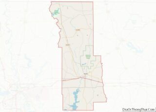
Dixie Inn location map. Where is Dixie Inn village?
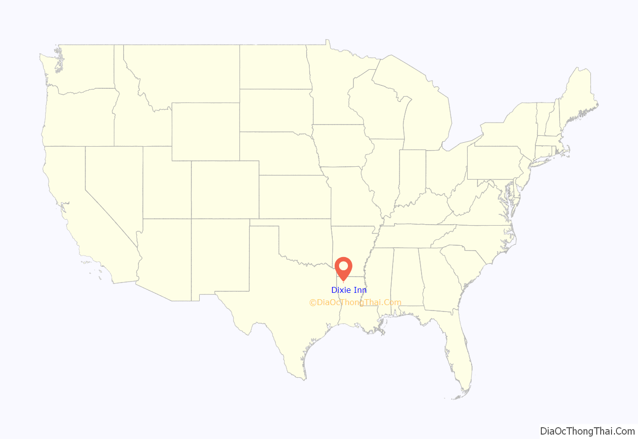
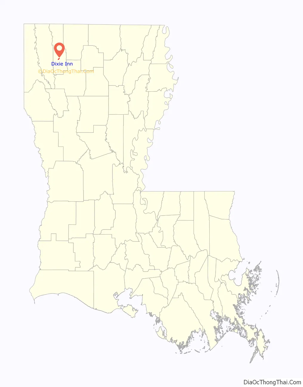
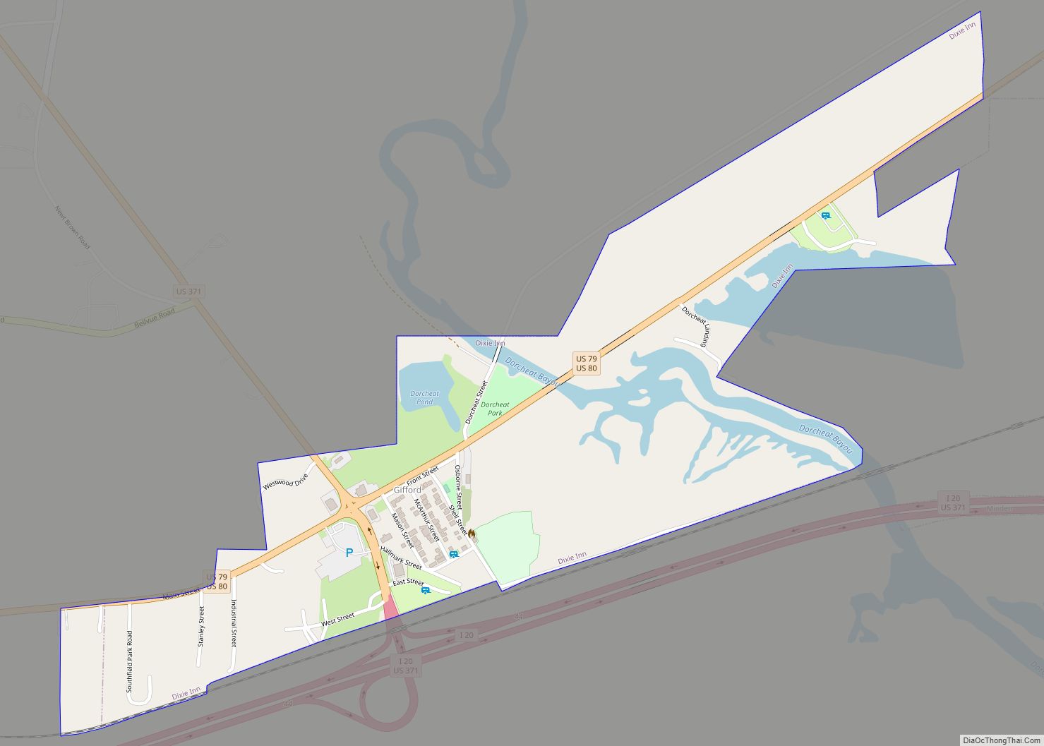
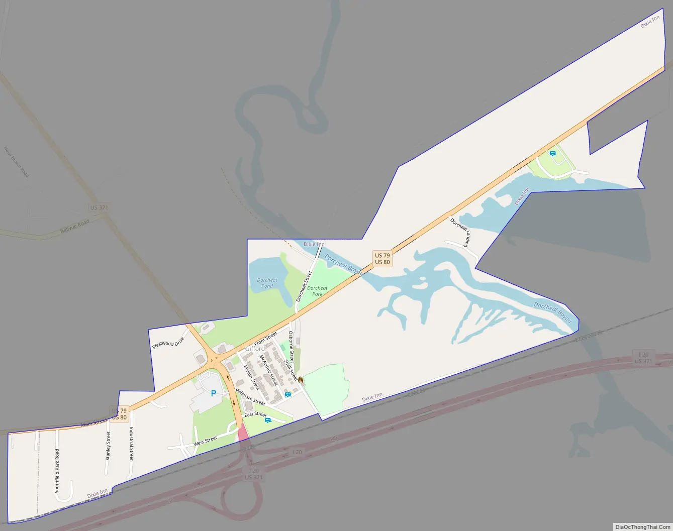
Dixie Inn Road Map
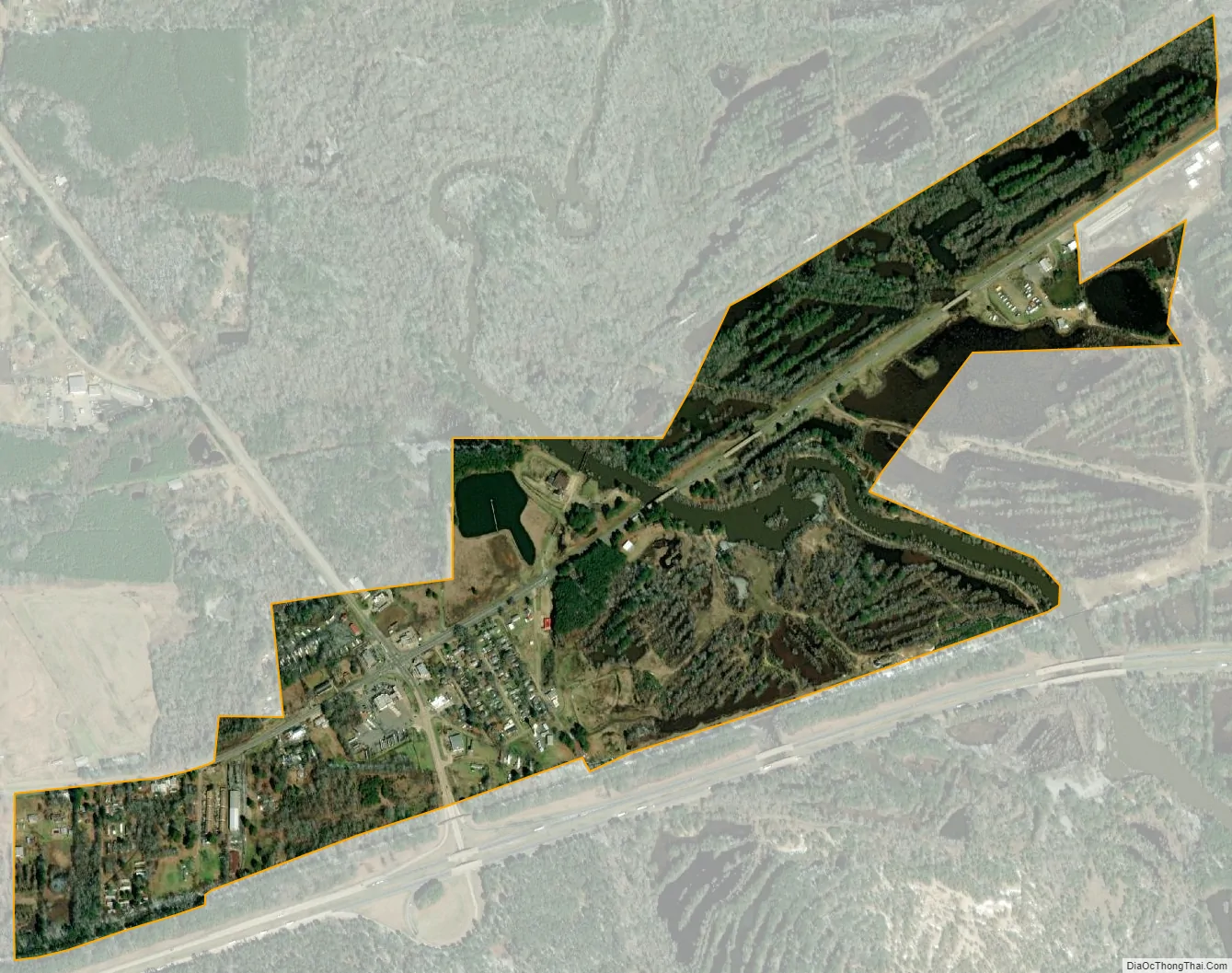
Dixie Inn city Satellite Map
Geography
Dixie Inn is located at 32°35′40″N 93°20′12″W / 32.59444°N 93.33667°W / 32.59444; -93.33667 (32.594552, -93.336707).
According to the United States Census Bureau, the village has a total area of 0.3 square miles (0.78 km), all land.
See also
Map of Louisiana State and its subdivision:- Acadia
- Allen
- Ascension
- Assumption
- Avoyelles
- Beauregard
- Bienville
- Bossier
- Caddo
- Calcasieu
- Caldwell
- Cameron
- Catahoula
- Claiborne
- Concordia
- De Soto
- East Baton Rouge
- East Carroll
- East Feliciana
- Evangeline
- Franklin
- Grant
- Iberia
- Iberville
- Jackson
- Jefferson
- Jefferson Davis
- La Salle
- Lafayette
- Lafourche
- Lincoln
- Livingston
- Madison
- Morehouse
- Natchitoches
- Orleans
- Ouachita
- Plaquemines
- Pointe Coupee
- Rapides
- Red River
- Richland
- Sabine
- Saint Bernard
- Saint Charles
- Saint Helena
- Saint James
- Saint John the Baptist
- Saint Landry
- Saint Martin
- Saint Mary
- Saint Tammany
- Tangipahoa
- Tensas
- Terrebonne
- Union
- Vermilion
- Vernon
- Washington
- Webster
- West Baton Rouge
- West Carroll
- West Feliciana
- Winn
- Alabama
- Alaska
- Arizona
- Arkansas
- California
- Colorado
- Connecticut
- Delaware
- District of Columbia
- Florida
- Georgia
- Hawaii
- Idaho
- Illinois
- Indiana
- Iowa
- Kansas
- Kentucky
- Louisiana
- Maine
- Maryland
- Massachusetts
- Michigan
- Minnesota
- Mississippi
- Missouri
- Montana
- Nebraska
- Nevada
- New Hampshire
- New Jersey
- New Mexico
- New York
- North Carolina
- North Dakota
- Ohio
- Oklahoma
- Oregon
- Pennsylvania
- Rhode Island
- South Carolina
- South Dakota
- Tennessee
- Texas
- Utah
- Vermont
- Virginia
- Washington
- West Virginia
- Wisconsin
- Wyoming