Oil City is a town in Caddo Parish, Louisiana. The population was 1,008 at the time of the 2010 census. Oil City is located on Louisiana Highway 1, north of Caddo Lake. It is part of the Shreveport–Bossier City Metropolitan Statistical Area.
| Name: | Oil City town |
|---|---|
| LSAD Code: | 43 |
| LSAD Description: | town (suffix) |
| State: | Louisiana |
| County: | Caddo Parish |
| Elevation: | 203 ft (62 m) |
| Total Area: | 1.85 sq mi (4.81 km²) |
| Land Area: | 1.78 sq mi (4.62 km²) |
| Water Area: | 0.07 sq mi (0.19 km²) |
| Total Population: | 901 |
| Population Density: | 505.33/sq mi (195.10/km²) |
| Area code: | 318 |
| FIPS code: | 2257590 |
| Website: | www.townofoilcity.com |
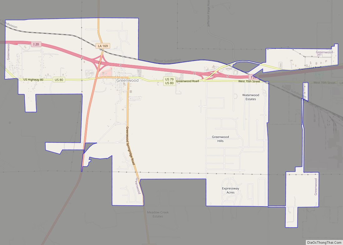
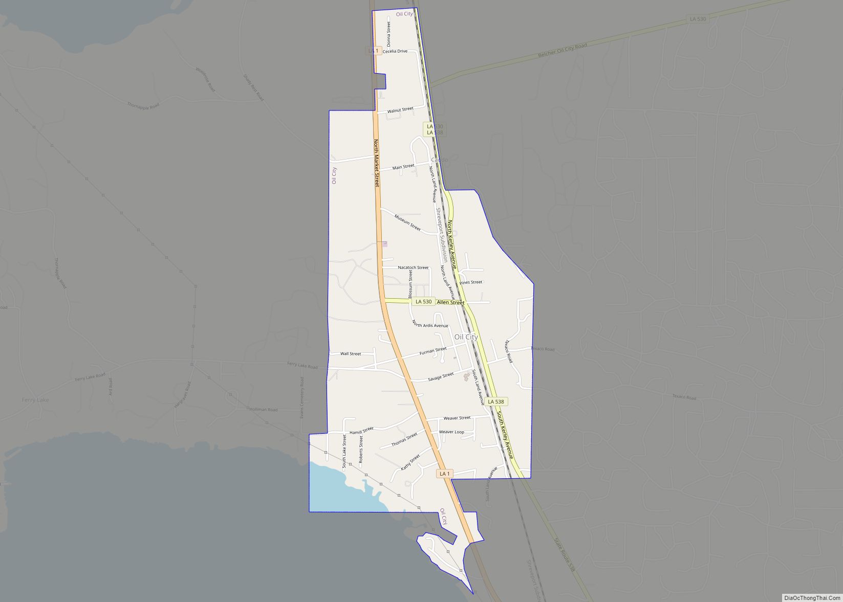
Online Interactive Map
Click on ![]() to view map in "full screen" mode.
to view map in "full screen" mode.
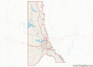
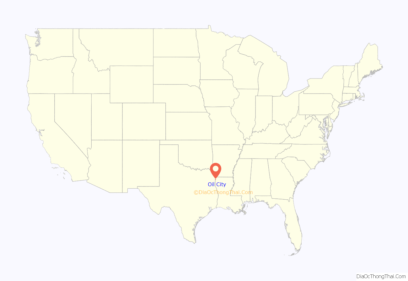
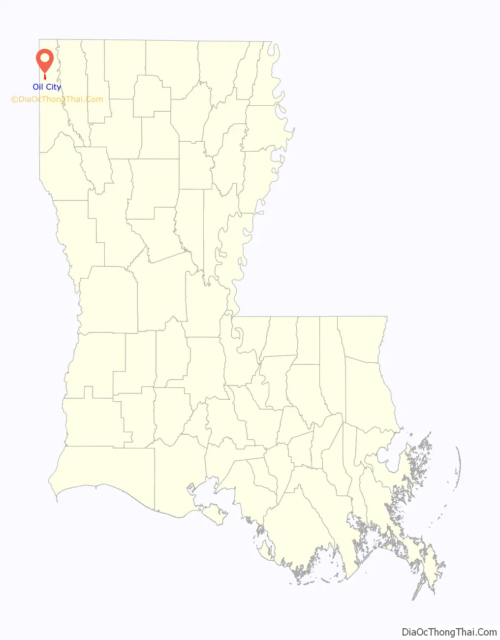
Oil City location map. Where is Oil City town?
History
The park in Oil City is named for Earl Williamson. The local politician served for 40 years on the Caddo Parish police jury (1933 to 1972) and again from 1979 to 1980. He served as mayor of Vivian from 1938 to 1946, and again from 1962 to 1966.
John Charles “Chip” Dickey, Jr., the mayor from 2005 until his death in office in 2016 at the age of sixty, pushed for economic ventures, including the community center and restaurants. He was an ordained minister and led various youth camps. Dickey’s father, John Charles Dickey, Sr., was the Oil City mayor from 1968 to 1976.
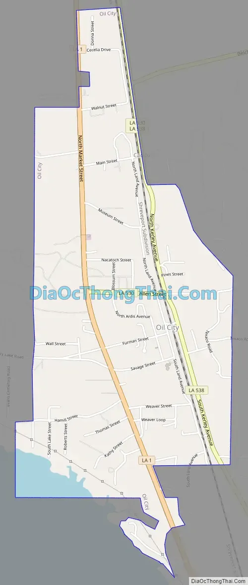
Oil City Road Map
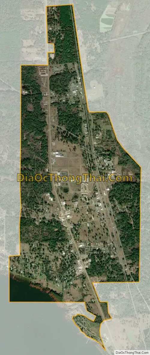
Oil City city Satellite Map
Geography
Oil City is located in northwestern Caddo Parish at 32°44′32″N 93°58′28″W / 32.74222°N 93.97444°W / 32.74222; -93.97444 (32.742170, -93.974376). Downtown Shreveport is 21 miles (34 km) to the southeast along Louisiana Highway 1, and Vivian is 9 miles (14 km) to the north.
According to the United States Census Bureau, Oil City has a total area of 1.85 square miles (4.78 km), of which 1.78 square miles (4.62 km) is land and 0.07 square miles (0.17 km), or 3.45%, is water.
See also
Map of Louisiana State and its subdivision:- Acadia
- Allen
- Ascension
- Assumption
- Avoyelles
- Beauregard
- Bienville
- Bossier
- Caddo
- Calcasieu
- Caldwell
- Cameron
- Catahoula
- Claiborne
- Concordia
- De Soto
- East Baton Rouge
- East Carroll
- East Feliciana
- Evangeline
- Franklin
- Grant
- Iberia
- Iberville
- Jackson
- Jefferson
- Jefferson Davis
- La Salle
- Lafayette
- Lafourche
- Lincoln
- Livingston
- Madison
- Morehouse
- Natchitoches
- Orleans
- Ouachita
- Plaquemines
- Pointe Coupee
- Rapides
- Red River
- Richland
- Sabine
- Saint Bernard
- Saint Charles
- Saint Helena
- Saint James
- Saint John the Baptist
- Saint Landry
- Saint Martin
- Saint Mary
- Saint Tammany
- Tangipahoa
- Tensas
- Terrebonne
- Union
- Vermilion
- Vernon
- Washington
- Webster
- West Baton Rouge
- West Carroll
- West Feliciana
- Winn
- Alabama
- Alaska
- Arizona
- Arkansas
- California
- Colorado
- Connecticut
- Delaware
- District of Columbia
- Florida
- Georgia
- Hawaii
- Idaho
- Illinois
- Indiana
- Iowa
- Kansas
- Kentucky
- Louisiana
- Maine
- Maryland
- Massachusetts
- Michigan
- Minnesota
- Mississippi
- Missouri
- Montana
- Nebraska
- Nevada
- New Hampshire
- New Jersey
- New Mexico
- New York
- North Carolina
- North Dakota
- Ohio
- Oklahoma
- Oregon
- Pennsylvania
- Rhode Island
- South Carolina
- South Dakota
- Tennessee
- Texas
- Utah
- Vermont
- Virginia
- Washington
- West Virginia
- Wisconsin
- Wyoming