DeLisle (/dəˈlɪl, dəˈliːl/) is a census-designated place (CDP) in Harrison County, Mississippi, United States. It is part of the Gulfport–Biloxi Metropolitan Statistical Area. The population was 1,147 at the 2010 census.
| Name: | DeLisle CDP |
|---|---|
| LSAD Code: | 57 |
| LSAD Description: | CDP (suffix) |
| State: | Mississippi |
| County: | Harrison County |
| Elevation: | 23 ft (7 m) |
| Total Area: | 5.34 sq mi (13.84 km²) |
| Land Area: | 5.23 sq mi (13.55 km²) |
| Water Area: | 0.11 sq mi (0.30 km²) |
| Total Population: | 1,275 |
| Population Density: | 243.74/sq mi (94.11/km²) |
| FIPS code: | 2818420 |
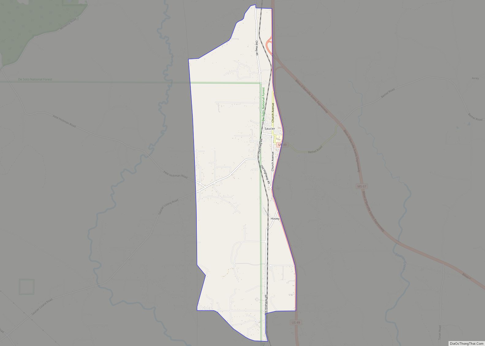
Online Interactive Map
Click on ![]() to view map in "full screen" mode.
to view map in "full screen" mode.
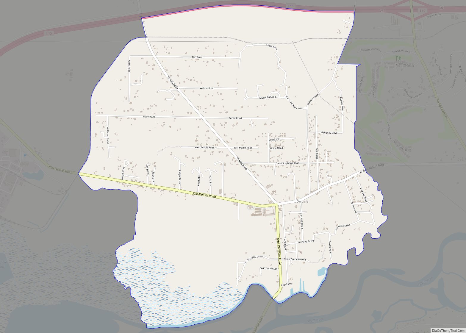
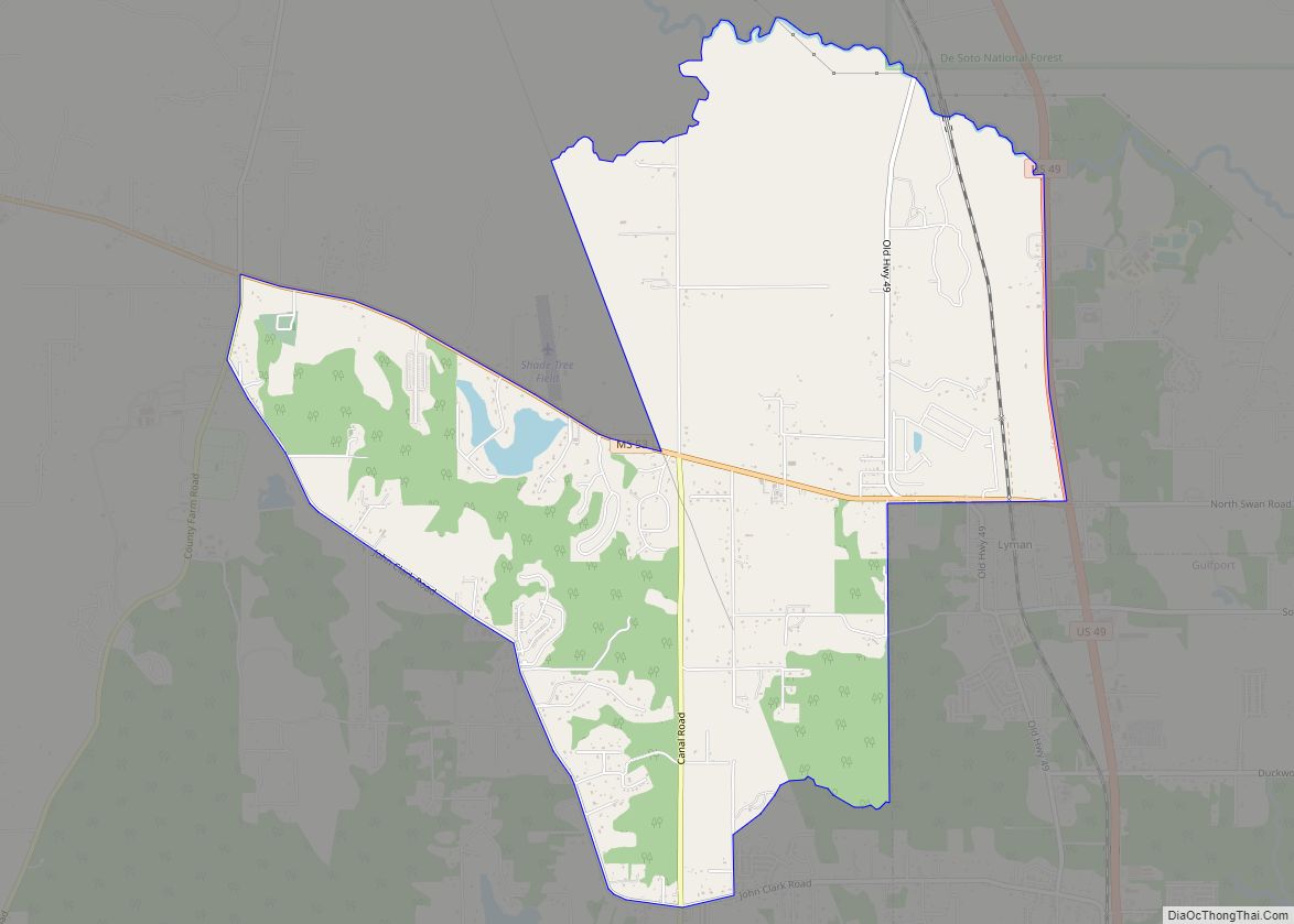
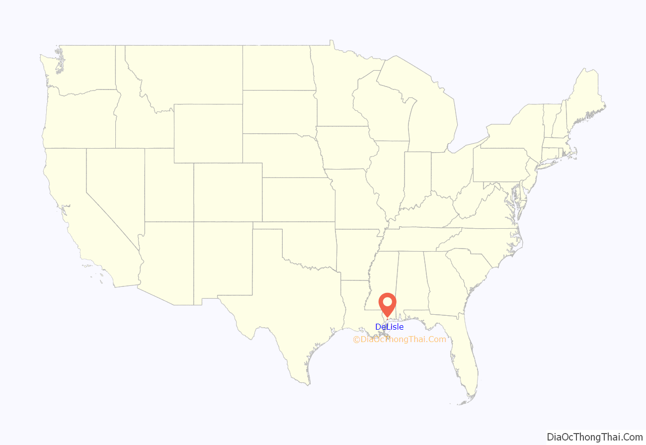
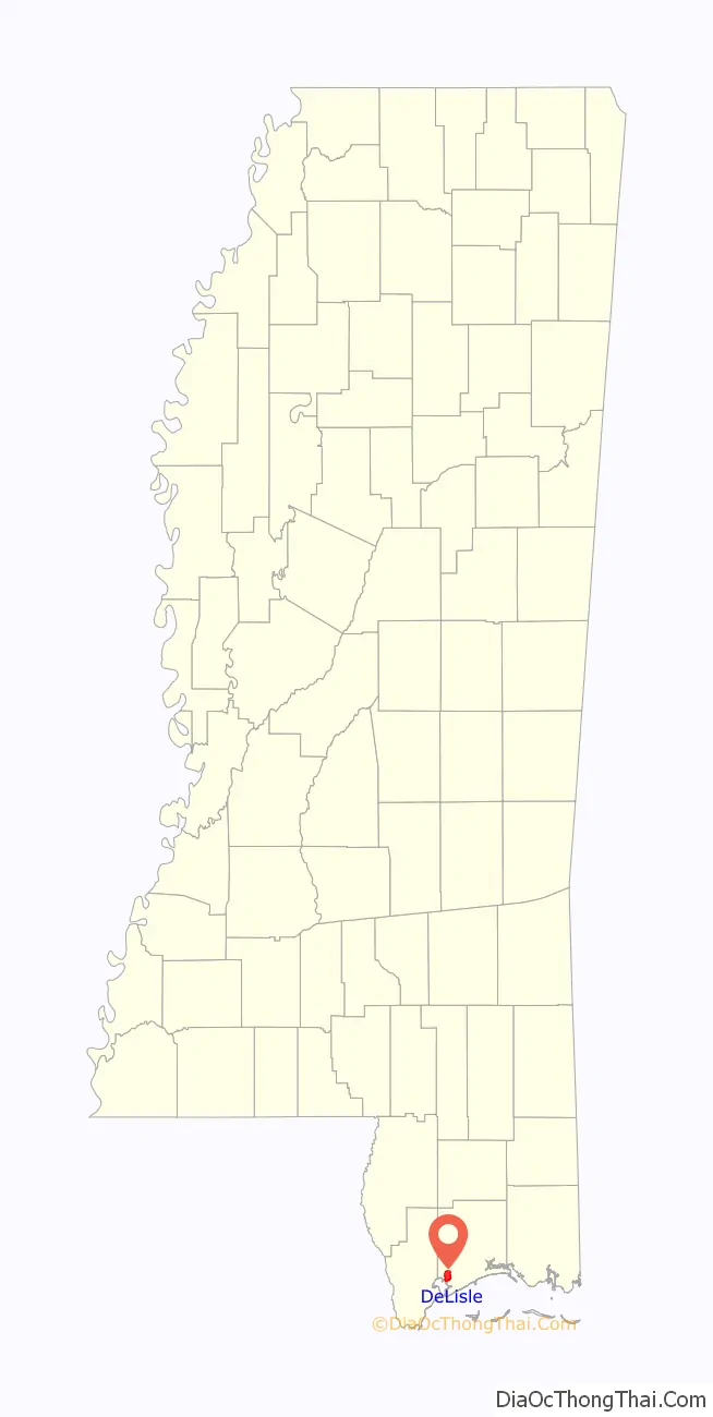
DeLisle location map. Where is DeLisle CDP?
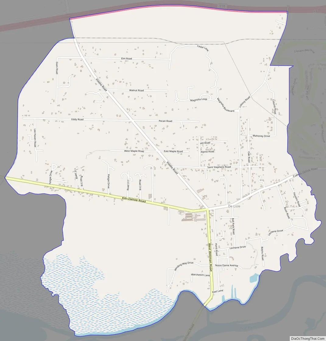
DeLisle Road Map
DeLisle city Satellite Map

Geography
DeLisle is located at 30°22′44″N 89°16′5″W / 30.37889°N 89.26806°W / 30.37889; -89.26806. It is located on the north side of DeLisle Bayou and the Wolf River, which separate the community from the city of Pass Christian.
According to the United States Census Bureau, the CDP has a total area of 5.3 square miles (13.8 km), of which 5.2 square miles (13.5 km) is land and 0.12 square miles (0.3 km), or 2.13%, is water.
Settlement
Pierre Le Moyne d’Iberville was chosen by Louis Phélypeaux, comte de Pontchartrain, Louis XIV’s minister of Marine, to establish a French colony in the area. On d’Iberville’s second trip to the Gulf in 1699-1700, d’Iberville was accompanied by the accomplished royal cartographer, Compte Guillaume Delisle. During this expedition, they charted and named Bayou Portage, Bayou Arcadia, and Bayou Delisle. The unincorporated area north of the bayou, known as DeLisle, shares a zip code with Pass Christian, Mississippi, but is not within the city limits. The early settlement was called La Riviere des Loups (Wolf River). The earliest verifiable records for the DeLisle area show that Barthelome Grelot was followed by his brother-in-law Philipe Saucier, who received two Spanish land grants; one in the St. Louis Bay area, recorded on August 27, 1781, followed in 1794, with a second tract that was situated on Bayou DeLisle, adjacent to his brother-in-law, Bartholome Grelot. These early French settlers were soon joined by Jean Baptiste Nicaise, Pierre Moran, Ramon Lizana, Chevalier DeDeaux, Jean Cassibry, and Charles Ladner.
A post office operated under the name DeLisle from 1884 to 1974.
DuPont opened a titanium dioxide plant in DeLisle in 1979. This plant, now operated by Chemours, is the second-largest producer of titanium dioxide in the world.
See also
Map of Mississippi State and its subdivision:- Adams
- Alcorn
- Amite
- Attala
- Benton
- Bolivar
- Calhoun
- Carroll
- Chickasaw
- Choctaw
- Claiborne
- Clarke
- Clay
- Coahoma
- Copiah
- Covington
- Desoto
- Forrest
- Franklin
- George
- Greene
- Grenada
- Hancock
- Harrison
- Hinds
- Holmes
- Humphreys
- Issaquena
- Itawamba
- Jackson
- Jasper
- Jefferson
- Jefferson Davis
- Jones
- Kemper
- Lafayette
- Lamar
- Lauderdale
- Lawrence
- Leake
- Lee
- Leflore
- Lincoln
- Lowndes
- Madison
- Marion
- Marshall
- Monroe
- Montgomery
- Neshoba
- Newton
- Noxubee
- Oktibbeha
- Panola
- Pearl River
- Perry
- Pike
- Pontotoc
- Prentiss
- Quitman
- Rankin
- Scott
- Sharkey
- Simpson
- Smith
- Stone
- Sunflower
- Tallahatchie
- Tate
- Tippah
- Tishomingo
- Tunica
- Union
- Walthall
- Warren
- Washington
- Wayne
- Webster
- Wilkinson
- Winston
- Yalobusha
- Yazoo
- Alabama
- Alaska
- Arizona
- Arkansas
- California
- Colorado
- Connecticut
- Delaware
- District of Columbia
- Florida
- Georgia
- Hawaii
- Idaho
- Illinois
- Indiana
- Iowa
- Kansas
- Kentucky
- Louisiana
- Maine
- Maryland
- Massachusetts
- Michigan
- Minnesota
- Mississippi
- Missouri
- Montana
- Nebraska
- Nevada
- New Hampshire
- New Jersey
- New Mexico
- New York
- North Carolina
- North Dakota
- Ohio
- Oklahoma
- Oregon
- Pennsylvania
- Rhode Island
- South Carolina
- South Dakota
- Tennessee
- Texas
- Utah
- Vermont
- Virginia
- Washington
- West Virginia
- Wisconsin
- Wyoming