Flora is a town in Madison County, Mississippi, United States. The population was 1,886 at the 2010 census. It is part of the Jackson Metropolitan Statistical Area.
The town is named after Flora Mann Jones, an early resident.
| Name: | Flora town |
|---|---|
| LSAD Code: | 43 |
| LSAD Description: | town (suffix) |
| State: | Mississippi |
| County: | Madison County |
| Elevation: | 240 ft (73 m) |
| Total Area: | 3.33 sq mi (8.64 km²) |
| Land Area: | 3.30 sq mi (8.54 km²) |
| Water Area: | 0.04 sq mi (0.10 km²) |
| Total Population: | 1,647 |
| Population Density: | 499.70/sq mi (192.94/km²) |
| ZIP code: | 39071 |
| Area code: | 601 |
| FIPS code: | 2824940 |
| GNISfeature ID: | 0670043 |
| Website: | www.florams.com |
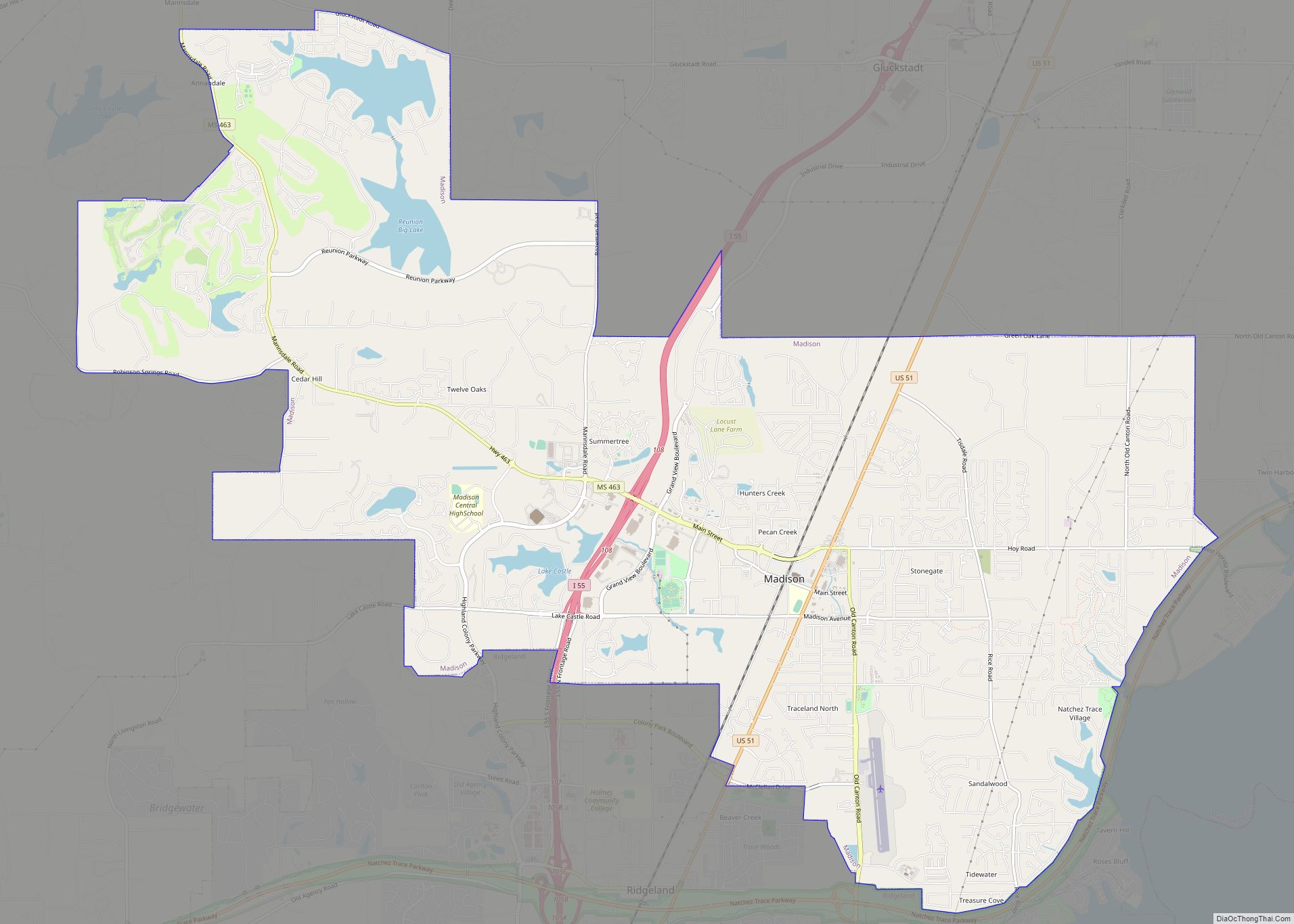
Online Interactive Map
Click on ![]() to view map in "full screen" mode.
to view map in "full screen" mode.
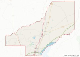
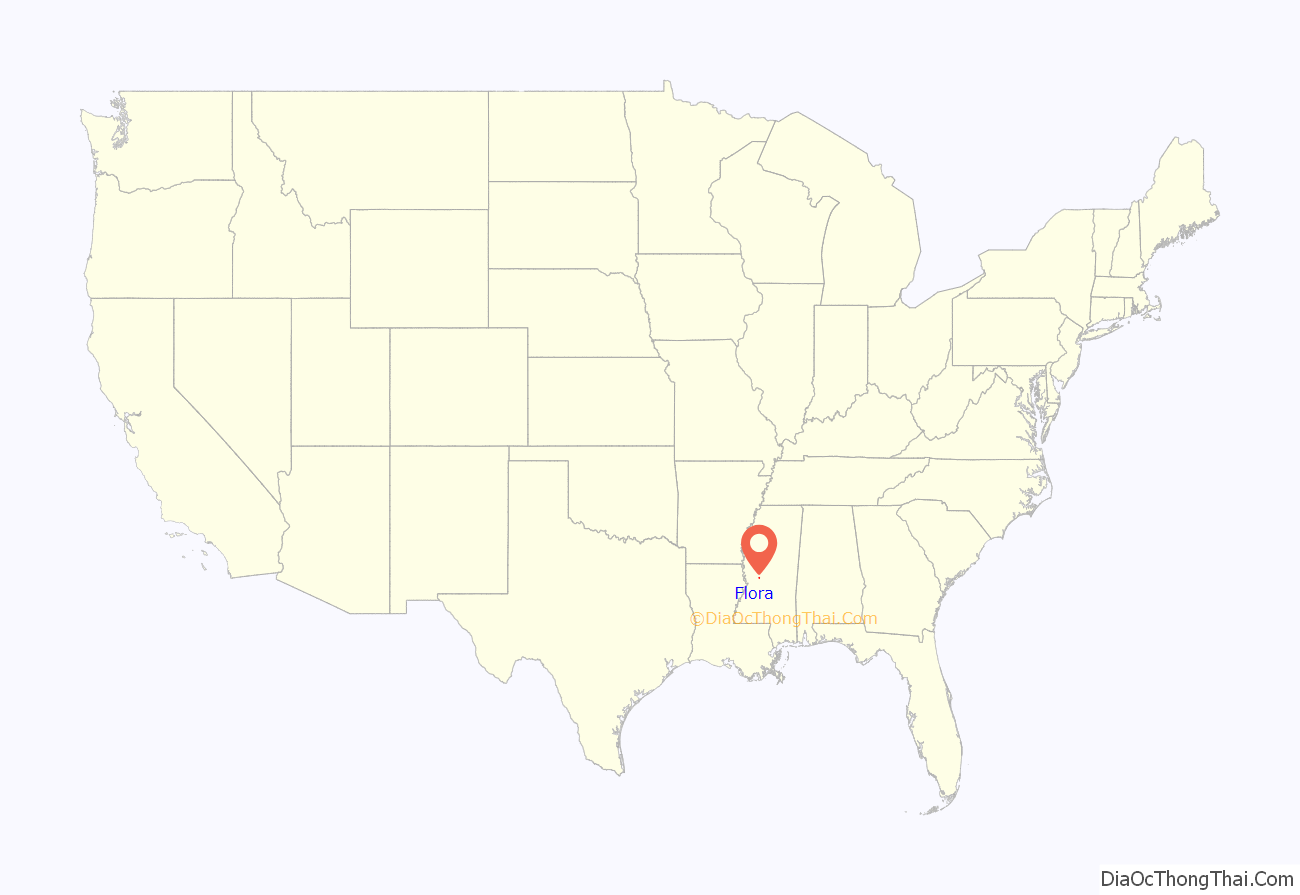
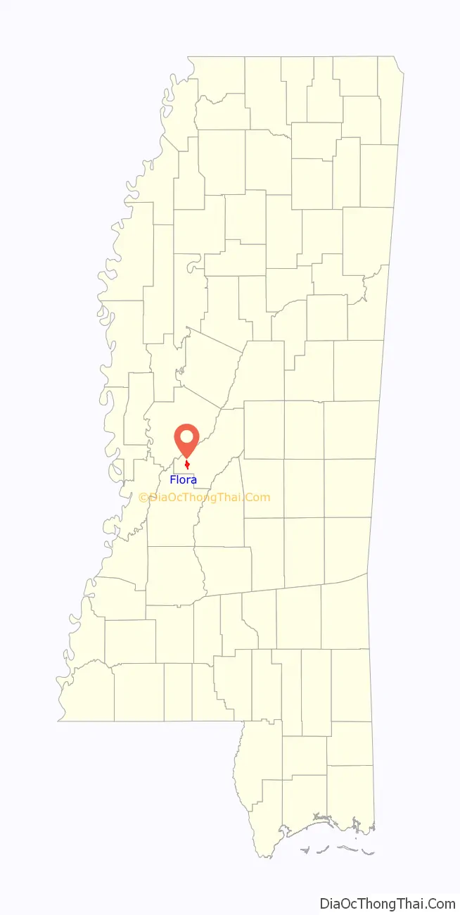
Flora location map. Where is Flora town?
History
Graves in Flora’s cemetery date to 1821. A post office was established in 1883. That same year, Flora became a stop on the newly constructed Yazoo and Mississippi Valley Railroad. The railroad depot is now a museum, and is listed on the National Register of Historic Places.
Flora was incorporated in 1886.
Mississippi Ordnance Plant
In 1941, the Mississippi Ordnance Plant was constructed north of Flora to produce propellant and igniter charges for large-caliber guns during World War II. The site also had firing ranges for sub-machine guns, rifles, anti-aircraft guns, live grenades, and demolition explosives. A notable employee was science fiction writer Cyril M. Kornbluth.
The plant was operated by General Tire. It generally hired African-American men only for jobs as janitors, yard workers, freight loaders, truck drivers and maintenance workers. They were allowed to work in the higher paying production jobs only if white men were not available. African-American women were employed only as maids and cafeteria helpers. In 1942, a local group of African-American citizens met to protest the company’s policy.
After the war, the Defense Department declared the site as surplus in 1945. The army certified it as “completely decontaminated”. But standards since then are more refined and the site was dangerously contaminated due to the production and heavy armaments.
In 1947, the Mississippi Department of Education planned to adapt part of the plant into a vocational school for African Americans, until white residents protested to the governor, stating that property values would be ruined.
One of the reinforced bunkers eventually became used for the “Southern Vital Records” storage facility. In 1977, a local high school student found an abandoned M-2A2 tank in a wooded area.
National Bio and Agro-Defense Facility
In 2008, the U.S. Department of Homeland Security announced that the Flora Industrial Park was one of six locations in the United States being considered for the construction of a new National Bio and Agro-Defense Facility. Some people were concerned about dangers from biological research.
Flora’s mayor, Scott Greaves, had responded to opposition to the facility in 2007, saying: “Education is the whole key to it. You have to find the people who are concerned and educate them. In the end, you’re still going to have a few idiots”. Manhattan, Kansas was finally selected as the site for the new facility.
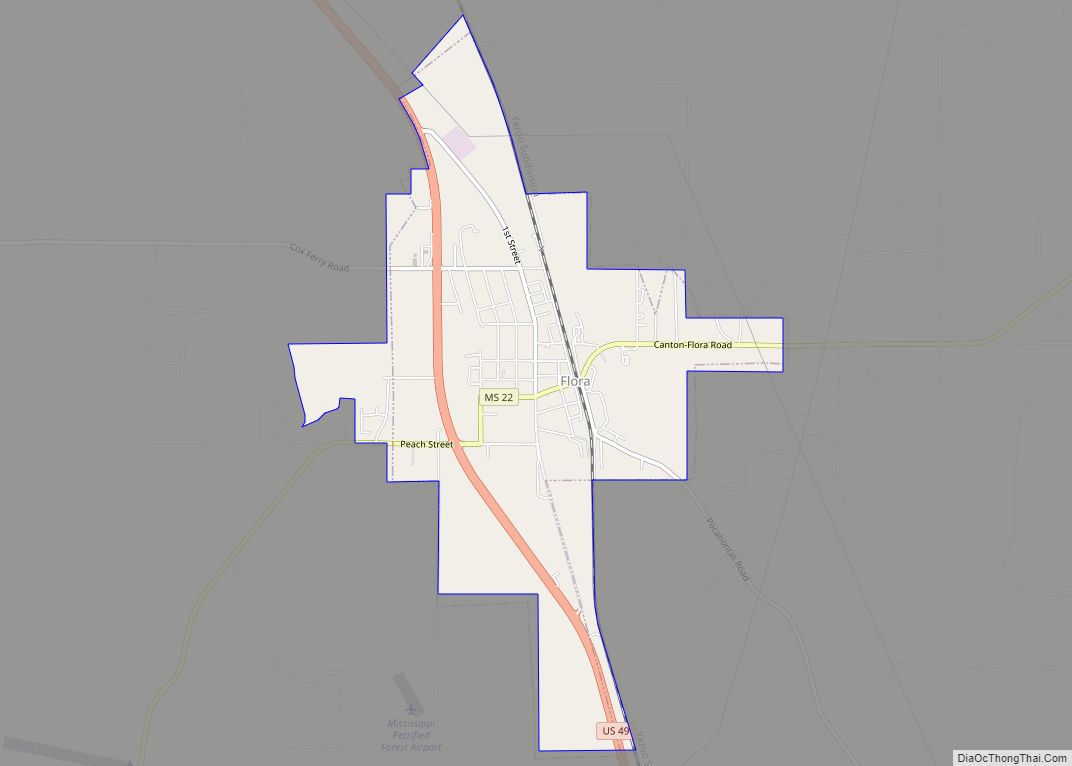
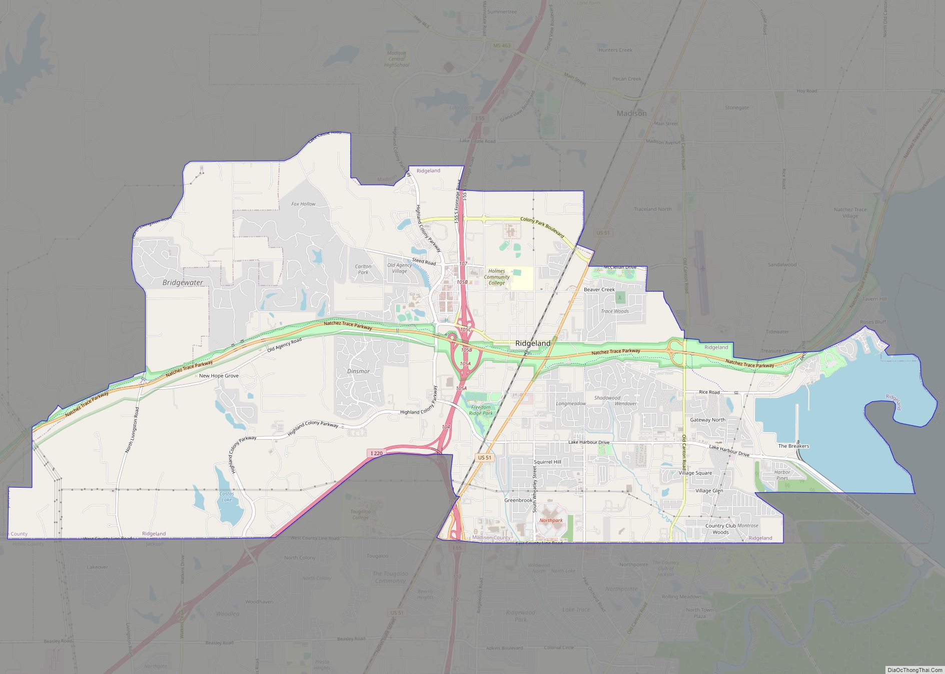
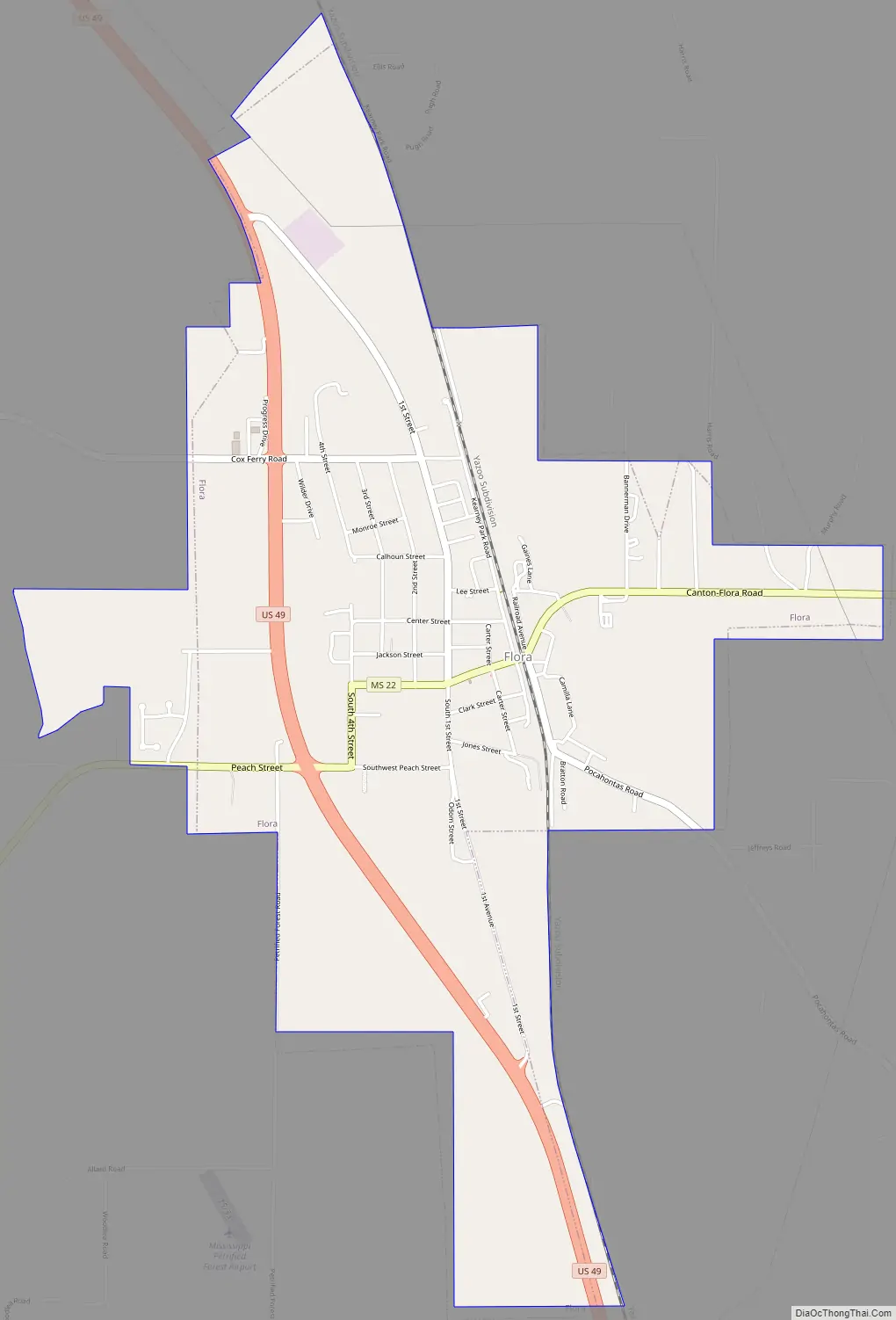
Flora Road Map
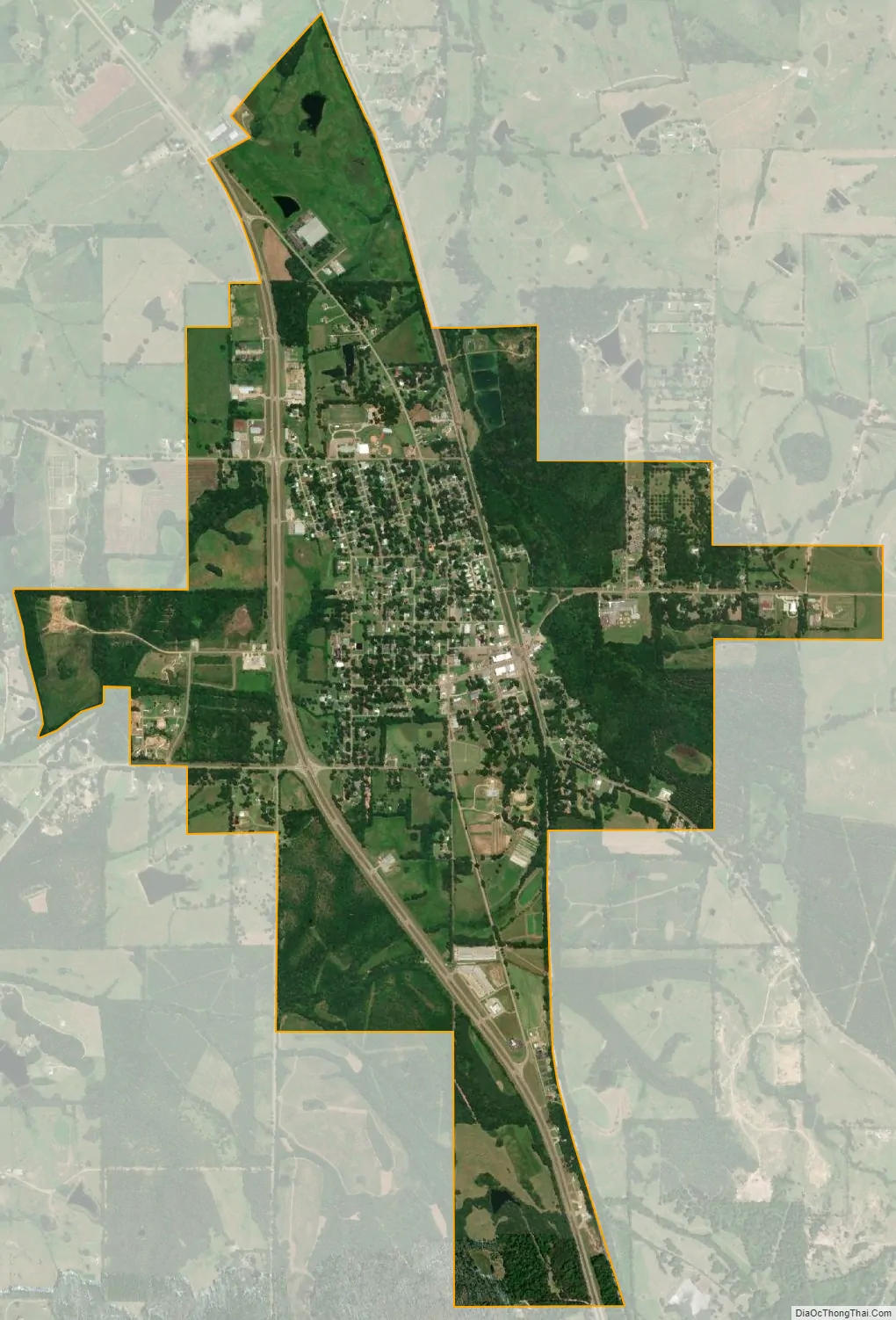
Flora city Satellite Map
Geography
According to the United States Census Bureau, the town has a total area of 3.4 square miles (8.8 km), all land.
Just outside the Flora city limits lies a forest collection of petrified wood, the Mississippi Petrified Forest. It is said to be the only such forest east of the Mississippi River.
See also
Map of Mississippi State and its subdivision:- Adams
- Alcorn
- Amite
- Attala
- Benton
- Bolivar
- Calhoun
- Carroll
- Chickasaw
- Choctaw
- Claiborne
- Clarke
- Clay
- Coahoma
- Copiah
- Covington
- Desoto
- Forrest
- Franklin
- George
- Greene
- Grenada
- Hancock
- Harrison
- Hinds
- Holmes
- Humphreys
- Issaquena
- Itawamba
- Jackson
- Jasper
- Jefferson
- Jefferson Davis
- Jones
- Kemper
- Lafayette
- Lamar
- Lauderdale
- Lawrence
- Leake
- Lee
- Leflore
- Lincoln
- Lowndes
- Madison
- Marion
- Marshall
- Monroe
- Montgomery
- Neshoba
- Newton
- Noxubee
- Oktibbeha
- Panola
- Pearl River
- Perry
- Pike
- Pontotoc
- Prentiss
- Quitman
- Rankin
- Scott
- Sharkey
- Simpson
- Smith
- Stone
- Sunflower
- Tallahatchie
- Tate
- Tippah
- Tishomingo
- Tunica
- Union
- Walthall
- Warren
- Washington
- Wayne
- Webster
- Wilkinson
- Winston
- Yalobusha
- Yazoo
- Alabama
- Alaska
- Arizona
- Arkansas
- California
- Colorado
- Connecticut
- Delaware
- District of Columbia
- Florida
- Georgia
- Hawaii
- Idaho
- Illinois
- Indiana
- Iowa
- Kansas
- Kentucky
- Louisiana
- Maine
- Maryland
- Massachusetts
- Michigan
- Minnesota
- Mississippi
- Missouri
- Montana
- Nebraska
- Nevada
- New Hampshire
- New Jersey
- New Mexico
- New York
- North Carolina
- North Dakota
- Ohio
- Oklahoma
- Oregon
- Pennsylvania
- Rhode Island
- South Carolina
- South Dakota
- Tennessee
- Texas
- Utah
- Vermont
- Virginia
- Washington
- West Virginia
- Wisconsin
- Wyoming