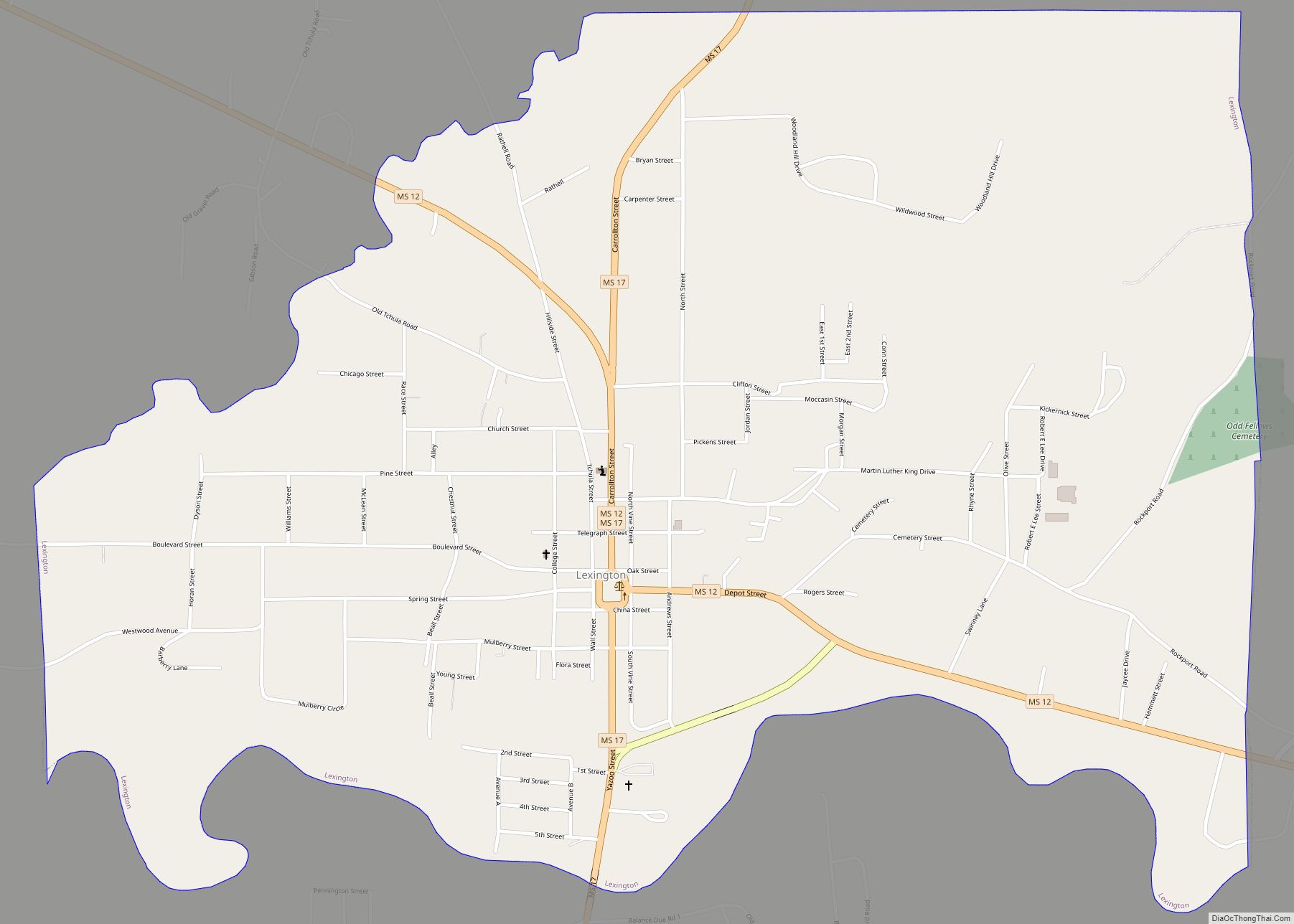
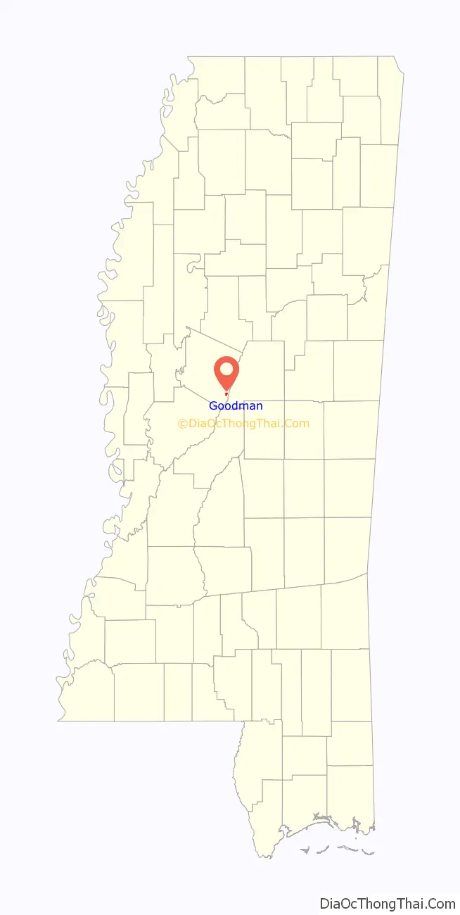
Goodman is a town in southeastern Holmes County, Mississippi, United States. Per the 2020 census, the population was 1,258.
| Name: | Goodman town |
|---|---|
| LSAD Code: | 43 |
| LSAD Description: | town (suffix) |
| State: | Mississippi |
| County: | Holmes County |
| Elevation: | 266 ft (81 m) |
| Total Area: | 0.83 sq mi (2.15 km²) |
| Land Area: | 0.82 sq mi (2.13 km²) |
| Water Area: | 0.01 sq mi (0.02 km²) |
| Total Population: | 1,258 |
| Population Density: | 1,530.41/sq mi (590.79/km²) |
| ZIP code: | 39079 |
| Area code: | 662 |
| FIPS code: | 2828220 |
| GNISfeature ID: | 0670500 |
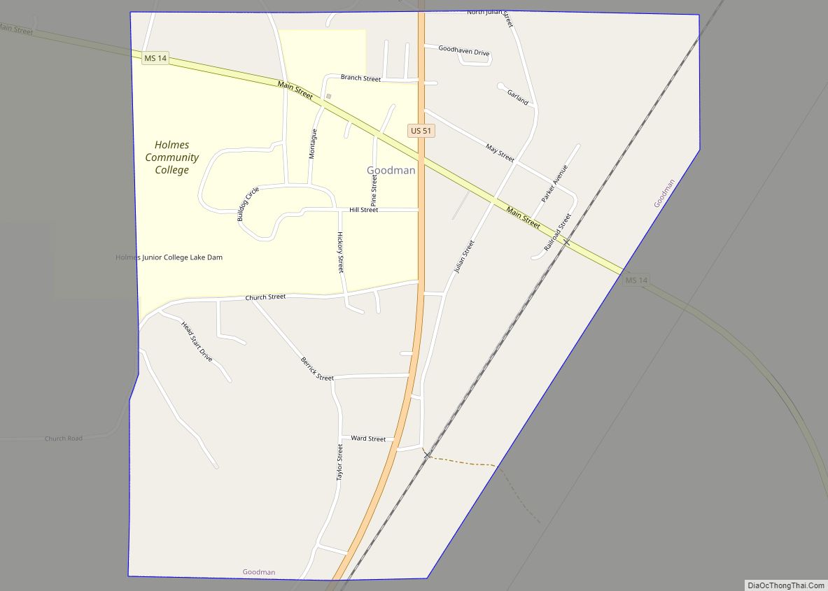
Online Interactive Map
Click on ![]() to view map in "full screen" mode.
to view map in "full screen" mode.
Goodman location map. Where is Goodman town?

History
Goodman was settled by European Americans in 1860. It was first chartered on November 16, 1865, after the end of the Civil War; and rechartered on March 5, 1878. The town is named for the first president of the Mississippi Central Railroad.
Goodman is the birthplace of John A. Lomax (1867–1948), pioneering folklorist, and David Herbert Donald (1920–2009), Pulitzer-prize-winning historian.
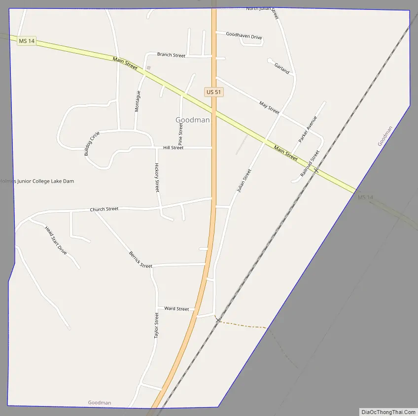
Goodman Road Map
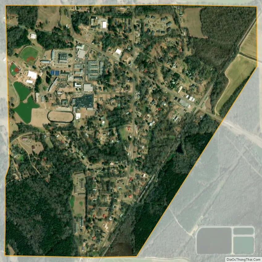
Goodman city Satellite Map
Geography
Goodman is located in southeastern Holmes County at 32°58′5″N 89°54′45″W / 32.96806°N 89.91250°W / 32.96806; -89.91250 (32.968057, -89.912625), west of the Big Black River. U.S. Route 51 passes through the center of town, leading northeast 8 miles (13 km) to Durant and southwest 7 miles (11 km) to Pickens. Mississippi Highway 14 crosses US 51 near the center of town, leading east 25 miles (40 km) to Kosciusko and west 11 miles (18 km) to Ebenezer. Highway 14 intersects Interstate 55 3 miles (5 km) west of the center of Goodman, at Exit 146. I-55 leads south 50 miles (80 km) to Jackson, the state capital, and north 158 miles (254 km) to Memphis, Tennessee.
According to the United States Census Bureau, Goodman has a total area of 0.85 square miles (2.2 km), of which 0.01 square miles (0.02 km), or 0.91%, are water.
See also
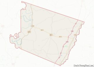
Map of Mississippi State and its subdivision:- Adams
- Alcorn
- Amite
- Attala
- Benton
- Bolivar
- Calhoun
- Carroll
- Chickasaw
- Choctaw
- Claiborne
- Clarke
- Clay
- Coahoma
- Copiah
- Covington
- Desoto
- Forrest
- Franklin
- George
- Greene
- Grenada
- Hancock
- Harrison
- Hinds
- Holmes
- Humphreys
- Issaquena
- Itawamba
- Jackson
- Jasper
- Jefferson
- Jefferson Davis
- Jones
- Kemper
- Lafayette
- Lamar
- Lauderdale
- Lawrence
- Leake
- Lee
- Leflore
- Lincoln
- Lowndes
- Madison
- Marion
- Marshall
- Monroe
- Montgomery
- Neshoba
- Newton
- Noxubee
- Oktibbeha
- Panola
- Pearl River
- Perry
- Pike
- Pontotoc
- Prentiss
- Quitman
- Rankin
- Scott
- Sharkey
- Simpson
- Smith
- Stone
- Sunflower
- Tallahatchie
- Tate
- Tippah
- Tishomingo
- Tunica
- Union
- Walthall
- Warren
- Washington
- Wayne
- Webster
- Wilkinson
- Winston
- Yalobusha
- Yazoo
- Alabama
- Alaska
- Arizona
- Arkansas
- California
- Colorado
- Connecticut
- Delaware
- District of Columbia
- Florida
- Georgia
- Hawaii
- Idaho
- Illinois
- Indiana
- Iowa
- Kansas
- Kentucky
- Louisiana
- Maine
- Maryland
- Massachusetts
- Michigan
- Minnesota
- Mississippi
- Missouri
- Montana
- Nebraska
- Nevada
- New Hampshire
- New Jersey
- New Mexico
- New York
- North Carolina
- North Dakota
- Ohio
- Oklahoma
- Oregon
- Pennsylvania
- Rhode Island
- South Carolina
- South Dakota
- Tennessee
- Texas
- Utah
- Vermont
- Virginia
- Washington
- West Virginia
- Wisconsin
- Wyoming