Latimer is a census-designated place (CDP) in Jackson County, Mississippi, United States. It is part of the Pascagoula Metropolitan Statistical Area. The population was 6,079 at the 2010 census, up from 4,288 at the 2000 census.
| Name: | Latimer CDP |
|---|---|
| LSAD Code: | 57 |
| LSAD Description: | CDP (suffix) |
| State: | Mississippi |
| County: | Jackson County |
| Elevation: | 72 ft (22 m) |
| Total Area: | 16.28 sq mi (42.18 km²) |
| Land Area: | 16.28 sq mi (42.17 km²) |
| Water Area: | 0.00 sq mi (0.00 km²) |
| Total Population: | 6,720 |
| Population Density: | 412.70/sq mi (159.35/km²) |
| ZIP code: | 39564 |
| Area code: | 228 |
| FIPS code: | 2839520 |
| GNISfeature ID: | 0705437 |
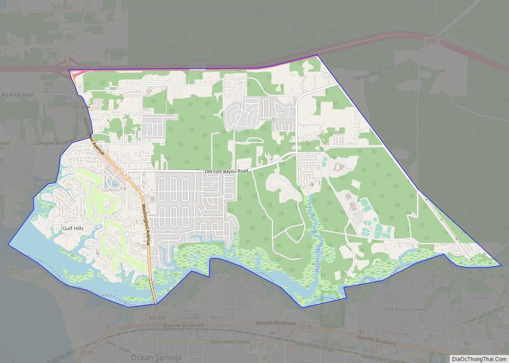
Online Interactive Map
Click on ![]() to view map in "full screen" mode.
to view map in "full screen" mode.
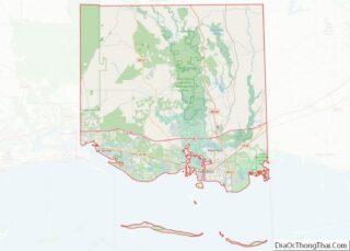
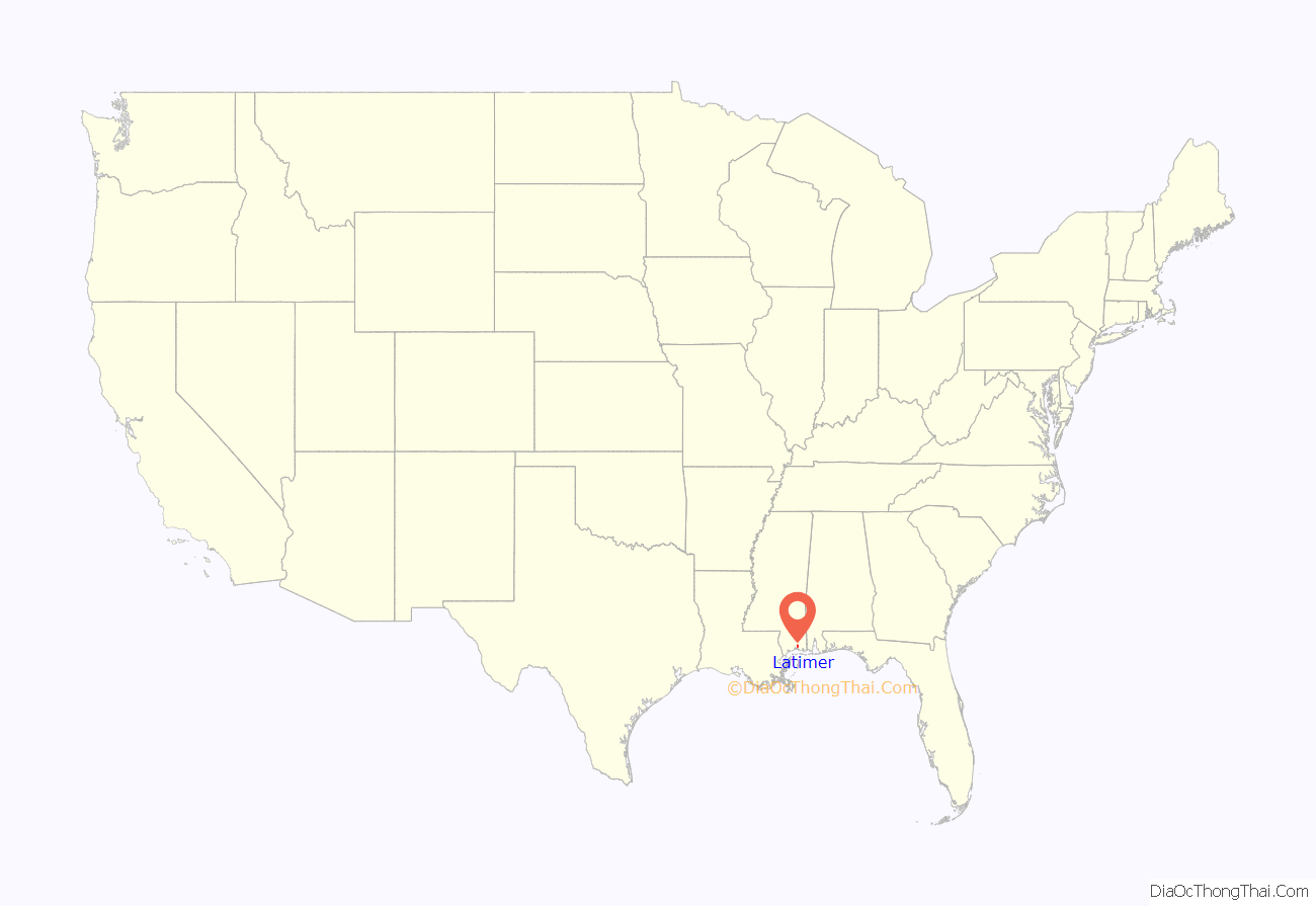
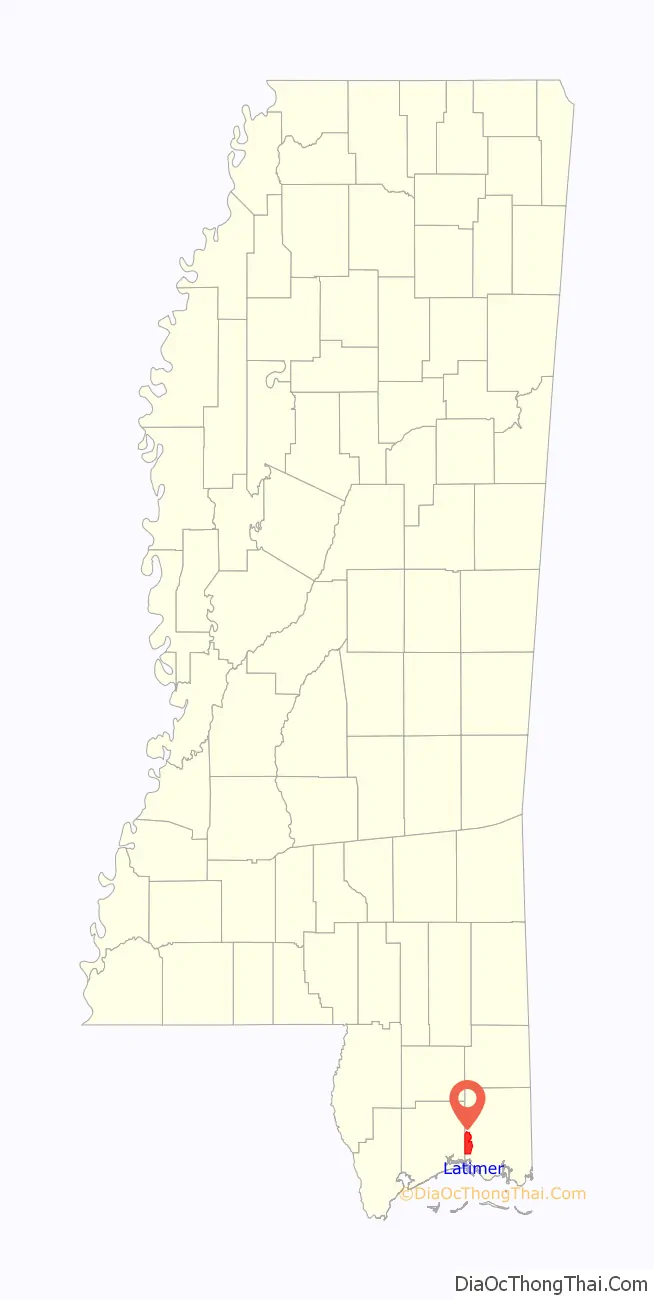
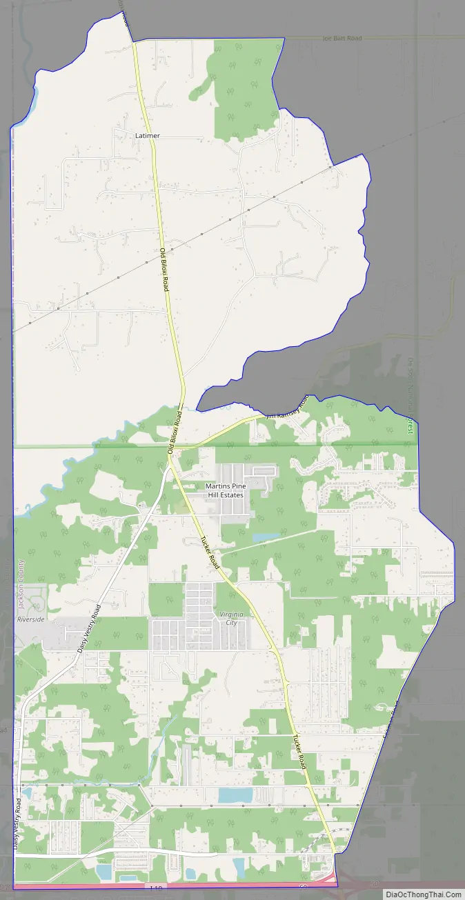
Latimer location map. Where is Latimer CDP?
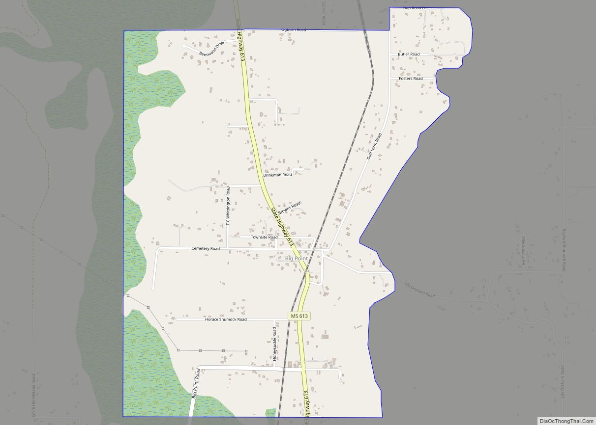
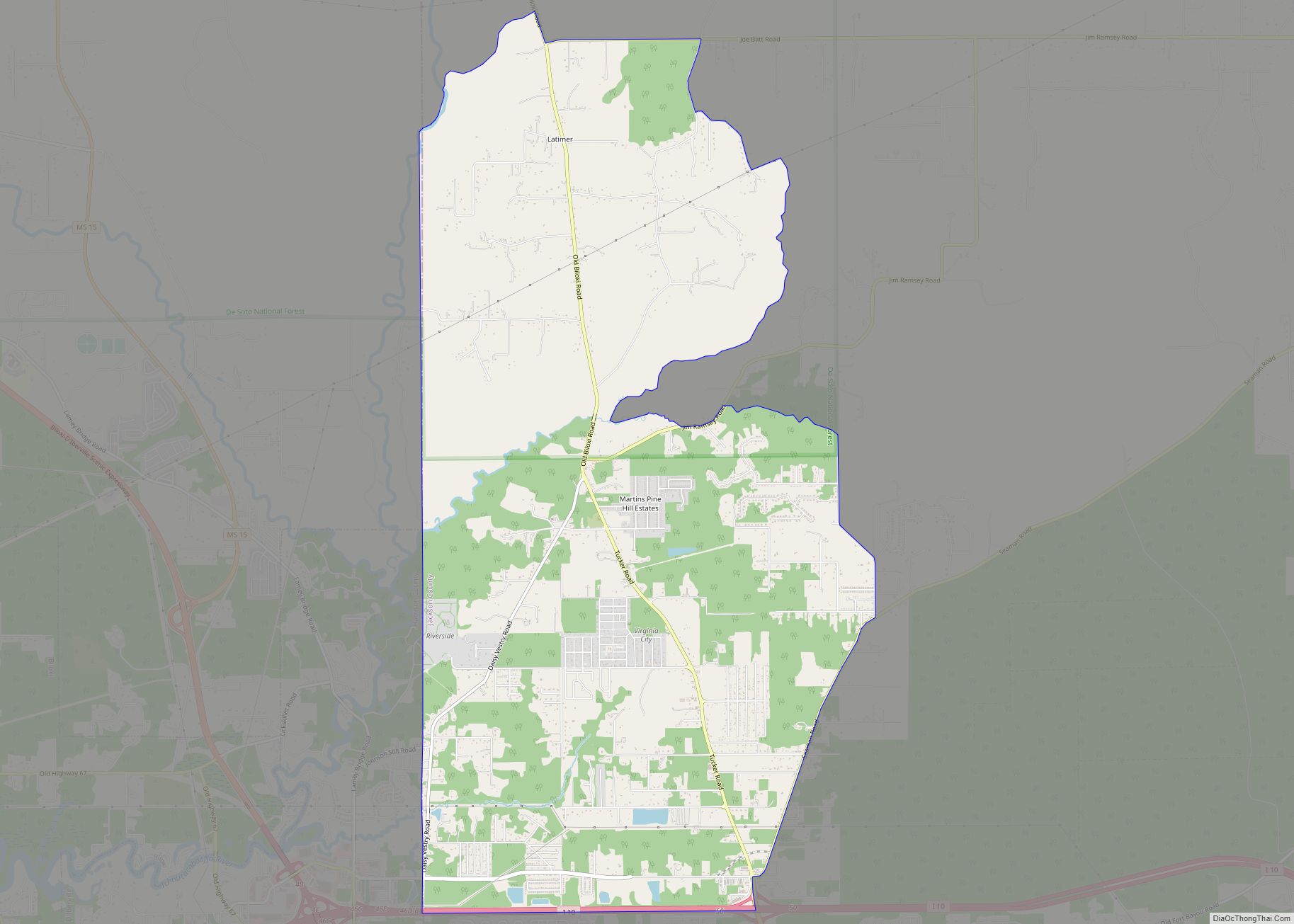
Latimer Road Map
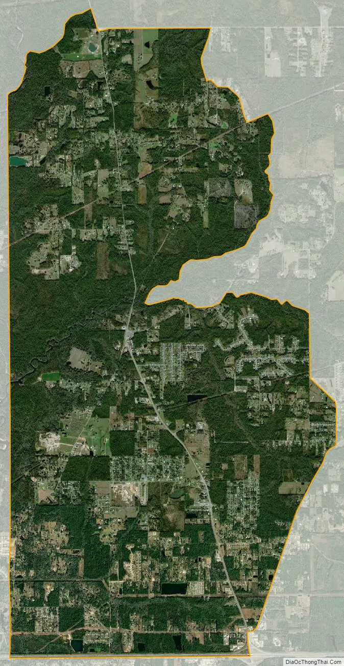
Latimer city Satellite Map
Geography
Latimer is in western Jackson County, bordered to the west by D’Iberville in Harrison County and to the south by St. Martin. Interstate 10 forms the southern boundary of the community, with access from Exit 50. Latimer is 11 miles (18 km) north of Biloxi and 27 miles (43 km) northwest of Pascagoula, the Jackson county seat. The northern, less-populated half of the Latimer CDP lies within De Soto National Forest.
According to the United States Census Bureau, the CDP has a total area of 16.3 square miles (42.3 km), of which 0.7 acres (3,028 m), or 0.01%, are water.
See also
Map of Mississippi State and its subdivision:- Adams
- Alcorn
- Amite
- Attala
- Benton
- Bolivar
- Calhoun
- Carroll
- Chickasaw
- Choctaw
- Claiborne
- Clarke
- Clay
- Coahoma
- Copiah
- Covington
- Desoto
- Forrest
- Franklin
- George
- Greene
- Grenada
- Hancock
- Harrison
- Hinds
- Holmes
- Humphreys
- Issaquena
- Itawamba
- Jackson
- Jasper
- Jefferson
- Jefferson Davis
- Jones
- Kemper
- Lafayette
- Lamar
- Lauderdale
- Lawrence
- Leake
- Lee
- Leflore
- Lincoln
- Lowndes
- Madison
- Marion
- Marshall
- Monroe
- Montgomery
- Neshoba
- Newton
- Noxubee
- Oktibbeha
- Panola
- Pearl River
- Perry
- Pike
- Pontotoc
- Prentiss
- Quitman
- Rankin
- Scott
- Sharkey
- Simpson
- Smith
- Stone
- Sunflower
- Tallahatchie
- Tate
- Tippah
- Tishomingo
- Tunica
- Union
- Walthall
- Warren
- Washington
- Wayne
- Webster
- Wilkinson
- Winston
- Yalobusha
- Yazoo
- Alabama
- Alaska
- Arizona
- Arkansas
- California
- Colorado
- Connecticut
- Delaware
- District of Columbia
- Florida
- Georgia
- Hawaii
- Idaho
- Illinois
- Indiana
- Iowa
- Kansas
- Kentucky
- Louisiana
- Maine
- Maryland
- Massachusetts
- Michigan
- Minnesota
- Mississippi
- Missouri
- Montana
- Nebraska
- Nevada
- New Hampshire
- New Jersey
- New Mexico
- New York
- North Carolina
- North Dakota
- Ohio
- Oklahoma
- Oregon
- Pennsylvania
- Rhode Island
- South Carolina
- South Dakota
- Tennessee
- Texas
- Utah
- Vermont
- Virginia
- Washington
- West Virginia
- Wisconsin
- Wyoming