Ocean Springs is a city in Jackson County, Mississippi, United States, approximately 2 miles (3.2 km) east of Biloxi and west of Gautier. It is part of the Pascagoula, Mississippi Metropolitan Statistical Area. The population was 17,225 at the 2000 U.S. Census. As of the 2010 U.S. Census, the city of Ocean Springs had a population of 17,442.
The town has a reputation as an arts community. The town was voted as a top 10 Happiest Seaside Town by Coastal Living in 2015. Its historic and secluded down town area, with streets lined by live oak trees, is home to several art galleries and shops. It is also home to a number of ethnic restaurants relatively uncommon in surrounding communities.
Ocean Springs was the home town of the late Walter Inglis Anderson, a nationally renowned painter and muralist who died in 1965 from lung cancer. The town plays host to several festivals, including its Peter Anderson Festival and The Herb Festival.
Ocean Springs was severely damaged on August 29, 2005, by Hurricane Katrina, which destroyed many buildings along the shoreline, including the Ocean Springs Yacht Club, and the wooden replica of Fort Maurepas, and gutted or flooded other buildings. Katrina’s 28 ft (8.5 m) storm surge also destroyed the Biloxi Bay Bridge, which connected Biloxi to Ocean Springs.
| Name: | Ocean Springs city |
|---|---|
| LSAD Code: | 25 |
| LSAD Description: | city (suffix) |
| State: | Mississippi |
| County: | Jackson County |
| Elevation: | 23 ft (7 m) |
| Total Area: | 15.21 sq mi (39.38 km²) |
| Land Area: | 11.55 sq mi (29.92 km²) |
| Water Area: | 3.66 sq mi (9.47 km²) |
| Total Population: | 18,429 |
| Population Density: | 1,595.58/sq mi (616.04/km²) |
| ZIP code: | 39564-39566 |
| Area code: | 228 |
| FIPS code: | 2853520 |
| GNISfeature ID: | 0675137 |
| Website: | www.oceansprings-ms.gov |
Online Interactive Map
Click on ![]() to view map in "full screen" mode.
to view map in "full screen" mode.
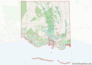
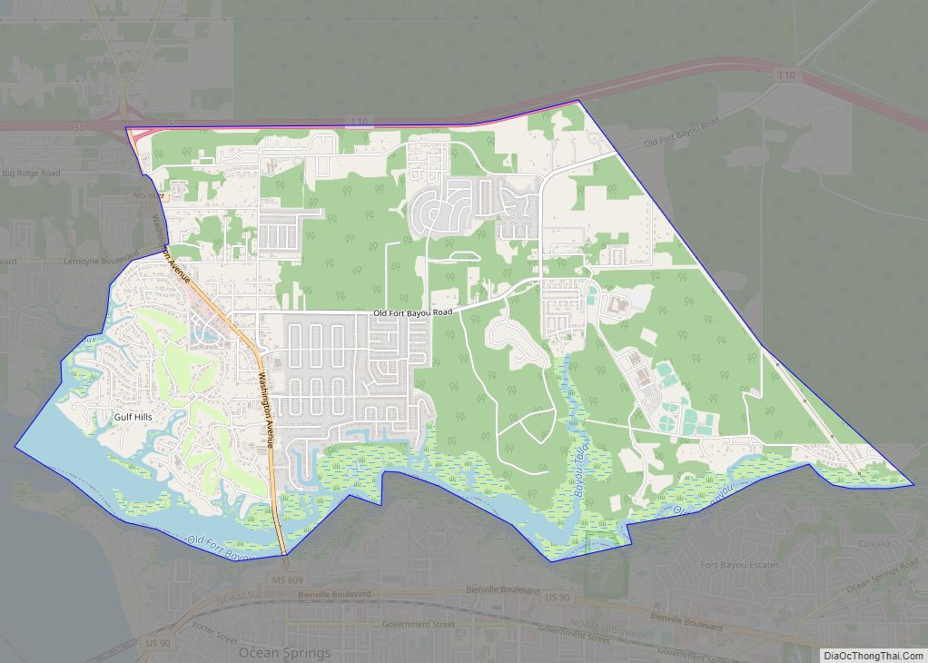
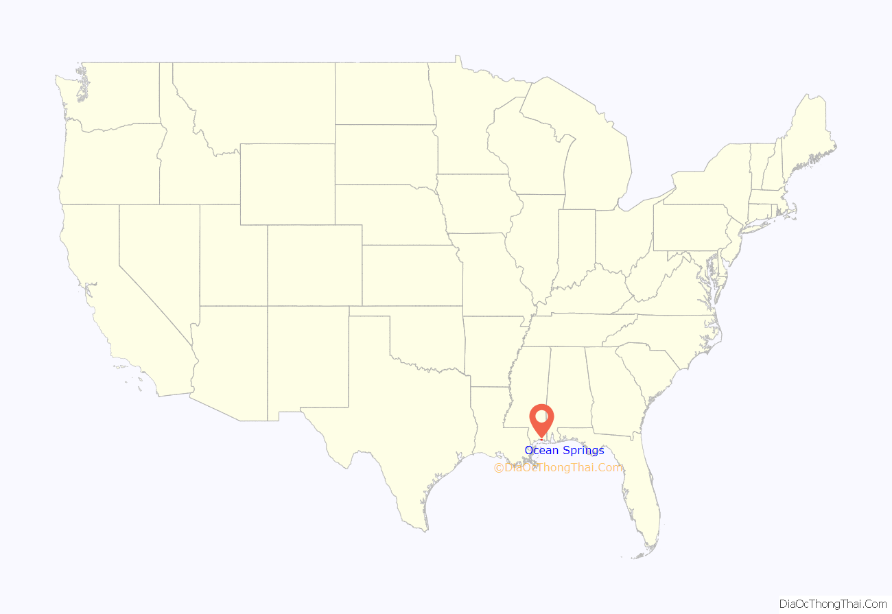
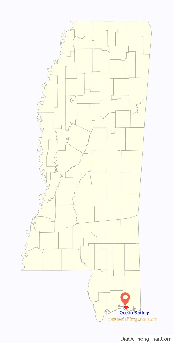
Ocean Springs location map. Where is Ocean Springs city?
History
The settlement of Fort Maurepas or Old Biloxi, in colonial French Louisiana (New France), began in April 1699 at present-day Ocean Springs, under the authority of King Louis XIV, as Fort Maurepas by Pierre Le Moyne d’Iberville. It was the first permanent French outpost in French Louisiana and was established as a foothold to prevent Spanish encroachment on France’s colonial claims. The site was maintained well into the early 18th century.
The name Ocean Springs was coined by Dr. William Glover Austin in 1854. He believed the local springs had healing qualities. Ocean Springs became a prosperous resort town and after several years reinvented itself as a historically-oriented residential community. The history of the town is celebrated annually in re enactments depicting d’Iberville’s landing near a replica of Fort Maurepas. The authorities had authorized John Egan to construct and operate a public wharf near this ancient fort site at the foot of Jackson Avenue prior to the Civil War.
From colonial times to present day, seafood has been celebrated. The abundance of seafood allowed French and French-Canadian explorers and settlers to thrive within the Fort Maurepas/Old Biloxi area. In the late nineteenth century, the development of ice plant industries along the coast increased seafood sales. Locals and tourists can still purchase freshly harvested shrimp, fish, crabs, and oysters to this day because of this thriving industry.
Ocean Springs was in the international spotlight following Hurricane Katrina’s landfall on August 29, 2005. The city, part of the Mississippi Gulf Coast directly hit by the storm, sustained significant damage. The Biloxi-Ocean Springs bridge, part of Highway 90 along the beach, was destroyed and was a widely broadcast visual testament to the hurricane’s impact.
Biloxi Bay Bridge
Hurricane Katrina’s 28-foot (8.5 m) storm surge destroyed the Biloxi Bay Bridge on August 29, 2005, which connected Biloxi to Ocean Springs. The bridge was completed in 1962, and damaged in 1969 by Hurricane Camille. The Biloxi Bay Bridge replaced the aging War Memorial Bridge which opened in 1930. As of 2007, the majority of the bridge’s remains have been removed via cranes based on barges located next to the bridge debris. The bridge ruins, capturing the breathtaking results of the force of Hurricane Katrina, had become a popular spot of photographers both professional and amateur. The construction for the new bridge was completed in April 2008. The new Biloxi Bay Bridge is 95′ in height at its main span, and supports six lanes of traffic. Two lanes of the six-lane bridge opened November 1, 2007. The new bridge has a curving roadway due to the implemented design-build process. In order to speed the process of rebuilding, the main body of the bridge was moved outside of the previous bridge’s debris area. The landing points for each side of U.S. Route 90 correspond with the previous bridge.
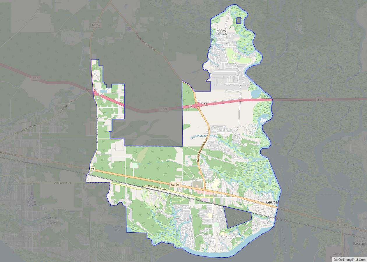
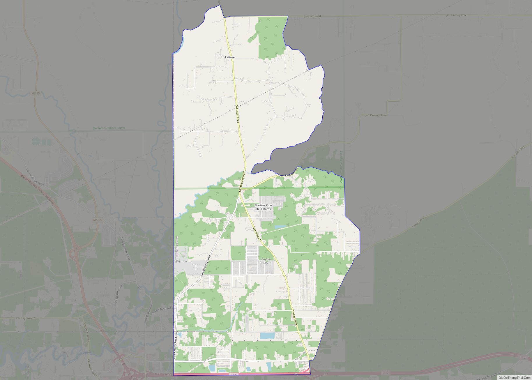
Ocean Springs Road Map

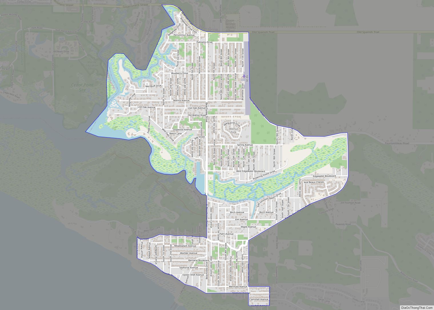
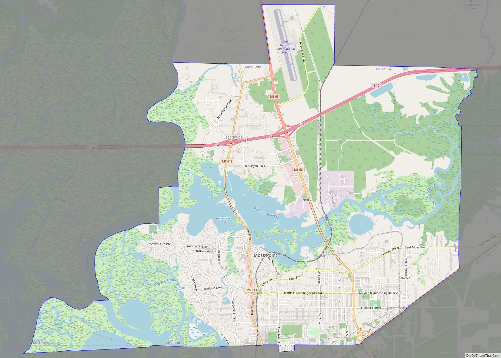
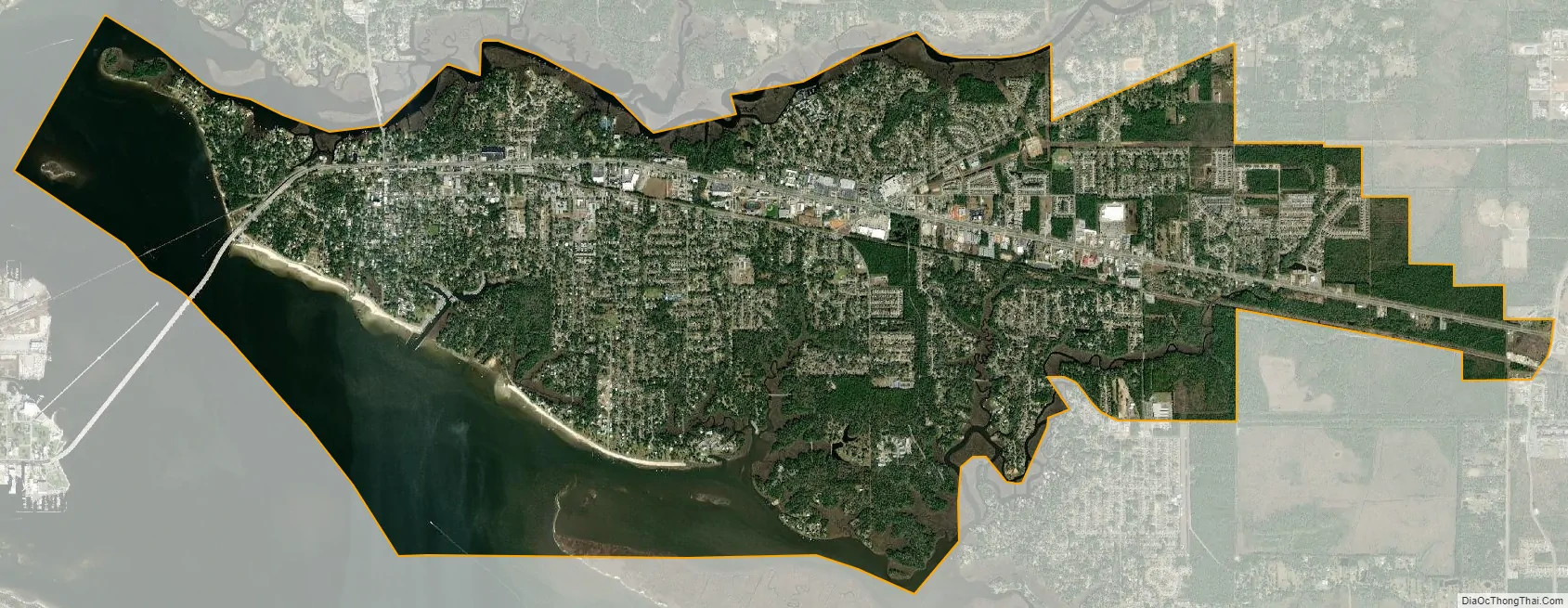
Ocean Springs city Satellite Map
Geography
According to the U.S. Census Bureau, the city has a total area of 15.2 square miles (39 km), of which 11.6 square miles (30 km) is land and 3.6 square miles (9.3 km) (23.57%) is water. The city is classified as having a subtropical climate. This has a hot, humid monsoon season, beginning in late spring and ending in early autumn, with frequent afternoon and evening thunderstorms with torrential downpours. Thunderstorms usually don’t last long but can be strong or even severe. The area is also prone to tropical weather such as tropical depressions, tropical storms, and hurricanes. Autumns and springs are usually cool to warm. Winters typically are warm with cool spells. Cool spells are accompanied with strong, Northerly dry winds which are unexpectedly chilly but do not typically last more than just a couple of days. Summers are consistently hot and humid both day and night with high temperatures usually in the low nineties and low temperatures oftentimes just barely below 80 degrees.
See also
Map of Mississippi State and its subdivision:- Adams
- Alcorn
- Amite
- Attala
- Benton
- Bolivar
- Calhoun
- Carroll
- Chickasaw
- Choctaw
- Claiborne
- Clarke
- Clay
- Coahoma
- Copiah
- Covington
- Desoto
- Forrest
- Franklin
- George
- Greene
- Grenada
- Hancock
- Harrison
- Hinds
- Holmes
- Humphreys
- Issaquena
- Itawamba
- Jackson
- Jasper
- Jefferson
- Jefferson Davis
- Jones
- Kemper
- Lafayette
- Lamar
- Lauderdale
- Lawrence
- Leake
- Lee
- Leflore
- Lincoln
- Lowndes
- Madison
- Marion
- Marshall
- Monroe
- Montgomery
- Neshoba
- Newton
- Noxubee
- Oktibbeha
- Panola
- Pearl River
- Perry
- Pike
- Pontotoc
- Prentiss
- Quitman
- Rankin
- Scott
- Sharkey
- Simpson
- Smith
- Stone
- Sunflower
- Tallahatchie
- Tate
- Tippah
- Tishomingo
- Tunica
- Union
- Walthall
- Warren
- Washington
- Wayne
- Webster
- Wilkinson
- Winston
- Yalobusha
- Yazoo
- Alabama
- Alaska
- Arizona
- Arkansas
- California
- Colorado
- Connecticut
- Delaware
- District of Columbia
- Florida
- Georgia
- Hawaii
- Idaho
- Illinois
- Indiana
- Iowa
- Kansas
- Kentucky
- Louisiana
- Maine
- Maryland
- Massachusetts
- Michigan
- Minnesota
- Mississippi
- Missouri
- Montana
- Nebraska
- Nevada
- New Hampshire
- New Jersey
- New Mexico
- New York
- North Carolina
- North Dakota
- Ohio
- Oklahoma
- Oregon
- Pennsylvania
- Rhode Island
- South Carolina
- South Dakota
- Tennessee
- Texas
- Utah
- Vermont
- Virginia
- Washington
- West Virginia
- Wisconsin
- Wyoming