Olive Branch is a city in DeSoto County, Mississippi, United States. As of the 2020 census, the population is 39,711. Olive Branch is part of the Memphis Metropolitan Statistical Area, a region that consists of three counties in southwest Tennessee, five counties in northwest Mississippi, and two counties in eastern Arkansas. Olive Branch was the fastest growing city in the United States, with a growth rate of 838% as of 2010 in a thirty year time frame. Along with other rapidly growing places in DeSoto County, Olive Branch attributes most of its growth and development to the exodus of large numbers of families from central Memphis.
| Name: | Olive Branch city |
|---|---|
| LSAD Code: | 25 |
| LSAD Description: | city (suffix) |
| State: | Mississippi |
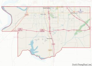
| County: | DeSoto County |
| Elevation: | 387 ft (118 m) |
| Total Area: | 56.05 sq mi (145.17 km²) |
| Land Area: | 55.84 sq mi (144.62 km²) |
| Water Area: | 0.21 sq mi (0.56 km²) |
| Total Population: | 39,711 |
| Population Density: | 711.18/sq mi (274.59/km²) |
| ZIP code: | 38654 |
| Area code: | 662 |
| FIPS code: | 2854040 |
| GNISfeature ID: | 0690369 |
| Website: | www.obms.us |
Online Interactive Map
Click on ![]() to view map in "full screen" mode.
to view map in "full screen" mode.
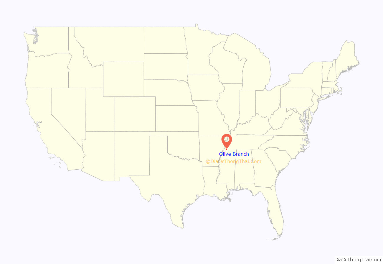
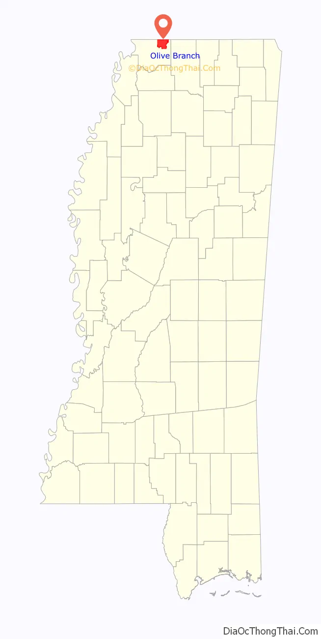
Olive Branch location map. Where is Olive Branch city?
History
The first permanent Anglo settlers in the area were Stephen Flinn and his wife’s brother-in-law, Milton Blocker. On April 13, 1836, they purchased 1,280 acres (520 ha) of land – known as Sections 34 and 35 – in newly created DeSoto County from Chickasaw chief Lush-Pun-Tubby for $1,600. Flinn conveyed the land to Blocker for $6,400 in 1840. A small community initially known as “Cowpens” sprang up in the early 1840s. The name was changed to “Watson’s Crossroads” in 1842. In 1846, when a post office was established, the name was changed again to “Olive Branch”. Frances Wilson Blocker, a descendant of one of the community’s founders, suggested the name as a way to symbolize the biblical story of a dove bringing a branch to Noah. With the exception of a few skirmishes occurring in an area southwest of the community, Olive Branch escaped much of the destruction and violence during the Civil War.
Olive Branch was incorporated as a town on May 1, 1874. Ben Wesson was elected as the first mayor. At the first census conducted after incorporation in 1880, the population was 73. Kansas City, Memphis & Birmingham built a railroad line through Olive Branch in 1885, connecting the town to Memphis and Birmingham. The town was officially designated a village on March 6, 1888.
At the turn of the 20th century, nearly 200 people lived in Olive Branch. In the ensuing years, several modern amenities were introduced in the village, including the first cotton gin (1910), a public water system (1922), and electrical service (1927). T.H. Norvell’s cheese plant (at the side of present-day BancorpSouth) opened in 1929, becoming the first major industry in Olive Branch. A public sewer system was built, and local streets were paved c. 1940. The village experienced modest growth during the next few decades, rising from 441 in the 1940 census, to 534 in 1950, and 642 in 1960. Growth accelerated in the 1960s, and by 1970 the population had more than doubled to 1,513. In 1971, a site located a few miles from downtown Olive Branch was chosen as the home of Holiday Inn University and Conference Center. Simultaneous with construction of the university, Holiday Inn began work on a 3,000-acre (1,200 ha) industrial park. This was followed by the opening of Olive Branch Airport in January 1973. With a runway length of 6,000 feet (1,800 m), it is currently one of Mississippi’s five most active airports for landings and takeoffs. U.S. Highway 78 was built through Olive Branch in 1974. Such developments and infrastructure improvements brought an influx of jobs, industries, and people to DeSoto County and Olive Branch.
The 1990s were a period of explosive growth in the city; 3,567 people lived in Olive Branch at the 1990 census. In 1996, a land annexation to the west doubled the city’s total land area. By 2000, the population had risen to 21,054, a 490 percent increase over the 1990 figure.
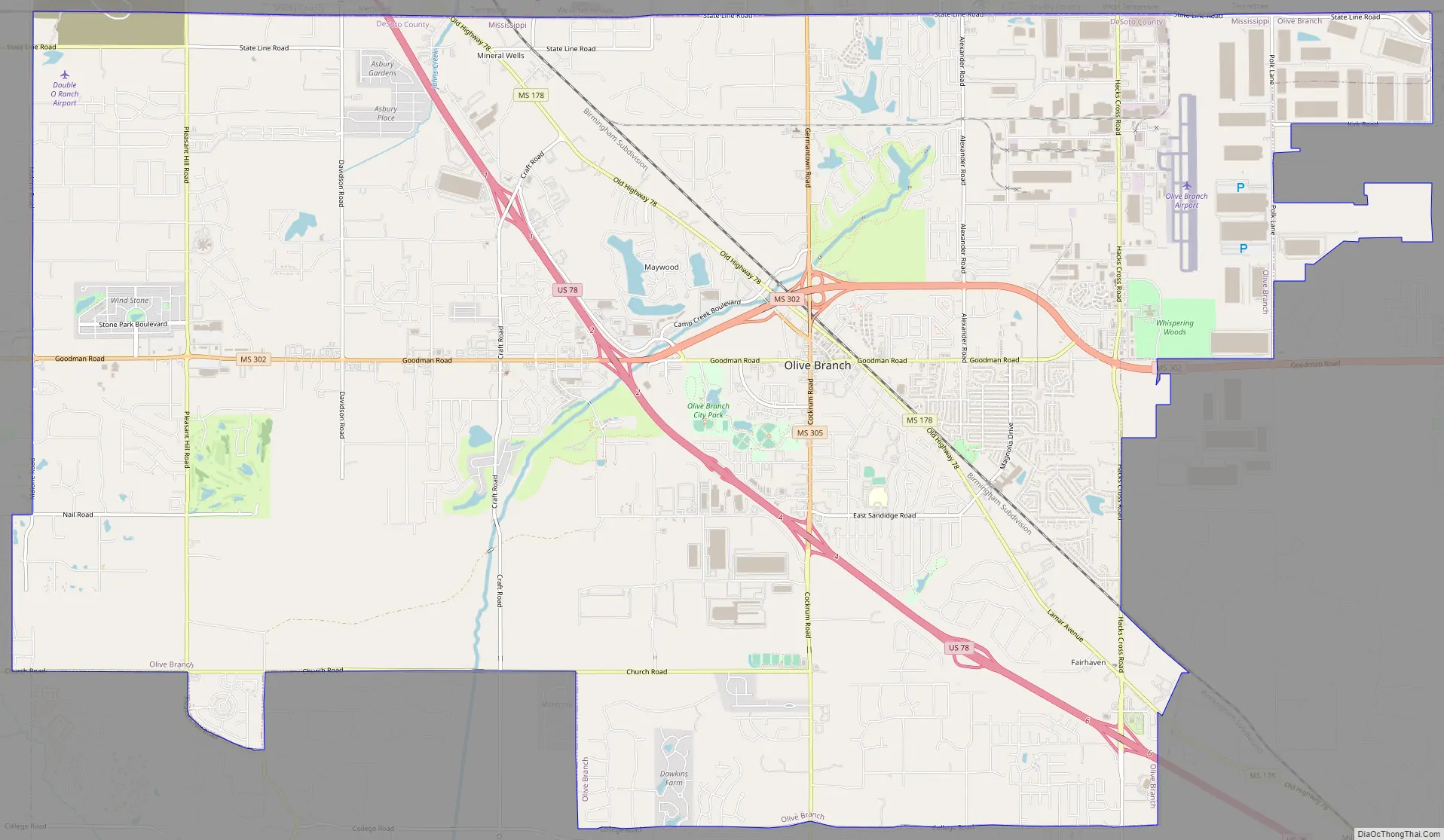
Olive Branch Road Map
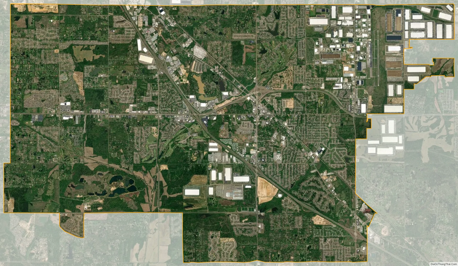
Olive Branch city Satellite Map
Geography
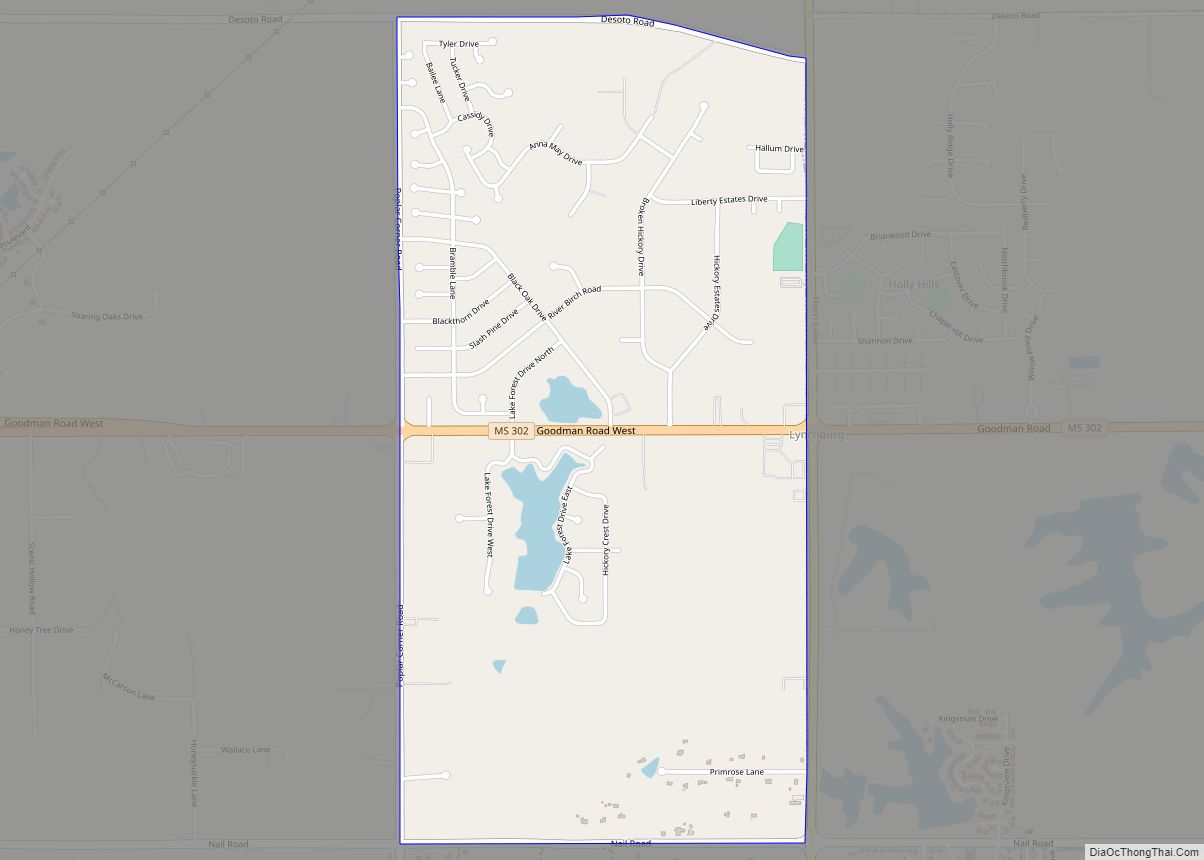
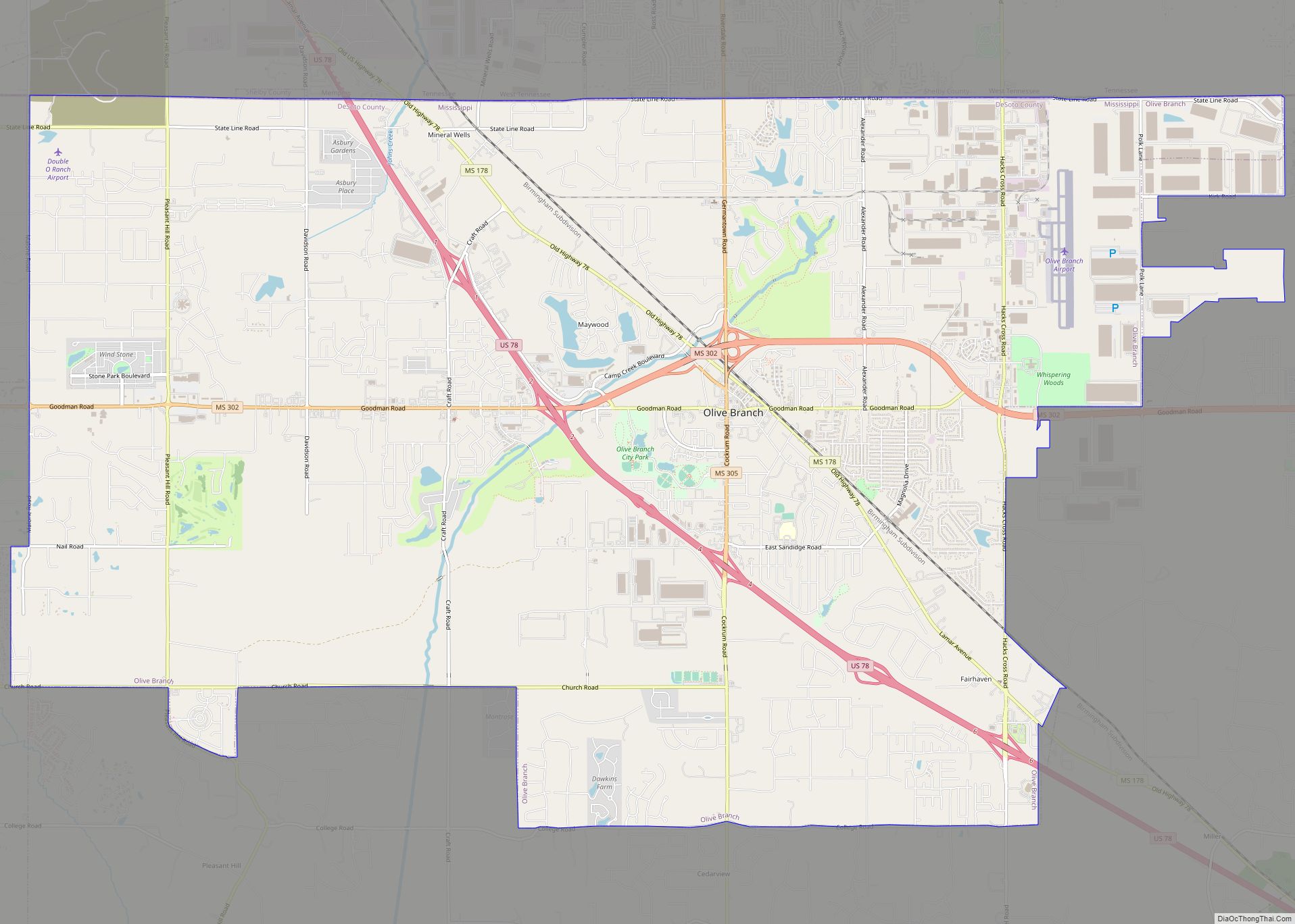
Olive Branch is located in northeastern DeSoto County, at the junction of U.S. Route 78, and State Highways 302 (known locally as Goodman Road) and 305 (Germantown Road/Cockrum Street). Via US 78 it is 22 miles (35 km) northwest to the center of Memphis.
The city’s northern border is the Mississippi/Tennessee state line. The Memphis city limits touch the western portion of Olive Branch’s northern border. The city of Southaven, Mississippi, borders Olive Branch on the west, and unincorporated areas border the city to the east and south.
According to the United States Census Bureau, the city of Olive Branch has a total area of 36.9 square miles (95.6 km), of which 36.7 square miles (95.0 km) is land and 0.2 square miles (0.5 km), or 0.56%, is water.
See also
Map of Mississippi State and its subdivision:- Adams
- Alcorn
- Amite
- Attala
- Benton
- Bolivar
- Calhoun
- Carroll
- Chickasaw
- Choctaw
- Claiborne
- Clarke
- Clay
- Coahoma
- Copiah
- Covington
- Desoto
- Forrest
- Franklin
- George
- Greene
- Grenada
- Hancock
- Harrison
- Hinds
- Holmes
- Humphreys
- Issaquena
- Itawamba
- Jackson
- Jasper
- Jefferson
- Jefferson Davis
- Jones
- Kemper
- Lafayette
- Lamar
- Lauderdale
- Lawrence
- Leake
- Lee
- Leflore
- Lincoln
- Lowndes
- Madison
- Marion
- Marshall
- Monroe
- Montgomery
- Neshoba
- Newton
- Noxubee
- Oktibbeha
- Panola
- Pearl River
- Perry
- Pike
- Pontotoc
- Prentiss
- Quitman
- Rankin
- Scott
- Sharkey
- Simpson
- Smith
- Stone
- Sunflower
- Tallahatchie
- Tate
- Tippah
- Tishomingo
- Tunica
- Union
- Walthall
- Warren
- Washington
- Wayne
- Webster
- Wilkinson
- Winston
- Yalobusha
- Yazoo
- Alabama
- Alaska
- Arizona
- Arkansas
- California
- Colorado
- Connecticut
- Delaware
- District of Columbia
- Florida
- Georgia
- Hawaii
- Idaho
- Illinois
- Indiana
- Iowa
- Kansas
- Kentucky
- Louisiana
- Maine
- Maryland
- Massachusetts
- Michigan
- Minnesota
- Mississippi
- Missouri
- Montana
- Nebraska
- Nevada
- New Hampshire
- New Jersey
- New Mexico
- New York
- North Carolina
- North Dakota
- Ohio
- Oklahoma
- Oregon
- Pennsylvania
- Rhode Island
- South Carolina
- South Dakota
- Tennessee
- Texas
- Utah
- Vermont
- Virginia
- Washington
- West Virginia
- Wisconsin
- Wyoming