Ashley is a city in and the county seat of McIntosh County, North Dakota, United States. The population was 613 at the 2020 census.
| Name: | Ashley city |
|---|---|
| LSAD Code: | 25 |
| LSAD Description: | city (suffix) |
| State: | North Dakota |
| County: | McIntosh County |
| Founded: | 1888 |
| Elevation: | 2,014 ft (614 m) |
| Total Area: | 0.64 sq mi (1.67 km²) |
| Land Area: | 0.64 sq mi (1.67 km²) |
| Water Area: | 0.00 sq mi (0.00 km²) |
| Total Population: | 613 |
| Population Density: | 953.34/sq mi (368.08/km²) |
| ZIP code: | 58413 |
| Area code: | 701 |
| FIPS code: | 3803540 |
| Website: | ashley-nd.com |
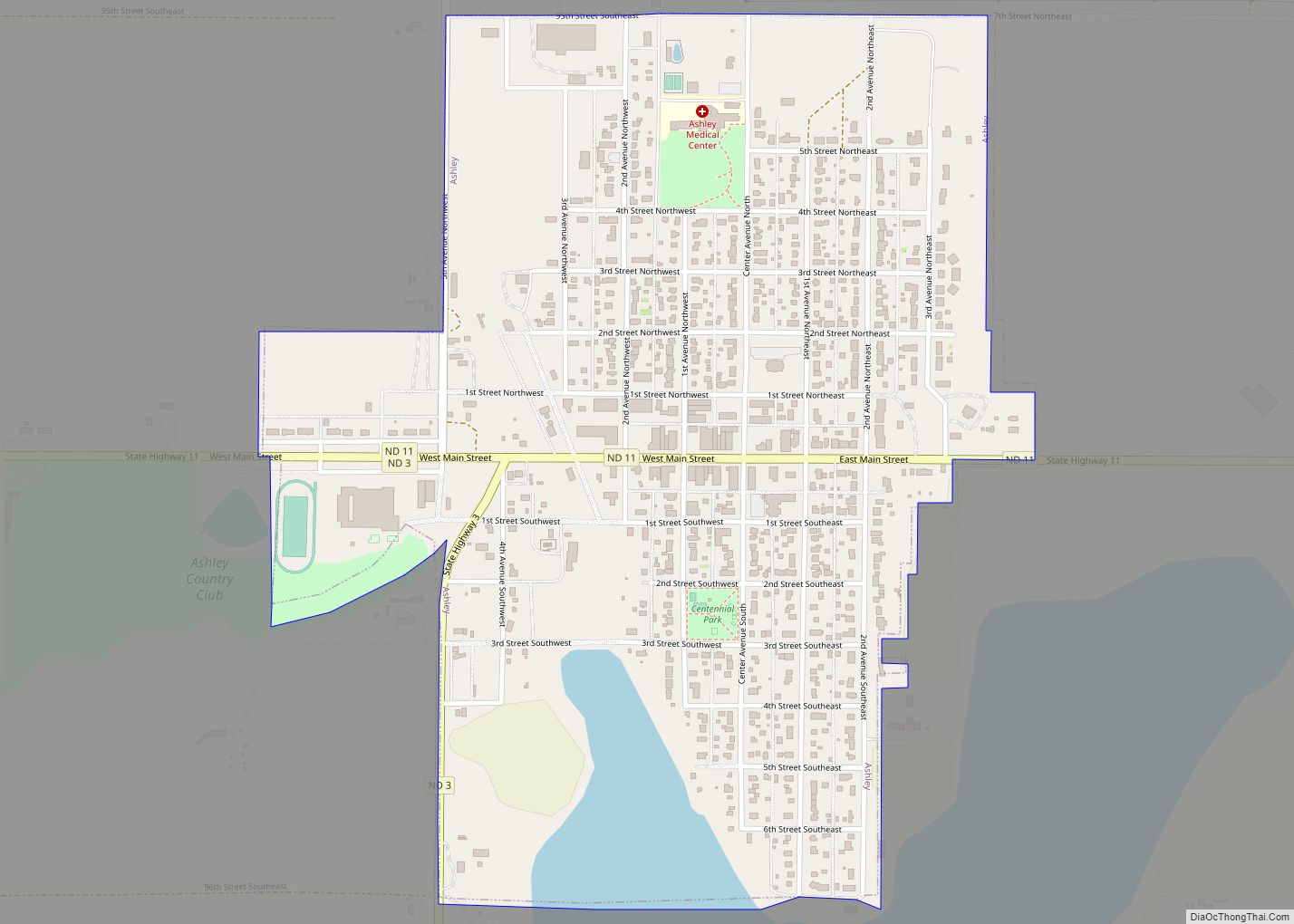
Online Interactive Map
Click on ![]() to view map in "full screen" mode.
to view map in "full screen" mode.
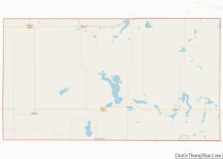
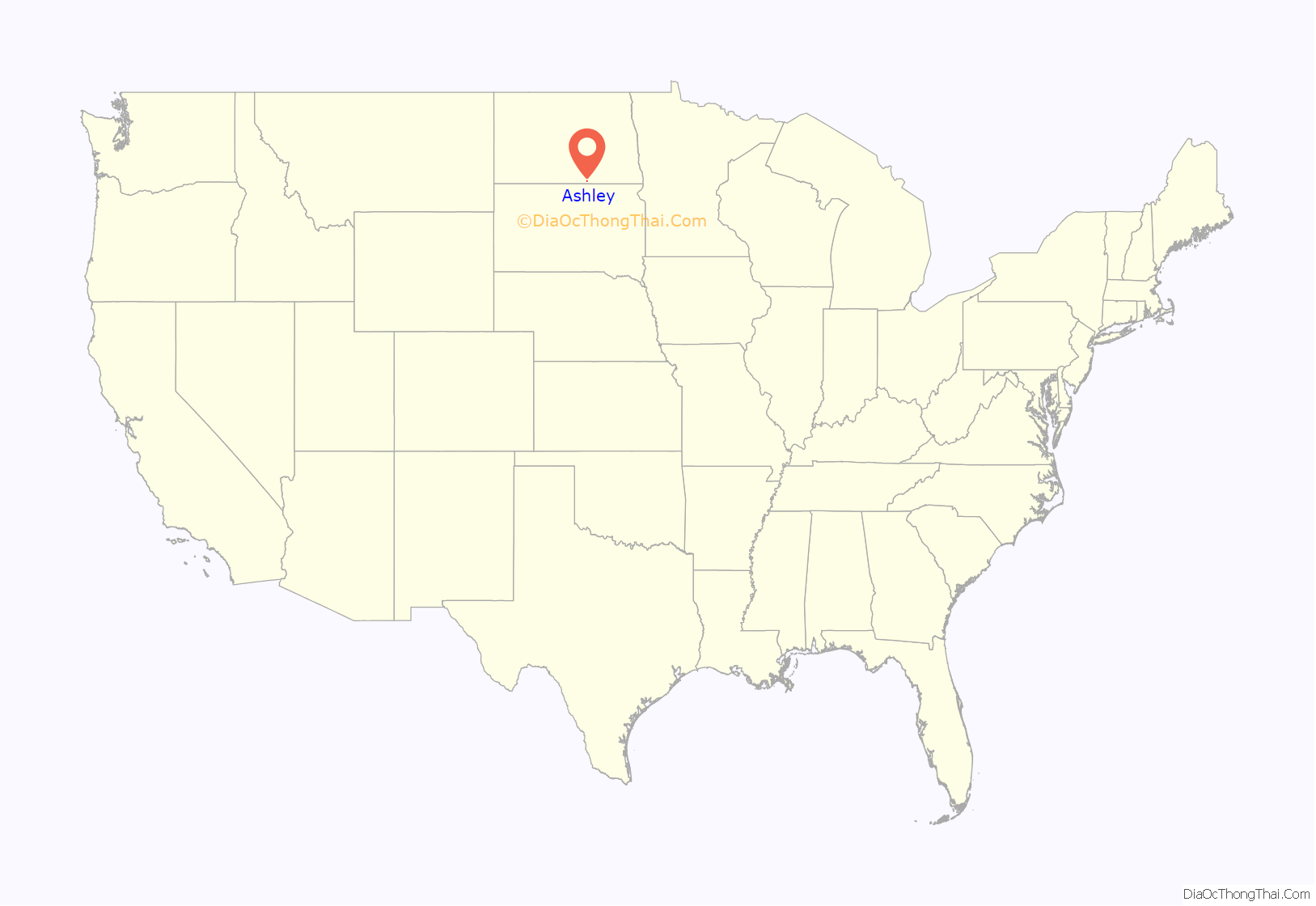
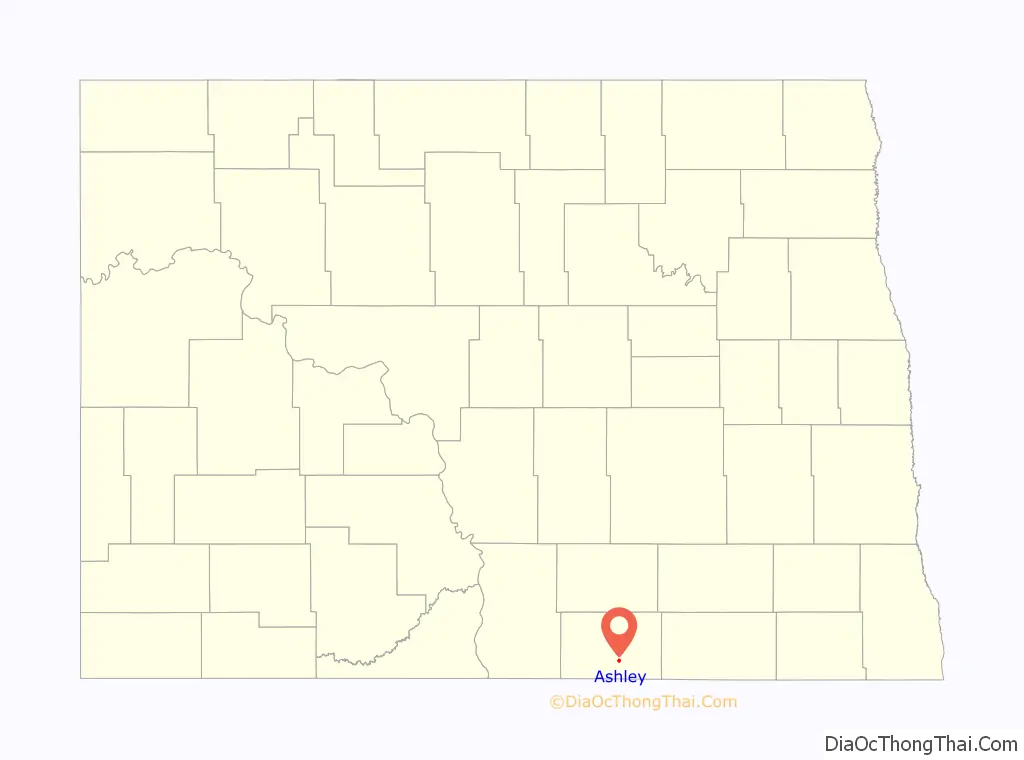
Ashley location map. Where is Ashley city?
History
Ashley was laid out in 1888 when the Minneapolis, St. Paul and Sault Ste. Marie Railroad was extended to that point. The city was named for Ashley E. Morrow, a railroad man. A post office has been in operation at Ashley since 1888. The McIntosh County Courthouse was built in 1919.
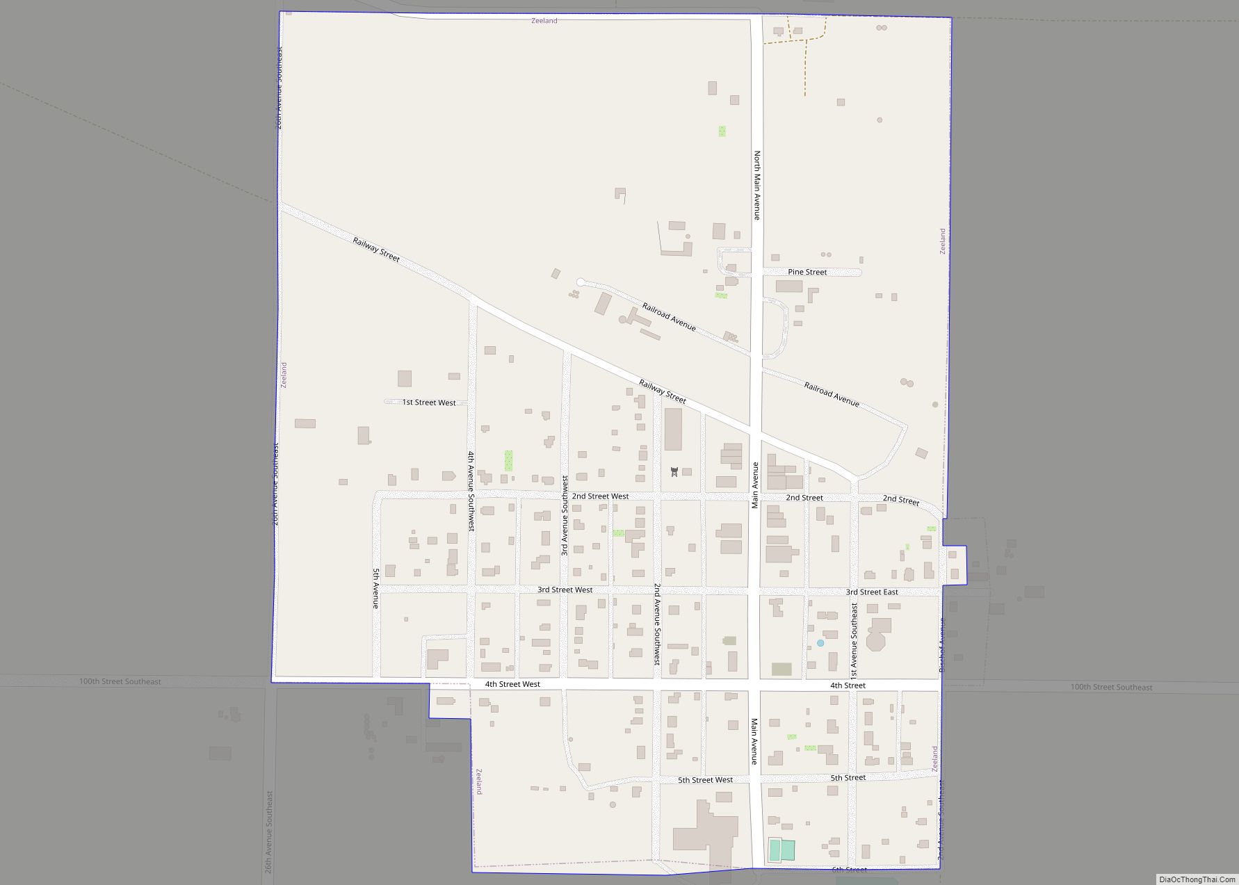
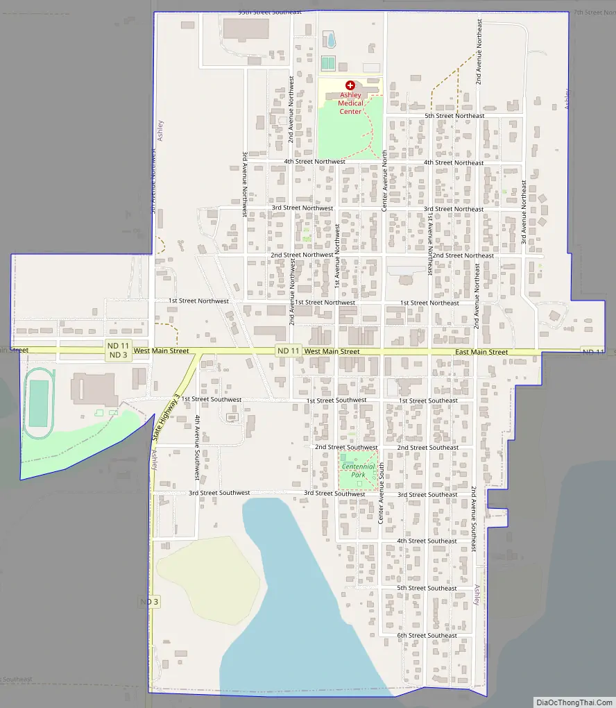
Ashley Road Map
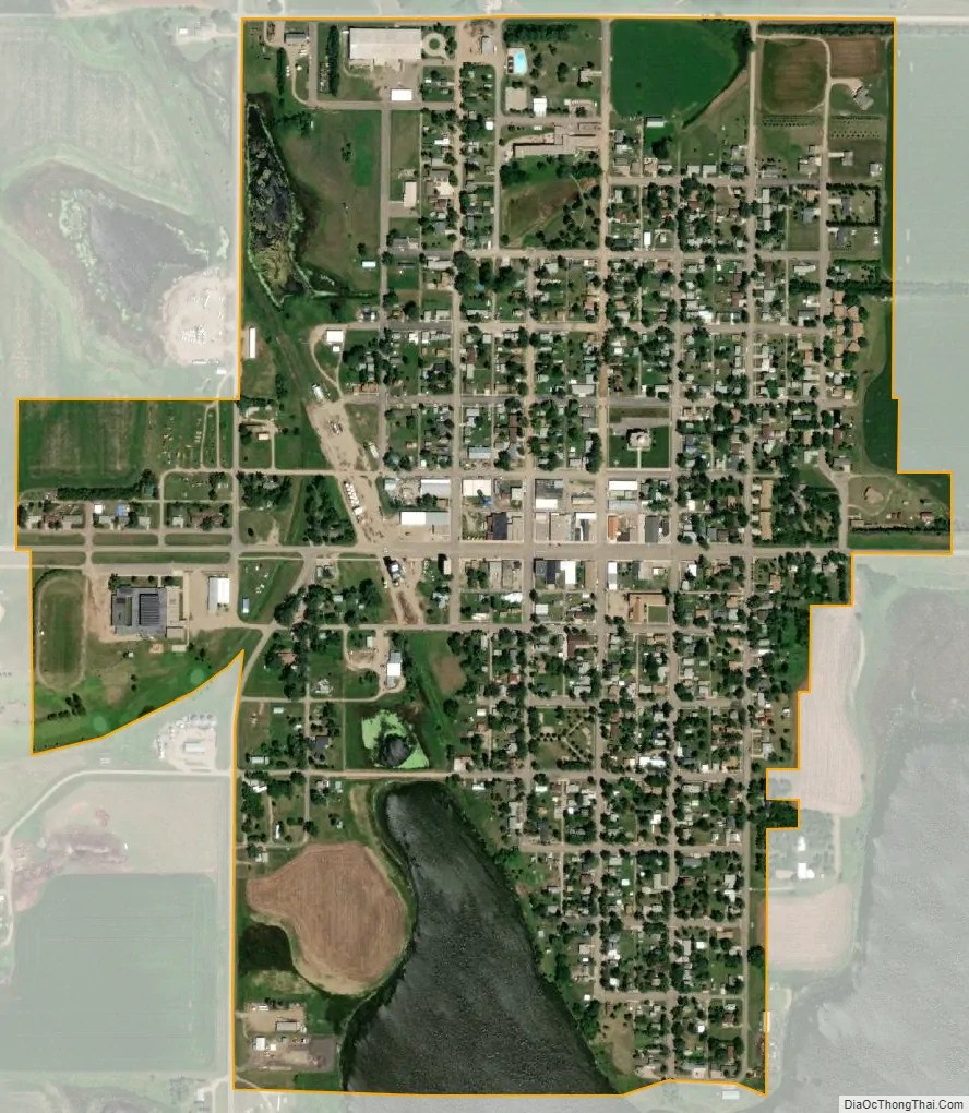
Ashley city Satellite Map
Geography
Ashley is located at 46°2′6″N 99°22′25″W / 46.03500°N 99.37361°W / 46.03500; -99.37361 (46.034894, -99.373714).
According to the United States Census Bureau, the city has a total area of 0.64 square miles (1.66 km), all land.
Climate
Ashley has a warm-summer humid continental climate (Köppen Dfb), with an annual precipitation average of 20.74 inches (526.8 mm). Winters are frigid and dry with moderate snowfall, while summers are wetter and very warm with pleasant mornings.
See also
Map of North Dakota State and its subdivision:- Adams
- Barnes
- Benson
- Billings
- Bottineau
- Bowman
- Burke
- Burleigh
- Cass
- Cavalier
- Dickey
- Divide
- Dunn
- Eddy
- Emmons
- Foster
- Golden Valley
- Grand Forks
- Grant
- Griggs
- Hettinger
- Kidder
- Lamoure
- Logan
- McHenry
- McIntosh
- McKenzie
- McLean
- Mercer
- Morton
- Mountrail
- Nelson
- Oliver
- Pembina
- Pierce
- Ramsey
- Ransom
- Renville
- Richland
- Rolette
- Sargent
- Sheridan
- Sioux
- Slope
- Stark
- Steele
- Stutsman
- Towner
- Traill
- Walsh
- Ward
- Wells
- Williams
- Alabama
- Alaska
- Arizona
- Arkansas
- California
- Colorado
- Connecticut
- Delaware
- District of Columbia
- Florida
- Georgia
- Hawaii
- Idaho
- Illinois
- Indiana
- Iowa
- Kansas
- Kentucky
- Louisiana
- Maine
- Maryland
- Massachusetts
- Michigan
- Minnesota
- Mississippi
- Missouri
- Montana
- Nebraska
- Nevada
- New Hampshire
- New Jersey
- New Mexico
- New York
- North Carolina
- North Dakota
- Ohio
- Oklahoma
- Oregon
- Pennsylvania
- Rhode Island
- South Carolina
- South Dakota
- Tennessee
- Texas
- Utah
- Vermont
- Virginia
- Washington
- West Virginia
- Wisconsin
- Wyoming