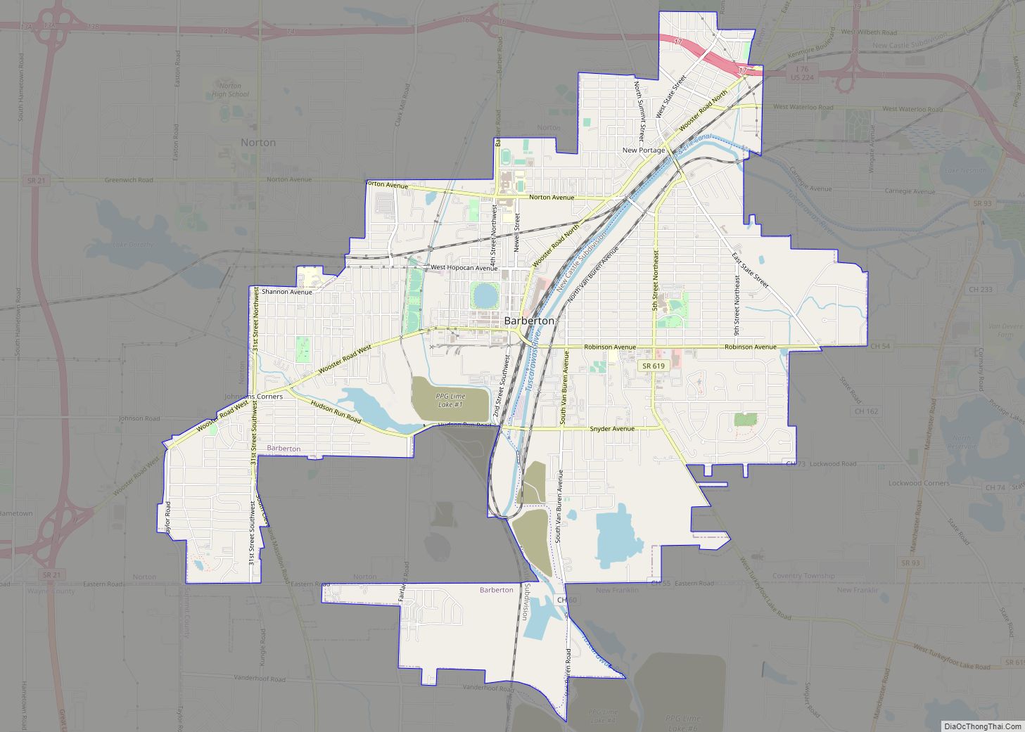
Barberton is a city in Summit County, Ohio, United States. The population was 25,191 at the 2020 census. Located directly southwest of Akron, it is a suburb of the Akron metropolitan area.
| Name: | Barberton city |
|---|---|
| LSAD Code: | 25 |
| LSAD Description: | city (suffix) |
| State: | Ohio |
| County: | Summit County |
| Elevation: | 974 ft (297 m) |
| Total Area: | 9.24 sq mi (23.93 km²) |
| Land Area: | 9.02 sq mi (23.35 km²) |
| Water Area: | 0.22 sq mi (0.57 km²) |
| Total Population: | 25,191 |
| Population Density: | 2,793.72/sq mi (1,078.70/km²) |
| FIPS code: | 3903828 |
| GNISfeature ID: | 1037625 |
| Website: | www.cityofbarberton.com |
Online Interactive Map
Click on ![]() to view map in "full screen" mode.
to view map in "full screen" mode.
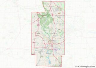
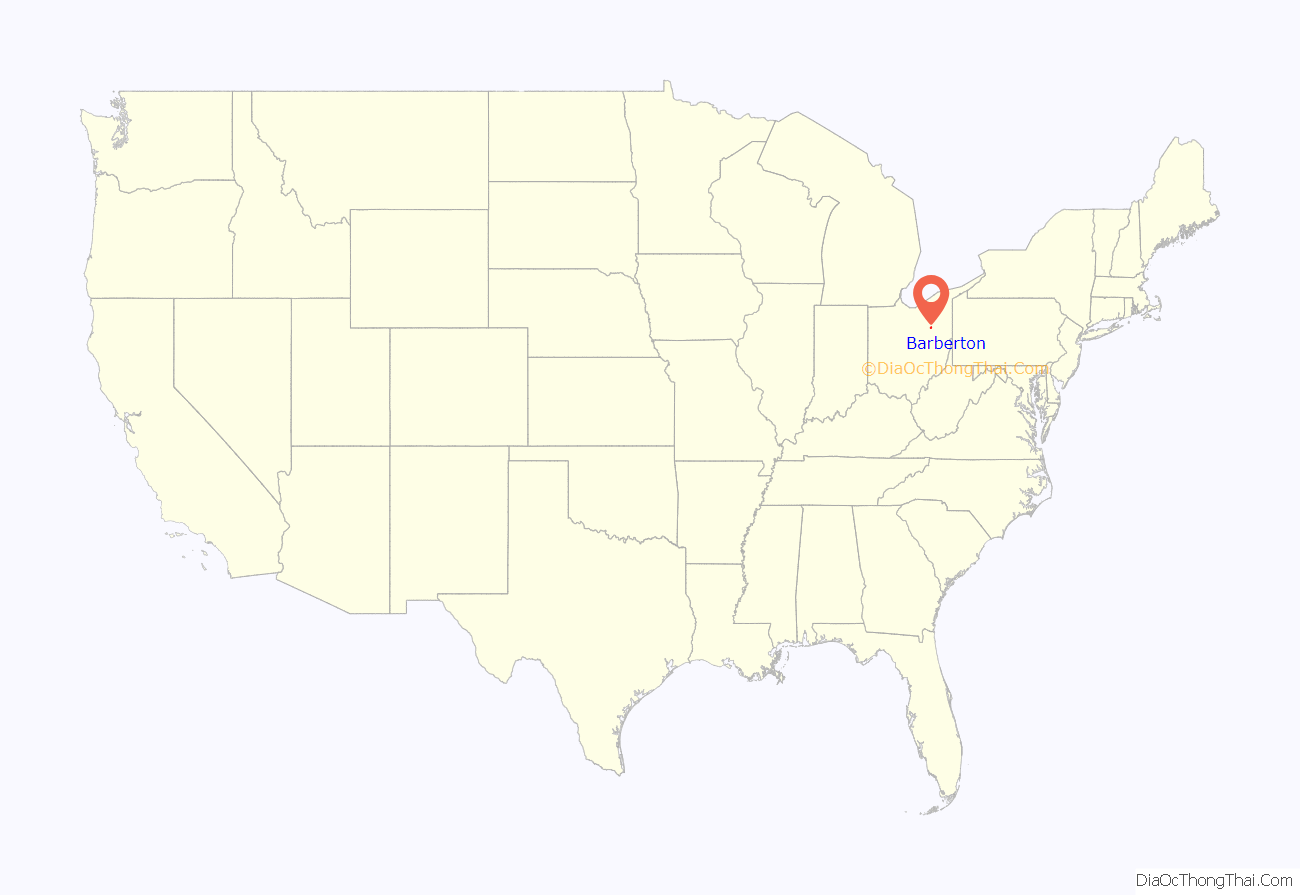
Barberton location map. Where is Barberton city?

History
Barberton was founded in 1891 by industrialist O.C. Barber, who planned the town according to his vision of industry, progress and community. In 1894 he moved the manufacturing operations of the Diamond Match Company, which he formed from a merger of 11 companies, from Akron to Barberton. He soon was producing 250 million matches a day. In the valley running parallel to the Tuscarawas River and the Ohio & Erie Canal, he oversaw the construction of factories, residential neighborhoods and a compact commercial downtown. In the center of the new city was Lake Anna, named after Barber’s only daughter, Anna Laura Barber.
Barberton became known as the “Magic City” because of its rapid population growth during its formative industrial years, at a time of waves of immigration from eastern and southern Europe. In 1891, when Barberton was incorporated, the scattered farms that had originally characterized the landscape were transformed into a fledgling city of 1,800. When an Akron Beacon Journal reporter revisited Barberton in 1893, he noted that since 1891, it had grown so quickly that it appeared to have grown by magic (hence its nickname). Many new immigrants were attracted to its industrial jobs, which provided a path to assimilation.
In 1908, on a high hill on the east side of town, Barber began construction of an experimental farm and estate, which he called Anna–Dean Farm. It included his 52-room, French Renaissance Revival-style mansion, completed in 1909, and lush gardens, dozens of barns and other structures in the same style, and greenhouses. Barber built 35 structures for the Anna-Dean Farm, all in the French Renaissance Revival style. The farm covered 3500 acres. Believing farming could be as efficient as an industry, Barber intended the farm to be the basis of an agricultural college, but he did not complete its financing before his death. He willed the farm to Western Reserve University (now Case Western Reserve University). It later sold much of the property.
Today, five of the eight primary buildings and associated property of the farm complex are owned by the Barberton Historical Society. These buildings are constructed of red brick edged in white concrete block, with royal blue trim and red tile roofing. The most significant of the remaining buildings is Barn No. 1, the former Dairy Barn, restored in 1985 and now the world headquarters of the Yoder Brothers Corporation, horticulturists. The building has castle tower-like silos, visible from much of the east side of the city. The other barns have been structurally stabilized and at least partially restored. All but one may be renovated for other economic uses. The Creamery has been restored as a residence for the same family since 1943 and served as the birthplace for the Apostolic Church of Barberton founded in 1950. After sale by Western Reserve University following World War 2, most of the 40-acre Barber estate was broken up and redeveloped for suburban residential housing. The mansion was demolished in 1965.
“The Magics” became the mascot name of the Barberton High School athletic teams. As Barberton High School colors are purple and white, “purple pride” marks local enthusiasm for the school. The city’s schools have also improved academic performance since the 1980s.
During the 1980s Barberton suffered a precipitous economic decline due to restructuring in heavy industry and job losses, similar to much of the rest of the industrial American Midwest. It was in many ways representative of a typical Rust Belt city. During this period, the city lost a large part of its economic base as factories shuttered and stores went vacant. The Magic City: Unemployment in a Working-Class Community (Cornell University Press, 1989) documents the consequences of the migration of major industries from the region and the responses of residents to such dramatic changes. In 1985, key business stakeholders and government leaders created the Barberton Community Development Corporation (BCDC). The BCDC has facilitated the creation of over 2,000 jobs, and in excess of $100 million in business expansion projects. They have stimulated the creation of three mini-industrial parks and 25 new construction projects.
The Barberton Community Foundation facilitated the construction of a new Barberton High School, located on reclaimed swampland in the northwest section of the city.
Barberton Road Map
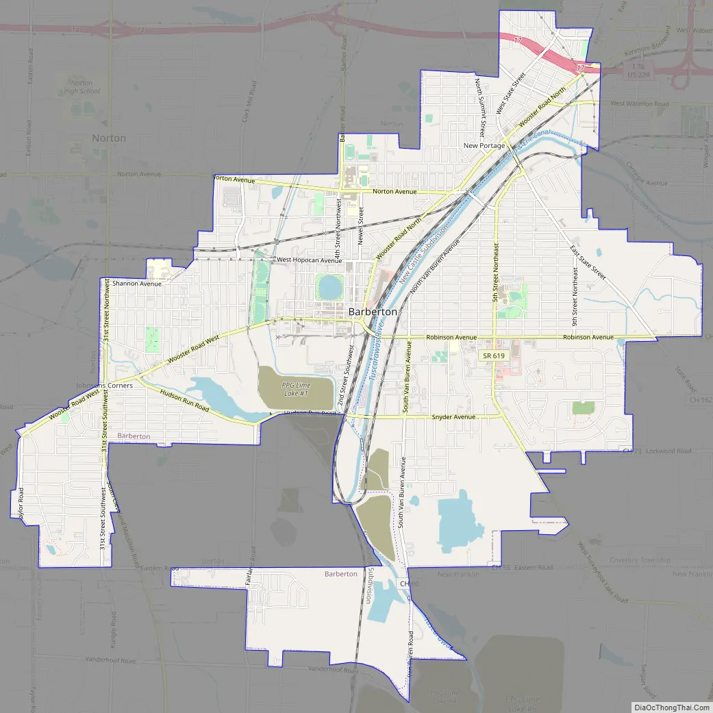
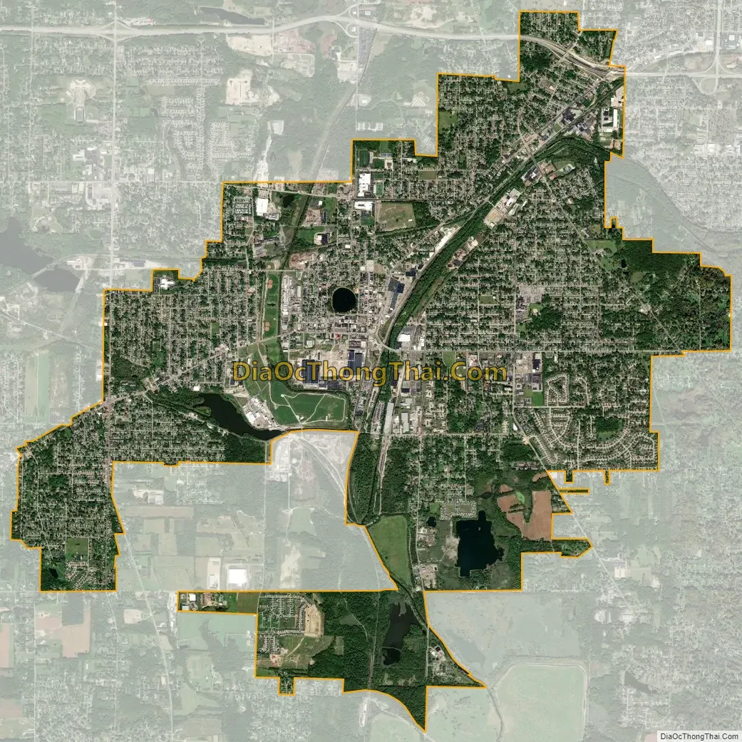
Barberton city Satellite Map
Geography
According to the 2010 census, the city has a total area of 9.26 square miles (24.0 km), of which 9.04 square miles (23.4 km) (or 97.62%) is land and 0.22 square miles (0.57 km) (or 2.38%) is water.
Lake Anna, a glacial kettle lake, is a 10-acre (40,000 m) natural spring lake that lies in the center of the original village of Barberton. It is the center of a 21-acre (85,000 m) park named after it. Lake Anna is named for O. C. Barber’s daughter Anna Laura Barber.
See also
Map of Ohio State and its subdivision:- Adams
- Allen
- Ashland
- Ashtabula
- Athens
- Auglaize
- Belmont
- Brown
- Butler
- Carroll
- Champaign
- Clark
- Clermont
- Clinton
- Columbiana
- Coshocton
- Crawford
- Cuyahoga
- Darke
- Defiance
- Delaware
- Erie
- Fairfield
- Fayette
- Franklin
- Fulton
- Gallia
- Geauga
- Greene
- Guernsey
- Hamilton
- Hancock
- Hardin
- Harrison
- Henry
- Highland
- Hocking
- Holmes
- Huron
- Jackson
- Jefferson
- Knox
- Lake
- Lake Erie
- Lawrence
- Licking
- Logan
- Lorain
- Lucas
- Madison
- Mahoning
- Marion
- Medina
- Meigs
- Mercer
- Miami
- Monroe
- Montgomery
- Morgan
- Morrow
- Muskingum
- Noble
- Ottawa
- Paulding
- Perry
- Pickaway
- Pike
- Portage
- Preble
- Putnam
- Richland
- Ross
- Sandusky
- Scioto
- Seneca
- Shelby
- Stark
- Summit
- Trumbull
- Tuscarawas
- Union
- Van Wert
- Vinton
- Warren
- Washington
- Wayne
- Williams
- Wood
- Wyandot
- Alabama
- Alaska
- Arizona
- Arkansas
- California
- Colorado
- Connecticut
- Delaware
- District of Columbia
- Florida
- Georgia
- Hawaii
- Idaho
- Illinois
- Indiana
- Iowa
- Kansas
- Kentucky
- Louisiana
- Maine
- Maryland
- Massachusetts
- Michigan
- Minnesota
- Mississippi
- Missouri
- Montana
- Nebraska
- Nevada
- New Hampshire
- New Jersey
- New Mexico
- New York
- North Carolina
- North Dakota
- Ohio
- Oklahoma
- Oregon
- Pennsylvania
- Rhode Island
- South Carolina
- South Dakota
- Tennessee
- Texas
- Utah
- Vermont
- Virginia
- Washington
- West Virginia
- Wisconsin
- Wyoming