Newtown is a village in southeastern Hamilton County, Ohio, United States, near Cincinnati. The population was 2,702 at the 2020 census. Newtown was settled in 1792 and incorporated as a village in 1901.
| Name: | Newtown village |
|---|---|
| LSAD Code: | 47 |
| LSAD Description: | village (suffix) |
| State: | Ohio |
| County: | Hamilton County |
| Elevation: | 499 ft (152 m) |
| Total Area: | 2.23 sq mi (5.76 km²) |
| Land Area: | 2.07 sq mi (5.35 km²) |
| Water Area: | 0.16 sq mi (0.41 km²) |
| Total Population: | 2,702 |
| Population Density: | 1,307.21/sq mi (504.62/km²) |
| ZIP code: | 45244 |
| Area code: | 513 |
| FIPS code: | 3955678 |
| GNISfeature ID: | 1065151 |
| Website: | www.newtownohio.gov |
Online Interactive Map
Click on ![]() to view map in "full screen" mode.
to view map in "full screen" mode.
Newtown location map. Where is Newtown village?


History
Multiple Native American mounds and other earthworks were once located on the site of Newtown.
Newtown was first settled in 1792 under the name of Mercersburg. The name was changed before the village incorporated in 1901. Still in existence today are the Odd Fellows’ Cemetery Mound and the Perin Village Site, plus the Turpin site and the Hahn Field Archeological District just outside the village’s boundaries.
Newtown withdrew from Anderson Township in the 1960s by forming a paper township.
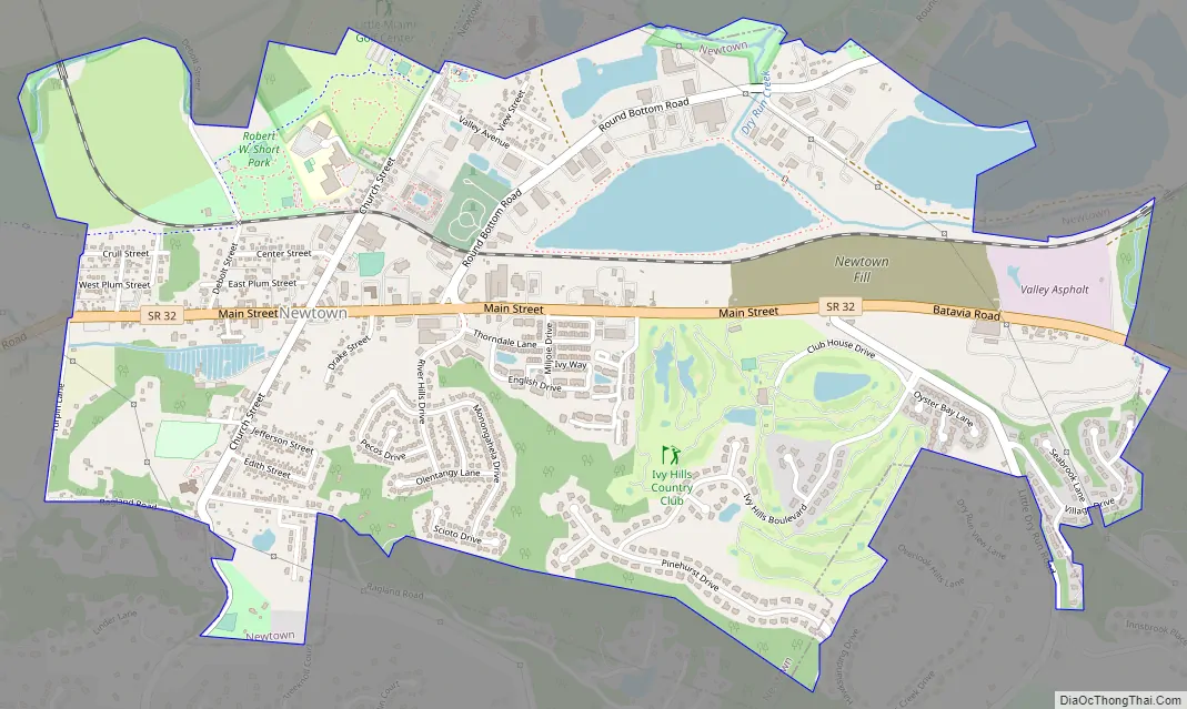
Newtown Road Map
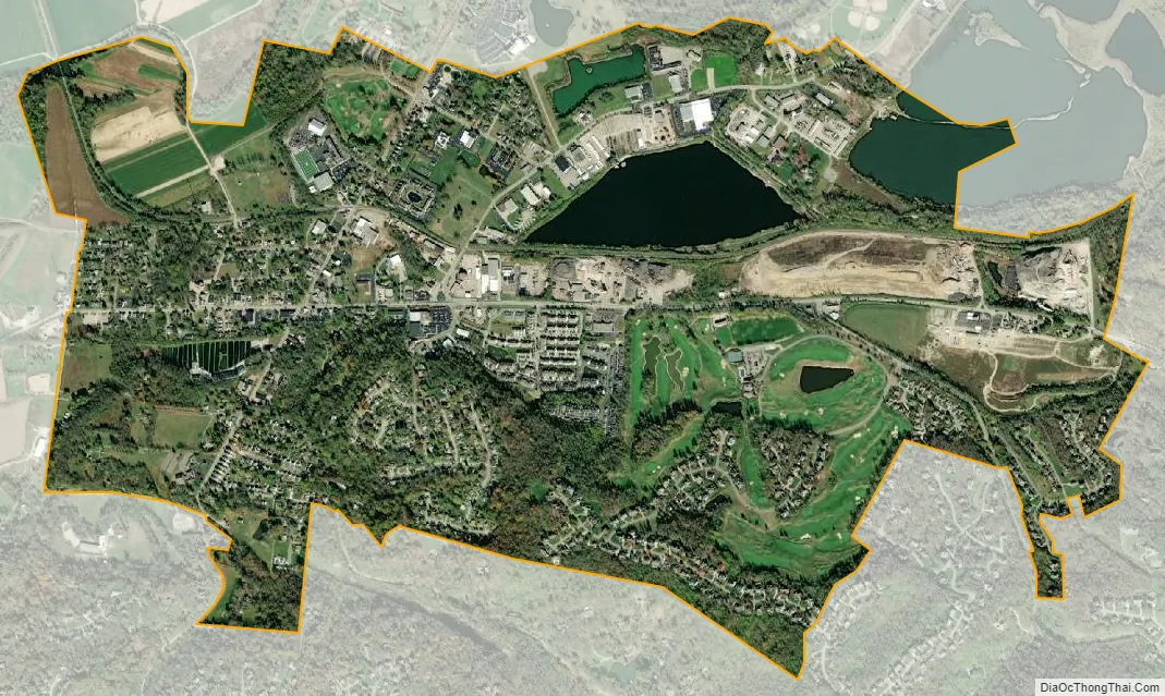
Newtown city Satellite Map
Geography
Newtown is located at 39°7′33″N 84°21′29″W / 39.12583°N 84.35806°W / 39.12583; -84.35806 (39.125811, -84.358102). It is surrounded by Anderson Township, from which it was split in the 1960s.
According to the United States Census Bureau, the village has a total area of 2.37 square miles (6.14 km), of which 2.17 square miles (5.62 km) is land and 0.20 square miles (0.52 km) is water.
See also
Map of Ohio State and its subdivision:- Adams
- Allen
- Ashland
- Ashtabula
- Athens
- Auglaize
- Belmont
- Brown
- Butler
- Carroll
- Champaign
- Clark
- Clermont
- Clinton
- Columbiana
- Coshocton
- Crawford
- Cuyahoga
- Darke
- Defiance
- Delaware
- Erie
- Fairfield
- Fayette
- Franklin
- Fulton
- Gallia
- Geauga
- Greene
- Guernsey
- Hamilton
- Hancock
- Hardin
- Harrison
- Henry
- Highland
- Hocking
- Holmes
- Huron
- Jackson
- Jefferson
- Knox
- Lake
- Lake Erie
- Lawrence
- Licking
- Logan
- Lorain
- Lucas
- Madison
- Mahoning
- Marion
- Medina
- Meigs
- Mercer
- Miami
- Monroe
- Montgomery
- Morgan
- Morrow
- Muskingum
- Noble
- Ottawa
- Paulding
- Perry
- Pickaway
- Pike
- Portage
- Preble
- Putnam
- Richland
- Ross
- Sandusky
- Scioto
- Seneca
- Shelby
- Stark
- Summit
- Trumbull
- Tuscarawas
- Union
- Van Wert
- Vinton
- Warren
- Washington
- Wayne
- Williams
- Wood
- Wyandot
- Alabama
- Alaska
- Arizona
- Arkansas
- California
- Colorado
- Connecticut
- Delaware
- District of Columbia
- Florida
- Georgia
- Hawaii
- Idaho
- Illinois
- Indiana
- Iowa
- Kansas
- Kentucky
- Louisiana
- Maine
- Maryland
- Massachusetts
- Michigan
- Minnesota
- Mississippi
- Missouri
- Montana
- Nebraska
- Nevada
- New Hampshire
- New Jersey
- New Mexico
- New York
- North Carolina
- North Dakota
- Ohio
- Oklahoma
- Oregon
- Pennsylvania
- Rhode Island
- South Carolina
- South Dakota
- Tennessee
- Texas
- Utah
- Vermont
- Virginia
- Washington
- West Virginia
- Wisconsin
- Wyoming


