Willoughby is a city in Lake County, Ohio, United States, along the Chagrin River. The population was 23,959 at the time of the 2020 census. A suburb of Cleveland, it is part of the Cleveland metropolitan area.
| Name: | Willoughby city |
|---|---|
| LSAD Code: | 25 |
| LSAD Description: | city (suffix) |
| State: | Ohio |
| County: | Lake County |
| Elevation: | 659 ft (201 m) |
| Total Area: | 10.33 sq mi (26.75 km²) |
| Land Area: | 10.24 sq mi (26.51 km²) |
| Water Area: | 0.09 sq mi (0.23 km²) |
| Total Population: | 23,959 |
| Population Density: | 2,340.43/sq mi (903.61/km²) |
| ZIP code: | 44094-44097 |
| Area code: | 440 |
| FIPS code: | 3985484 |
| GNISfeature ID: | 1061788 |
| Website: | www.willoughbyohio.com |
Online Interactive Map
Click on ![]() to view map in "full screen" mode.
to view map in "full screen" mode.
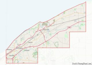
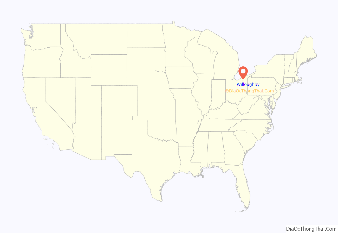
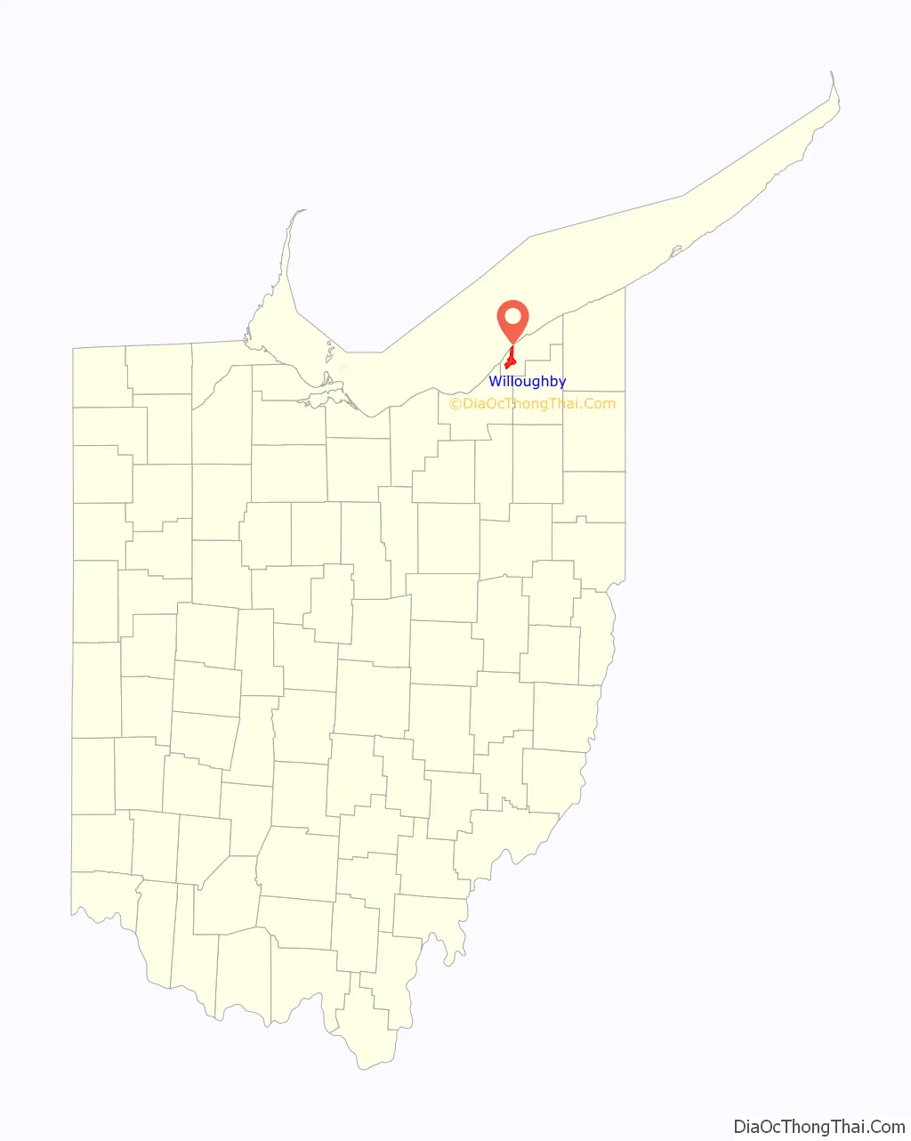
Willoughby location map. Where is Willoughby city?
History
Willoughby’s first permanent settler was David Abbott in 1798, who operated a gristmill. Abbott and his family were said to have had close relations with a band of Indians along the banks of the local river, which the Indians called the “Sha-ga-rin” meaning “Clear Water.” This river was later called the Chagrin River, though the origin of the name remains in dispute.
In 1835, the village was permanently named “Willoughby” in honor of Westel Willoughby, Jr., a public health official that the founders of a short-lived Medical College, which was based in the city, hoped to attract to the area. Many historical buildings from this period survive to this date, affording the downtown Willoughby area some outstanding specimens of 19th century architecture.
In World War I, the U.S. Army chose Willoughby as the site for a chemical weapons plant producing lewisite.
Over time, Willoughby sent citizens into every major U.S. military conflict. Several memorials and historical relics are displayed in Wes Point Park, the center of downtown Willoughby, to honor those that have served.
Willoughby is the only town in America that has belonged, at one time or other, to six counties (Washington, Jefferson, Trumbull, Geauga, Cuyahoga, and Lake).
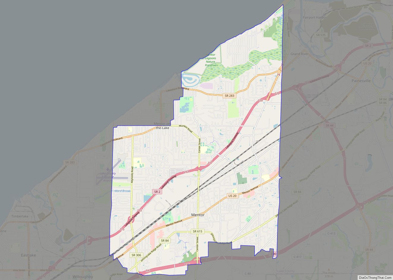
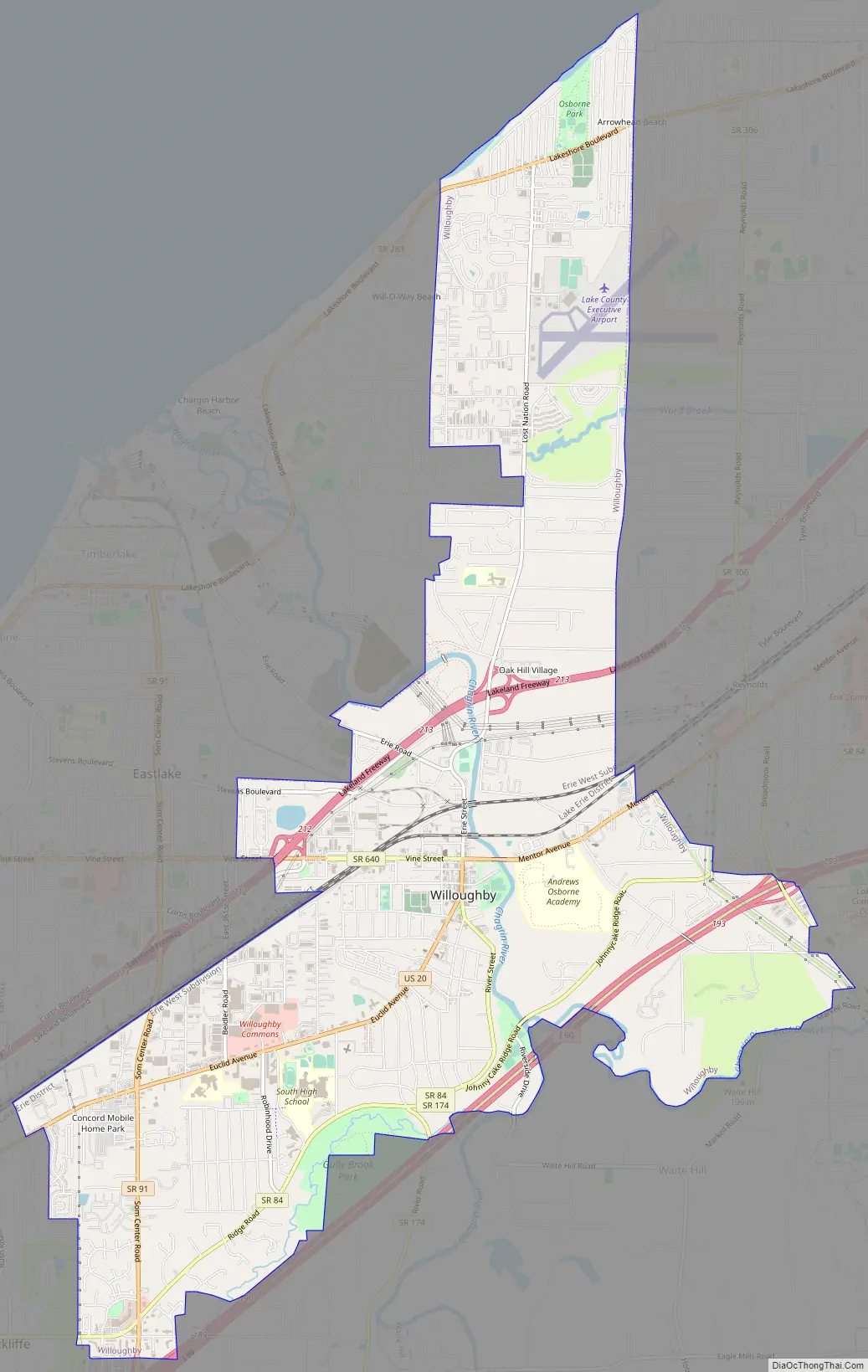
Willoughby Road Map
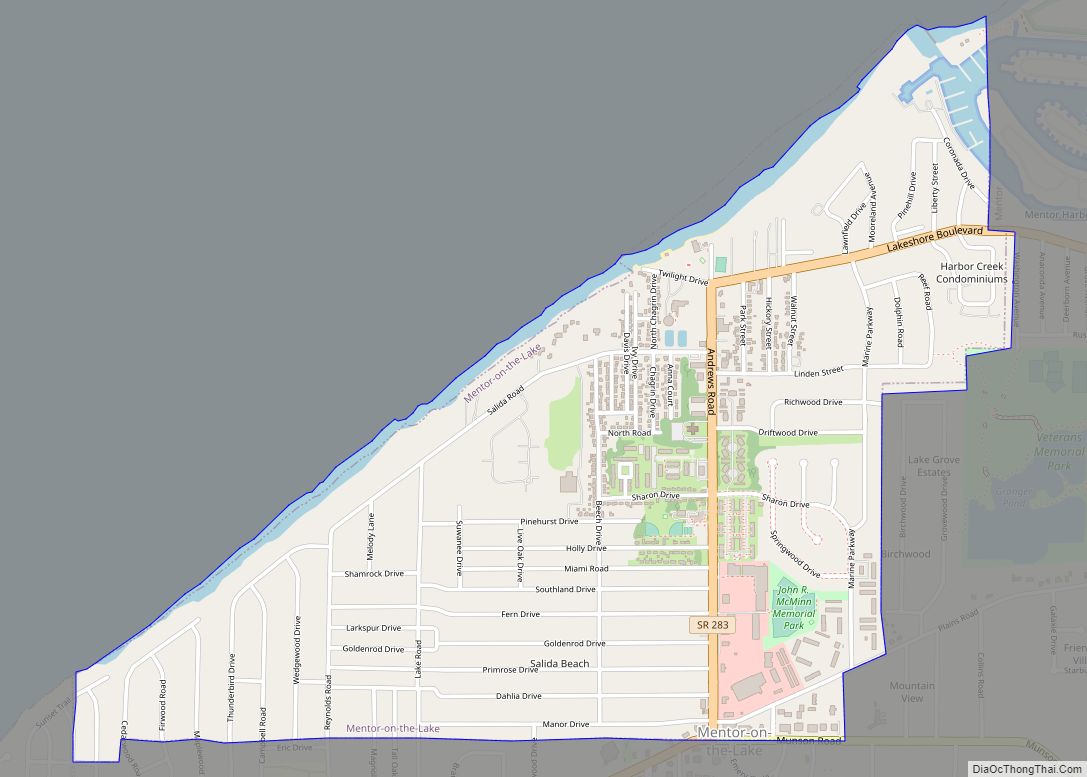
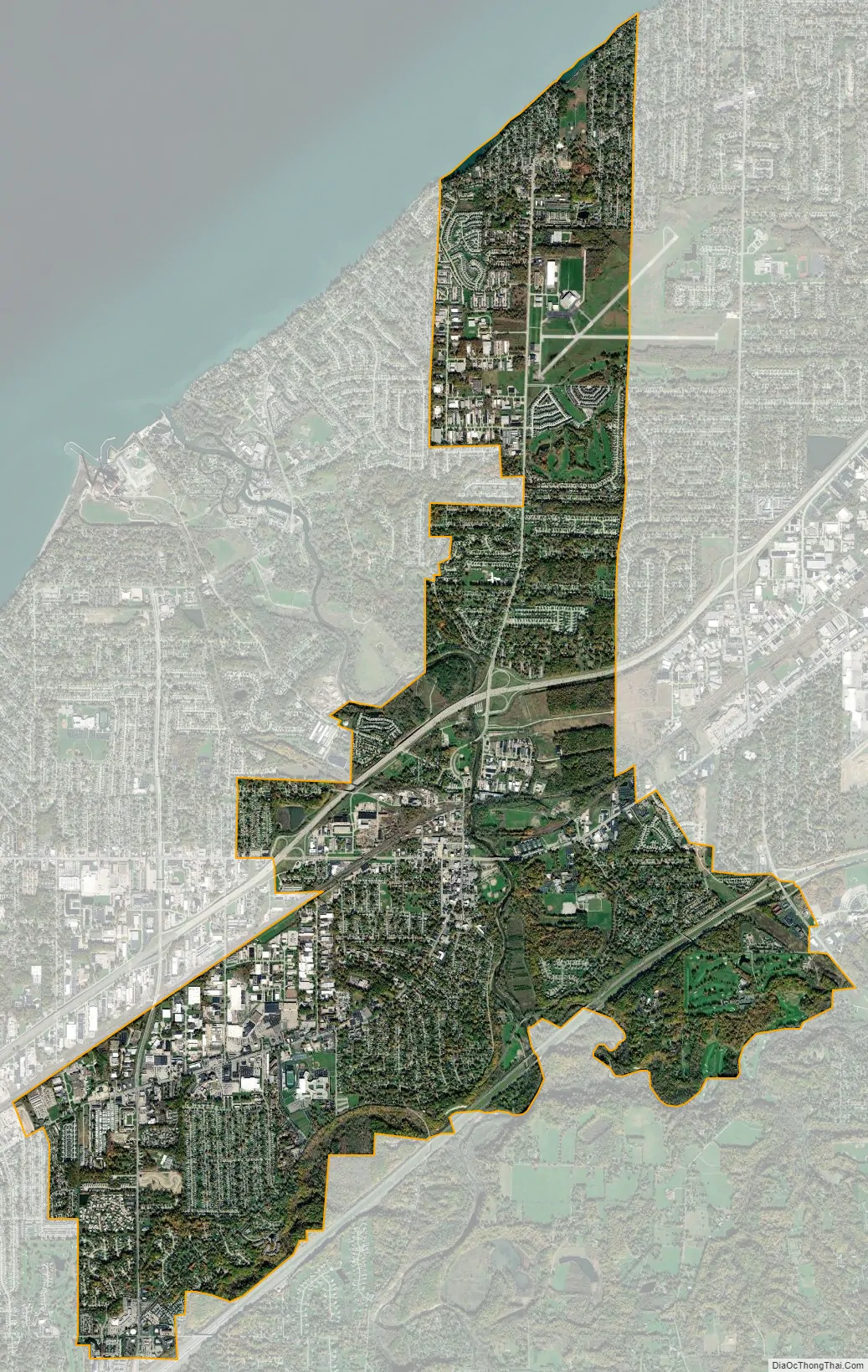
Willoughby city Satellite Map
Geography
Willoughby is located at 41°38′45″N 81°24′35″W / 41.645915°N 81.409681°W / 41.645915; -81.409681 (41.645915, -81.408515).
According to the United States Census Bureau, the city has a total area of 10.34 square miles (26.78 km), of which 10.25 square miles (26.55 km) is land and 0.09 square miles (0.23 km) is water.
See also
Map of Ohio State and its subdivision:- Adams
- Allen
- Ashland
- Ashtabula
- Athens
- Auglaize
- Belmont
- Brown
- Butler
- Carroll
- Champaign
- Clark
- Clermont
- Clinton
- Columbiana
- Coshocton
- Crawford
- Cuyahoga
- Darke
- Defiance
- Delaware
- Erie
- Fairfield
- Fayette
- Franklin
- Fulton
- Gallia
- Geauga
- Greene
- Guernsey
- Hamilton
- Hancock
- Hardin
- Harrison
- Henry
- Highland
- Hocking
- Holmes
- Huron
- Jackson
- Jefferson
- Knox
- Lake
- Lake Erie
- Lawrence
- Licking
- Logan
- Lorain
- Lucas
- Madison
- Mahoning
- Marion
- Medina
- Meigs
- Mercer
- Miami
- Monroe
- Montgomery
- Morgan
- Morrow
- Muskingum
- Noble
- Ottawa
- Paulding
- Perry
- Pickaway
- Pike
- Portage
- Preble
- Putnam
- Richland
- Ross
- Sandusky
- Scioto
- Seneca
- Shelby
- Stark
- Summit
- Trumbull
- Tuscarawas
- Union
- Van Wert
- Vinton
- Warren
- Washington
- Wayne
- Williams
- Wood
- Wyandot
- Alabama
- Alaska
- Arizona
- Arkansas
- California
- Colorado
- Connecticut
- Delaware
- District of Columbia
- Florida
- Georgia
- Hawaii
- Idaho
- Illinois
- Indiana
- Iowa
- Kansas
- Kentucky
- Louisiana
- Maine
- Maryland
- Massachusetts
- Michigan
- Minnesota
- Mississippi
- Missouri
- Montana
- Nebraska
- Nevada
- New Hampshire
- New Jersey
- New Mexico
- New York
- North Carolina
- North Dakota
- Ohio
- Oklahoma
- Oregon
- Pennsylvania
- Rhode Island
- South Carolina
- South Dakota
- Tennessee
- Texas
- Utah
- Vermont
- Virginia
- Washington
- West Virginia
- Wisconsin
- Wyoming