Riddle is a city in Douglas County, Oregon, United States. The population was 1,185 at the 2010 census.
| Name: | Riddle city |
|---|---|
| LSAD Code: | 25 |
| LSAD Description: | city (suffix) |
| State: | Oregon |
| County: | Douglas County |
| Incorporated: | 1893 |
| Elevation: | 712 ft (217 m) |
| Total Area: | 0.64 sq mi (1.64 km²) |
| Land Area: | 0.64 sq mi (1.64 km²) |
| Water Area: | 0.00 sq mi (0.00 km²) |
| Total Population: | 1,214 |
| Population Density: | 1,911.81/sq mi (738.45/km²) |
| ZIP code: | 97469 |
| Area code: | 541 |
| FIPS code: | 4161850 |
| GNISfeature ID: | 2410943 |
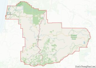
Online Interactive Map
Click on ![]() to view map in "full screen" mode.
to view map in "full screen" mode.
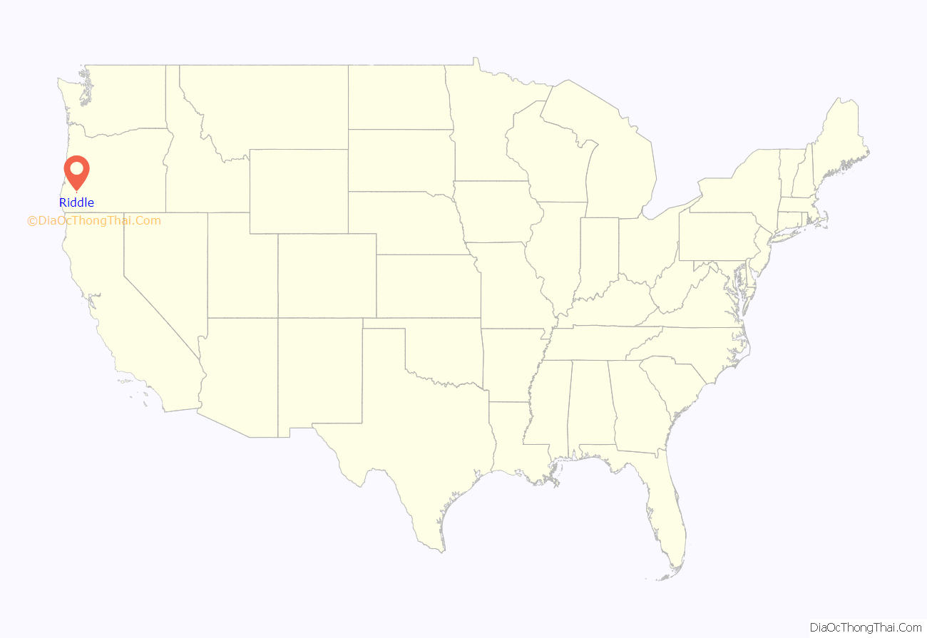
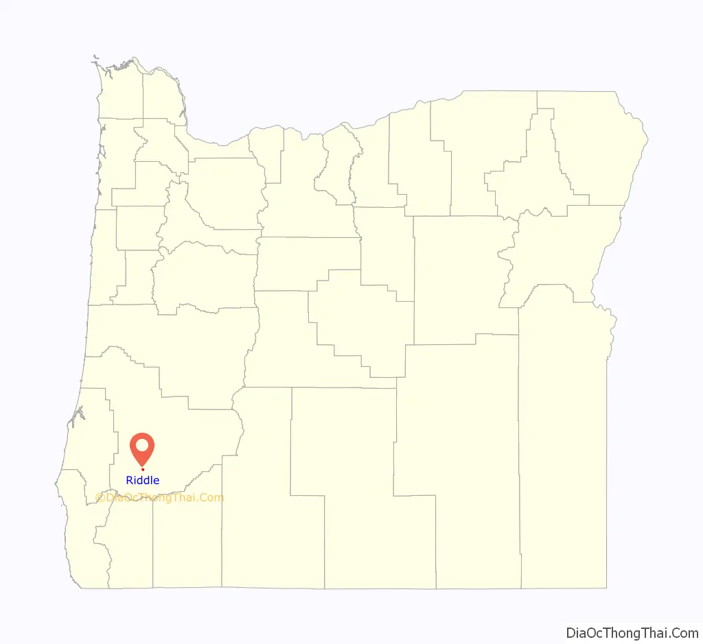
Riddle location map. Where is Riddle city?
History
Riddle was founded by John Bouseman Riddle, the son of William H. Riddle, for whom the town was named. William H. Riddle was a native of Springfield, Illinois, who settled in the area in 1851. By 1881, the Southern Pacific Railroad line south of Roseburg had a station here called “Riddlesburg”, which was changed to “Riddles” in 1882 and to “Riddle” in 1889. A post office at this location opened under the name of “Riddles” in 1882 and was changed to “Riddle” in 1910.
J. B. Riddle purchased a land claim from J.Q.C. VanDenbosch at the age of nineteen in the year 1863. In 1869, Riddle sold 140.5 acres of his claim to his brother, Abner. When the railroad came through, it passed between the brothers’ properties. J.B. took advantage of the opportunity afforded by the railroad and changed his profession to business from farming. He and his second wife, Mary Catching, built a hotel in what would become the city of Riddle, where J.B. opened several small eating houses to Medford, Oregon along the tracks.
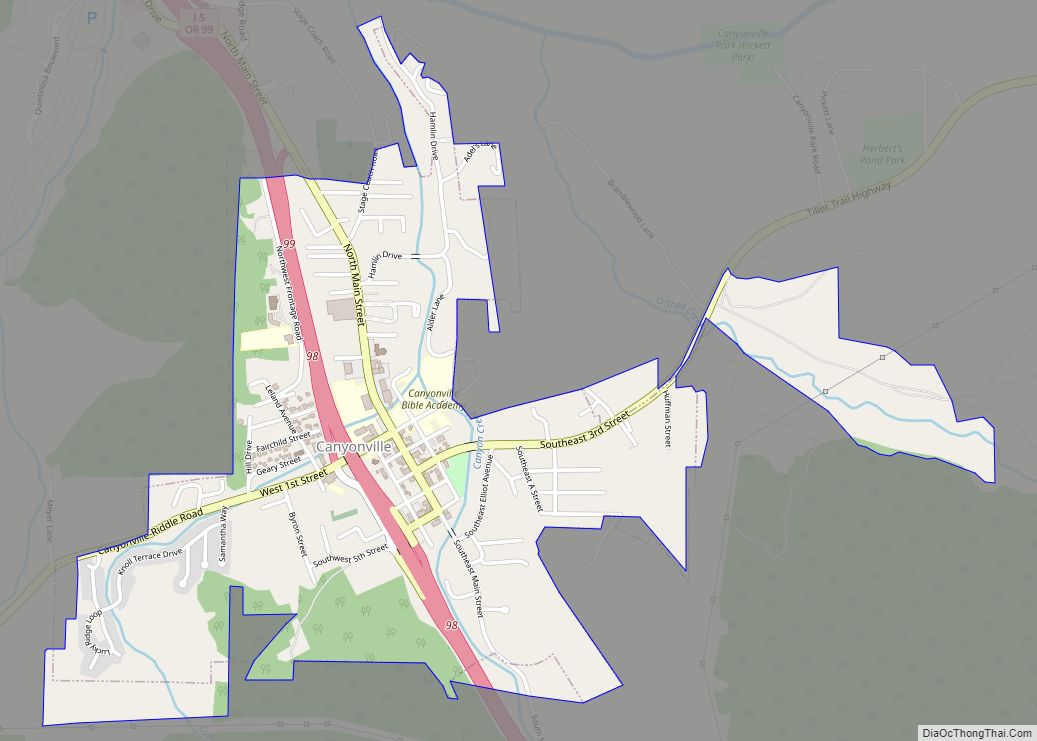
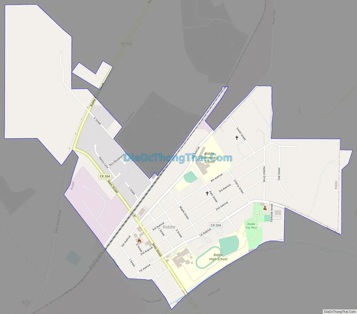
Riddle Road Map
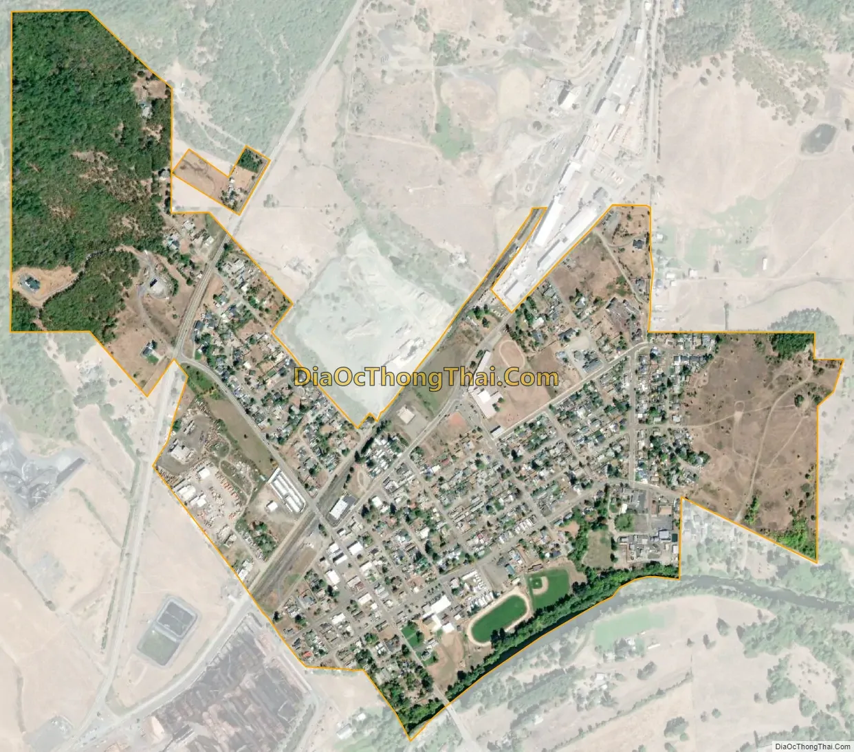
Riddle city Satellite Map
Geography
Riddle is about 25 miles (40 km) south of Roseburg and 220 miles (350 km) south of Portland. It lies about 4 miles (6.4 km) west of Oregon Route 99 (Interstate 5) at an elevation of about 700 feet (210 m) above sea level. Cow Creek flows by Riddle before entering the nearby South Umpqua River.
According to the United States Census Bureau, the city has a total area of 0.63 square miles (1.63 km), all of it land.
Climate
Riddle has a warm-summer Mediterranean climate (Csb) according to the Köppen climate classification system. Summers are cool during the mornings but become hot by afternoon, whilst winters are chilly, if not severe, and rainy. During hot spells in the summer, there are 28 afternoons reaching over 90 °F or 32.2 °C and three afternoons over 100 °F or 37.8 °C, although only five mornings have ever stayed at or above 68 °F or 20 °C. The hottest afternoon has been 111 °F (43.9 °C) on June 27, 2021, and the hottest morning 72 °F (22.2 °C) on June 28, 2015. The hottest month on record has been July 2015 with a mean of 75.1 °F (23.9 °C), although the hottest mean maximum is 93.6 °F or 34.2 °C in July 1938 and August 1939.
During winter, most days feature westerly surface and aloft winds, although rainfall is restricted by the coastal mountains. On rare occasions, a block in the Gulf of Alaska will drive cold air from the continent west of the Sierra/Cascade crest, producing much colder than normal weather with either snow or clear skies. The coldest month on record has been January 1937 with a mean of 32.7 °F (0.4 °C) and a maximum of 40.0 °F (4.4 °C). The coldest temperature on record has been −3 °F (−19.4 °C) on January 22, 1962, while the coldest maximum temperature was 20 °F (−6.7 °C) on December 21, 1990.
The wettest year was from July 1973 to June 1974 with 50.01 inches (1,270.3 mm) and the driest from July 1976 to June 1977 with 16.20 inches (411.5 mm). The wettest day on record has been November 20, 2012 when 4.43 inches (112.5 mm) fell, and the wettest month December 1996 with 16.72 inches (424.7 mm). Snowfall is rare: the mean is 5.2 inches or 0.13 metres; although the most in one month was 42.9 inches (1.09 m) in January 1950 and the most on the ground was 13 inches or 0.33 metres on January 13, 1930, eighteen seasons have had zero snowfall and four more only a trace.
See also
Map of Oregon State and its subdivision: Map of other states:- Alabama
- Alaska
- Arizona
- Arkansas
- California
- Colorado
- Connecticut
- Delaware
- District of Columbia
- Florida
- Georgia
- Hawaii
- Idaho
- Illinois
- Indiana
- Iowa
- Kansas
- Kentucky
- Louisiana
- Maine
- Maryland
- Massachusetts
- Michigan
- Minnesota
- Mississippi
- Missouri
- Montana
- Nebraska
- Nevada
- New Hampshire
- New Jersey
- New Mexico
- New York
- North Carolina
- North Dakota
- Ohio
- Oklahoma
- Oregon
- Pennsylvania
- Rhode Island
- South Carolina
- South Dakota
- Tennessee
- Texas
- Utah
- Vermont
- Virginia
- Washington
- West Virginia
- Wisconsin
- Wyoming