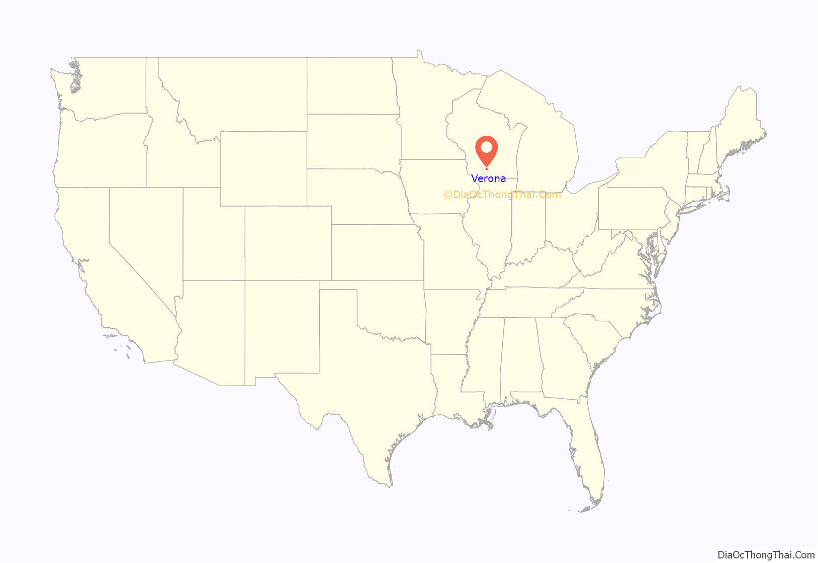
Verona is a city in Dane County, Wisconsin, in the United States and is a suburb of Madison. The population was 14,030 at the 2020 census. The city is located ten miles southwest of downtown Madison within the Town of Verona. It is part of the Madison Metropolitan Statistical Area.
| Name: | Verona city |
|---|---|
| LSAD Code: | 25 |
| LSAD Description: | city (suffix) |
| State: | Wisconsin |
| County: | Dane County |
| Total Area: | 7.55 sq mi (19.57 km²) |
| Land Area: | 7.48 sq mi (19.38 km²) |
| Water Area: | 0.07 sq mi (0.18 km²) |
| Total Population: | 14,030 |
| Population Density: | 1,768.41/sq mi (682.75/km²) |
| ZIP code: | 53593 |
| Area code: | 608 |
| FIPS code: | 5582600 |
| Website: | www.ci.verona.wi.us |
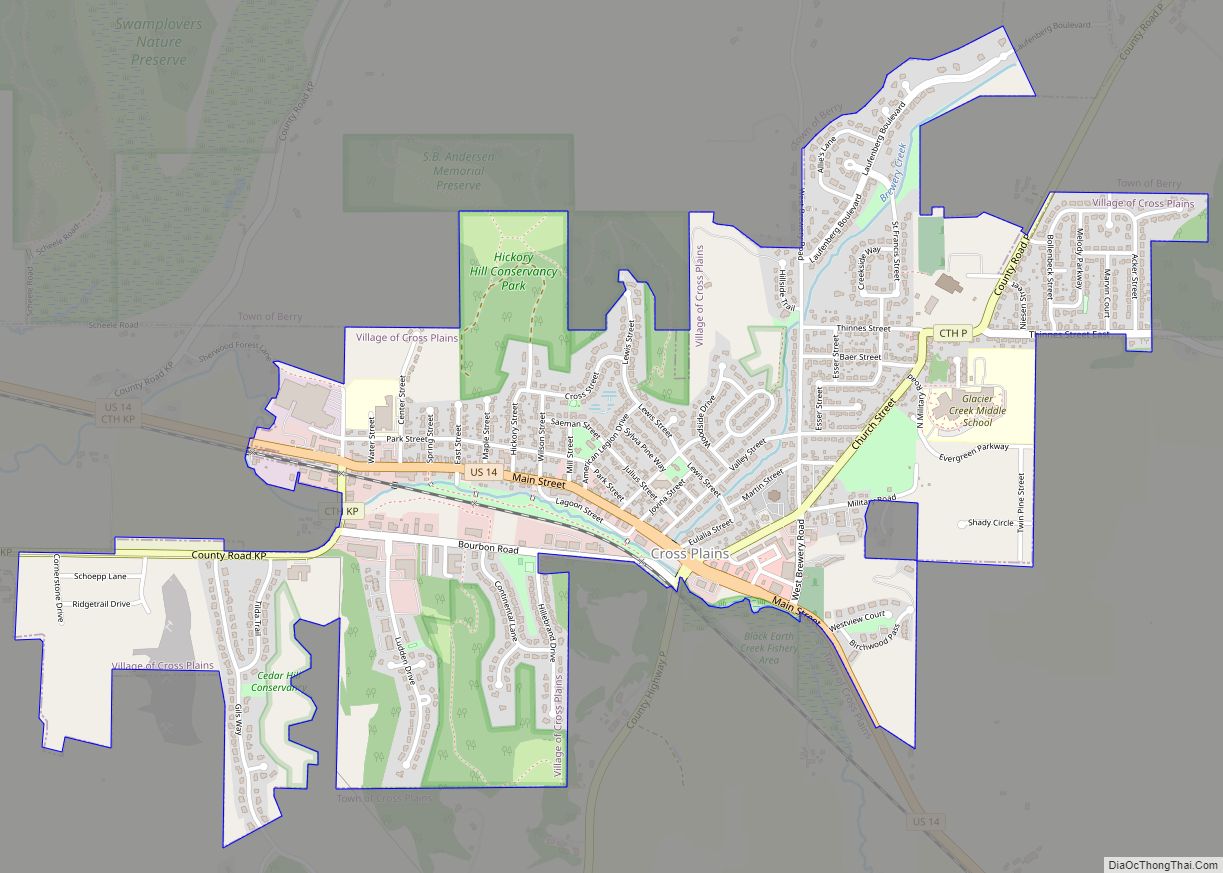
Online Interactive Map
Click on ![]() to view map in "full screen" mode.
to view map in "full screen" mode.
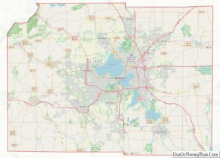
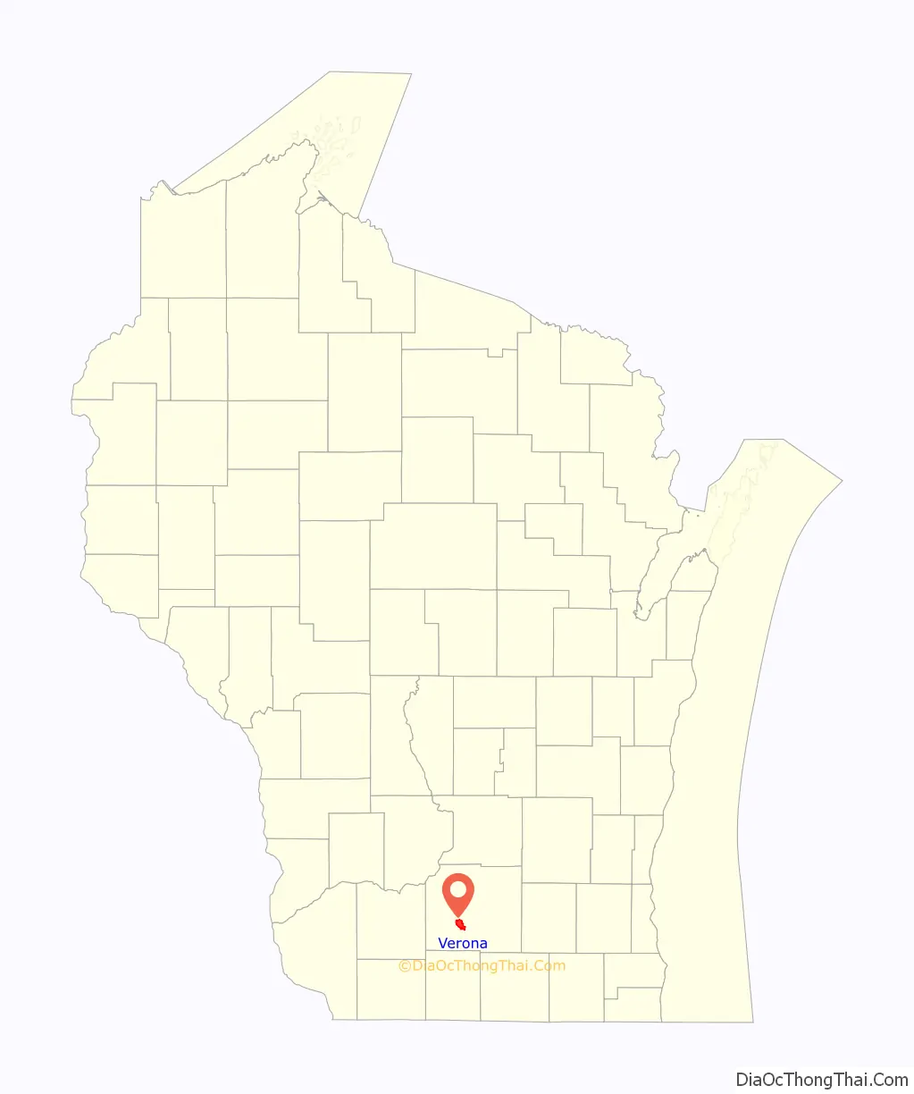
Verona location map. Where is Verona city?
History
The town was named for Verona, New York. It was incorporated as a village in 1921 and as a city in 1978.
Verona used to be home to the Dane County Insane Asylum which opened in 1882, closed in 1973, and was demolished in 2006. It was previously a poor farm for people who needed care due to old age, blindness, disease, deformity, loss of limbs and insanity.
The area was also the site of a small leper colony sometime between 1890–1910. It is now a dog park.
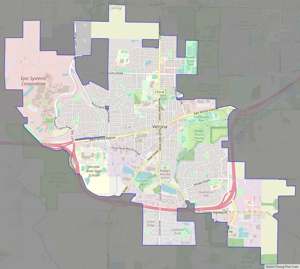
Verona Road Map
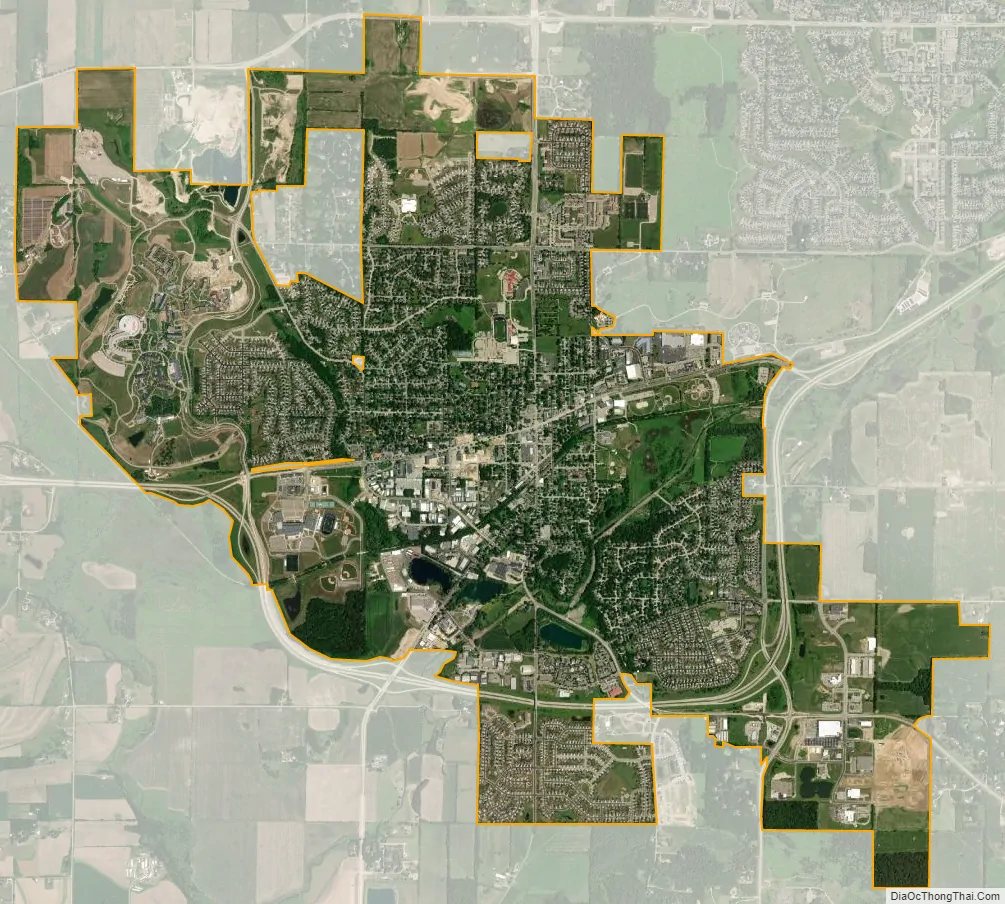
Verona city Satellite Map
Geography
Verona is located at 42°59′23″N 89°32′7″W / 42.98972°N 89.53528°W / 42.98972; -89.53528 (42.989853, −89.535552).
According to the United States Census Bureau, the city has a total area of 6.36 square miles (16.47 km), of which, 6.30 square miles (16.32 km) is land and 0.06 square miles (0.16 km) is water. Notable geographical features include the Verona Sugar River Valley, the Badger Mill Creek, and the Sugar River State Trail. A portion of the Ice Age National Scenic Trail also runs through Verona.
Climate and weather
On July 22, 2010, a tornado rated EF1 hit Verona.
On June 9, 2011, an EF1 tornado struck Verona, with winds peaking around 90 mph.
On the night of June 16, 2014 an EF3 tornado tore through Country View Elementary School and surrounding neighborhoods. No one was hurt by the tornado and the school was rebuilt and remodeled before school started in the fall.
On July 29, 2021 around 12:44 am an EF1 tornado with winds of 93 mph struck as well as a high-end EF0 tornado with winds of 85 mph at 12:47 am in Verona.
See also
Map of Wisconsin State and its subdivision:- Adams
- Ashland
- Barron
- Bayfield
- Brown
- Buffalo
- Burnett
- Calumet
- Chippewa
- Clark
- Columbia
- Crawford
- Dane
- Dodge
- Door
- Douglas
- Dunn
- Eau Claire
- Florence
- Fond du Lac
- Forest
- Grant
- Green
- Green Lake
- Iowa
- Iron
- Jackson
- Jefferson
- Juneau
- Kenosha
- Kewaunee
- La Crosse
- Lafayette
- Lake Michigan
- Lake Superior
- Langlade
- Lincoln
- Manitowoc
- Marathon
- Marinette
- Marquette
- Menominee
- Milwaukee
- Monroe
- Oconto
- Oneida
- Outagamie
- Ozaukee
- Pepin
- Pierce
- Polk
- Portage
- Price
- Racine
- Richland
- Rock
- Rusk
- Saint Croix
- Sauk
- Sawyer
- Shawano
- Sheboygan
- Taylor
- Trempealeau
- Vernon
- Vilas
- Walworth
- Washburn
- Washington
- Waukesha
- Waupaca
- Waushara
- Winnebago
- Wood
- Alabama
- Alaska
- Arizona
- Arkansas
- California
- Colorado
- Connecticut
- Delaware
- District of Columbia
- Florida
- Georgia
- Hawaii
- Idaho
- Illinois
- Indiana
- Iowa
- Kansas
- Kentucky
- Louisiana
- Maine
- Maryland
- Massachusetts
- Michigan
- Minnesota
- Mississippi
- Missouri
- Montana
- Nebraska
- Nevada
- New Hampshire
- New Jersey
- New Mexico
- New York
- North Carolina
- North Dakota
- Ohio
- Oklahoma
- Oregon
- Pennsylvania
- Rhode Island
- South Carolina
- South Dakota
- Tennessee
- Texas
- Utah
- Vermont
- Virginia
- Washington
- West Virginia
- Wisconsin
- Wyoming