Butler County is a county located in the southwestern part of the U.S. state of Ohio. As of the 2020 census, the population was 390,357. Its county seat and largest city is Hamilton. It is named for General Richard Butler, who died in 1791 during St. Clair’s Defeat. Located along the Great Miami River, it is also home to Miami University, a public university founded in 1809. Butler County is part of the Cincinnati, OH-KY-IN Metropolitan Statistical Area. The majority of the county is in District 52 of the State House.
| Name: | Butler County |
|---|---|
| FIPS code: | 39-017 |
| State: | Ohio |
| Founded: | May 1, 1803 |
| Named for: | General Richard Butler |
| Seat: | Hamilton |
| Largest city: | Hamilton |
| Total Area: | 470 sq mi (1,200 km²) |
| Land Area: | 467 sq mi (1,210 km²) |
| Total Population: | 390,357 |
| Population Density: | 830/sq mi (320/km²) |
| Time zone: | UTC−5 (Eastern) |
| Summer Time Zone (DST): | UTC−4 (EDT) |
| Website: | www.butlercountyohio.org |
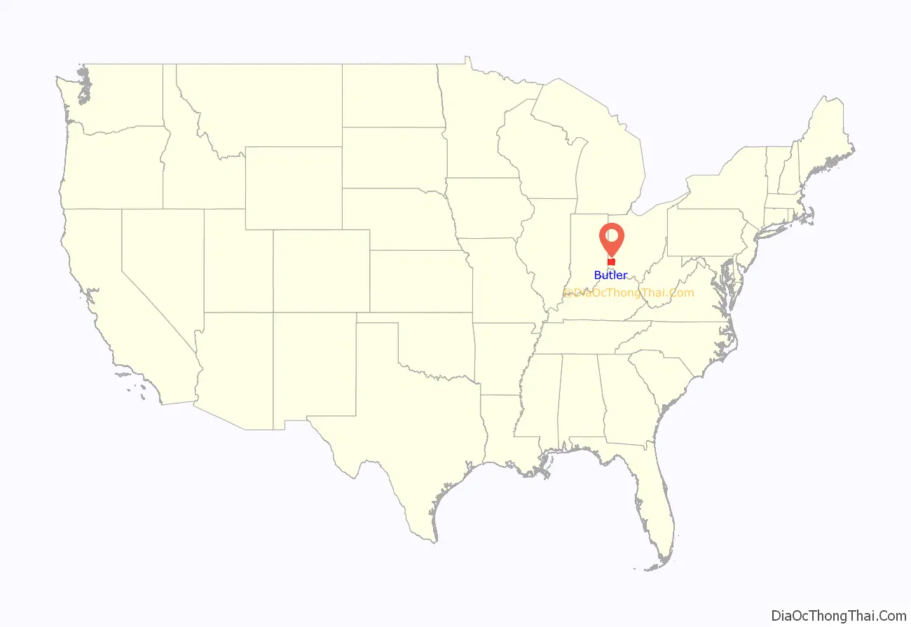
Butler County location map. Where is Butler County?
History
Successive cultures of ancient Indigenous peoples of the Americas occupied areas of the county. They built large earthworks, seven of which were still standing and recorded by a Smithsonian survey.
Early French explorers likely passed through the area along the Miami River. The gravesites of David and Margaret Gregory indicate they were some of the first white settlers in the area in Liberty Township. White settlers began moving into the area in larger numbers after the 1793 Treaty of Greenville was signed with the Native Americans of the area.
Butler County was formed on March 24, 1803, from portions of Hamilton County. It is named for General Richard Butler. Between 1803 and 1823, the townships of the county became officially recognized. Large portions of the county were held by non-resident owners, including 640 acres owned by future President William H Harrison. Some land that was originally part of Butler County was reassigned to Warren County in the north and Hamilton County to the south. Butler County’s original size was 480 sq miles.
In 1830, Peter Schrock emigrated from France to live in Butler County.
Around the late 1860s or early 1870s, the community of Mauds was the sight of an attempt by a local entrepreneur to construct a mill that worked via perpetual motion. A large crowd gathered to watch the mill start, and when it did not, laughter ensued. Nothing was heard from the unnamed entrepreneur again, and the mill quickly vanished. The local newspapers did not record the event, and the only record of its occurrence was transmitted by elderly residents of Mauds to one William Marion Miller of Miami University.
The Great Flood of 1913 affected much of the county, particularly the communities of Middletown, Ohio where approximately 25% of the town was flooded and 6 people died and Hamilton, Ohio, where 46% of the city was flooded, over 300 buildings destroyed, and at least 98 people killed.
In the 1920s, Butler, Pickaway and Washington counties were central areas of the rural membership of the Ku Klux Klan in Ohio.
In 1957 the Ohio Legislature established Hueston Woods State Park, which covers 3,596 acres in Butler and neighboring Preble County. In addition to a 625-acre manmade lake, the park contains the 200-acre Hueston Woods, one of the last near-virgin growths of American beech and maple in Ohio.
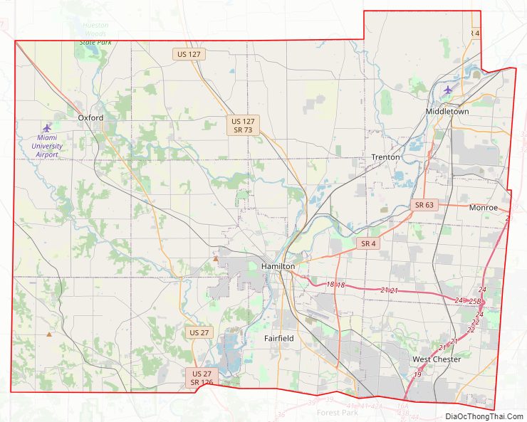
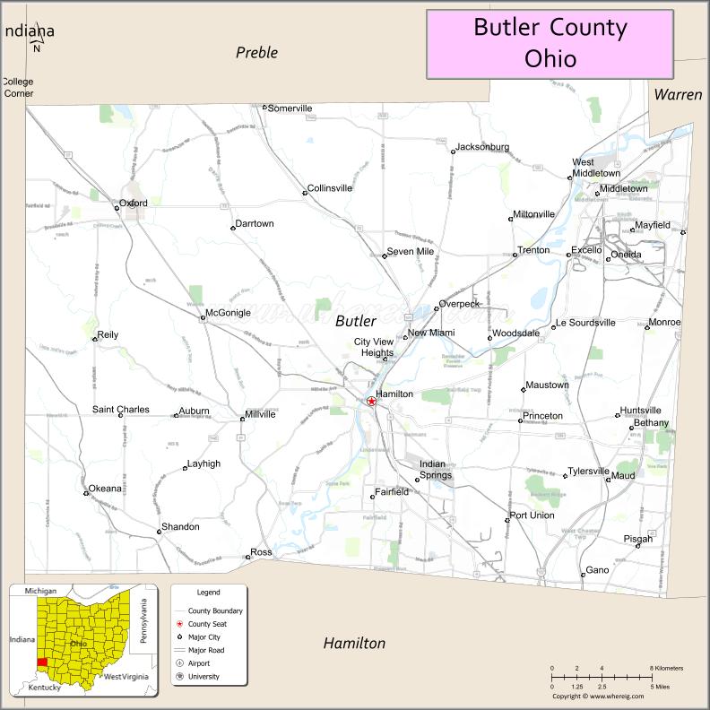
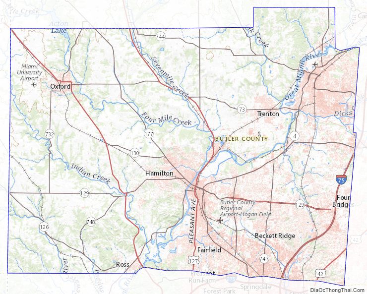
Butler County Road Map
Geography
According to the United States Census Bureau, the county has a total area of 470 square miles (1,200 km), of which 467 square miles (1,210 km) is land and 3.1 square miles (8.0 km) (0.7%) is water.
The majority of Butler County consists of the river valleys of the Great and Little Miami Rivers. The valley was originally carved by glaciation.
The soil at highest uplands is frequently heavy in clay, moving downhill to a sandy loam, while in the valleys the soil is black with river deposits.
Before deforestation by settlers, much of the area was forests of American beech and maple trees.
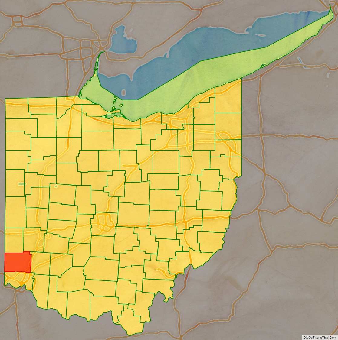
Adjacent counties
- Preble County (north)
- Montgomery County (northeast)
- Warren County (east)
- Hamilton County (south)
- Dearborn County, Indiana (southwest)
- Franklin County, Indiana (west)
- Union County, Indiana (northwest)
Butler County Topographic Map
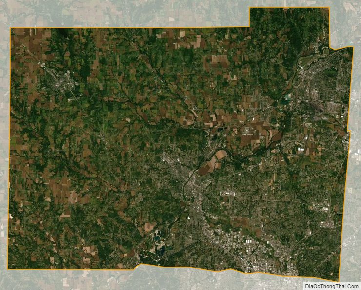
Butler County Satellite Map
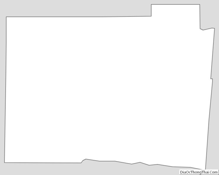
Butler County Outline Map
See also
Map of Ohio State and its subdivision:- Adams
- Allen
- Ashland
- Ashtabula
- Athens
- Auglaize
- Belmont
- Brown
- Butler
- Carroll
- Champaign
- Clark
- Clermont
- Clinton
- Columbiana
- Coshocton
- Crawford
- Cuyahoga
- Darke
- Defiance
- Delaware
- Erie
- Fairfield
- Fayette
- Franklin
- Fulton
- Gallia
- Geauga
- Greene
- Guernsey
- Hamilton
- Hancock
- Hardin
- Harrison
- Henry
- Highland
- Hocking
- Holmes
- Huron
- Jackson
- Jefferson
- Knox
- Lake
- Lake Erie
- Lawrence
- Licking
- Logan
- Lorain
- Lucas
- Madison
- Mahoning
- Marion
- Medina
- Meigs
- Mercer
- Miami
- Monroe
- Montgomery
- Morgan
- Morrow
- Muskingum
- Noble
- Ottawa
- Paulding
- Perry
- Pickaway
- Pike
- Portage
- Preble
- Putnam
- Richland
- Ross
- Sandusky
- Scioto
- Seneca
- Shelby
- Stark
- Summit
- Trumbull
- Tuscarawas
- Union
- Van Wert
- Vinton
- Warren
- Washington
- Wayne
- Williams
- Wood
- Wyandot
- Alabama
- Alaska
- Arizona
- Arkansas
- California
- Colorado
- Connecticut
- Delaware
- District of Columbia
- Florida
- Georgia
- Hawaii
- Idaho
- Illinois
- Indiana
- Iowa
- Kansas
- Kentucky
- Louisiana
- Maine
- Maryland
- Massachusetts
- Michigan
- Minnesota
- Mississippi
- Missouri
- Montana
- Nebraska
- Nevada
- New Hampshire
- New Jersey
- New Mexico
- New York
- North Carolina
- North Dakota
- Ohio
- Oklahoma
- Oregon
- Pennsylvania
- Rhode Island
- South Carolina
- South Dakota
- Tennessee
- Texas
- Utah
- Vermont
- Virginia
- Washington
- West Virginia
- Wisconsin
- Wyoming