Ouachita County (/ˈwɑːʃɪtɑː/ WAH-shi-tah) is a county located in the south central part of the U.S. state of Arkansas. As of the 2020 census, the population was 22,650.
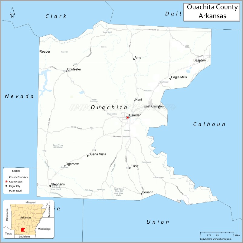
The county seat is Camden. Ouachita County is part of the Camden, AR Micropolitan Statistical Area. Formed on November 29, 1842, the county is named for the Ouachita River.
| Name: | Ouachita County |
|---|---|
| FIPS code: | 05-103 |
| State: | Arkansas |
| Founded: | November 29, 1842 |
| Seat: | Camden |
| Largest city: | Camden |
| Total Area: | 740 sq mi (1,900 km²) |
| Land Area: | 733 sq mi (1,900 km²) |
| Total Population: | 22,650 |
| Population Density: | 31/sq mi (12/km²) |
| Time zone: | UTC−6 (Central) |
| Summer Time Zone (DST): | UTC−5 (CDT) |
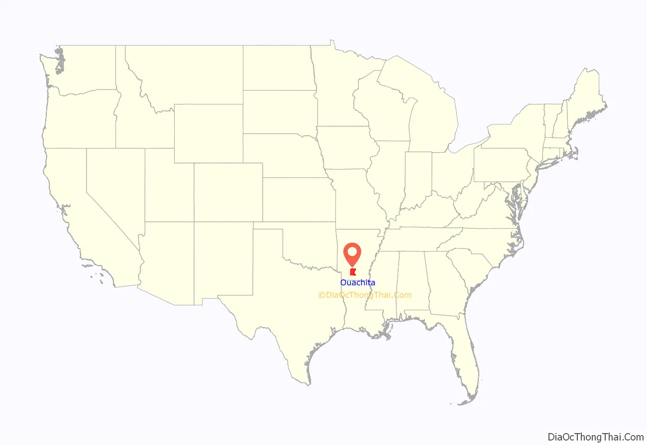
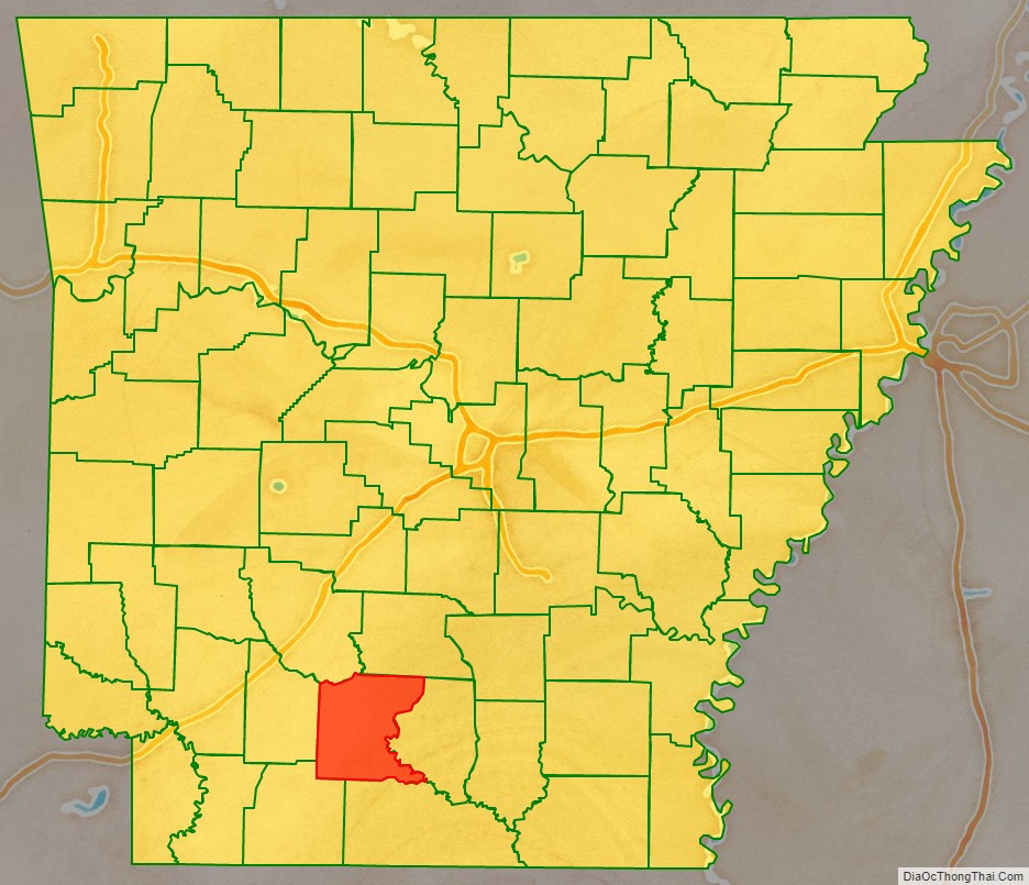
Ouachita County location map. Where is Ouachita County?
History
Until the late 20th century, the county was a Democratic Party stronghold, aided by the state’s having disenfranchised most African Americans at the turn of the century. As in much of the rest of the South, conservative whites, who constitute the majority of the population in the county, have shifted into the Republican Party. In 1972, U.S. President Richard M. Nixon became the first Republican presidential nominee in the 20th century to win a majority in Ouachita County. Much later, in the 2008 presidential election, U.S. Senator John McCain won the county by nearly ten percentage votes over Senator Barack Obama, following President George W. Bush’s victory over Senator John F. Kerry in 2004.
The politically influential Pryor family is based here; they include two U.S. senators, David Pryor (serving 1978–1997) and his son Mark Pryor (elected 2002). The elder Pryor also served as a former governor of Arkansas and US Congressman. The county is served by a daily newspaper, The Camden News.
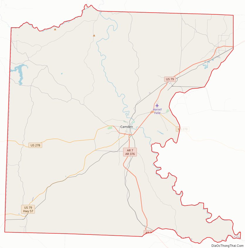
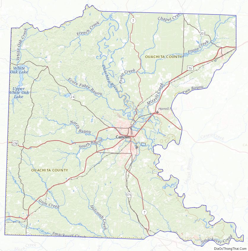
Ouachita County Road Map
Geography
According to the U.S. Census Bureau, the county has a total area of 740 square miles (1,900 km), of which 733 square miles (1,900 km) is land and 7.0 square miles (18 km) (0.9%) is water.
Major highways
- Future Interstate 69
- U.S. Highway 79
- U.S. Highway 278
- Highway 4
- Highway 7
- Highway 9
- Highway 24
Adjacent counties
- Dallas County (north)
- Calhoun County (east)
- Union County (south)
- Columbia County (southwest)
- Nevada County (west)
- Clark County (northwest)
Ouachita County Topographic Map
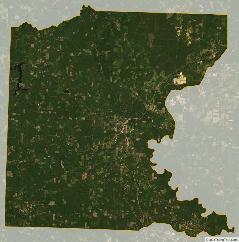
Ouachita County Satellite Map
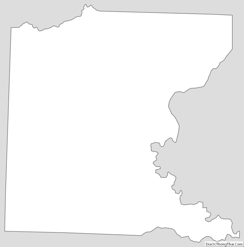
Ouachita County Outline Map
See also
Map of Arkansas State and its subdivision:- Arkansas
- Ashley
- Baxter
- Benton
- Boone
- Bradley
- Calhoun
- Carroll
- Chicot
- Clark
- Clay
- Cleburne
- Cleveland
- Columbia
- Conway
- Craighead
- Crawford
- Crittenden
- Cross
- Dallas
- Desha
- Drew
- Faulkner
- Franklin
- Fulton
- Garland
- Grant
- Greene
- Hempstead
- Hot Spring
- Howard
- Independence
- Izard
- Jackson
- Jefferson
- Johnson
- Lafayette
- Lawrence
- Lee
- Lincoln
- Little River
- Logan
- Lonoke
- Madison
- Marion
- Miller
- Mississippi
- Monroe
- Montgomery
- Nevada
- Newton
- Ouachita
- Perry
- Phillips
- Pike
- Poinsett
- Polk
- Pope
- Prairie
- Pulaski
- Randolph
- Saint Francis
- Saline
- Scott
- Searcy
- Sebastian
- Sevier
- Sharp
- Stone
- Union
- Van Buren
- Washington
- White
- Woodruff
- Yell
- Alabama
- Alaska
- Arizona
- Arkansas
- California
- Colorado
- Connecticut
- Delaware
- District of Columbia
- Florida
- Georgia
- Hawaii
- Idaho
- Illinois
- Indiana
- Iowa
- Kansas
- Kentucky
- Louisiana
- Maine
- Maryland
- Massachusetts
- Michigan
- Minnesota
- Mississippi
- Missouri
- Montana
- Nebraska
- Nevada
- New Hampshire
- New Jersey
- New Mexico
- New York
- North Carolina
- North Dakota
- Ohio
- Oklahoma
- Oregon
- Pennsylvania
- Rhode Island
- South Carolina
- South Dakota
- Tennessee
- Texas
- Utah
- Vermont
- Virginia
- Washington
- West Virginia
- Wisconsin
- Wyoming