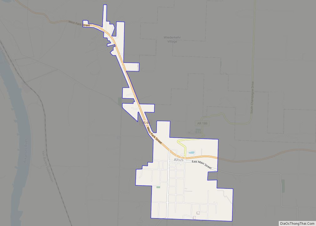
Altus is a city in Franklin County, Arkansas, United States. Located within the Arkansas River Valley at the edge of the Ozark Mountains, the city is within the Fort Smith metropolitan area. The epicenter of the Altus American Viticultural Area (AVA) within Arkansas Wine Country, the city is home to four wineries. Although founded as a coal mining community, the wine industry has driven the Altus economy since the first vineyards were planted in 1872. The population was 758 at the 2010 census, down from 817 at the 2000 census.
Altus is the site of Our Lady of Perpetual Help Church (St. Mary’s Catholic Church), which is on the National Register of Historic Places. St. Mary’s Catholic Church was built in 1902 and is known for its beautiful paintings, ornate gold leaf walls, and Roman architecture.
| Name: | Altus city |
|---|---|
| LSAD Code: | 25 |
| LSAD Description: | city (suffix) |
| State: | Arkansas |
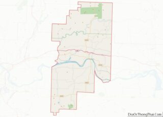
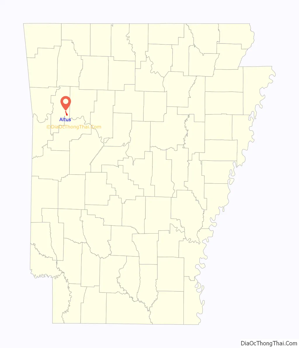
| County: | Franklin County |
| Elevation: | 535 ft (163 m) |
| Total Area: | 1.89 sq mi (4.90 km²) |
| Land Area: | 1.89 sq mi (4.90 km²) |
| Water Area: | 0.00 sq mi (0.00 km²) |
| Total Population: | 665 |
| Population Density: | 351.48/sq mi (135.72/km²) |
| ZIP code: | 72821 |
| Area code: | 479 |
| FIPS code: | 0501210 |
| GNISfeature ID: | 2403091 |
Online Interactive Map
Click on ![]() to view map in "full screen" mode.
to view map in "full screen" mode.
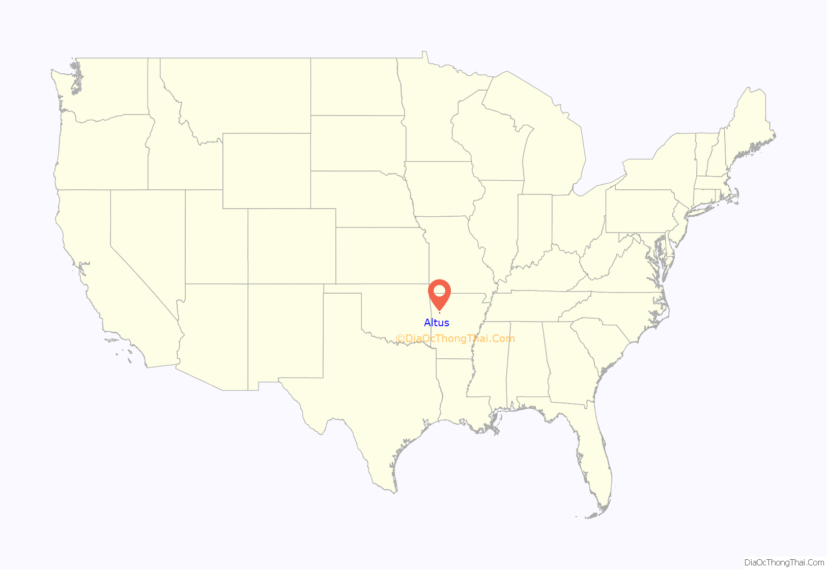
Altus location map. Where is Altus city?
History
Altus had its start in 1875 when the railroad was extended to that point. Altus station was the highest point on the track. In recognition of this highest railroad elevation between Little Rock and Fort Smith, the station was originally known as “Summit”. The town’s initial development was due to railroad efforts encouraging German immigration to settle lands adjacent to the railroad. In 1903, the railroad mainline was shifted to a more favorable alignment along the Arkansas River. The track through Altus was removed in the 1930s, but the railroad station has been preserved as a commercial establishment.
Altus is also the former site of Hendrix College.
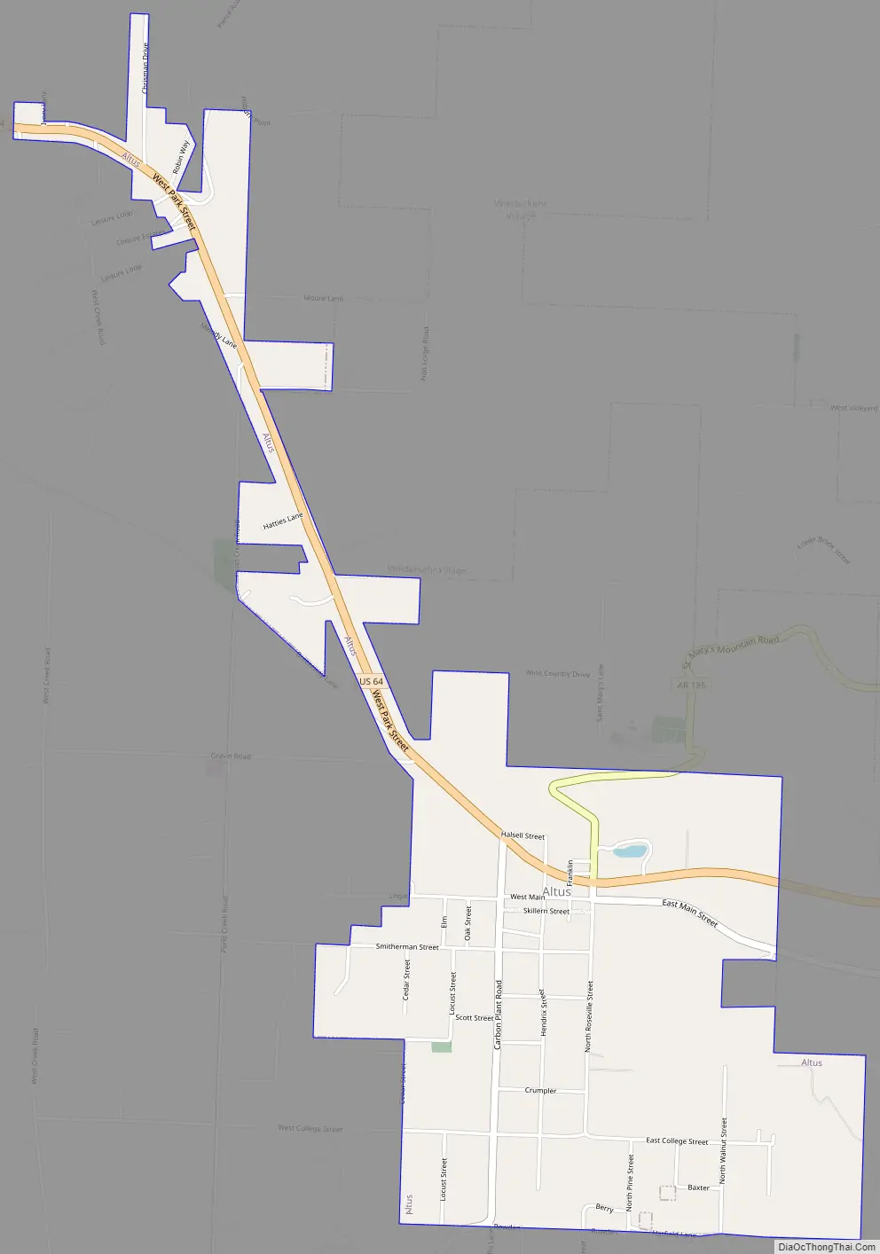
Altus Road Map
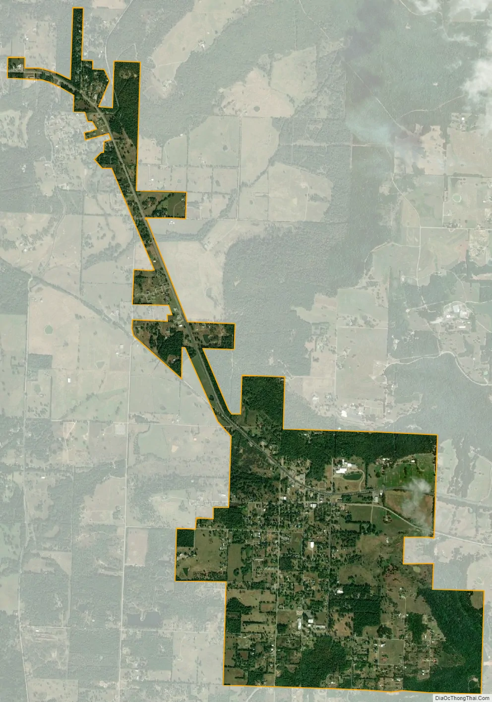
Altus city Satellite Map
Geography
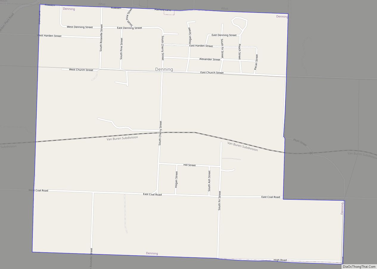
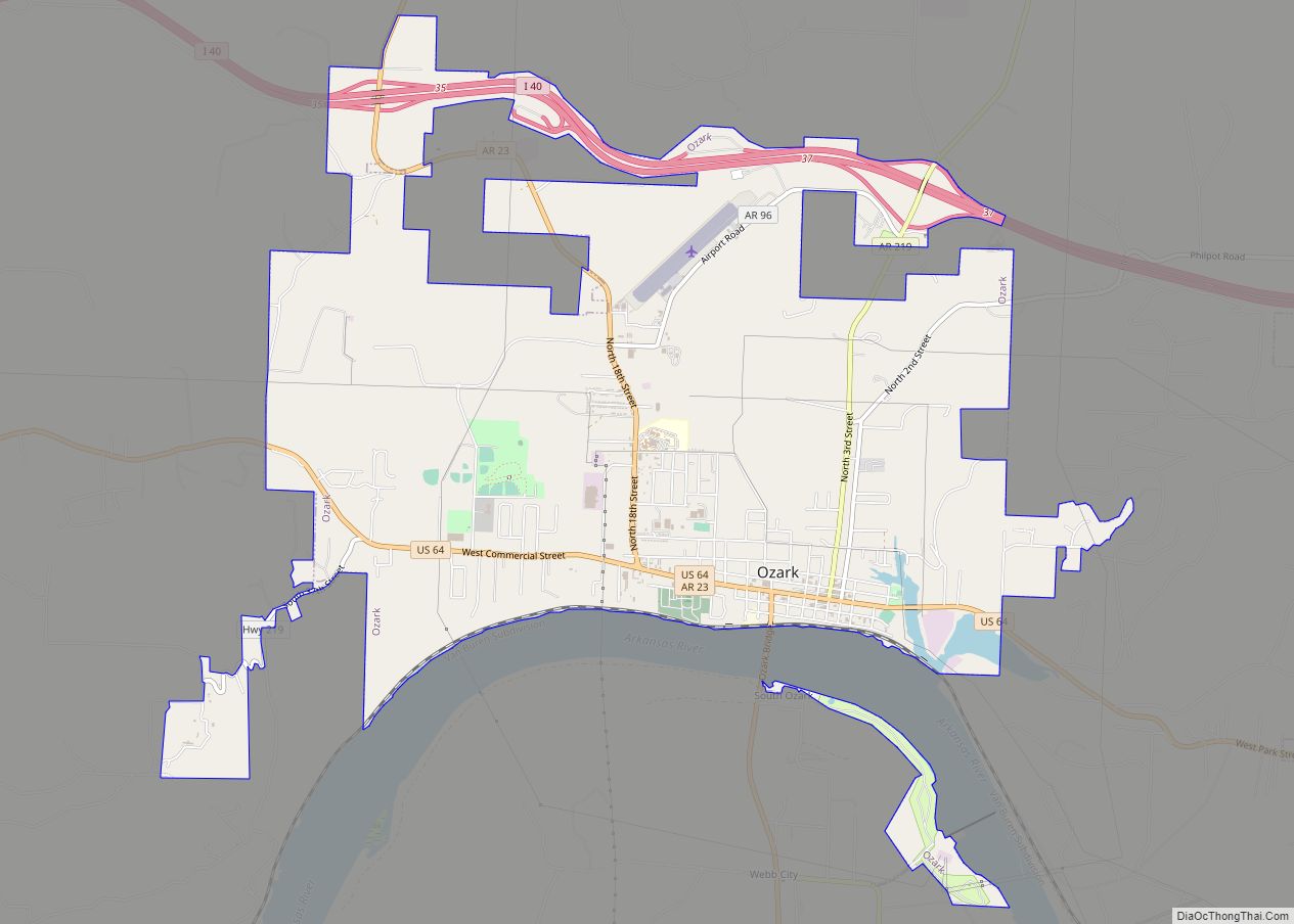
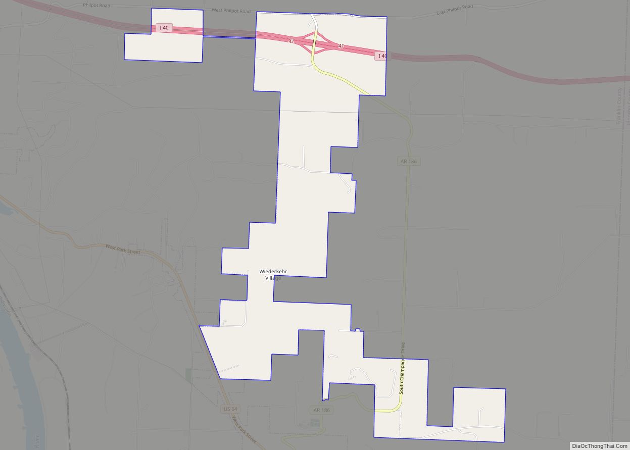
Altus is located in southeastern Franklin County, bordered to the south by the town of Denning. Wiederkehr Village is directly to the north. U.S. Route 64 passes through the center of Altus, leading northwest 5 miles (8 km) to Ozark and east 17 miles (27 km) to Clarksville. The Arkansas River is 3 miles (5 km) to the west.
Altus is south of the Boston Mountains range between the Ozark Mountains to the north and the Ouachita Mountains to the south. The soil type here is generally linker on the hilltops: a sandy loam, slightly acid soil and good for grape growing. Several wineries are located in Altus, and it is the location of the Altus American Viticultural Area.
According to the United States Census Bureau, the city has a total area of 1.8 square miles (4.7 km), all land.
See also
Map of Arkansas State and its subdivision:- Arkansas
- Ashley
- Baxter
- Benton
- Boone
- Bradley
- Calhoun
- Carroll
- Chicot
- Clark
- Clay
- Cleburne
- Cleveland
- Columbia
- Conway
- Craighead
- Crawford
- Crittenden
- Cross
- Dallas
- Desha
- Drew
- Faulkner
- Franklin
- Fulton
- Garland
- Grant
- Greene
- Hempstead
- Hot Spring
- Howard
- Independence
- Izard
- Jackson
- Jefferson
- Johnson
- Lafayette
- Lawrence
- Lee
- Lincoln
- Little River
- Logan
- Lonoke
- Madison
- Marion
- Miller
- Mississippi
- Monroe
- Montgomery
- Nevada
- Newton
- Ouachita
- Perry
- Phillips
- Pike
- Poinsett
- Polk
- Pope
- Prairie
- Pulaski
- Randolph
- Saint Francis
- Saline
- Scott
- Searcy
- Sebastian
- Sevier
- Sharp
- Stone
- Union
- Van Buren
- Washington
- White
- Woodruff
- Yell
- Alabama
- Alaska
- Arizona
- Arkansas
- California
- Colorado
- Connecticut
- Delaware
- District of Columbia
- Florida
- Georgia
- Hawaii
- Idaho
- Illinois
- Indiana
- Iowa
- Kansas
- Kentucky
- Louisiana
- Maine
- Maryland
- Massachusetts
- Michigan
- Minnesota
- Mississippi
- Missouri
- Montana
- Nebraska
- Nevada
- New Hampshire
- New Jersey
- New Mexico
- New York
- North Carolina
- North Dakota
- Ohio
- Oklahoma
- Oregon
- Pennsylvania
- Rhode Island
- South Carolina
- South Dakota
- Tennessee
- Texas
- Utah
- Vermont
- Virginia
- Washington
- West Virginia
- Wisconsin
- Wyoming