Augusta is a city in Woodruff County, Arkansas, United States, located on the east bank of the White River. The population was 2,199 at the 2010 census. The city is the county seat of Woodruff County.
| Name: | Augusta city |
|---|---|
| LSAD Code: | 25 |
| LSAD Description: | city (suffix) |
| State: | Arkansas |
| County: | Woodruff County |
| Founded: | 1848 |
| Incorporated: | July 9, 1860 |
| Elevation: | 217 ft (66 m) |
| Total Area: | 2.09 sq mi (5.41 km²) |
| Land Area: | 2.07 sq mi (5.37 km²) |
| Water Area: | 0.02 sq mi (0.04 km²) |
| Total Population: | 1,998 |
| Population Density: | 964.29/sq mi (372.25/km²) |
| ZIP code: | 72006 |
| Area code: | 870 |
| FIPS code: | 0502740 |
| GNISfeature ID: | 0076211 |
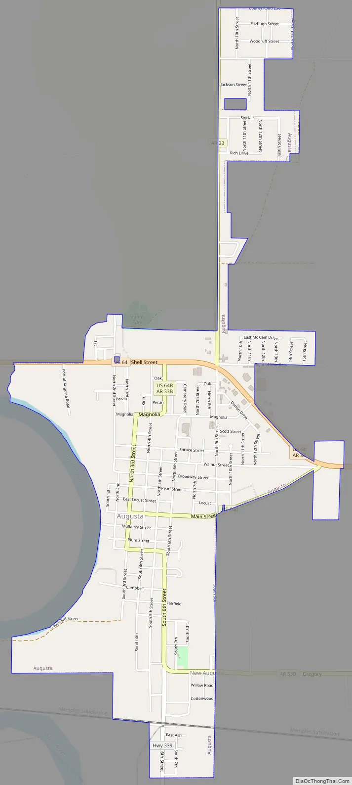
Online Interactive Map
Click on ![]() to view map in "full screen" mode.
to view map in "full screen" mode.
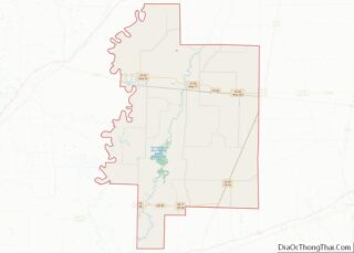
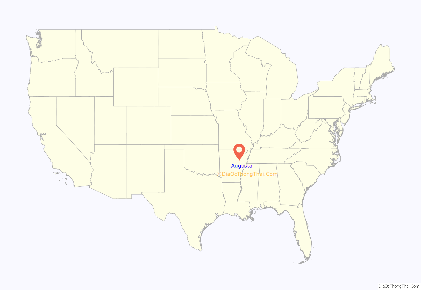
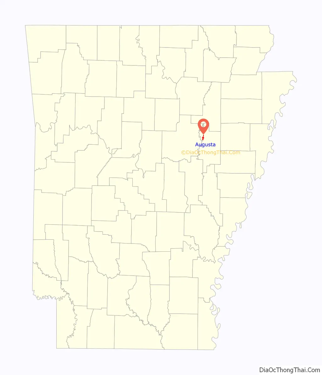
Augusta location map. Where is Augusta city?
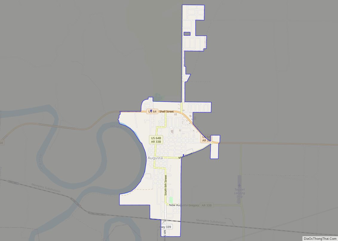
Augusta Road Map
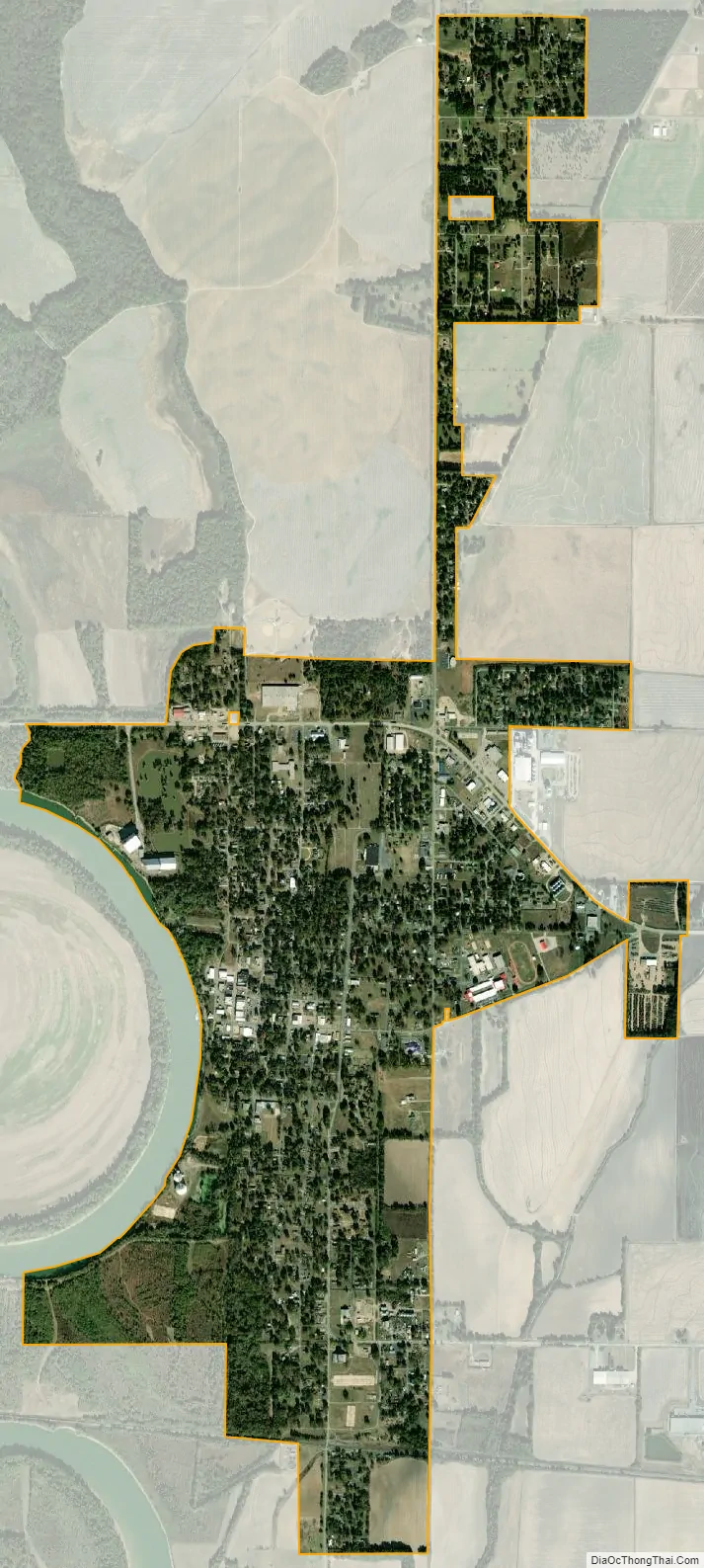
Augusta city Satellite Map
Geography
Augusta is located at 35°17′11″N 91°21′39″W / 35.28639°N 91.36083°W / 35.28639; -91.36083 (35.286501, -91.360935). Augusta is located approximately 75 miles (121 km) northeast of Little Rock and 81 miles (130 km) west of Memphis, Tennessee. According to the United States Census Bureau, the city has a total area of 2.0 square miles (5.2 km), all land.
Region
Augusta is located in the Arkansas Delta, one of the six primary geographic regions of Arkansas. The Arkansas Delta is a subregion of the Mississippi Alluvial Plain, which is a flat area consisting of rich, fertile sediment deposits from the Mississippi River between Louisiana and Illinois. Prior to settlement, Woodruff County was densely forested, with bayous, sloughs, and swamps crossing the land. Seeking to take advantage of the area’s fertile soils, settlers cleared the land to better suit row crops.
County
Although some swampland has been preserved in the Cache River NWR and some former farmland has undergone reforestation, the majority (56 percent) of the county remains in cultivation.
The nearby Cache River NWR, owned by the United States Fish and Wildlife Service, is a preservation area maintaining the original features of the area. Stretching approximately 90 miles (140 km) across adjacent counties, the NWR is listed as a Ramsar wetlands of international importance, and serves as a key wintering area for ducks and the largest contiguous tract of bottomland hardwood forest in North America.
Climate
Woodruff County has a humid subtropical climate (Köppen Cfa). Woodruff County experiences all four seasons, although summers can be extremely hot and humid and winters are mild with little snow. July is the hottest month of the year, with an average high of 93 °F (33.9 °C) and an average low of 70 °F (21.1 °C). Temperatures above 100 °F (38 °C) are not uncommon. January is the coldest month with an average high of 49 °F (9.4 °C) and an average low of 27 °F (−2.8 °C). The highest temperature was 112 °F (44.4 °C), recorded in 1936 and 1972. The lowest temperature recorded was −11 °F (−24 °C), on January 8, 1942.
See also
Map of Arkansas State and its subdivision:- Arkansas
- Ashley
- Baxter
- Benton
- Boone
- Bradley
- Calhoun
- Carroll
- Chicot
- Clark
- Clay
- Cleburne
- Cleveland
- Columbia
- Conway
- Craighead
- Crawford
- Crittenden
- Cross
- Dallas
- Desha
- Drew
- Faulkner
- Franklin
- Fulton
- Garland
- Grant
- Greene
- Hempstead
- Hot Spring
- Howard
- Independence
- Izard
- Jackson
- Jefferson
- Johnson
- Lafayette
- Lawrence
- Lee
- Lincoln
- Little River
- Logan
- Lonoke
- Madison
- Marion
- Miller
- Mississippi
- Monroe
- Montgomery
- Nevada
- Newton
- Ouachita
- Perry
- Phillips
- Pike
- Poinsett
- Polk
- Pope
- Prairie
- Pulaski
- Randolph
- Saint Francis
- Saline
- Scott
- Searcy
- Sebastian
- Sevier
- Sharp
- Stone
- Union
- Van Buren
- Washington
- White
- Woodruff
- Yell
- Alabama
- Alaska
- Arizona
- Arkansas
- California
- Colorado
- Connecticut
- Delaware
- District of Columbia
- Florida
- Georgia
- Hawaii
- Idaho
- Illinois
- Indiana
- Iowa
- Kansas
- Kentucky
- Louisiana
- Maine
- Maryland
- Massachusetts
- Michigan
- Minnesota
- Mississippi
- Missouri
- Montana
- Nebraska
- Nevada
- New Hampshire
- New Jersey
- New Mexico
- New York
- North Carolina
- North Dakota
- Ohio
- Oklahoma
- Oregon
- Pennsylvania
- Rhode Island
- South Carolina
- South Dakota
- Tennessee
- Texas
- Utah
- Vermont
- Virginia
- Washington
- West Virginia
- Wisconsin
- Wyoming