Santa Monica, from Santa Mónica (Spanish for ‘Saint Monica’), is a city in Los Angeles County, situated along Santa Monica Bay on California‘s South Coast. Santa Monica’s 2020 U.S. Census population was 93,076. Santa Monica is a popular resort town, owing to its climate, beaches, and hospitality industry. It has a diverse economy, hosting headquarters of companies such as Hulu, Universal Music Group, Lionsgate Films, and The Recording Academy.
Santa Monica traces its history to Rancho San Vicente y Santa Mónica, granted in 1839 to the Sepúlveda family of California. The rancho was later sold to John P. Jones and Robert Baker, who in 1875, along with his Californio heiress wife Arcadia Bandini de Stearns Baker, founded Santa Monica, which incorporated as a city in 1886. The city developed into a seaside resort during the late 19th and early 20th centuries, with the creation of tourist attractions such as Palisades Park, the Santa Monica Pier, Ocean Park, and the Hotel Casa del Mar.
| Name: | Santa Monica city |
|---|---|
| LSAD Code: | 25 |
| LSAD Description: | city (suffix) |
| State: | California |
| County: | Los Angeles County |
| Incorporated: | November 30, 1886 |
| Elevation: | 105 ft (32 m) |
| Total Area: | 16.00 sq mi (41.43 km²) |
| Land Area: | 8.41 sq mi (21.80 km²) |
| Water Area: | 7.58 sq mi (19.64 km²) |
| Total Population: | 93,076 |
| Population Density: | 5,800/sq mi (2,200/km²) |
| FIPS code: | 0670000 |
| Website: | santamonica.gov |
Online Interactive Map
Click on ![]() to view map in "full screen" mode.
to view map in "full screen" mode.
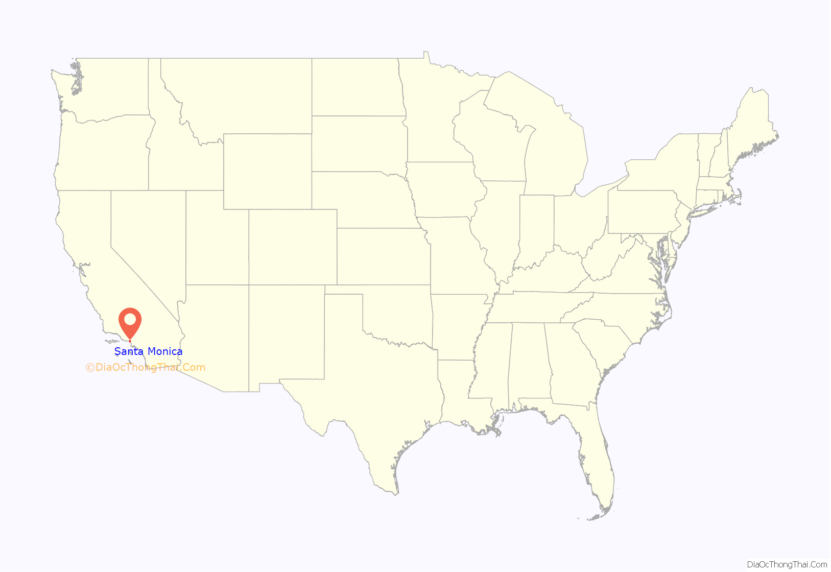
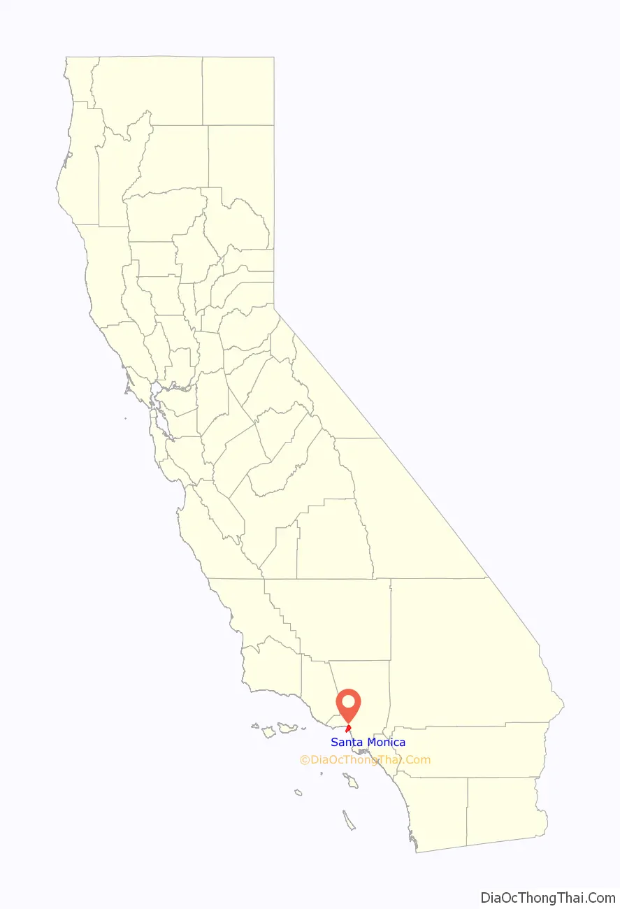
Santa Monica location map. Where is Santa Monica city?
History
Indigenous
The Tongva are Indigenous to the Santa Monica area. The village of Comicranga was established in the Santa Monica area. One of the village’s notable residents was Victoria Reid, who was the daughter of the chief of the village. During the Spanish period, she was taken to Mission San Gabriel from her parents at the age of six.
Spanish era
The first non-indigenous group to set foot in the area was the party of explorer Gaspar de Portolà, which camped near the present-day intersection of Barrington and Ohio Avenues on August 3, 1769.
There are two different accounts of how the city’s name came to be. One says it was named in honor of the feast day of Saint Monica (mother of Saint Augustine), but her feast day is May 4. Another version says it was named by Juan Crespí on account of a pair of springs, the Kuruvungna Springs, that were reminiscent of the tears Saint Monica shed over her son’s early impiety.
Mexican era
In 1839, Governor Juan Bautista Alvarado granted Rancho San Vicente y Santa Mónica to Francisco Sepúlveda II, of the Sepúlveda family of California. As the definitions of the rancho grant were not precise, the Sepúlveda family came into conflict with the neighboring Rancho Boca de Santa Mónica, owned by Ysidro Reyes and Francisco Márquez. A small Californio community grew up on Rancho San Vicente y Santa Mónica, made up primarily of vaqueros working on the rancho and their families.
Post-conquest era
After the American conquest of California, Mexico signed the Treaty of Guadalupe Hidalgo, which gave Mexicans and Californios living in state certain unalienable rights. U.S. government sovereignty in California began on February 2, 1848.
In the 1870s, the Los Angeles and Independence Railroad connected Santa Monica with Los Angeles, and a wharf out into the bay. The first town hall was an 1873 brick building, later a beer hall, and now part of the Santa Monica Hostel. By 1885, the town’s first hotel was the Santa Monica Hotel.
Amusement piers became popular in the first decades of the 20th century and the extensive Pacific Electric Railway brought people to the city’s beaches from across the Greater Los Angeles Area.
Around the start of the 20th century, a growing population of Asian Americans lived in and around Santa Monica and Venice. A Japanese fishing village was near the Long Wharf while small numbers of Chinese lived or worked in Santa Monica and Venice. The two ethnic minorities were often viewed differently by White Americans, who were often well-disposed toward the Japanese but condescending to the Chinese. The Japanese village fishermen were an integral economic part of the Santa Monica Bay community.
Donald Wills Douglas Sr. built a plant in 1922 at Clover Field (Santa Monica Airport) for the Douglas Aircraft Company. In 1924, four Douglas-built planes took off from Clover Field to attempt the first aerial circumnavigation of the world. Two planes returned after covering 27,553 miles (44,342 km) in 175 days, and were greeted on their return September 23, 1924, by a crowd of 200,000. The Douglas Company (later McDonnell Douglas) kept facilities in the city until the 1970s.
The Great Depression hit Santa Monica deeply. One report gives citywide employment in 1933 of just 1,000. Hotels and office building owners went bankrupt. In the 1930s, corruption infected Santa Monica (along with neighboring Los Angeles). The federal Works Project Administration helped build several buildings, most notably City Hall. The main Post Office and Barnum Hall (Santa Monica High School auditorium) were also among other WPA projects.
Modern era
Douglas’s business grew with the onset of World War II, employing as many as 44,000 people in 1943. To defend against air attack, set designers from the Warner Brothers Studios prepared elaborate camouflage that disguised the factory and airfield. The RAND Corporation began as a project of the Douglas Company in 1945, and spun off into an independent think tank on May 14, 1948. RAND acquired a 15-acre (61,000 m) campus across the street from the Civic Center and is still there today.
The completion of the Santa Monica Civic Auditorium in 1958 eliminated Belmar, the first African American community in the city, and the Santa Monica Freeway in 1966 decimated the Pico neighborhood that had been a leading African American enclave on the Westside.
Beach volleyball is believed to have been developed by Duke Kahanamoku in Santa Monica during the 1920s.
Santa Monica has two hospitals: Saint John’s Health Center and Santa Monica-UCLA Medical Center. Its cemetery is Woodlawn Memorial.
Santa Monica has several local newspapers including Santa Monica Daily Press, Santa Monica Mirror, and Santa Monica Star.
Santa Monica Road Map

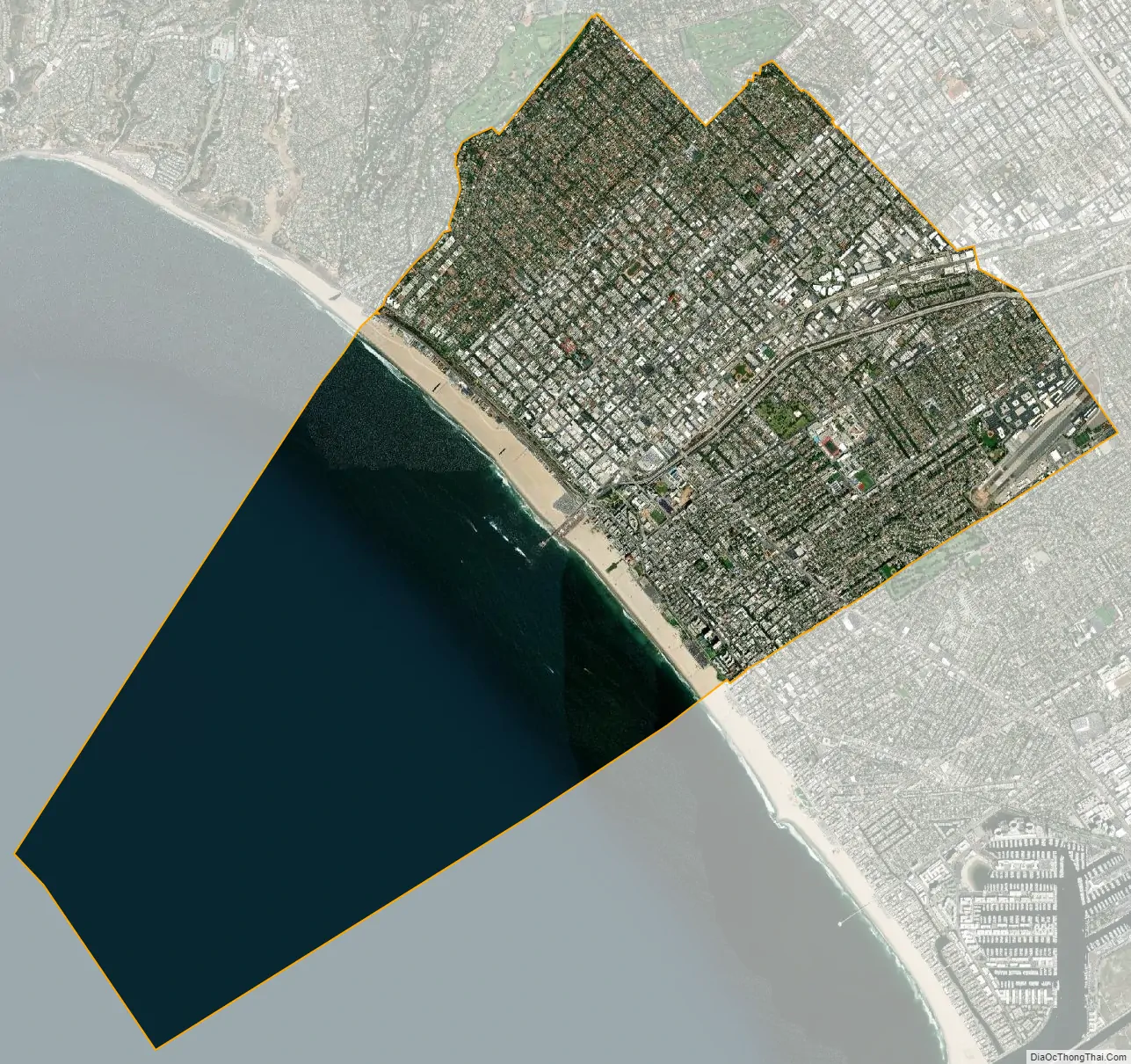
Santa Monica city Satellite Map
Geography
Santa Monica rests on a mostly flat slope that angles down toward Ocean Avenue and toward the south. High bluffs separate the north side of the city from the beaches. Santa Monica borders the L.A. neighborhoods of Pacific Palisades to the north and Venice to the south. To the west, Santa Monica has a 3-mile coastline fronting Santa Monica Bay, and to the east of the city are the L.A. communities of West Los Angeles and Brentwood.
Climate
Santa Monica has a coastal Mediterranean climate (Köppen Csb). It enjoys an average of 310 days of sunshine a year. It is in USDA plant hardiness zone 11a. Because of its location, nestled on the vast and open Santa Monica Bay, morning fog is a common phenomenon in May, June, July and early August (caused by ocean temperature variations and currents). Like other inhabitants of the greater Los Angeles area, residents have a particular terminology for this phenomenon: the “May Gray”, the “June Gloom” and even “Fogust”. Overcast skies are common on June mornings, but usually the strong sun burns the fog off by noon. In the late winter/early summer, daily fog is a phenomenon too. It happens suddenly and it may last some hours or past sunset time. Nonetheless, it will sometimes stay cloudy and cool all day during June, even as other parts of the Los Angeles area enjoy sunny skies and warmer temperatures. At times, the sun can be shining east of 20th Street while the beach area is overcast. As a general rule, the beach temperature is from 5 to 10 degrees Fahrenheit (3 to 6 degrees Celsius) cooler than it is inland during summer days, and 5 to 10 degrees warmer during winter nights.
It is also in September that the highest temperatures tend to be reached. It is winter, however, when the hot, dry winds of the Santa Anas are most common. In contrast, temperatures exceeding 10 degrees below average are rare.
The rainy season is from late October through late March. Winter storms usually approach from the northwest and pass quickly through the Southland. There is very little rain during the rest of the year. Yearly rainfall totals are unpredictable as rainy years are occasionally followed by droughts. There has never been any snow or frost, but there has been hail.
Santa Monica usually enjoys cool breezes blowing in from the ocean, which tend to keep the air fresh and clean. Therefore, smog is less of a problem for Santa Monica than elsewhere around Los Angeles. However, from September through November, the Santa Ana winds sometimes blow from the east, bringing smoggy and hot inland air to the beaches.
The hottest temperature ever reported in Santa Monica was 100 °F (38 °C) on November 1, 1966, while the lowest is 33 °F (1 °C) on March 1, 1945, and again on March 21, 1952. The highest minimum temperature is 72 °F (22 °C) on October 24, 2007, and the lowest maximum temperature is 51 °F (11 °C) on 4 dates in February 2001 and again March 10, 2006. The snowiest months on record are January 1954 and March 1955, both with trace amounts. They are the only months to ever report snowfall. Many months have reported no rainfall at all. Conversely, the wettest month on record is January 1995 with a total of 17.82 inches (453 mm) of rainfall. The wettest year on record is 1998, with a total of 25.4 inches (650 mm) of rainfall; the driest is 1989, with a total of 4.04 inches (103 mm) of rainfall.
Environment
The city first proposed its Sustainable City Plan in 1992 and in 1994, was one of the first cities in the nation to formally adopt a comprehensive sustainability plan, setting waste reduction and water conservation policies for both public and private sector through its Office of Sustainability and the Environment. Eighty-two percent of the city’s public works vehicles run on alternative fuels, including most of the municipal bus system, making it among the largest such fleets in the country. Santa Monica fleet vehicles and buses source their natural gas from Redeem, a Southern California-based supplier of renewable and sustainable natural gas obtained from non-fracked methane biogas generated from organic landfill waste.
Santa Monica adopted a Community Energy Independence Initiative, with a goal of achieving complete energy independence by 2020 (vs. California’s already ambitious 33% renewables goal). The city exceeded that aspiration when, in February 2019, it switched over to electricity from the Clean Power Alliance, with a citywide default of 100% renewably sourced energy. That same year, the Santa Monica City Council adopted a Climate Action and Adaptation Plan aimed at achieving an 80% cut in carbon emissions by 2030, and reaching community-wide carbon neutrality by 2050 or sooner.
An urban runoff facility (SMURFF), the first of its kind in the US, catches and treats 3.5 million US gallons (13,000 m) of water each week that would otherwise flow into the bay via storm-drains and sells it back to end-users within the city for reuse as gray-water, while bioswales throughout the city allow rainwater to percolate into and replenish the groundwater. The groundwater supply plays an important role in the city’s Sustainable Water Master Plan, whereby Santa Monica has set a goal of attaining 100% water independence by 2020. The city has numerous programs designed to promote water conservation among residents, including a rebate for those who convert lawns to drought-tolerant gardens that require less water.
Santa Monica has also instituted a green building-code whereby merely constructing to code automatically renders a building equivalent to the US Green Building Council’s LEED Silver standards. The city’s Main Library is one of many LEED certified or LEED equivalent buildings in the city. It is built over a 200,000 gallon cistern that collects filtered stormwater from the roof. The water is used for landscape irrigation.
Since 2009, Santa Monica has been developing the Zero Waste Strategic Operations Plan by which the city will set a goal of diverting at least 95% of all waste away from landfills, and toward recycling and composting, by 2030. The plan includes a food waste composting program, which diverts 3 million pounds of restaurant food waste away from landfills annually. As of 2013, 77% of all solid waste produced citywide is diverted from landfills.
Environmentally focused initiatives include curbside recycling, curbside composting bins (in addition to trash, yard-waste, and recycle bins), farmers’ markets, community gardens, garden-share, an urban forest initiative, a hazardous materials home-collection service, and a green business certification.
As in other coastal beach communities, coastal erosion due to coastal infrastructure and high human usage is an increasing challenge, and will become worse due to sea level rise. Starting in 2016, local environmental groups began dune and beach restoration projects.
See also
Map of California State and its subdivision:- Alameda
- Alpine
- Amador
- Butte
- Calaveras
- Colusa
- Contra Costa
- Del Norte
- El Dorado
- Fresno
- Glenn
- Humboldt
- Imperial
- Inyo
- Kern
- Kings
- Lake
- Lassen
- Los Angeles
- Madera
- Marin
- Mariposa
- Mendocino
- Merced
- Modoc
- Mono
- Monterey
- Napa
- Nevada
- Orange
- Placer
- Plumas
- Riverside
- Sacramento
- San Benito
- San Bernardino
- San Diego
- San Francisco
- San Joaquin
- San Luis Obispo
- San Mateo
- Santa Barbara
- Santa Clara
- Santa Cruz
- Shasta
- Sierra
- Siskiyou
- Solano
- Sonoma
- Stanislaus
- Sutter
- Tehama
- Trinity
- Tulare
- Tuolumne
- Ventura
- Yolo
- Yuba
- Alabama
- Alaska
- Arizona
- Arkansas
- California
- Colorado
- Connecticut
- Delaware
- District of Columbia
- Florida
- Georgia
- Hawaii
- Idaho
- Illinois
- Indiana
- Iowa
- Kansas
- Kentucky
- Louisiana
- Maine
- Maryland
- Massachusetts
- Michigan
- Minnesota
- Mississippi
- Missouri
- Montana
- Nebraska
- Nevada
- New Hampshire
- New Jersey
- New Mexico
- New York
- North Carolina
- North Dakota
- Ohio
- Oklahoma
- Oregon
- Pennsylvania
- Rhode Island
- South Carolina
- South Dakota
- Tennessee
- Texas
- Utah
- Vermont
- Virginia
- Washington
- West Virginia
- Wisconsin
- Wyoming


