San Bernardino County (/sæn ˌbɜːrnəˈdiːnoʊ/ (listen)), officially the County of San Bernardino, is a county located in the southern portion of the U.S. state of California, and is located within the Inland Empire area. As of the 2020 U.S. Census, the population was 2,181,654, making it the fifth-most populous county in California and the 14th-most populous in the United States. The county seat is San Bernardino.
While included within the Greater Los Angeles area, San Bernardino County is included in the Riverside–San Bernardino–Ontario metropolitan statistical area, as well as the Los Angeles–Long Beach combined statistical area.
With an area of 20,105 square miles (52,070 km), San Bernardino County is the largest county in the contiguous United States by area, although some of Alaska’s boroughs and census areas are larger. The county is close to the size of West Virginia.
This vast county stretches from where the bulk of the county population resides in three Census County Divisions (Fontana, San Bernardino, and Victorville-Hesperia), counting 1,793,186 people as of the 2010 Census, covering 1,730 square miles (4,480 km), across the thinly populated deserts and mountains. It spans an area from south of the San Bernardino Mountains in San Bernardino Valley, to the Nevada border and the Colorado River.
With a population that is 53.7% Hispanic as of 2020, it is California’s most populous majority-Hispanic county and the second-largest nationwide.
| Name: | San Bernardino County |
|---|---|
| FIPS code: | 06-071 |
| State: | California |
| Founded: | 1853 |
| Named for: | San Bernardino, named for San Bernardino de Sena Estancia, named in turn for Saint Bernardino of Siena |
| Seat: | San Bernardino |
| Largest city: | Victorville |
| Total Area: | 20,105 sq mi (52,070 km²) |
| Land Area: | 20,057 sq mi (51,950 km²) |
| Total Population: | 2,181,654 |
| Population Density: | 110/sq mi (40/km²) |
| Time zone: | UTC−8 (Pacific Time Zone) |
| Summer Time Zone (DST): | UTC−7 (Pacific Daylight Time) |
| Website: | www.sbcounty.gov |
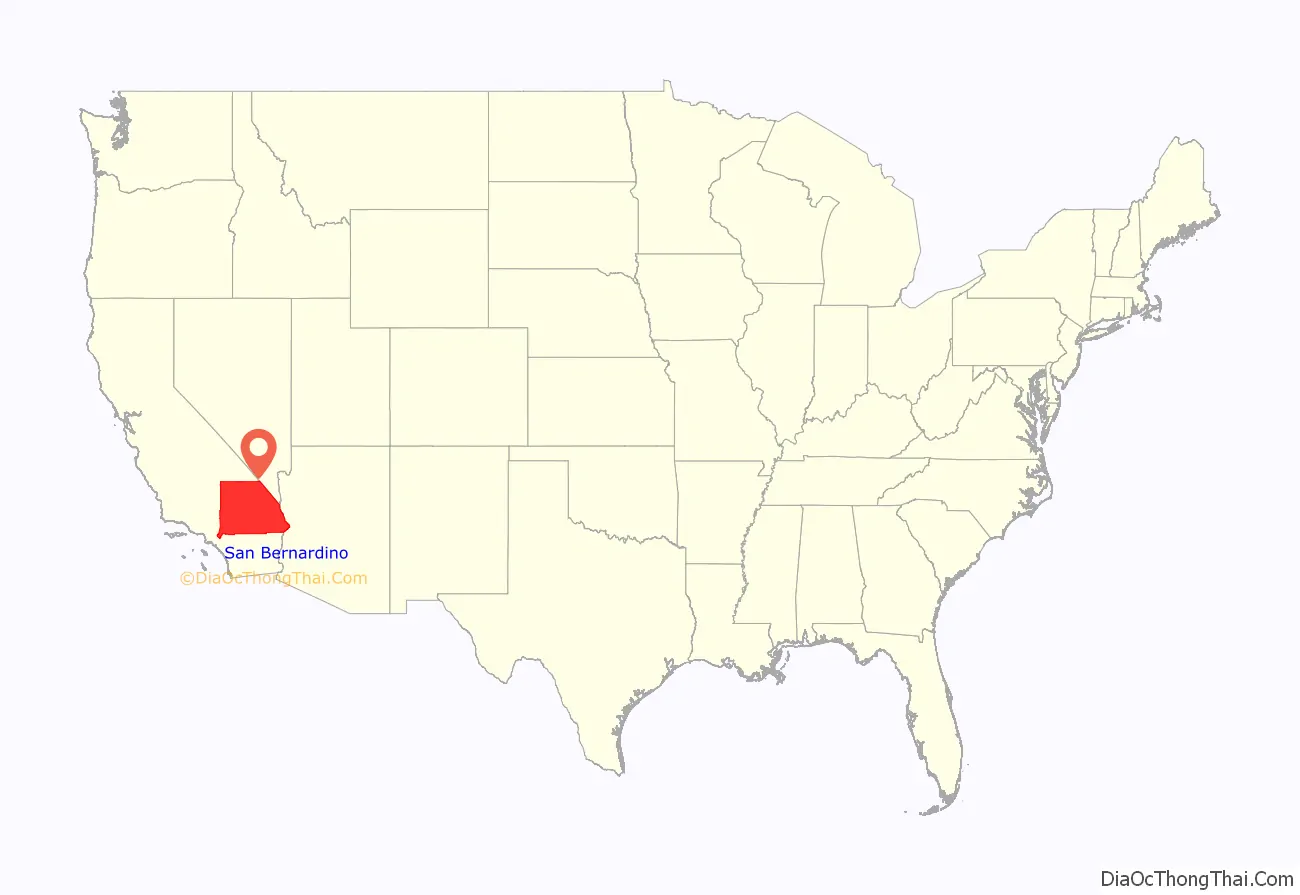
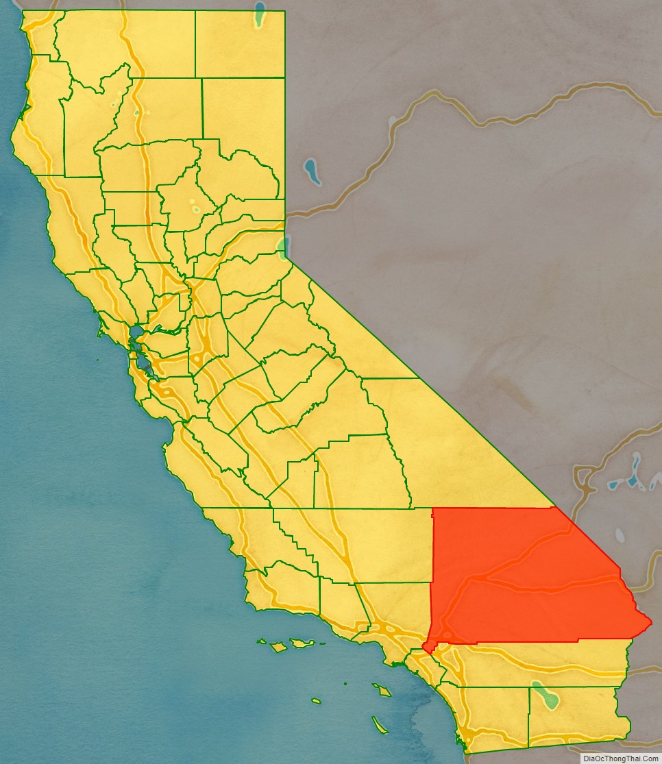
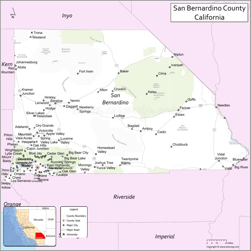
San Bernardino County location map. Where is San Bernardino County?
History
Indigenous
The indigenous peoples that resided in what is now San Bernardino County were primarily the Taaqtam (Serrano) and ʔívil̃uqaletem (Cahuilla) peoples who lived in the San Bernardino Valley and the San Bernardino Mountains; the Chemehuevi and the Kawaiisu peoples who lived in the Mojave Desert region; and the ‘Aha Makhav (Mohave) and the Piipaash (Maricopa) peoples who lived along the Colorado River. These groups established various villages and settlements throughout the region that were interconnected by a series of extensive trails.
Wa’aachnga was a major Tongva village site, also occupied by the Serrano and Cahuilla, located near what is now the city of San Bernardino. The village was part of an extensive trade network along the Mohave Trail that connected villages in San Bernardino County from the Colorado River to the Los Angeles Basin. Wá’peat was a Desert Serrano village located near what is now the city of Hesperia. It was part of a series of villages located along the Mojave River. By the late 1700s, villages in the area were being increasingly encroached upon by Spanish soldiers and missionaries, who were coming into the region from Mission San Gabriel.
Colonial period
Spanish Missionaries from Mission San Gabriel Arcángel established a church at the village of Wa’aachnga, which would be renamed Politania in 1810. Father Francisco Dumetz named the church San Bernardino on May 20, 1810, after the feast day of St. Bernardino of Siena. The Franciscans also gave the name San Bernardino to the snowcapped peak in Southern California, in honor of the saint and it is from him that the county derives its name. In 1819, they established the San Bernardino de Sena Estancia, a mission farm in what is now Redlands.
Following Mexican independence from Spain in 1821, Mexican citizens were granted land grants to establish ranchos in the area of the county. Rancho Jurupa in 1838, Rancho Cucamonga and El Rincon in 1839, Rancho Santa Ana del Chino in 1841, Rancho San Bernardino in 1842 and Rancho Muscupiabe in 1844.
Agua Mansa was the first town in what became San Bernardino County, settled by immigrants from New Mexico on land donated from the Rancho Jurupa in 1841.
Establishment
Following the purchase of Rancho San Bernardino, and the establishment of the town of San Bernardino in 1851 by Mormon colonists, San Bernardino County was formed in 1853 from parts of Los Angeles County. Some of the southern parts of the county’s territory were given to Riverside County in 1893.
In the 1980s, Northern San Bernardino County proposed to create Mojave County due to the abysmal service levels the county provided. Ultimately, the vote for county secession failed. The proposed county was from the Cajon Pass to the city of Needles.
In 1998, County administrator James Hlawek resigned after being subject to an FBI investigation for bribery. only after Harry Mays, county Treasurer-Tax Collector Thomas O’Donnell, County Investment Officer Sol Levin and three businessmen had agreed to plead guilty to federal bribery charges.
In 2004, County Supervisor Geral Eaves Pleaded guilty to bribery for accepting gifts from businesses for allowing billboards on county land.
In 2004, the county was embroiled in a corruption scandal, that lasted until 2016, over the colonies housing development with real estate developer Jeff Burum in upland. The scandal resulted in 102 million being paid to Jeff Burums real estate company. Supervisor Bill Postmus pleaded guilty to 10 felonies in regard to his previous post as county assessor. in 2020, Jeff Burum sued the county again and the county reached for a 69 million dollar settlement. 2022, the county’s insurance company, Ironside, balked at paying the settlement, claiming that the county willfully “retaliate against the Colonies II Plaintiffs as part of a decades-long dispute over land and water rights in Upland, California, culminating in a malicious prosecution of Burum.”
In 2020, voters approved Measure K, which limited county supervisors to one term instead of three, while reducing pay from 250 thousand dollars to 60 thousand dollars. County Supervisors appealed the decision, only to lose in the state’s appeals court. By 2022, term limits were restored and pay was restored to 80% of the annual base compensation for San Bernardino Superior Court judges under a supervisor lead ballot measure
In 2022, The Board of supervisors were pushed by a major supervisor campaign contributor Jeff Burum to vote for secession from the State of California to form the state of Empire.
San Bernardino County Road Map
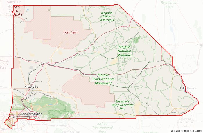
Geography
According to the U.S. Census Bureau, the county has a total area of 20,105 square miles (52,070 km), of which 20,057 square miles (51,950 km) is land and 48 square miles (120 km) (0.2%) is water. It is the largest county by area in California and the largest in the United States (excluding boroughs in Alaska). It is slightly larger than the states of New Jersey, Connecticut, Delaware and Rhode Island combined, and is also slightly larger than Switzerland. It borders both Nevada and Arizona.
The bulk of the population, nearly two million, live in the roughly 480 square miles south of the San Bernardino Mountains adjacent to Riverside and in the San Bernardino Valley in the southwestern portion of the county. About 390,000 residents live just north of the San Bernardino Mountains, in and around the roughly 280 square-mile area that includes the Victor Valley. Roughly another 100,000 people live scattered across the rest of the sprawling county.
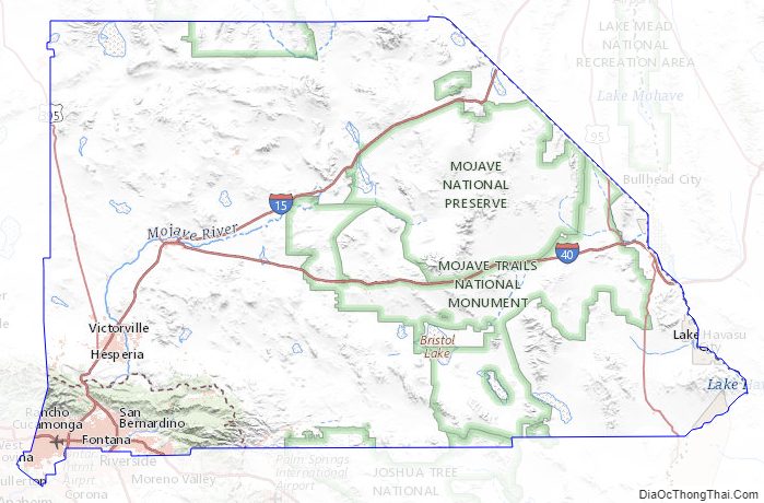
The Mojave National Preserve covers some of the eastern desert, especially between Interstate 15 and Interstate 40. The desert portion also includes the cities of Needles next to the Colorado River and Barstow at the junction of Interstate 15 and Interstate 40. Trona is at the northwestern part of the county, west of Death Valley. This national park, mostly within Inyo County, also has a small portion of land within San Bernardino County. The largest metropolitan area in the Mojave Desert part of the county is the Victor Valley, with the incorporated localities of Adelanto, Apple Valley, Hesperia, and Victorville. Further south, a portion of Joshua Tree National Park overlaps the county near the High Desert area, in the vicinity of Twentynine Palms. The remaining towns make up the remainder of the High Desert: Pioneertown, Yucca Valley, Joshua Tree, Landers, and Morongo Valley.
The mountains are home to the San Bernardino National Forest, and include the communities of Crestline, Lake Arrowhead, Running Springs, Big Bear City, Forest Falls, and Big Bear Lake.
The San Bernardino Valley is at the eastern end of the San Gabriel Valley. The San Bernardino Valley includes the cities of Ontario, Chino, Chino Hills, Upland, Fontana, Rialto, Colton, Grand Terrace, Montclair, Rancho Cucamonga, San Bernardino, Loma Linda, Highland, Redlands, and Yucaipa.
Adjacent counties
National protected areas
- Angeles National Forest (part)
- Death Valley National Park (part)
- Havasu National Wildlife Refuge (part)
- Joshua Tree National Park (part)
- Mojave National Preserve
- San Bernardino National Forest (part)
- Sand to Snow National Monument (part)
More than 80% of the county’s land is owned by the federal government. There are at least 35 official wilderness areas in the county that are part of the National Wilderness Preservation System. This is the largest number of any county in the United States (although not the largest in total area). The majority are managed by the Bureau of Land Management, but some are integral components of the above listed national protected areas. Most of these wilderness areas lie entirely within the county, but a few are shared with neighboring counties (and two of these are shared with the neighboring states of Arizona and Nevada).
Except as noted, these wilderness areas are managed solely by the Bureau of Land Management and lie within San Bernardino County:
- Bigelow Cholla Garden Wilderness
- Bighorn Mountain Wilderness (part)
- Black Mountain Wilderness
- Bristol Mountains Wilderness
- Cadiz Dunes Wilderness
- Chemehuevi Mountains Wilderness
- Cleghorn Lakes Wilderness
- Clipper Mountain Wilderness
- Cucamonga Wilderness
- Dead Mountains Wilderness
- Death Valley Wilderness (part)
- Golden Valley Wilderness
- Grass Valley Wilderness
- Havasu Wilderness (part)
- Hollow Hills Wilderness
- Joshua Tree Wilderness (part)
- Kelso Dunes Wilderness
- Kingston Range Wilderness
- Mesquite Wilderness
- Mojave Wilderness
- Newberry Mountains Wilderness
- North Mesquite Mountains Wilderness
- Old Woman Mountains Wilderness
- Pahrump Valley Wilderness (part)
- Piute Mountains Wilderness
- Rodman Mountains Wilderness
- Saddle Peak Hills Wilderness (part)
- San Gorgonio Wilderness (part)
- Sheep Mountain Wilderness (part)
- Sheephole Valley Wilderness
- Stateline Wilderness
- Stepladder Mountains Wilderness
- Trilobite Wilderness
- Turtle Mountains Wilderness
- Whipple Mountains Wilderness
San Bernardino County Topographic Map
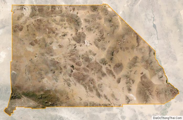
San Bernardino County Satellite Map
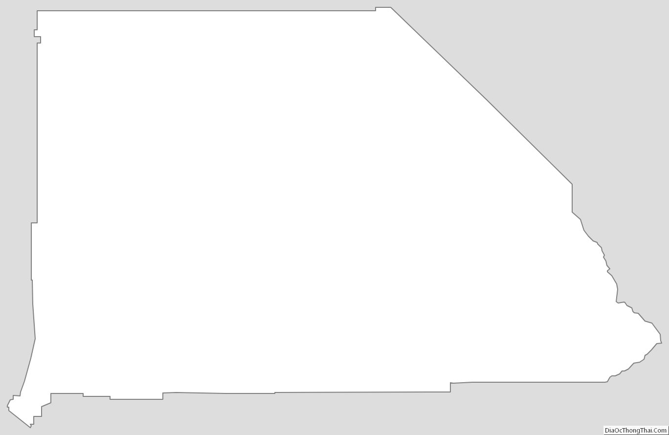
San Bernardino County Outline Map