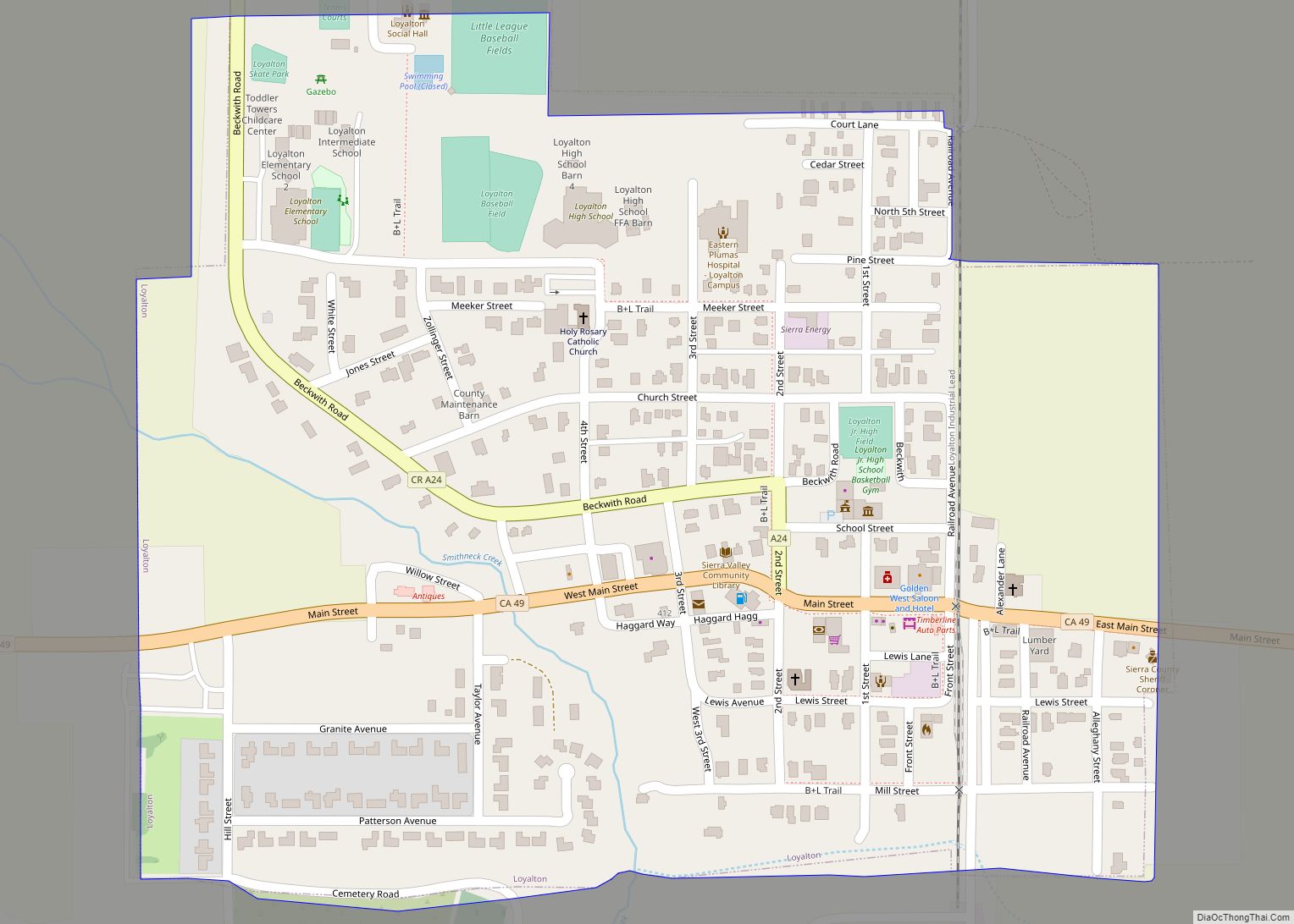
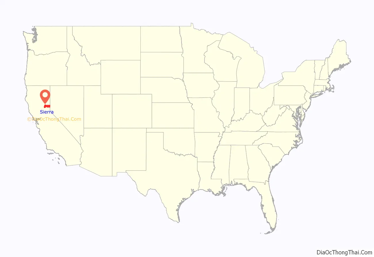
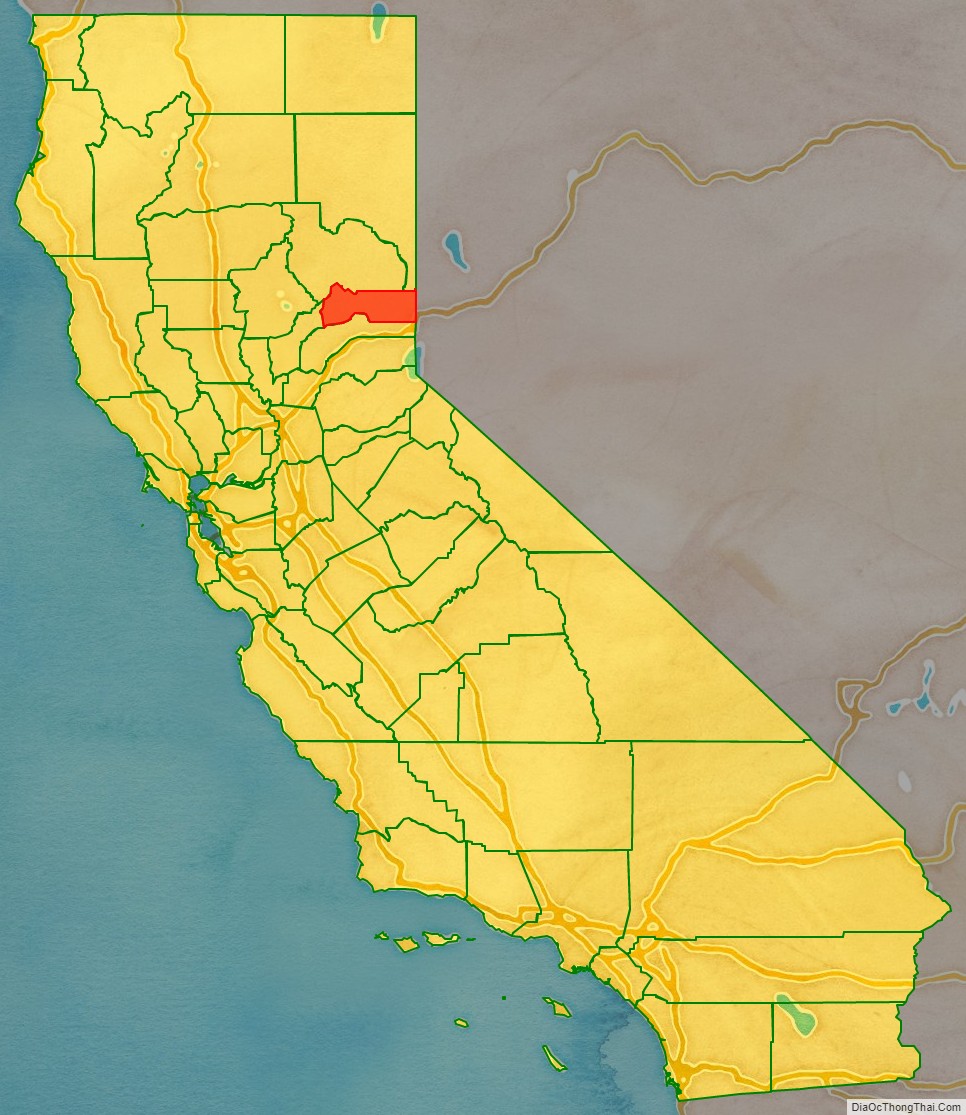
Sierra County (/siˈɛrə/ (listen)) is a county located in the U.S. state of California. As of the 2020 census, the population was 3,236, making it California’s second-least populous county. The county seat is Downieville; the sole incorporated city is Loyalton. The county is in the Sierra Nevada, northeast of Sacramento on the border with Nevada.
| Name: | Sierra County |
|---|---|
| FIPS code: | 06-091 |
| State: | California |
| Founded: | 1852 |
| Named for: | Sierra Nevada |
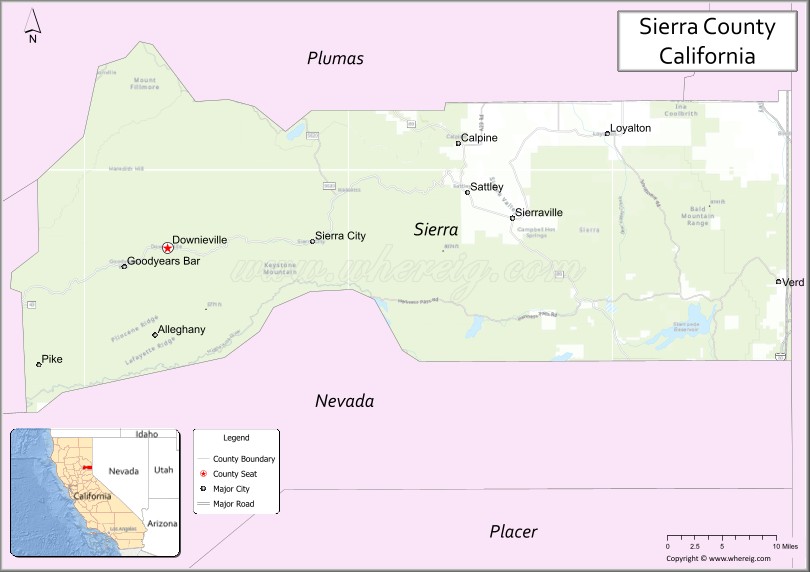
| Seat: | Downieville |
| Largest city: | Loyalton |
| Total Area: | 962 sq mi (2,490 km²) |
| Land Area: | 953 sq mi (2,470 km²) |
| Total Population: | 3,236 |
| Population Density: | 3.4/sq mi (1.3/km²) |
| Time zone: | UTC-8 (Pacific Standard Time) |
| Summer Time Zone (DST): | UTC-7 (Pacific Daylight Time) |
| Website: | www.sierracounty.ca.gov |
Sierra County location map. Where is Sierra County?
History
Sierra County was formed from parts of Yuba County in 1852. The county derives its name from the Sierra Nevada.
Prior to the California Gold Rush, the area was home to both the Maidu and the Washoe peoples. They generally summered in the higher elevations to hunt and fish, and returned to lower elevations for the winter months. After the discovery of gold in the Sierra foothills sparked the California Gold Rush, more than 16,000 miners settled in Sierra County between 1848 and 1860. Most mining settlements in the county sprung up along the North and Middle Forks of the Yuba River, both of which had rich deposits of gold. While some of the mining boom towns faded away once gold fever died down, other settlements such as Downieville and Sierra City have remained.
Notable gold nuggets found in the county include a 26.5 pound specimen, avoirdupois, found by a group of sailors at Sailor Ravine, two miles above Downieville. A 51-pound specimen was found in 1853 by a group of Frenchmen in French Ravine. The 106 pound Monumental Nugget was found in Sept. 1869 at Sierra City.
The Bald Mountain drift mine in Forest City was founded in Aug. 1864, and was the largest of its kind in the state at the time. The Bald Mountain Extension was located in 1874 east of Forest. The Monte Cristo Mine was located in 1854. The largest quartz-mine is the Sierra Buttes Gold Mine was located in 1850 near Sierra City. The Gold Bluff Mine was located near Downieville in 1854. By 1880 the county was “crushing” 70,000 tons of quartz and had 266 miles of mining ditches.
Sierra County Road Map
Geography
Sierra County, California is a vast and beautiful area that covers 962 square miles according to the U.S. Census Bureau. The county comprises of 953 square miles of land and 9 square miles of water. The county is located in the Sierra Nevada, known for its rugged mountain ranges and picturesque landscapes. The county is known for its natural beauty and rich history, providing a diverse range of landscapes, from rugged mountains to lush forests, tranquil lakes, and streams, and much more. The area is a great place for outdoor enthusiasts, with opportunities for hiking, fishing, hunting, and exploring the natural wonders of the Sierra Nevada.
Adjacent counties
- Nevada County, California – south
- Yuba County, California – west
- Plumas County, California – north
- Lassen County, California – northeast
- Washoe County, Nevada – east
National protected areas
- Plumas National Forest (part)
- Tahoe National Forest (part)
- Toiyabe National Forest (part)
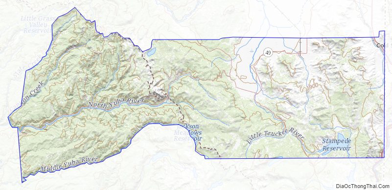
Sierra County Topographic Map
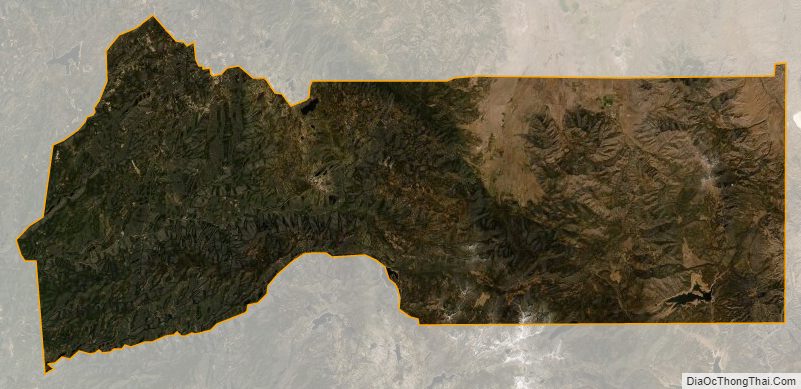
Sierra County Satellite Map
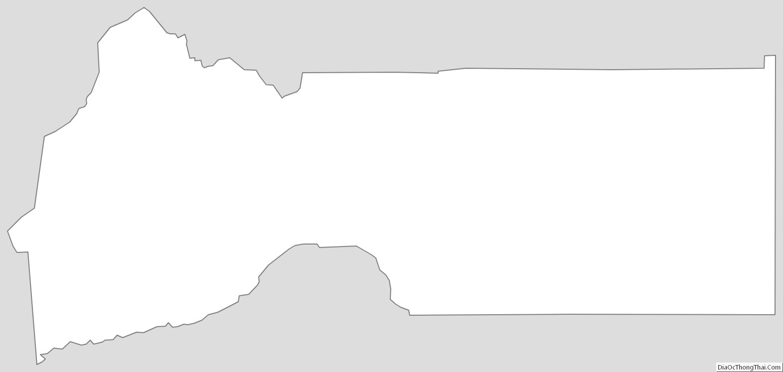
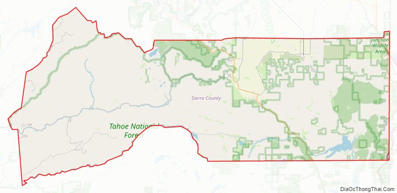
Sierra County Outline Map