Boyce is a town in northern Rapides Parish, Louisiana, United States. It is part of the Alexandria, Louisiana Metropolitan Statistical Area. The population was 1,004 at the 2010 census. The community is nearly 75 percent African American.
| Name: | Boyce town |
|---|---|
| LSAD Code: | 43 |
| LSAD Description: | town (suffix) |
| State: | Louisiana |
| County: | Rapides Parish |
| Elevation: | 85 ft (26 m) |
| Total Area: | 0.62 sq mi (1.60 km²) |
| Land Area: | 0.46 sq mi (1.19 km²) |
| Water Area: | 0.16 sq mi (0.41 km²) |
| Total Population: | 888 |
| Population Density: | 1,930.43/sq mi (745.97/km²) |
| Area code: | 318 |
| FIPS code: | 2209165 |
Online Interactive Map
Click on ![]() to view map in "full screen" mode.
to view map in "full screen" mode.
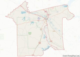
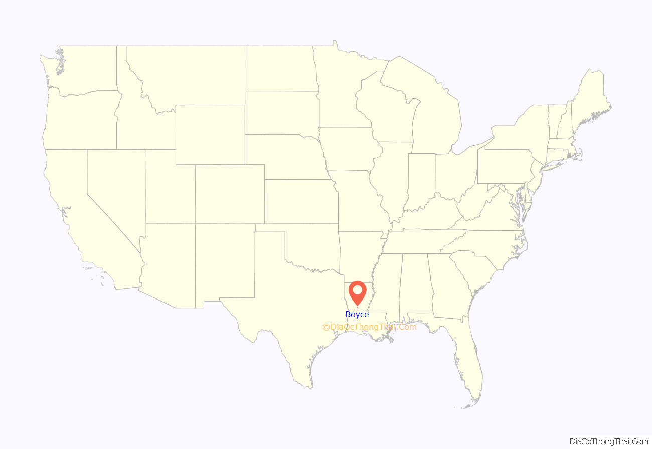
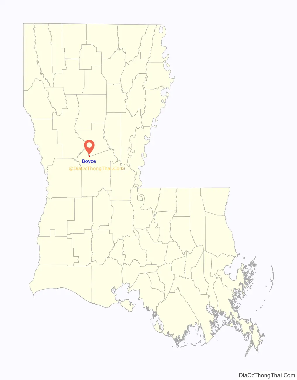
Boyce location map. Where is Boyce town?
History
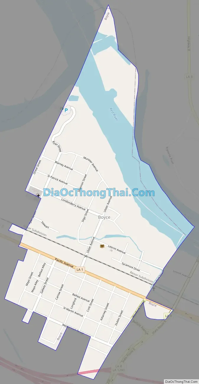
Originally called Cotile Landing, the name was changed to Boyce in 1880, when the Texas and Pacific Railroad made Boyce its terminal point. The town was named for Judge Henry Boyce, who owned the land on which the town was located. Being of Irish descent, Boyce, and/or his son Henry Archinard Boyce, gave all the streets Irish names as he did his own cotton farmland, Ulster, which was immediately adjacent to the town along Bayou Jeunes des Gens (Jean de Jean). The post office was moved more than once but was returned to Boyce in 1883 and the Postal Service chose Boyce, even though there was a majority opposition, because the train depot already carried that name. Under charter of May 7, 1887, Boyce was organized and a council elected.
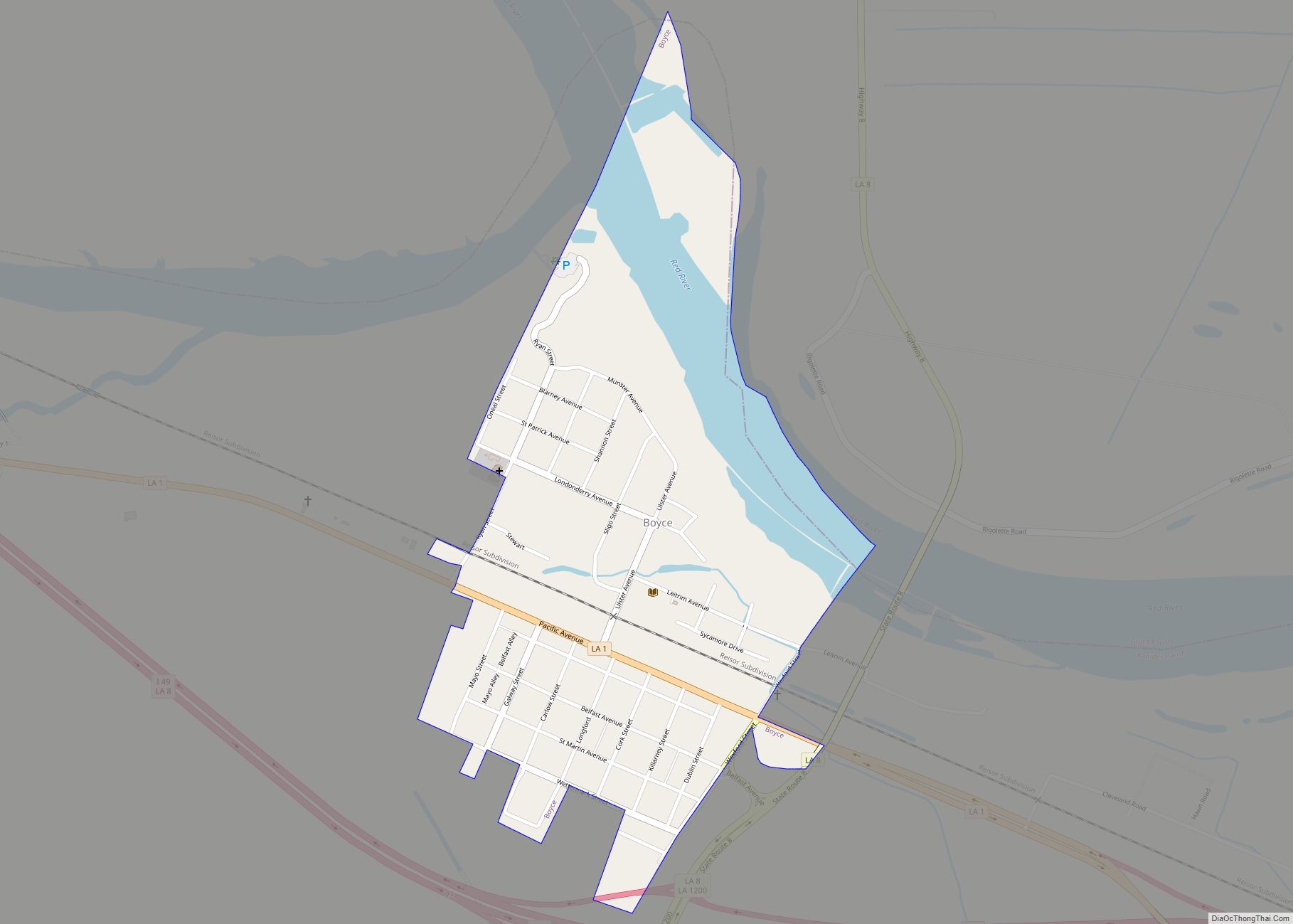
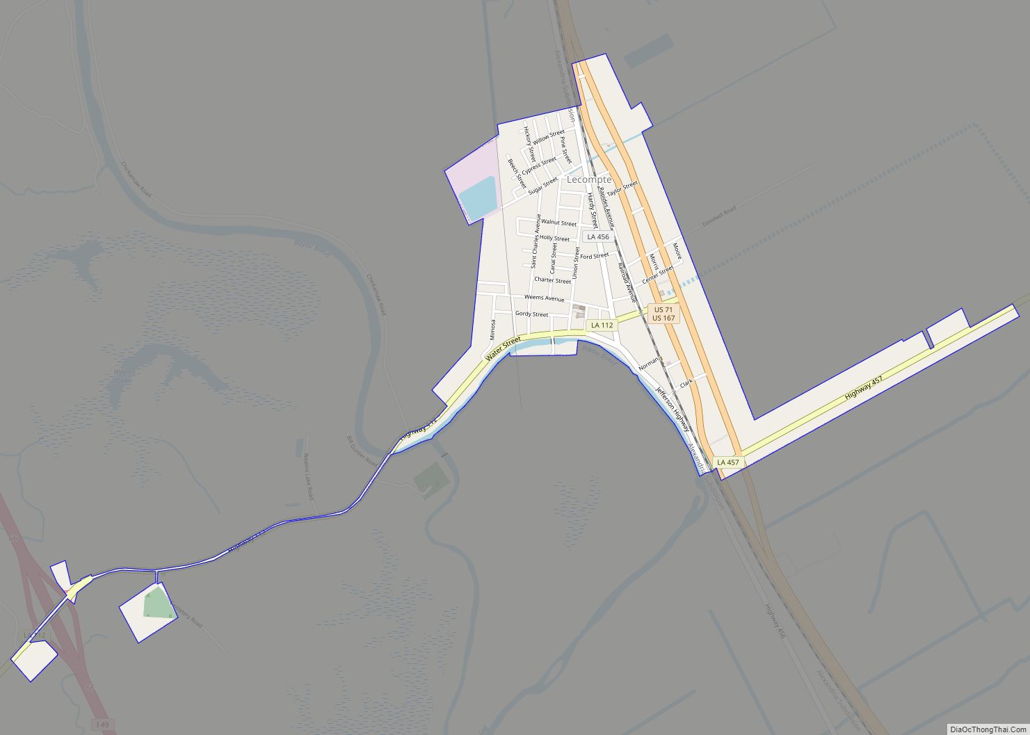
Boyce Road Map
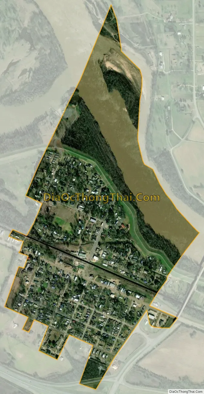
Boyce city Satellite Map
Geography
Boyce is located at 31°23′12″N 92°40′14″W / 31.38667°N 92.67056°W / 31.38667; -92.67056 (31.386778, -92.670577).
According to the United States Census Bureau, the town has a total area of 0.6 square miles (1.6 km), of which 0.5 square miles (1.3 km) is land and 0.1 square miles (0.26 km) (8.62%) is water.
A number of small bayous, such as Bayou Jean de Jean and Bayou Helen, are located just outside the town.
An island in the Red River North of the town was created with the straightening of the portion of the river next to the Town by the Army Corps of Engineers. The owners of the Island named it St. Alfred Island, after Alfred Boyce Wettermark, (1916-2010).
Climate
See also
Map of Louisiana State and its subdivision:- Acadia
- Allen
- Ascension
- Assumption
- Avoyelles
- Beauregard
- Bienville
- Bossier
- Caddo
- Calcasieu
- Caldwell
- Cameron
- Catahoula
- Claiborne
- Concordia
- De Soto
- East Baton Rouge
- East Carroll
- East Feliciana
- Evangeline
- Franklin
- Grant
- Iberia
- Iberville
- Jackson
- Jefferson
- Jefferson Davis
- La Salle
- Lafayette
- Lafourche
- Lincoln
- Livingston
- Madison
- Morehouse
- Natchitoches
- Orleans
- Ouachita
- Plaquemines
- Pointe Coupee
- Rapides
- Red River
- Richland
- Sabine
- Saint Bernard
- Saint Charles
- Saint Helena
- Saint James
- Saint John the Baptist
- Saint Landry
- Saint Martin
- Saint Mary
- Saint Tammany
- Tangipahoa
- Tensas
- Terrebonne
- Union
- Vermilion
- Vernon
- Washington
- Webster
- West Baton Rouge
- West Carroll
- West Feliciana
- Winn
- Alabama
- Alaska
- Arizona
- Arkansas
- California
- Colorado
- Connecticut
- Delaware
- District of Columbia
- Florida
- Georgia
- Hawaii
- Idaho
- Illinois
- Indiana
- Iowa
- Kansas
- Kentucky
- Louisiana
- Maine
- Maryland
- Massachusetts
- Michigan
- Minnesota
- Mississippi
- Missouri
- Montana
- Nebraska
- Nevada
- New Hampshire
- New Jersey
- New Mexico
- New York
- North Carolina
- North Dakota
- Ohio
- Oklahoma
- Oregon
- Pennsylvania
- Rhode Island
- South Carolina
- South Dakota
- Tennessee
- Texas
- Utah
- Vermont
- Virginia
- Washington
- West Virginia
- Wisconsin
- Wyoming