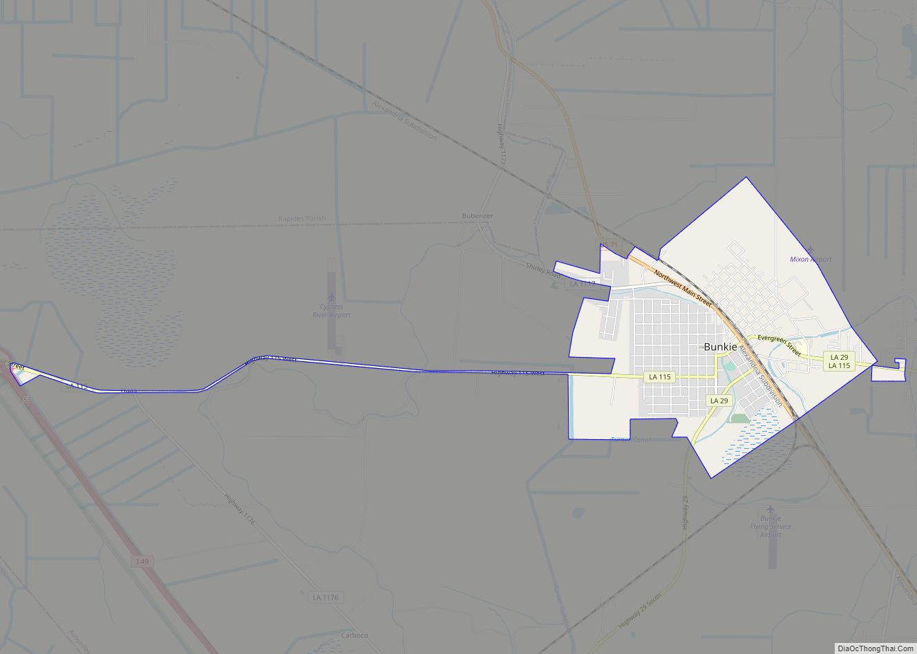
Bunkie is a city in Avoyelles Parish, Louisiana, United States. The population was 4,171 at the 2010 census.
| Name: | Bunkie city |
|---|---|
| LSAD Code: | 25 |
| LSAD Description: | city (suffix) |
| State: | Louisiana |
| County: | Avoyelles Parish |
| Elevation: | 66 ft (20 m) |
| Total Area: | 3.04 sq mi (7.87 km²) |
| Land Area: | 3.02 sq mi (7.83 km²) |
| Water Area: | 0.01 sq mi (0.04 km²) |
| Total Population: | 3,346 |
| Population Density: | 1,107.21/sq mi (427.48/km²) |
| Area code: | 318 |
| FIPS code: | 2210950 |
| Website: | bunkiecityhall.com |
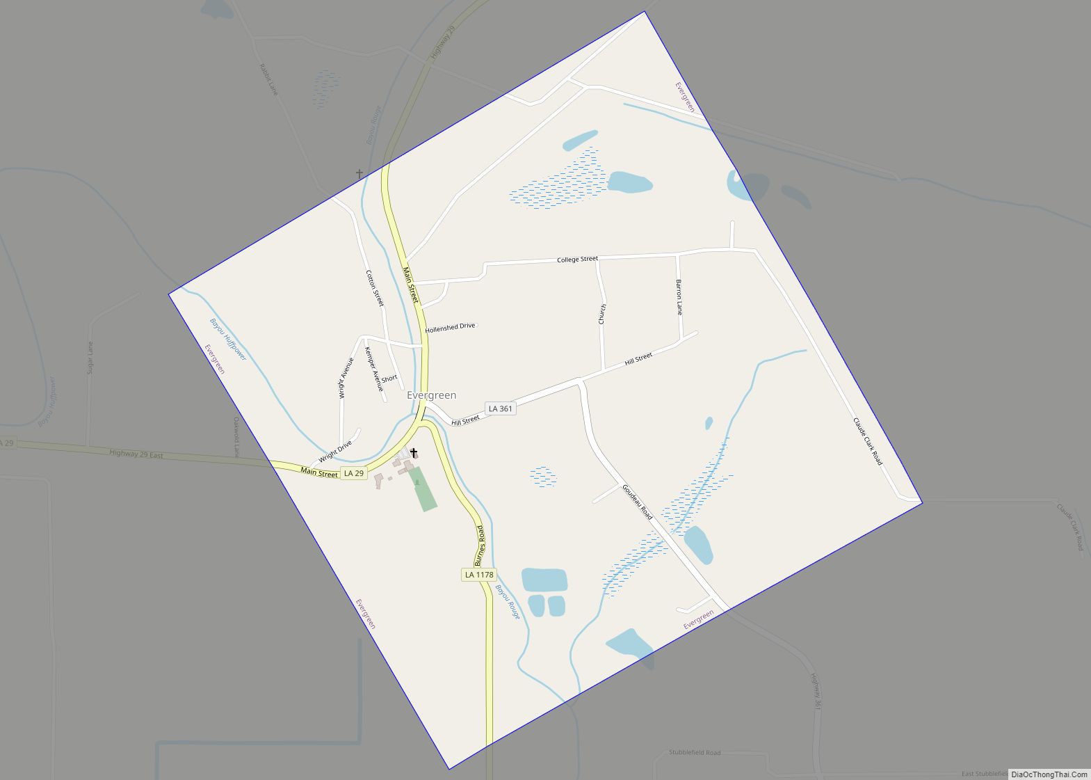
Online Interactive Map
Click on ![]() to view map in "full screen" mode.
to view map in "full screen" mode.
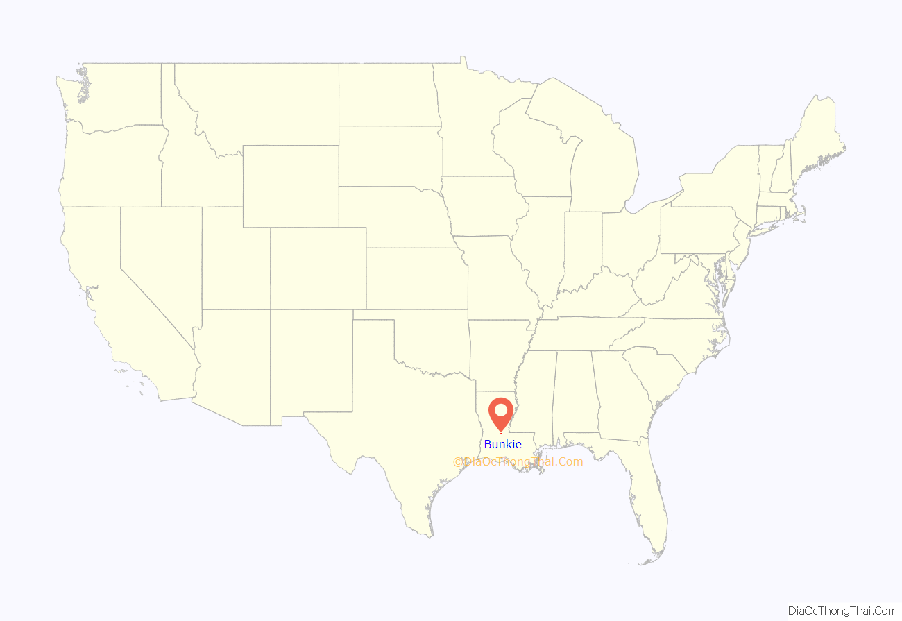
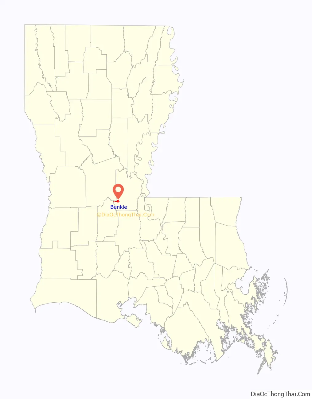
Bunkie location map. Where is Bunkie city?
History
Bunkie was founded as a station terminus on the Texas and Pacific Railroad line. It was named for the daughter (whose nickname was “Bunkie”) of the original landowner.
The federal post office in town contains a mural, Cotton Pickers, painted in 1939 during the Great Depression by Caroline Speare Rohland. Federally commissioned murals were produced from 1934 to 1943 in the United States through the Section of Painting and Sculpture, later called the Section of Fine Arts, of the Treasury Department. This work was part of the effort by the federal government to employ artists during the difficult Depression years.
The area around Bunkie is devoted to agriculture; since the late 20th century, corn has been an important commodity crop. Since 1987, Bunkie has hosted the annual Louisiana Corn Festival during the second full weekend of June.
Bunkie Road Map
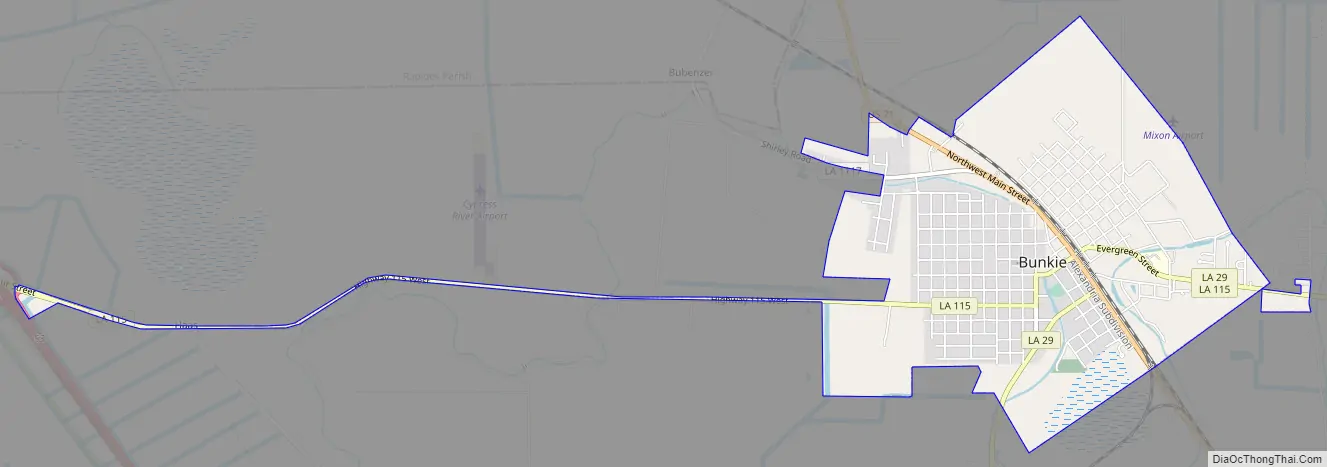
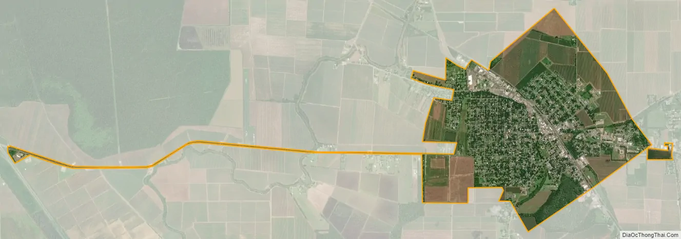
Bunkie city Satellite Map
Geography
According to the United States Census Bureau, the city has a total area of 2.69 square miles (6.97 km), of which 2.68 square miles (6.93 km) is land and 0.015 square miles (0.04 km), or 0.57%, is water.
Climate
See also
Map of Louisiana State and its subdivision:- Acadia
- Allen
- Ascension
- Assumption
- Avoyelles
- Beauregard
- Bienville
- Bossier
- Caddo
- Calcasieu
- Caldwell
- Cameron
- Catahoula
- Claiborne
- Concordia
- De Soto
- East Baton Rouge
- East Carroll
- East Feliciana
- Evangeline
- Franklin
- Grant
- Iberia
- Iberville
- Jackson
- Jefferson
- Jefferson Davis
- La Salle
- Lafayette
- Lafourche
- Lincoln
- Livingston
- Madison
- Morehouse
- Natchitoches
- Orleans
- Ouachita
- Plaquemines
- Pointe Coupee
- Rapides
- Red River
- Richland
- Sabine
- Saint Bernard
- Saint Charles
- Saint Helena
- Saint James
- Saint John the Baptist
- Saint Landry
- Saint Martin
- Saint Mary
- Saint Tammany
- Tangipahoa
- Tensas
- Terrebonne
- Union
- Vermilion
- Vernon
- Washington
- Webster
- West Baton Rouge
- West Carroll
- West Feliciana
- Winn
- Alabama
- Alaska
- Arizona
- Arkansas
- California
- Colorado
- Connecticut
- Delaware
- District of Columbia
- Florida
- Georgia
- Hawaii
- Idaho
- Illinois
- Indiana
- Iowa
- Kansas
- Kentucky
- Louisiana
- Maine
- Maryland
- Massachusetts
- Michigan
- Minnesota
- Mississippi
- Missouri
- Montana
- Nebraska
- Nevada
- New Hampshire
- New Jersey
- New Mexico
- New York
- North Carolina
- North Dakota
- Ohio
- Oklahoma
- Oregon
- Pennsylvania
- Rhode Island
- South Carolina
- South Dakota
- Tennessee
- Texas
- Utah
- Vermont
- Virginia
- Washington
- West Virginia
- Wisconsin
- Wyoming