Campti is a town in the northern part of Natchitoches Parish, Louisiana, United States. The population was 1,056 at the 2010 census. It is part of the Natchitoches Micropolitan Statistical Area. Campti is a flat area of mostly farmland. It is located on the eastern bank of the Red River. Considerable herds of cattle are also raised in the general area.
| Name: | Campti town |
|---|---|
| LSAD Code: | 43 |
| LSAD Description: | town (suffix) |
| State: | Louisiana |
| County: | Natchitoches Parish |
| Founded: | 1745 |
| Elevation: | 128 ft (39 m) |
| Total Area: | 1.04 sq mi (2.70 km²) |
| Land Area: | 1.04 sq mi (2.70 km²) |
| Water Area: | 0.00 sq mi (0.00 km²) |
| Total Population: | 887 |
| Population Density: | 851.25/sq mi (328.75/km²) |
| ZIP code: | 71411 |
| Area code: | 318 |
| FIPS code: | 2212280 |
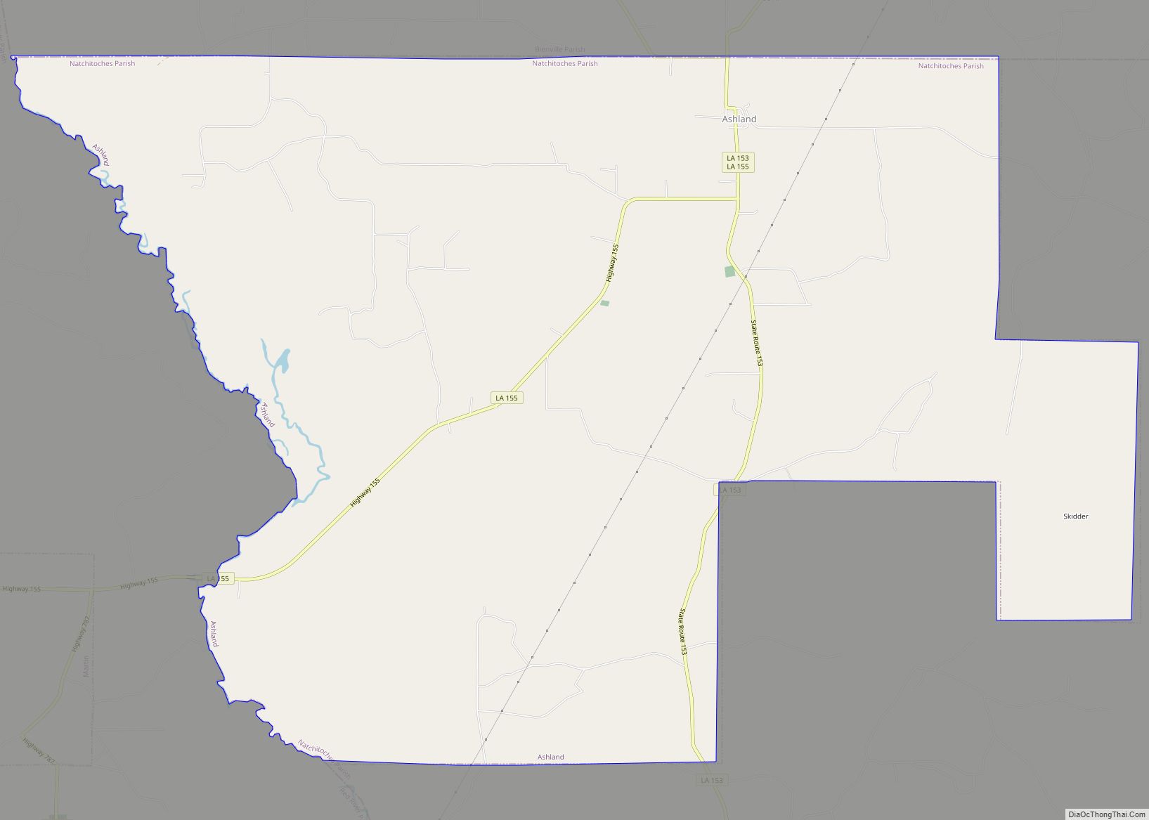
Online Interactive Map
Click on ![]() to view map in "full screen" mode.
to view map in "full screen" mode.
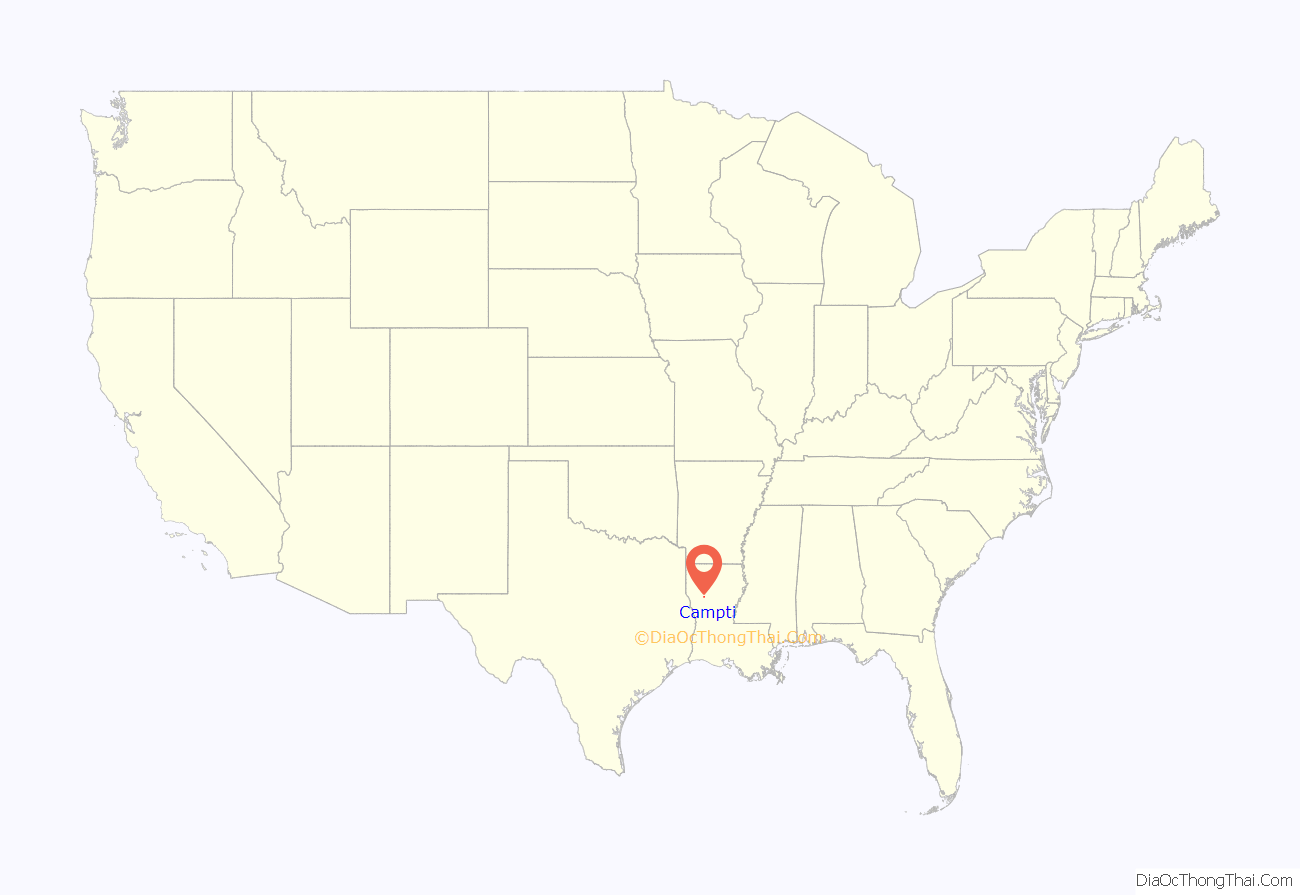
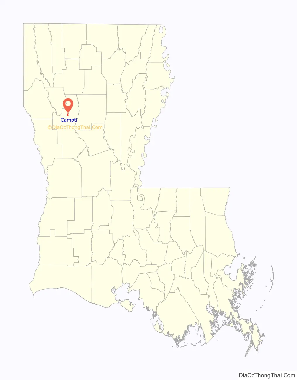
Campti location map. Where is Campti town?
History
The rural parish was developed for large cotton plantations, and a majority of the population were enslaved African Americans in the antebellum years. But by the time of the American Civil War, a number of free people of color also lived in Campti and the area. They were known to be related to several of the longtime white families, who acknowledged them, and they were generally well accepted. According to one authority on this area, they lived nearly as white. At least nine men of color, and likely more, enlisted in the Confederate Army during the Civil War and “easily entered a predominately white military company.”
During the war, Union Brigadier-General A. J. Smith, with two brigades, reached Campti to assist Rear-Admiral David D. Porter’s gunboats on the Red River there. Confederate Brigadier-General St. John R. Liddell’s scattered troops had been harassing the Union fleet but quickly retreated as Smith’s overwhelming force arrived on April 13, 1864. Smith and his men burned what was left of Campti, on April 14, 1864. The gunboats were returned safely upriver to Grand Ecore in Natchitoches Parish.
In the postwar years, cotton and agriculture continued as mainstays of the economy. Later cattle raising was introduced. Large-scale agriculture and ranching have reduced economic opportunities in the rural area. The population of Campti has continued to be majority African American, reflecting the history of its development.
Campti Road Map
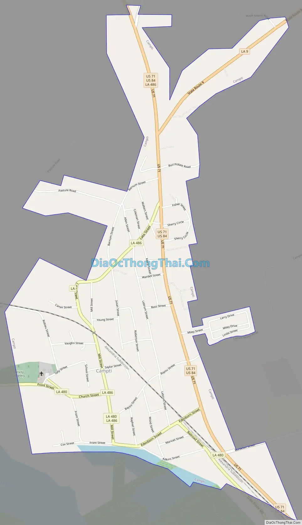
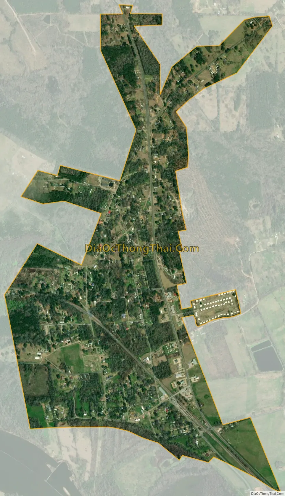
Campti city Satellite Map
Geography
Campti is located at 31°53′44″N 93°6′50″W / 31.89556°N 93.11389°W / 31.89556; -93.11389 (31.895511, -93.113966).
According to the United States Census Bureau, the town has a total area of 1.0 square mile (2.6 km), all land.
See also
Map of Louisiana State and its subdivision:- Acadia
- Allen
- Ascension
- Assumption
- Avoyelles
- Beauregard
- Bienville
- Bossier
- Caddo
- Calcasieu
- Caldwell
- Cameron
- Catahoula
- Claiborne
- Concordia
- De Soto
- East Baton Rouge
- East Carroll
- East Feliciana
- Evangeline
- Franklin
- Grant
- Iberia
- Iberville
- Jackson
- Jefferson
- Jefferson Davis
- La Salle
- Lafayette
- Lafourche
- Lincoln
- Livingston
- Madison
- Morehouse
- Natchitoches
- Orleans
- Ouachita
- Plaquemines
- Pointe Coupee
- Rapides
- Red River
- Richland
- Sabine
- Saint Bernard
- Saint Charles
- Saint Helena
- Saint James
- Saint John the Baptist
- Saint Landry
- Saint Martin
- Saint Mary
- Saint Tammany
- Tangipahoa
- Tensas
- Terrebonne
- Union
- Vermilion
- Vernon
- Washington
- Webster
- West Baton Rouge
- West Carroll
- West Feliciana
- Winn
- Alabama
- Alaska
- Arizona
- Arkansas
- California
- Colorado
- Connecticut
- Delaware
- District of Columbia
- Florida
- Georgia
- Hawaii
- Idaho
- Illinois
- Indiana
- Iowa
- Kansas
- Kentucky
- Louisiana
- Maine
- Maryland
- Massachusetts
- Michigan
- Minnesota
- Mississippi
- Missouri
- Montana
- Nebraska
- Nevada
- New Hampshire
- New Jersey
- New Mexico
- New York
- North Carolina
- North Dakota
- Ohio
- Oklahoma
- Oregon
- Pennsylvania
- Rhode Island
- South Carolina
- South Dakota
- Tennessee
- Texas
- Utah
- Vermont
- Virginia
- Washington
- West Virginia
- Wisconsin
- Wyoming