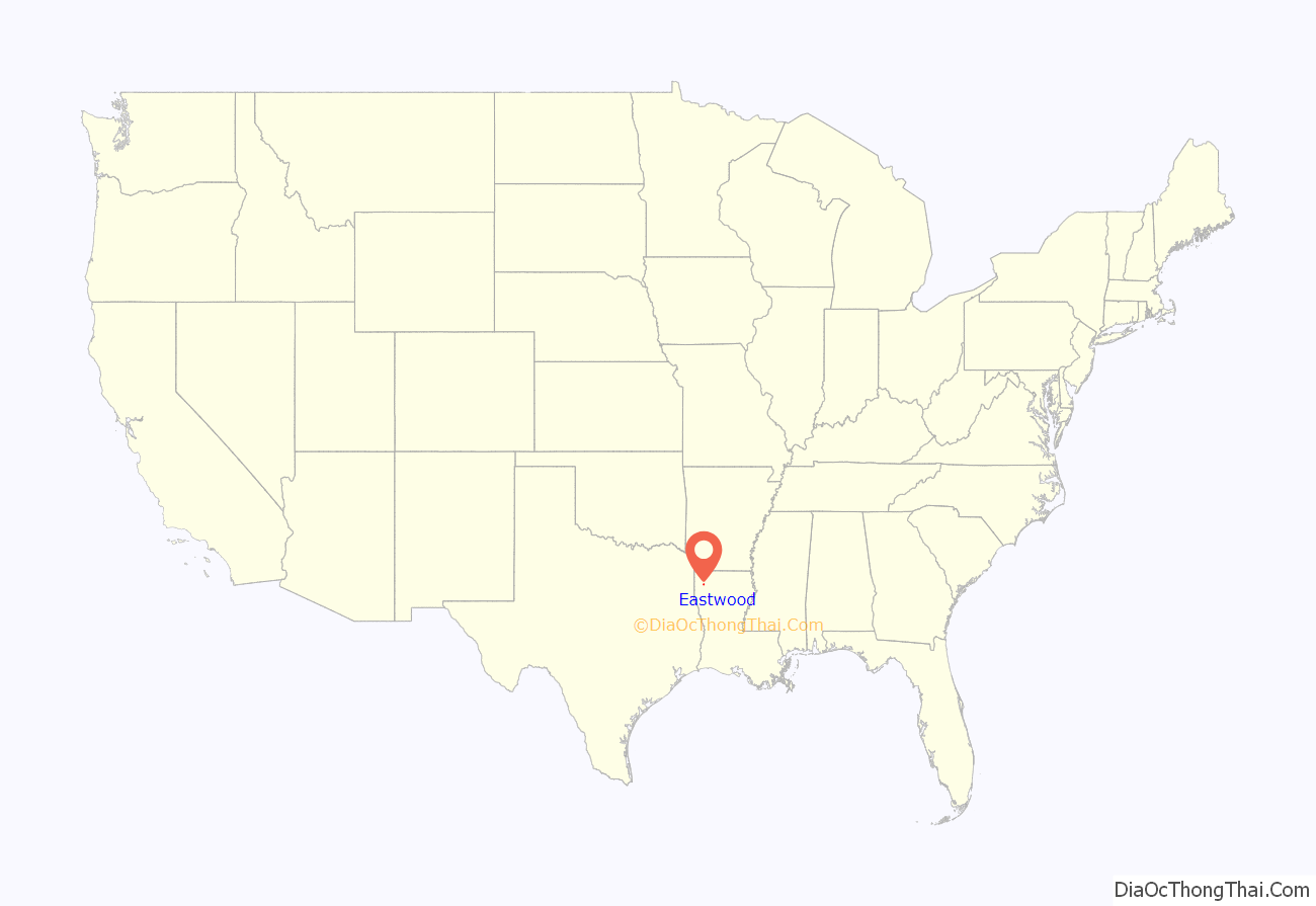
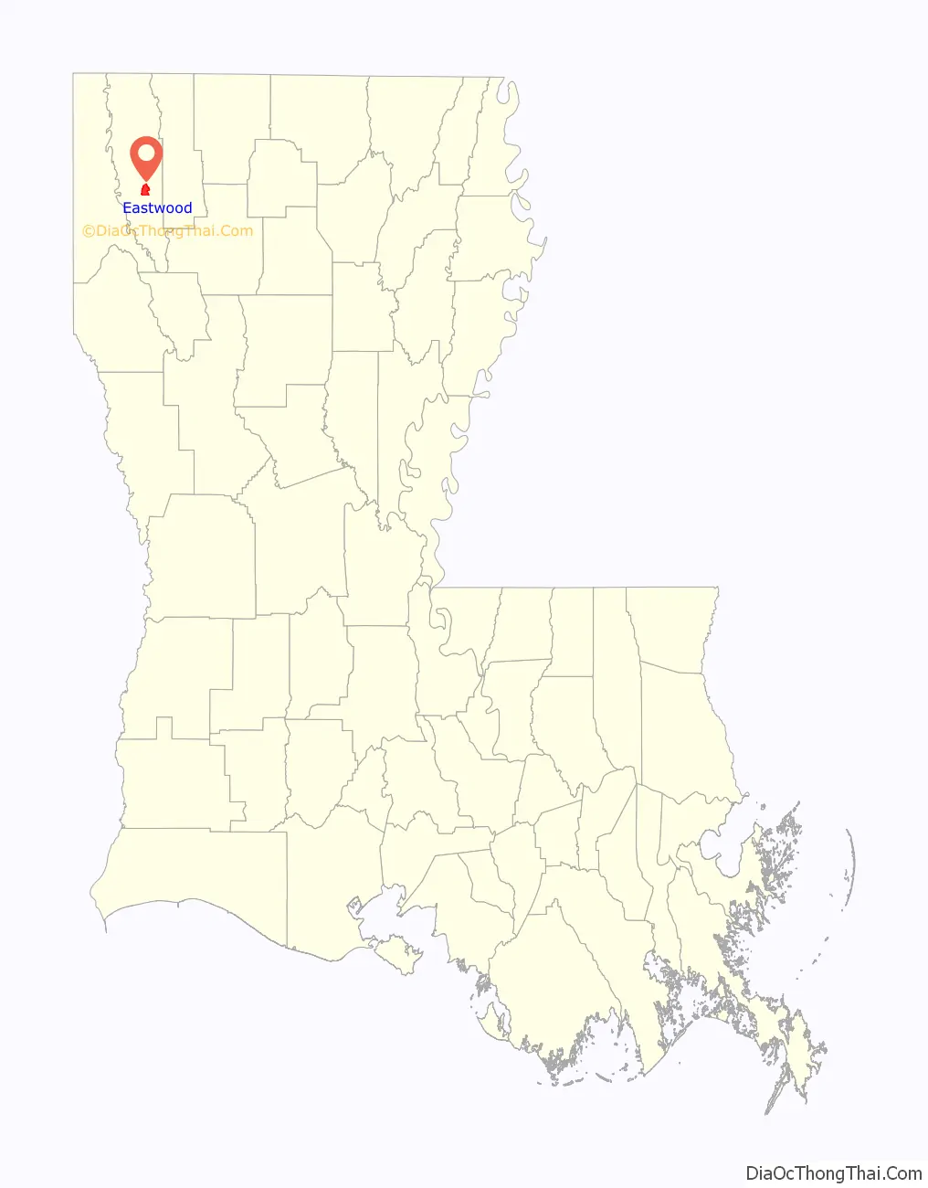
Eastwood is a census-designated place (CDP) in Bossier Parish, Louisiana, United States. The population was 4,093 at the 2010 census. It is part of the Shreveport–Bossier City Metropolitan Statistical Area.
| Name: | Eastwood CDP |
|---|---|
| LSAD Code: | 57 |
| LSAD Description: | CDP (suffix) |
| State: | Louisiana |
| County: | Bossier Parish |
| Elevation: | 239 ft (73 m) |
| Total Area: | 6.35 sq mi (16.44 km²) |
| Land Area: | 6.35 sq mi (16.44 km²) |
| Water Area: | 0.00 sq mi (0.00 km²) |
| Total Population: | 4,390 |
| Population Density: | 691.45/sq mi (266.99/km²) |
| Area code: | 318 |
| FIPS code: | 2222610 |
Online Interactive Map
Click on ![]() to view map in "full screen" mode.
to view map in "full screen" mode.
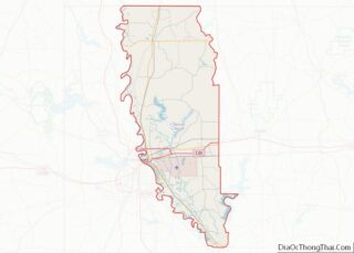
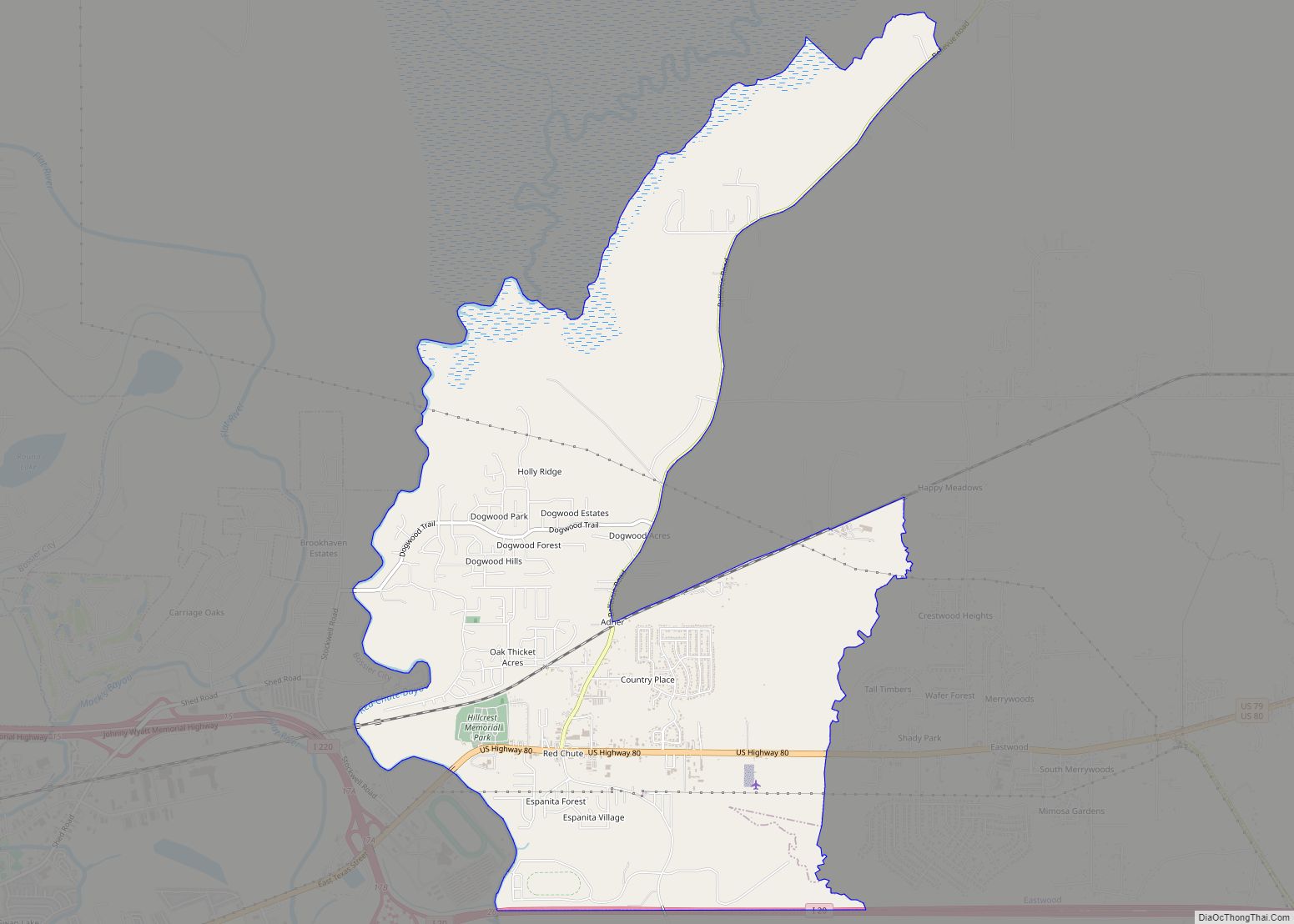
Eastwood location map. Where is Eastwood CDP?
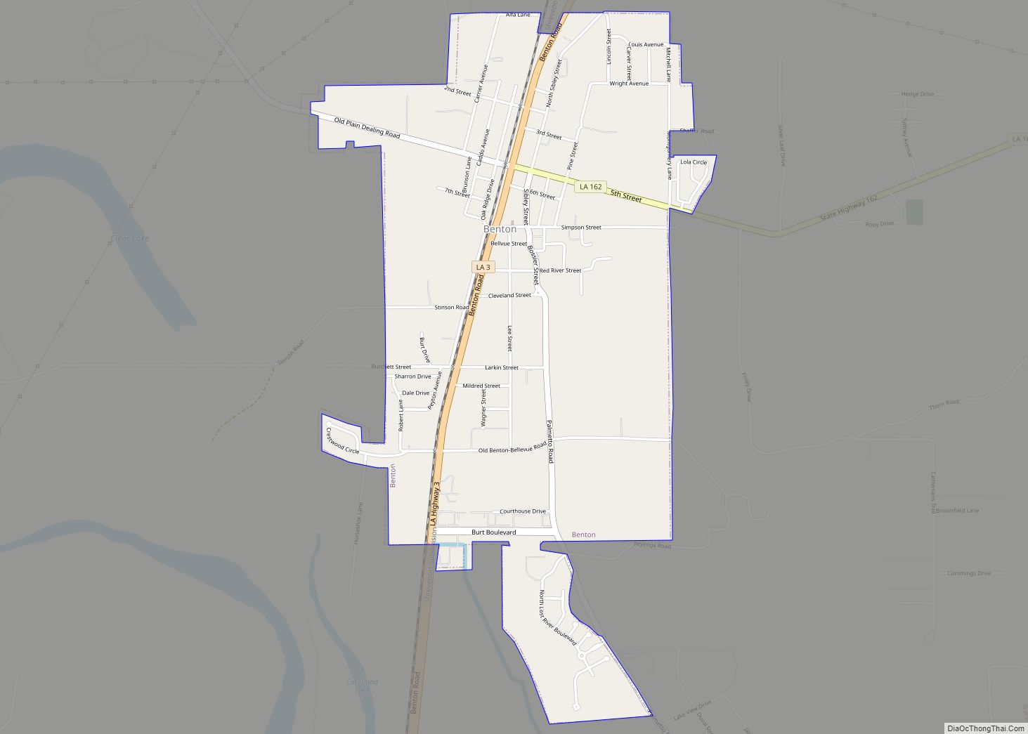
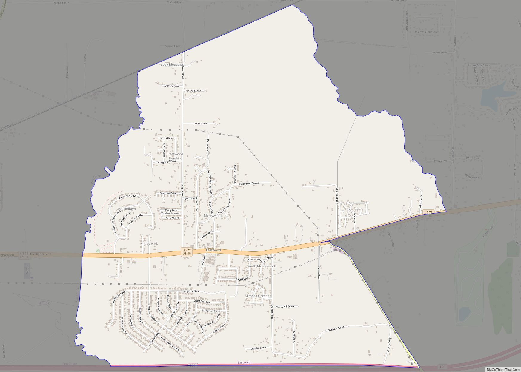
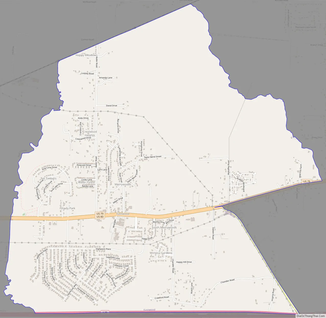
Eastwood Road Map
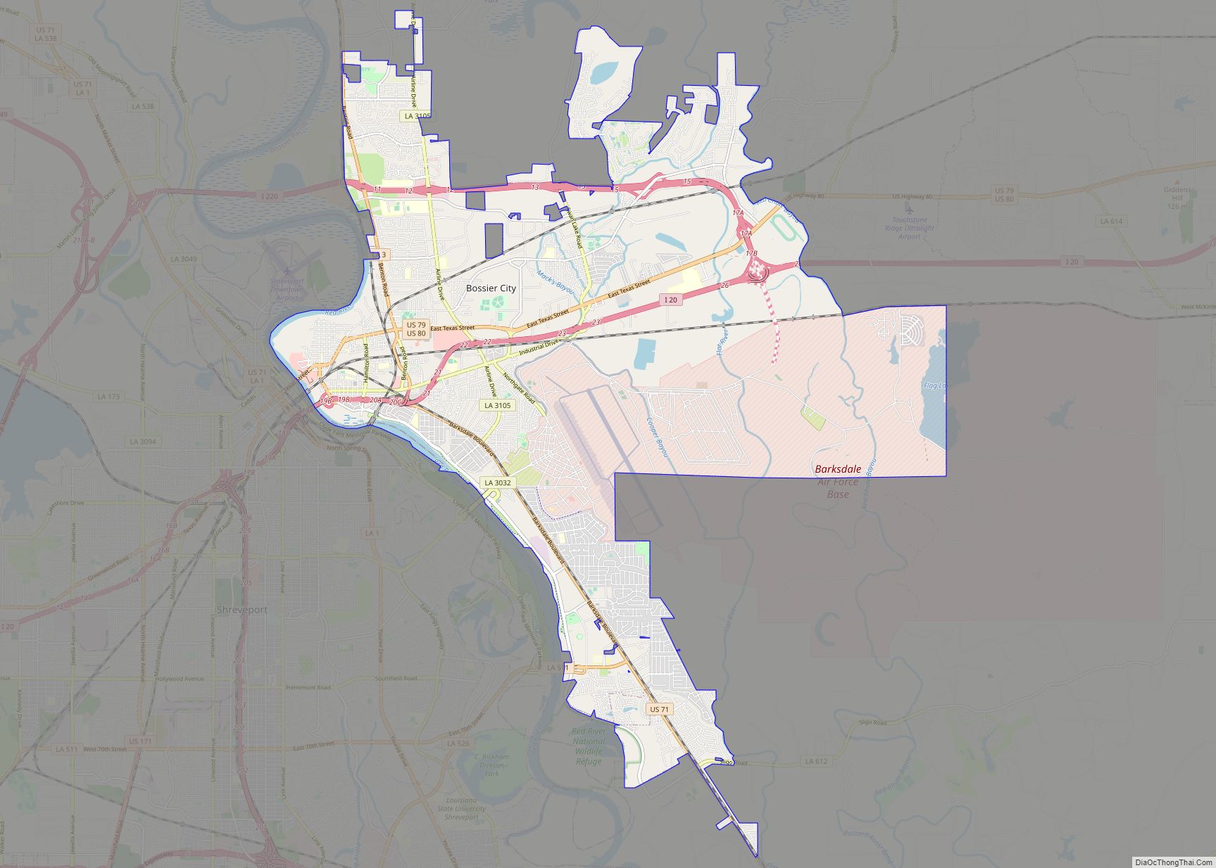
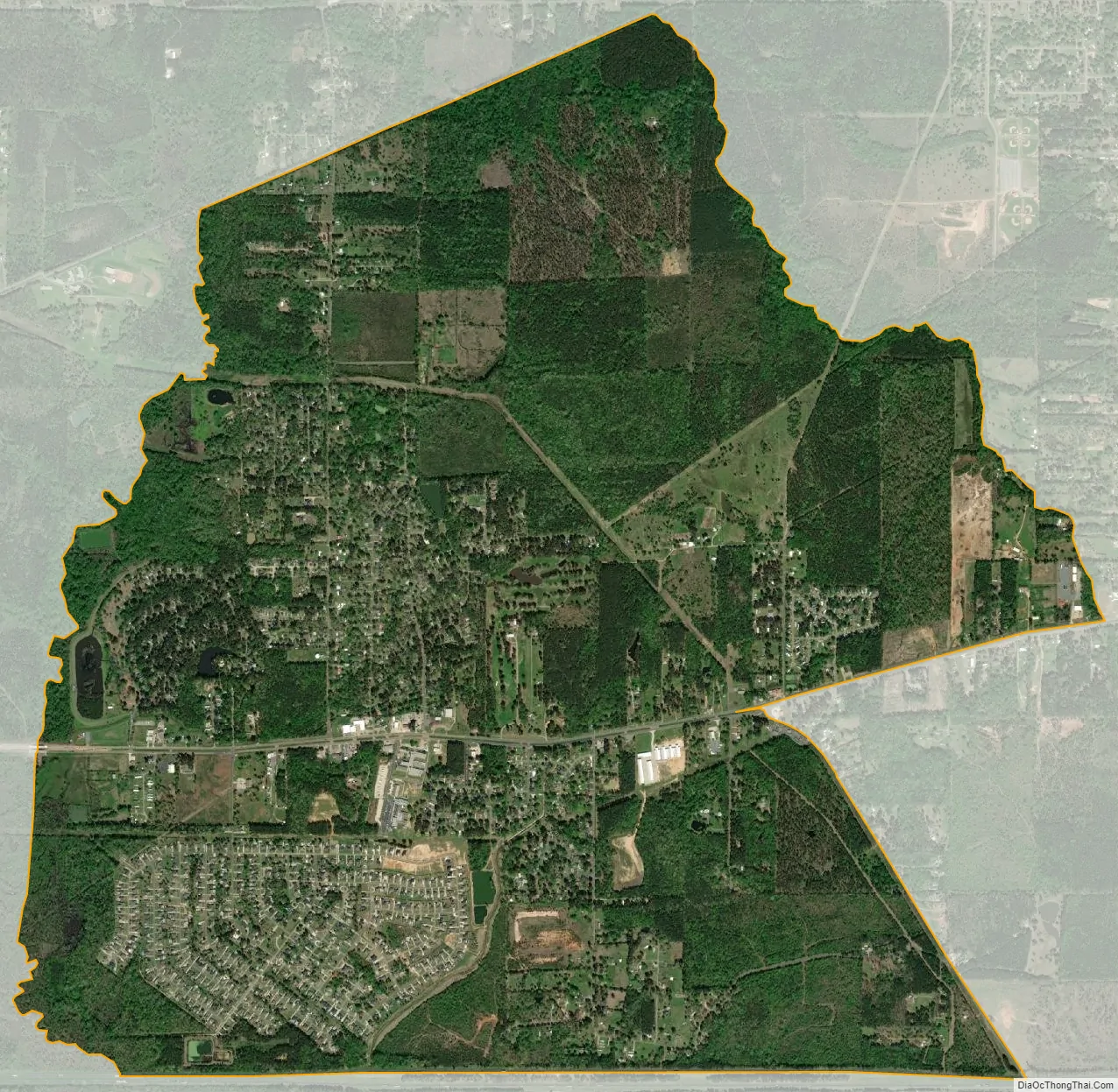
Eastwood city Satellite Map
Geography
Eastwood is located at 32°33′26″N 93°34′7″W / 32.55722°N 93.56861°W / 32.55722; -93.56861 (32.557317, -93.568480). It is bordered to the west by the Red Chute CDP, and the town of Haughton is nearby to the southeast. U.S. Routes 80 and 79 pass east–west through the center of Eastwood, and Interstate 20 forms the southern edge of the CDP but with no direct access to it. Via Highways 80/79, it is 11 miles (18 km) west to downtown Shreveport.
According to the United States Census Bureau, the Eastwood CDP has a total area of 6.4 square miles (16.6 km), all land.
See also
Map of Louisiana State and its subdivision:- Acadia
- Allen
- Ascension
- Assumption
- Avoyelles
- Beauregard
- Bienville
- Bossier
- Caddo
- Calcasieu
- Caldwell
- Cameron
- Catahoula
- Claiborne
- Concordia
- De Soto
- East Baton Rouge
- East Carroll
- East Feliciana
- Evangeline
- Franklin
- Grant
- Iberia
- Iberville
- Jackson
- Jefferson
- Jefferson Davis
- La Salle
- Lafayette
- Lafourche
- Lincoln
- Livingston
- Madison
- Morehouse
- Natchitoches
- Orleans
- Ouachita
- Plaquemines
- Pointe Coupee
- Rapides
- Red River
- Richland
- Sabine
- Saint Bernard
- Saint Charles
- Saint Helena
- Saint James
- Saint John the Baptist
- Saint Landry
- Saint Martin
- Saint Mary
- Saint Tammany
- Tangipahoa
- Tensas
- Terrebonne
- Union
- Vermilion
- Vernon
- Washington
- Webster
- West Baton Rouge
- West Carroll
- West Feliciana
- Winn
- Alabama
- Alaska
- Arizona
- Arkansas
- California
- Colorado
- Connecticut
- Delaware
- District of Columbia
- Florida
- Georgia
- Hawaii
- Idaho
- Illinois
- Indiana
- Iowa
- Kansas
- Kentucky
- Louisiana
- Maine
- Maryland
- Massachusetts
- Michigan
- Minnesota
- Mississippi
- Missouri
- Montana
- Nebraska
- Nevada
- New Hampshire
- New Jersey
- New Mexico
- New York
- North Carolina
- North Dakota
- Ohio
- Oklahoma
- Oregon
- Pennsylvania
- Rhode Island
- South Carolina
- South Dakota
- Tennessee
- Texas
- Utah
- Vermont
- Virginia
- Washington
- West Virginia
- Wisconsin
- Wyoming