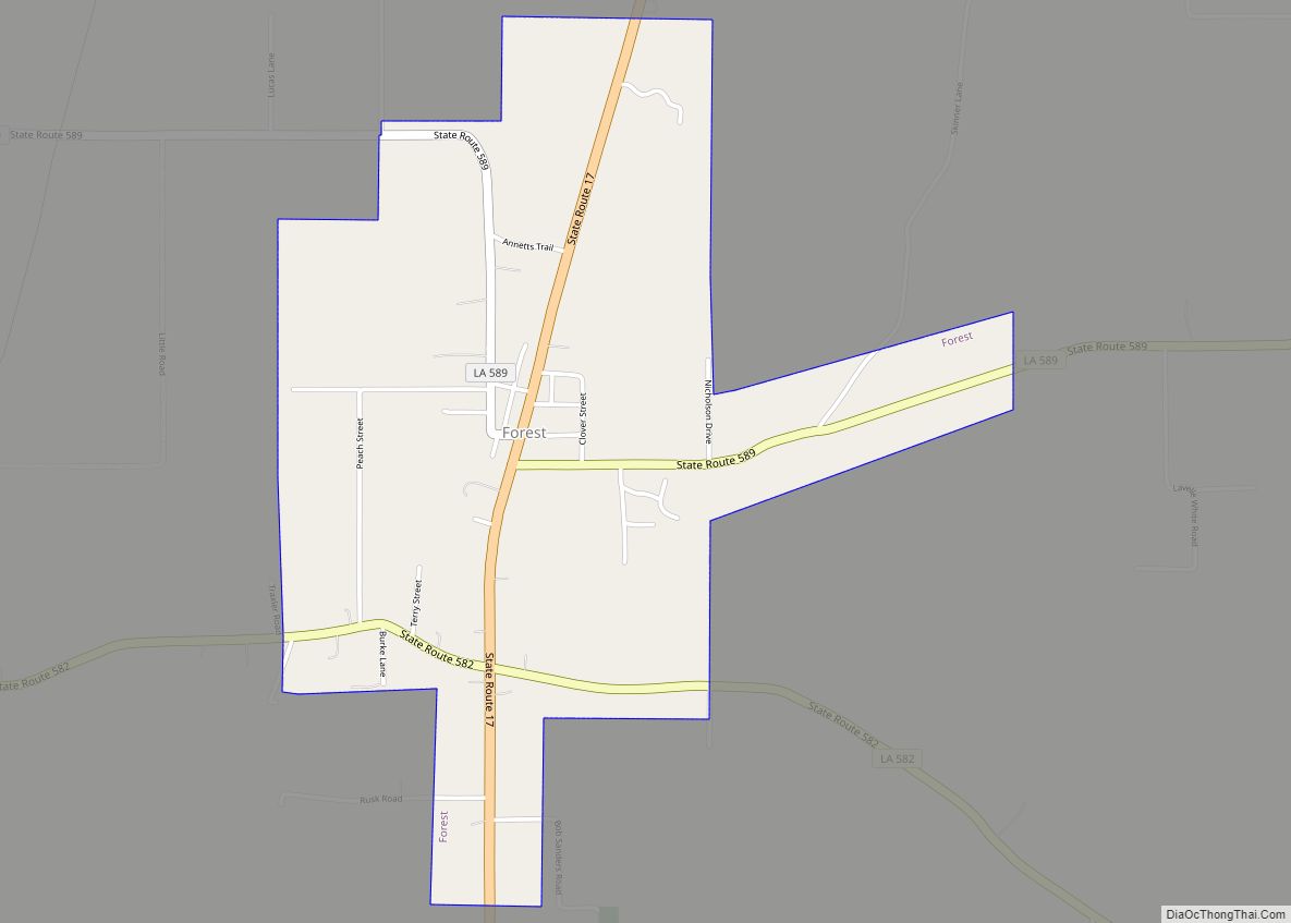
Forest is a village in West Carroll Parish in northeastern Louisiana, United States. The population was 275 at the 2000 census.
Forest Police Chief James Robert “Bob” Smith (Independent; born June 1931), with service since 1998 is the oldest elected official in the State of Louisiana, as of 2017. After thirty years as a mechanic for the United States Air Force, Smith began a civilian career with International Oil Company, based in Saudi Arabia. A North Carolina native, he retired to Forest, where his wife had formerly resided.
| Name: | Forest village |
|---|---|
| LSAD Code: | 47 |
| LSAD Description: | village (suffix) |
| State: | Louisiana |
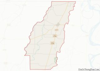
| County: | West Carroll Parish |
| Elevation: | 125 ft (38 m) |
| Total Area: | 1.67 sq mi (4.33 km²) |
| Land Area: | 1.67 sq mi (4.33 km²) |
| Water Area: | 0.00 sq mi (0.00 km²) |
| Total Population: | 304 |
| Population Density: | 181.93/sq mi (70.23/km²) |
| Area code: | 318 |
| FIPS code: | 2226350 |
Online Interactive Map
Click on ![]() to view map in "full screen" mode.
to view map in "full screen" mode.
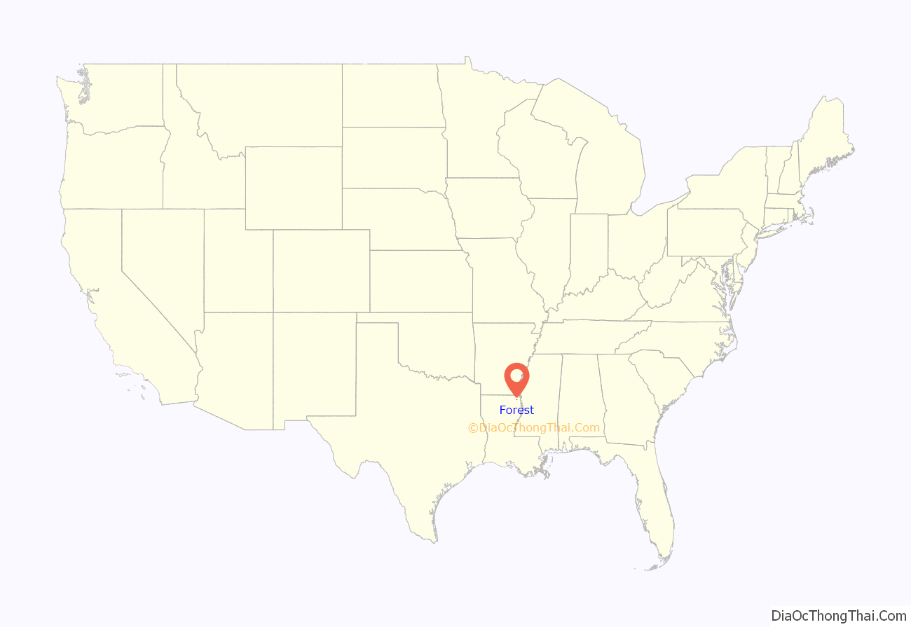
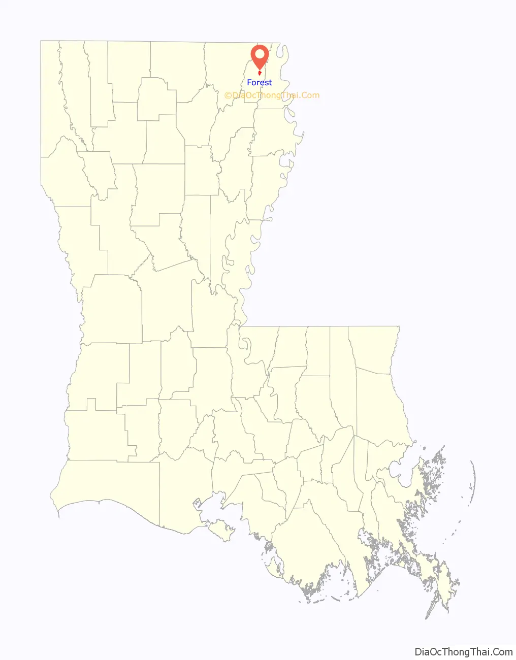
Forest location map. Where is Forest village?
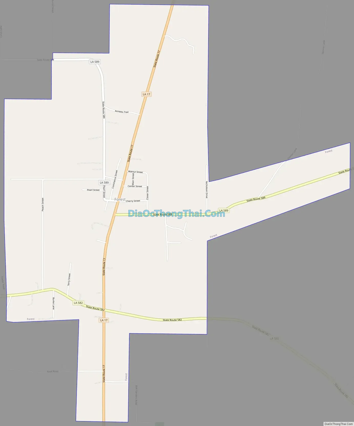
Forest Road Map
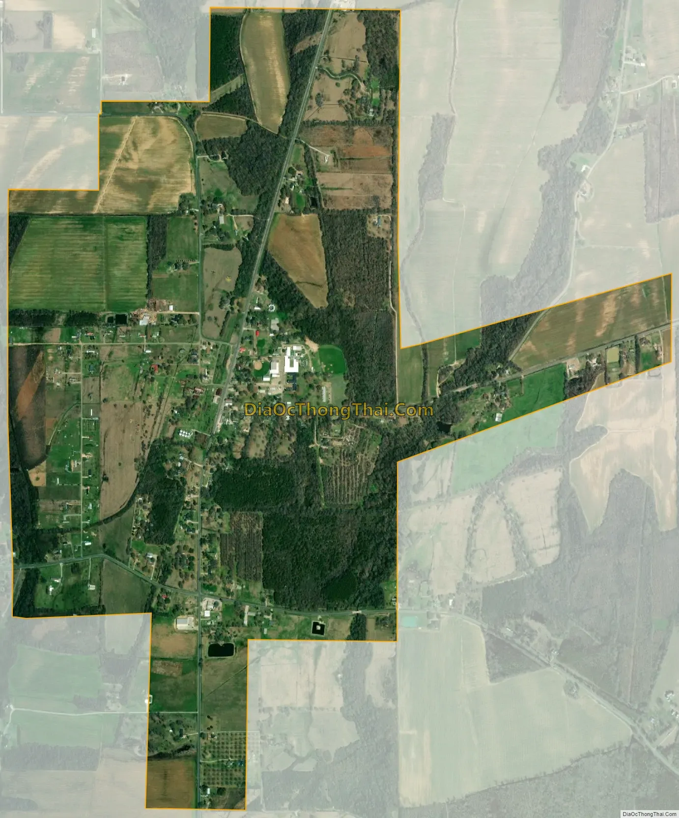
Forest city Satellite Map
Geography
Forest is located at 32°47′30″N 91°24′43″W / 32.79167°N 91.41194°W / 32.79167; -91.41194 (32.791594, -91.411978).
According to the United States Census Bureau, the village has a total area of 1.7 square miles (4.4 km), all land.
See also
Map of Louisiana State and its subdivision:- Acadia
- Allen
- Ascension
- Assumption
- Avoyelles
- Beauregard
- Bienville
- Bossier
- Caddo
- Calcasieu
- Caldwell
- Cameron
- Catahoula
- Claiborne
- Concordia
- De Soto
- East Baton Rouge
- East Carroll
- East Feliciana
- Evangeline
- Franklin
- Grant
- Iberia
- Iberville
- Jackson
- Jefferson
- Jefferson Davis
- La Salle
- Lafayette
- Lafourche
- Lincoln
- Livingston
- Madison
- Morehouse
- Natchitoches
- Orleans
- Ouachita
- Plaquemines
- Pointe Coupee
- Rapides
- Red River
- Richland
- Sabine
- Saint Bernard
- Saint Charles
- Saint Helena
- Saint James
- Saint John the Baptist
- Saint Landry
- Saint Martin
- Saint Mary
- Saint Tammany
- Tangipahoa
- Tensas
- Terrebonne
- Union
- Vermilion
- Vernon
- Washington
- Webster
- West Baton Rouge
- West Carroll
- West Feliciana
- Winn
- Alabama
- Alaska
- Arizona
- Arkansas
- California
- Colorado
- Connecticut
- Delaware
- District of Columbia
- Florida
- Georgia
- Hawaii
- Idaho
- Illinois
- Indiana
- Iowa
- Kansas
- Kentucky
- Louisiana
- Maine
- Maryland
- Massachusetts
- Michigan
- Minnesota
- Mississippi
- Missouri
- Montana
- Nebraska
- Nevada
- New Hampshire
- New Jersey
- New Mexico
- New York
- North Carolina
- North Dakota
- Ohio
- Oklahoma
- Oregon
- Pennsylvania
- Rhode Island
- South Carolina
- South Dakota
- Tennessee
- Texas
- Utah
- Vermont
- Virginia
- Washington
- West Virginia
- Wisconsin
- Wyoming