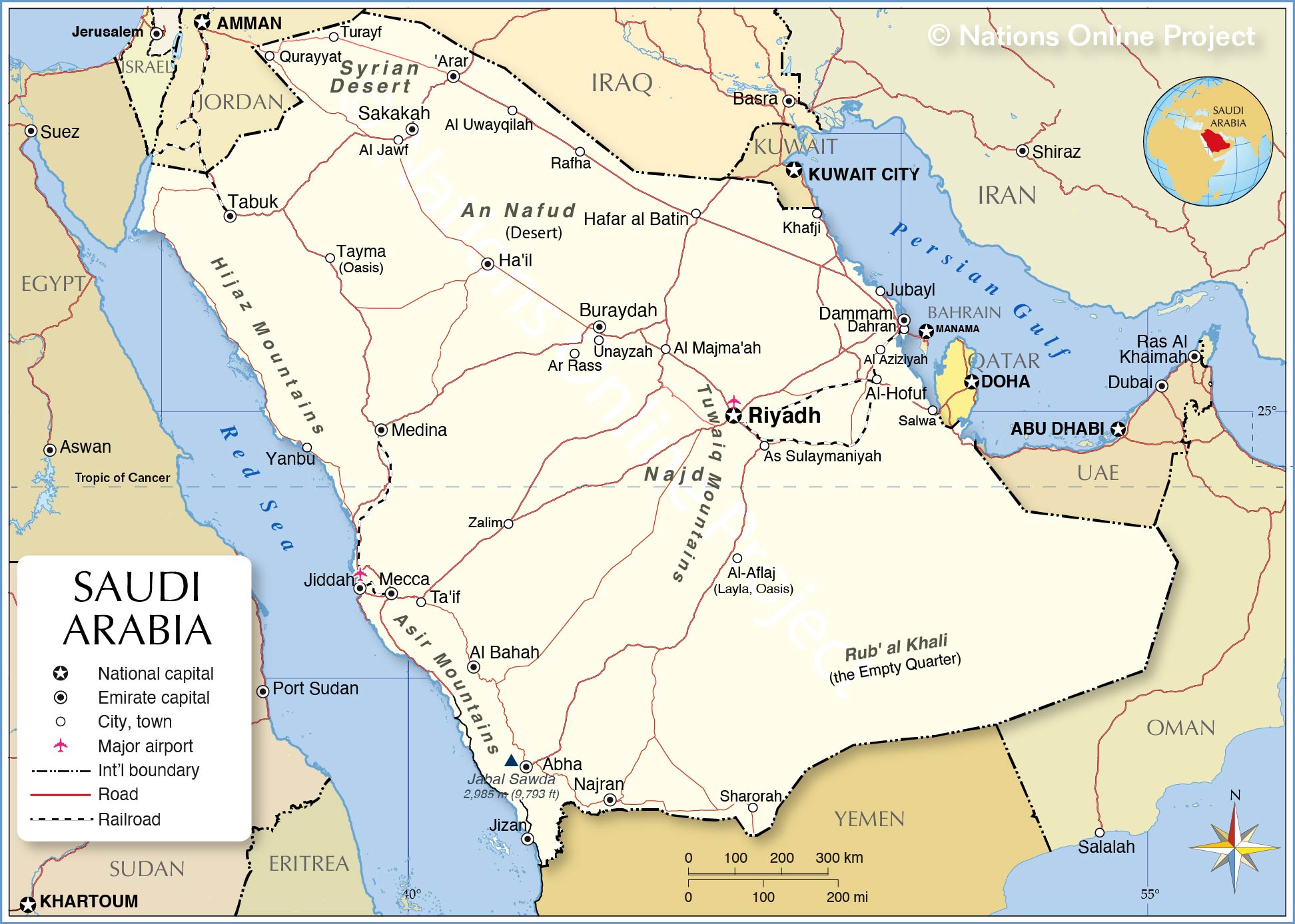
With an area of 2,150,000 sq. km, Saudi Arabia is the largest sovereign country of Arabia. It occupies nearly 80% of the area of the Arabian Peninsula and has extensive coastlines on the Red Sea and the Persian Gulf.
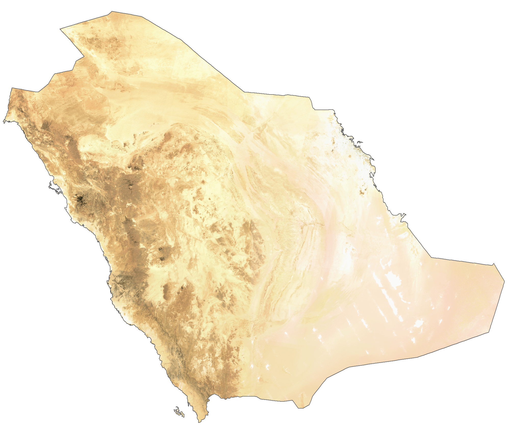
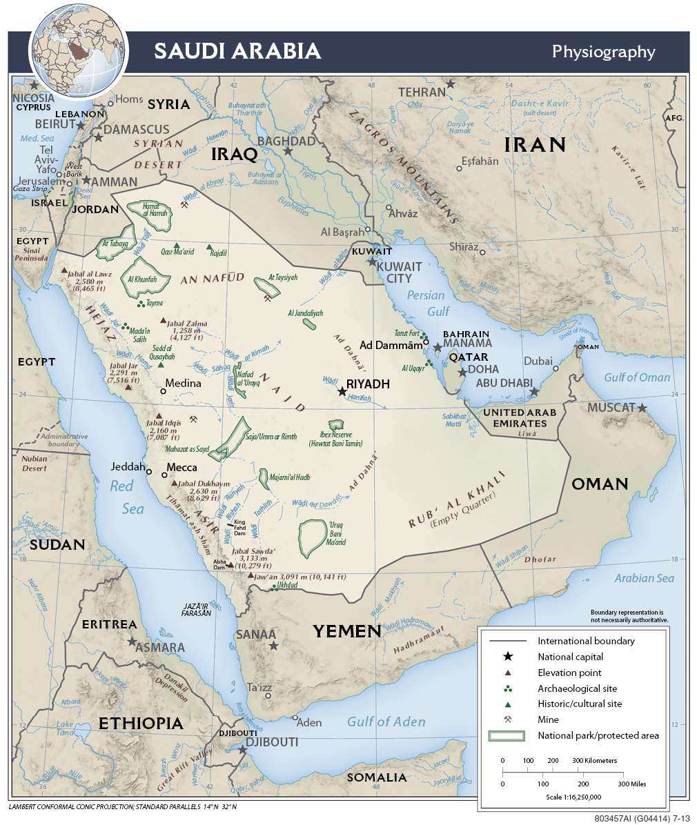
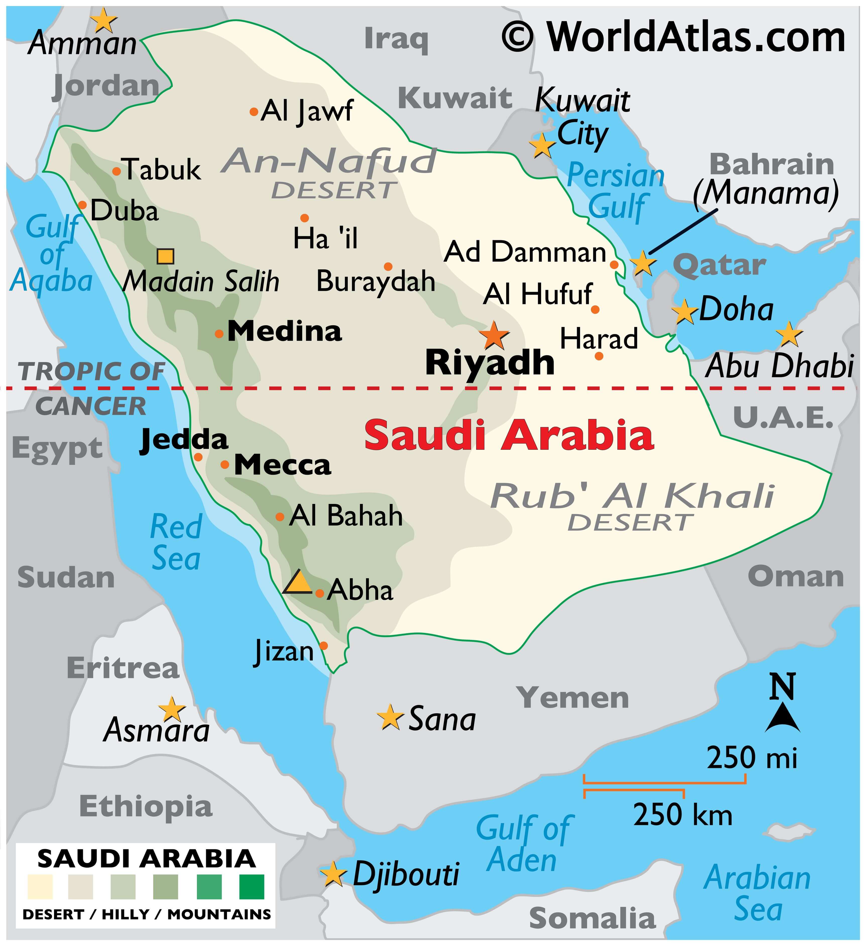
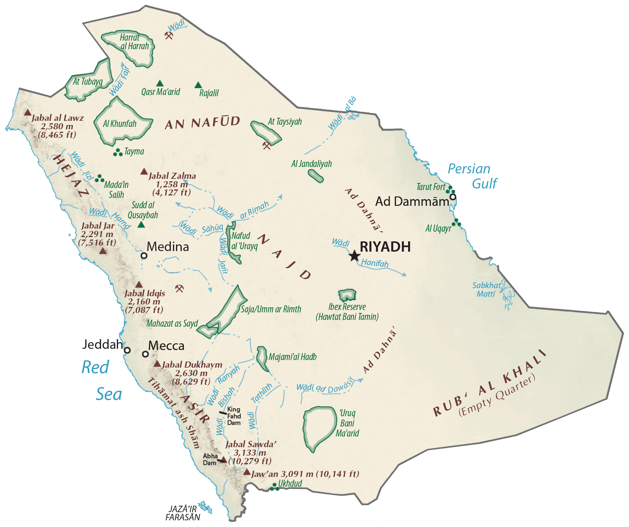
Saudi Arabia is, for the most part, an uninhabited desert land. As observed on the physical map above, two main desert regions dominate the landscape of the country. These are the Rub’ Al Khali Desert, the larges mass of sand in the world, and the An-Nafud Desert – where sand dunes often exceed 100 ft. in height.
The land (desert) rises into hills and mountains in the west and southwest, along the edges of the Red Sea. Mountain ranges include the Hejaz in the northwest, and the Azir in the southwest.
Saudi Arabia’s highest point is Jabal Sawda’ which peaks at 10,279 ft. (3,133 m). It has been marked on the map by a yellow upright triangle.
There are no perennial lakes or rivers but numerous wadis. The lowest point in the country is at 0 m or 0 ft in the Red Sea and Persian Gulf.
| Flag: |  |
|---|---|
| Legal Name: | Kingdom of Saudi Arabia |
| Capital Value: | Riyadh |
| Official languages: | Arabic |
| Demonym(s): |
|
| Government: | Unitary Islamic absolute monarchy |
| Legislature: | none |
| Total Area: | 2,149,690 km² |
| Land Area: | 2,149,690 km² |
| Population: | 34,268,528 |
| Density: | 15/km (38.8/sq mi) (174th) |
| GDP: | $792.97 Billion |
| GDP Per Capita: | $23,139.80 |
| Currency Value: | Saudi riyals (SAR) |
| Driving side: | right |
| Calling code: | +966 |
| Internet TLD: |
|
Discover the beauty and diversity of Saudi Arabia with this interactive map. From its sprawling deserts to its bustling cities, this map showcases the many wonders of this Middle Eastern country. Zoom in to view its cities, highways, water, and provinces in detail. Get a bird’s eye view of the country with satellite imagery and a physical map that displays its deserts and topography. With this map, you’ll never miss a detail of the incredible landscape of Saudi Arabia.
Online Interactive Political Map
Click on ![]() to view map in "full screen" mode.
to view map in "full screen" mode.
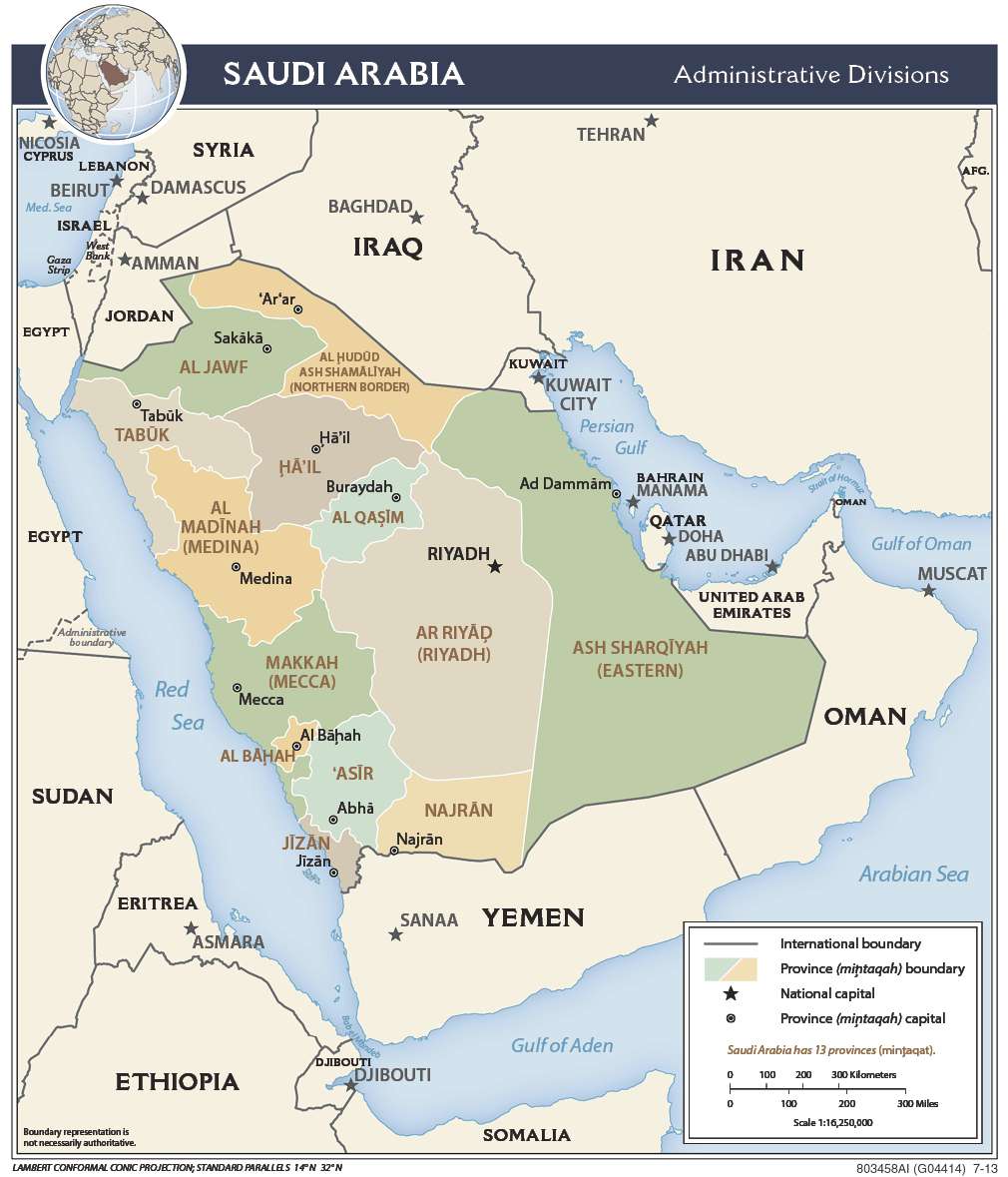
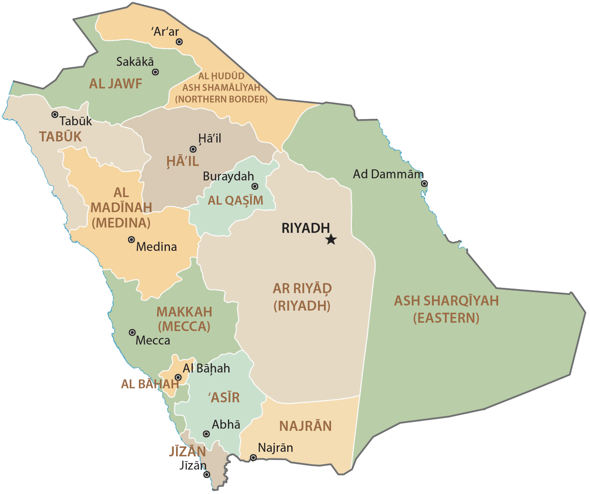
Saudi Arabia (officially, Kingdom of Saudi Arabia) is divided into 13 administrative provinces or emirates. In alphabetical order, these provinces are: Al Baha, Al Jawf, Al Madinah, Aseer, Eastern province, Ha’il province, Jazan, Makkah, Najran, Northern Border province, Qassim, Riyadh and Tabuk. These provinces are divided into 118 governorates which are further subdivided into sub-governorates.
Riyadh is the capital and largest city and is located in the center of an-Nafud desert, on the eastern region of the Najid Plateau. With a population of 7.6 million, it is the most populous city in Saudi Arabia.
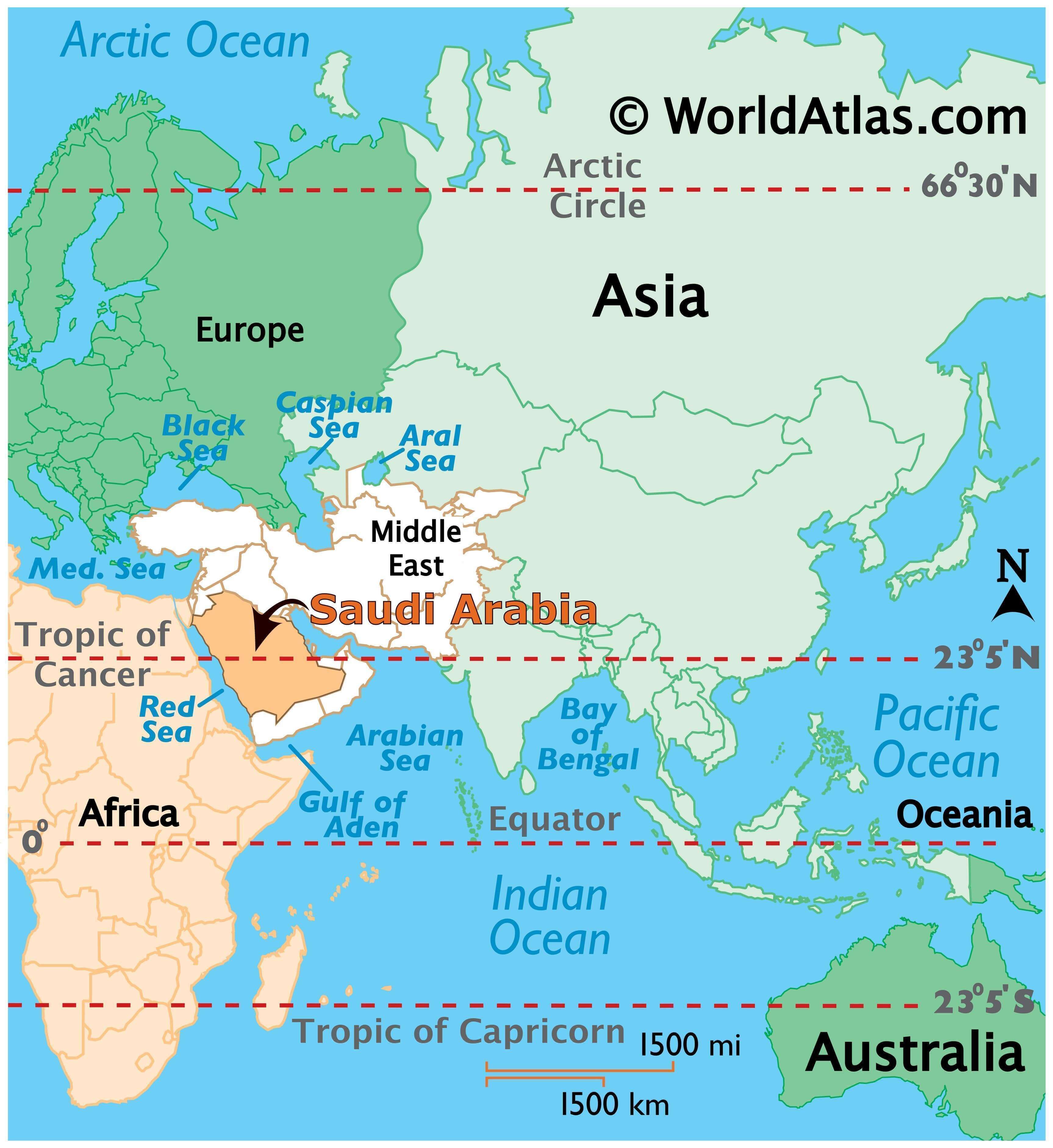
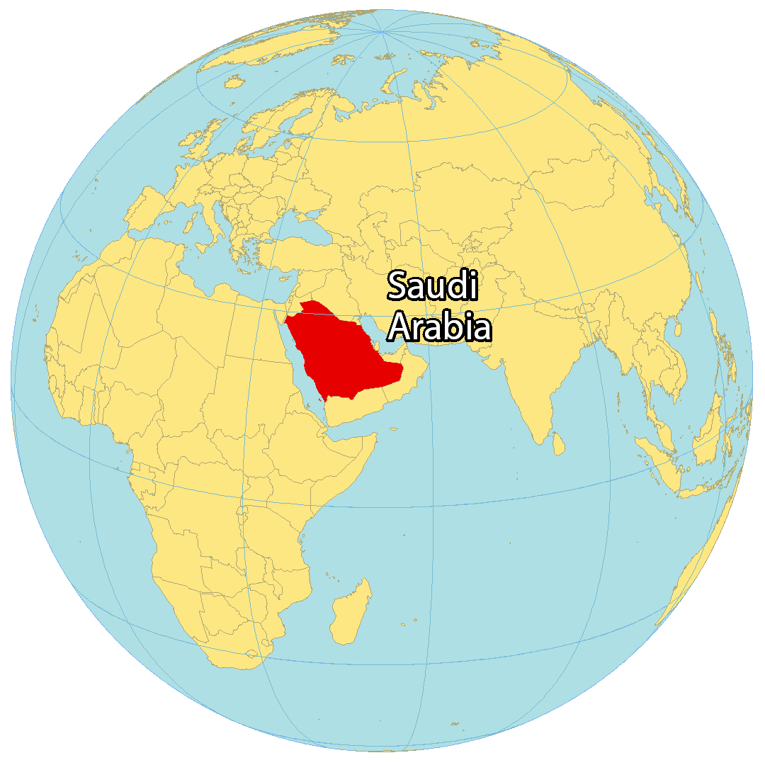
Location Maps
Where is Saudi Arabia?
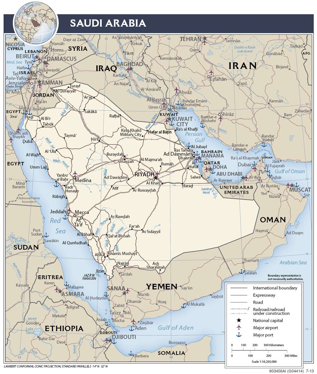
Saudi Arabia is part of the Arabian Peninsula, between the Red Sea and the Persian Gulf. It borders 8 other countries, including Iraq and Jordan to the north, Kuwait to the northeast, Oman to the southeast, and Yemen to the south as well as Qatar, Bahrain, and the United Arab Emirates to the east.
Saudi Arabia is an Islamic country and all people in Saudi Arabia are Muslim. It’s a monarchy system led by a Saud dynasty ruler. Saudi Arabia has the second most proven oil reserves in the world, after Venezuela. Riyadh is the capital and largest city of Saudi Arabia. Other major cities are Jeddah, Mecca, and Medina.

High Definition Political Map of Saudi Arabia
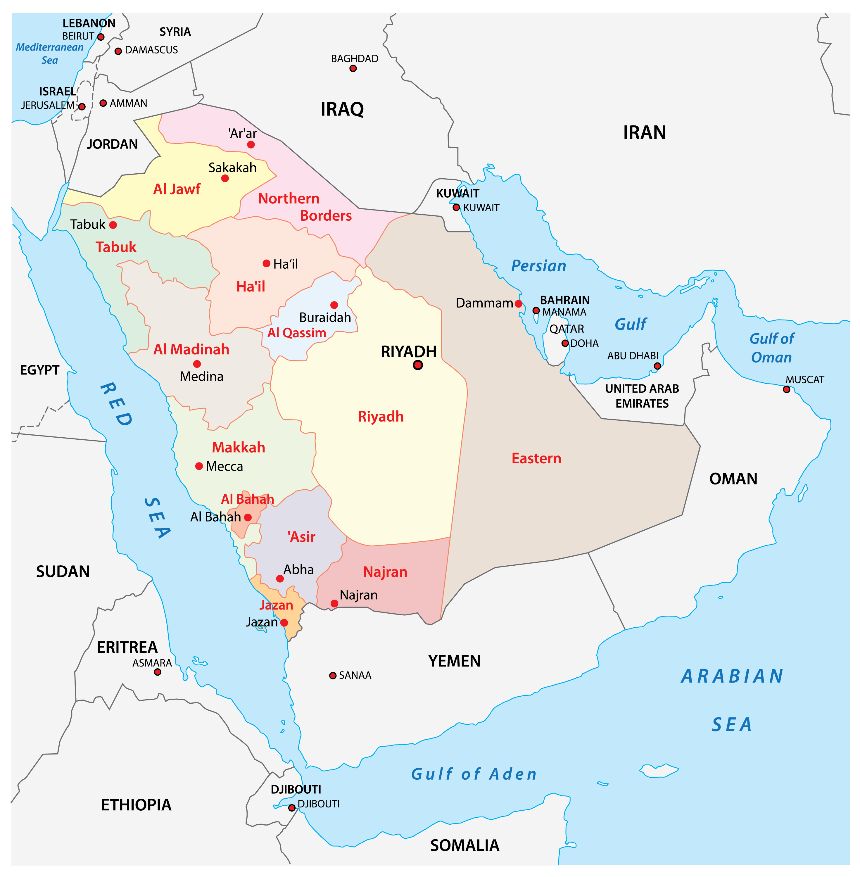
Saudi Arabia Administrative Map
Physical Map of Saudi Arabia
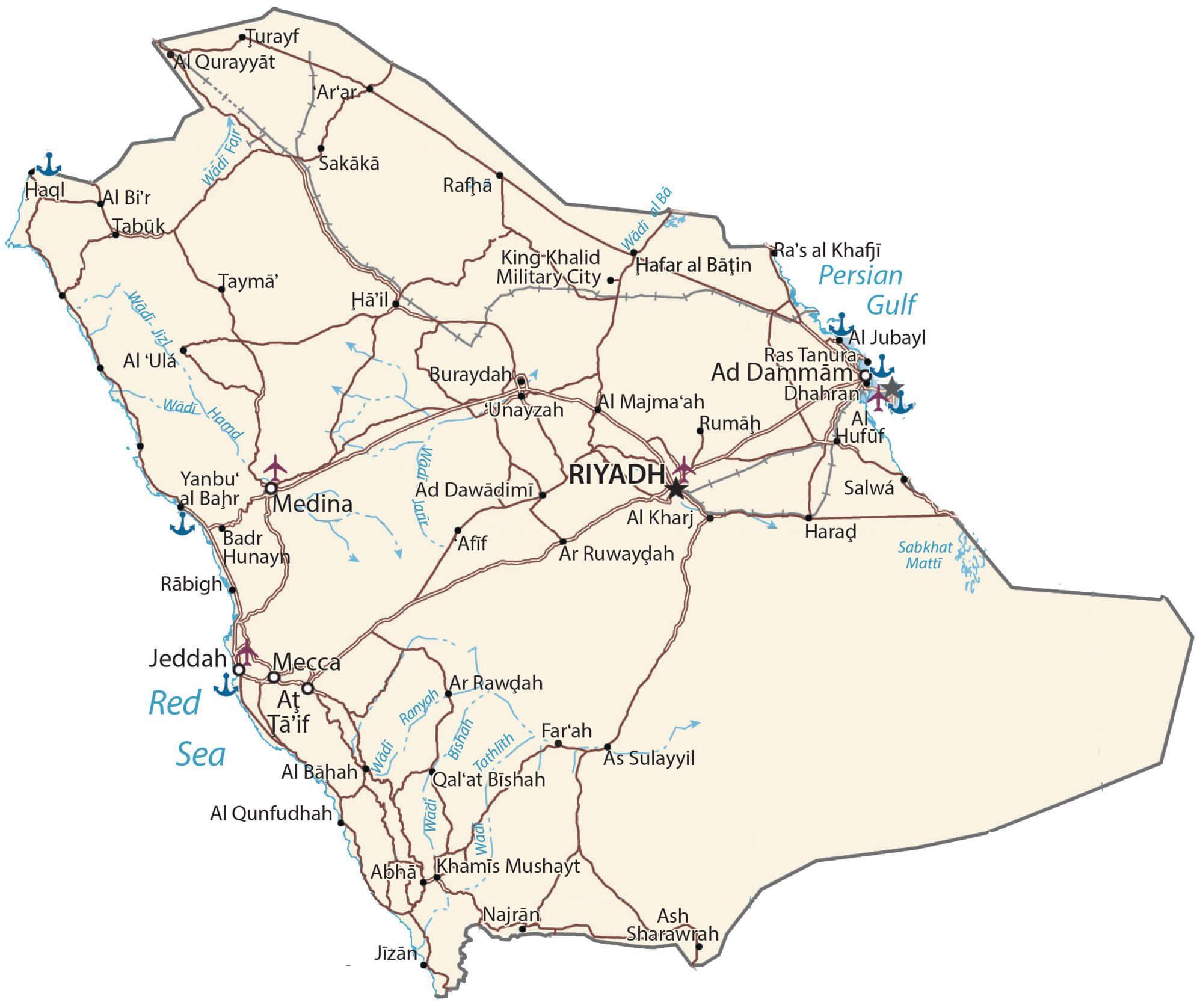
Transportation Map of Saudi Arabia
Saudi Arabia Satellite Map