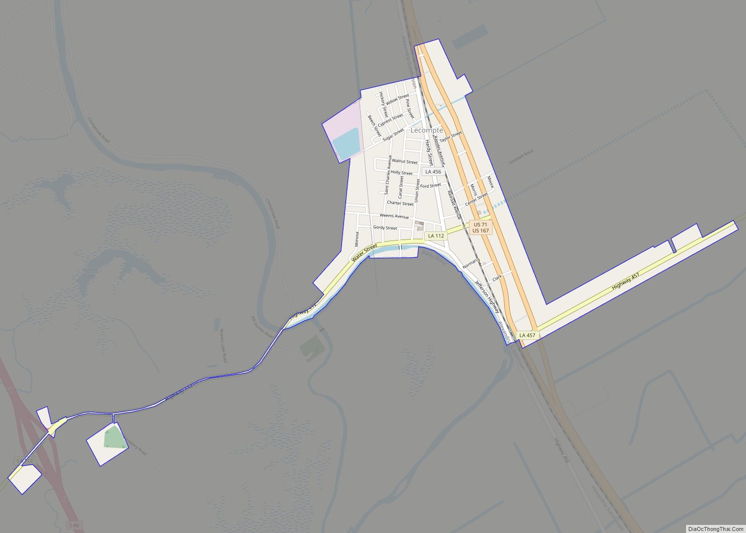
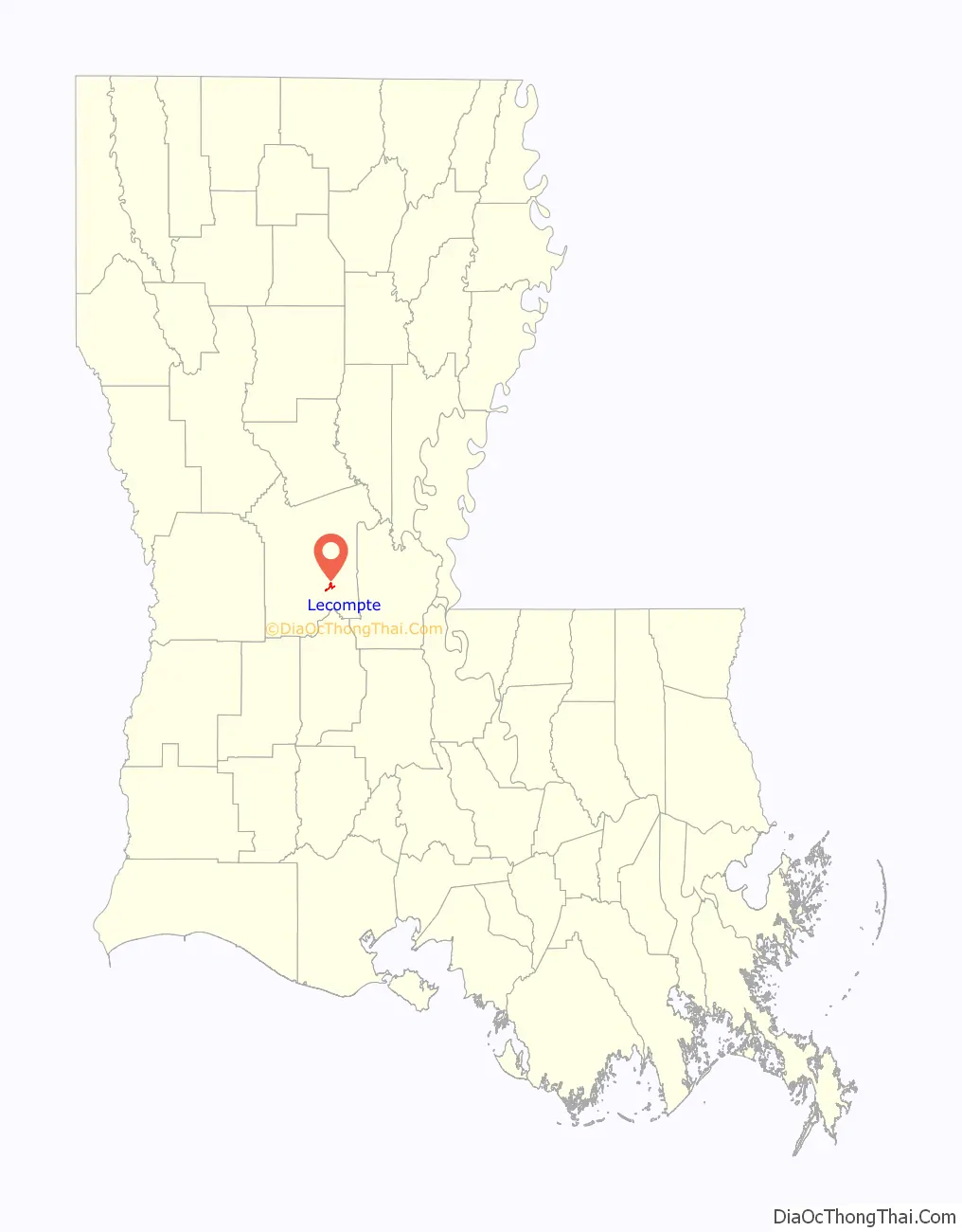
Lecompte (/ləˈkaʊnt/ lə-KOWNT) is a town in Rapides Parish, Louisiana, United States. Lecompte is situated along the banks of the Red River in central Louisiana. US Highway 71, Louisiana’s major north-south route which connects Baton Rouge and Shreveport, runs through Lecompte. Lecompte is named after a horse called LeComte, which was named after horse breeder Ambrose LeComte. It is part of the Alexandria, Louisiana Metropolitan Statistical Area. The population was 1,227 at the 2010 census.
| Name: | Lecompte town |
|---|---|
| LSAD Code: | 43 |
| LSAD Description: | town (suffix) |
| State: | Louisiana |
| County: | Rapides Parish |
| Elevation: | 69 ft (21 m) |
| Total Area: | 1.06 sq mi (2.75 km²) |
| Land Area: | 1.06 sq mi (2.75 km²) |
| Water Area: | 0.00 sq mi (0.00 km²) |
| Total Population: | 845 |
| Population Density: | 794.92/sq mi (306.85/km²) |
| Area code: | 318 |
| FIPS code: | 2242800 |
Online Interactive Map
Click on ![]() to view map in "full screen" mode.
to view map in "full screen" mode.
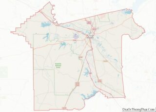
Lecompte location map. Where is Lecompte town?

History
The town of Lecompte, Louisiana, was named after a famous race horse owned by the Wells family who lived on a plantation south of the town. The horse’s name was LeComte. He won races at the Fair Grounds Race Course in New Orleans. During the days of the Lecompte High School, the yearbook was named The LeComte with a picture of the horse on the first page. When the railroad company painted a sign for the town on the side of the train depot, a “p” was accidentally added to the name and it has remained there ever since. The horse was named after horse breeder Ambrose LeComte who lived in the area and was a great lover of fine stock and owner of a fine string of race horses.
Lecompte Road Map

Lecompte city Satellite Map

Geography
Lecompte is located at 31°5′28″N 92°24′1″W / 31.09111°N 92.40028°W / 31.09111; -92.40028 (31.091135, -92.400397).
According to the United States Census Bureau, the town has a total area of 1.0 square mile (2.6 km), all land.
Major highways
- U.S. Route 71
- Louisiana Highway 112
- Louisiana Highway 457
See also
Map of Louisiana State and its subdivision:- Acadia
- Allen
- Ascension
- Assumption
- Avoyelles
- Beauregard
- Bienville
- Bossier
- Caddo
- Calcasieu
- Caldwell
- Cameron
- Catahoula
- Claiborne
- Concordia
- De Soto
- East Baton Rouge
- East Carroll
- East Feliciana
- Evangeline
- Franklin
- Grant
- Iberia
- Iberville
- Jackson
- Jefferson
- Jefferson Davis
- La Salle
- Lafayette
- Lafourche
- Lincoln
- Livingston
- Madison
- Morehouse
- Natchitoches
- Orleans
- Ouachita
- Plaquemines
- Pointe Coupee
- Rapides
- Red River
- Richland
- Sabine
- Saint Bernard
- Saint Charles
- Saint Helena
- Saint James
- Saint John the Baptist
- Saint Landry
- Saint Martin
- Saint Mary
- Saint Tammany
- Tangipahoa
- Tensas
- Terrebonne
- Union
- Vermilion
- Vernon
- Washington
- Webster
- West Baton Rouge
- West Carroll
- West Feliciana
- Winn
- Alabama
- Alaska
- Arizona
- Arkansas
- California
- Colorado
- Connecticut
- Delaware
- District of Columbia
- Florida
- Georgia
- Hawaii
- Idaho
- Illinois
- Indiana
- Iowa
- Kansas
- Kentucky
- Louisiana
- Maine
- Maryland
- Massachusetts
- Michigan
- Minnesota
- Mississippi
- Missouri
- Montana
- Nebraska
- Nevada
- New Hampshire
- New Jersey
- New Mexico
- New York
- North Carolina
- North Dakota
- Ohio
- Oklahoma
- Oregon
- Pennsylvania
- Rhode Island
- South Carolina
- South Dakota
- Tennessee
- Texas
- Utah
- Vermont
- Virginia
- Washington
- West Virginia
- Wisconsin
- Wyoming