McNary is a village in Rapides Parish, Louisiana, United States. It is part of the Alexandria, Louisiana, Metropolitan Statistical Area. The population was 211 at the 2000 census.
McNary was established as a company lumber town that grew to a population of around 3,000 with a hospital, several stores, a theater, and even a pool. When the lumber played out the lumber company purchased a town in Arizona and moved the entire mill operation to what was renamed as McNary, Arizona. The community in Louisiana struggled but has survived as an incorporated village.
| Name: | McNary village |
|---|---|
| LSAD Code: | 47 |
| LSAD Description: | village (suffix) |
| State: | Louisiana |
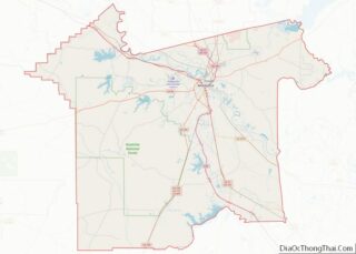
| County: | Rapides Parish |
| Elevation: | 125 ft (38 m) |
| Total Area: | 1.87 sq mi (4.85 km²) |
| Land Area: | 1.84 sq mi (4.77 km²) |
| Water Area: | 0.03 sq mi (0.07 km²) |
| Total Population: | 201 |
| Population Density: | 109.12/sq mi (42.13/km²) |
| Area code: | 318 |
| FIPS code: | 2247315 |
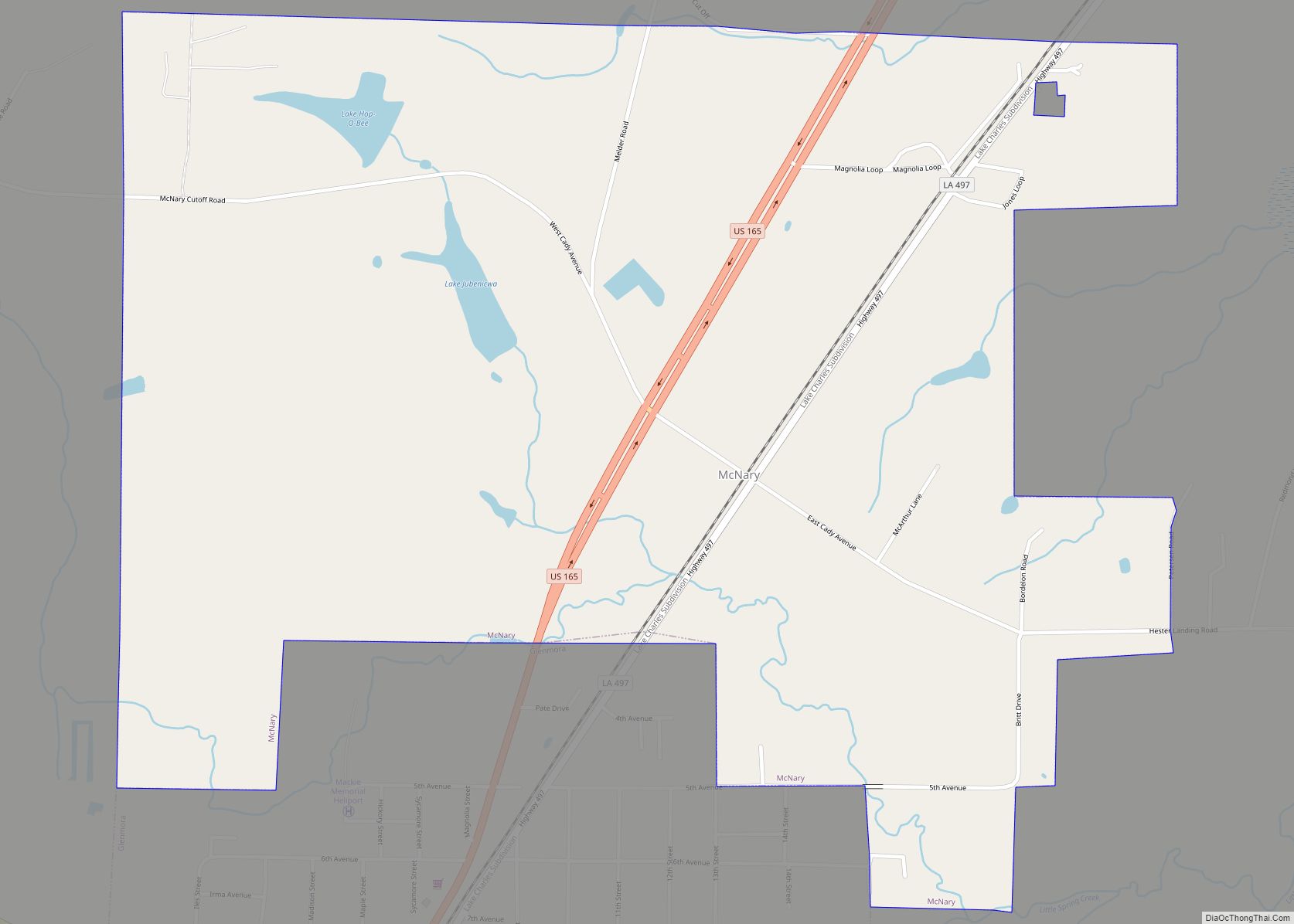
Online Interactive Map
Click on ![]() to view map in "full screen" mode.
to view map in "full screen" mode.
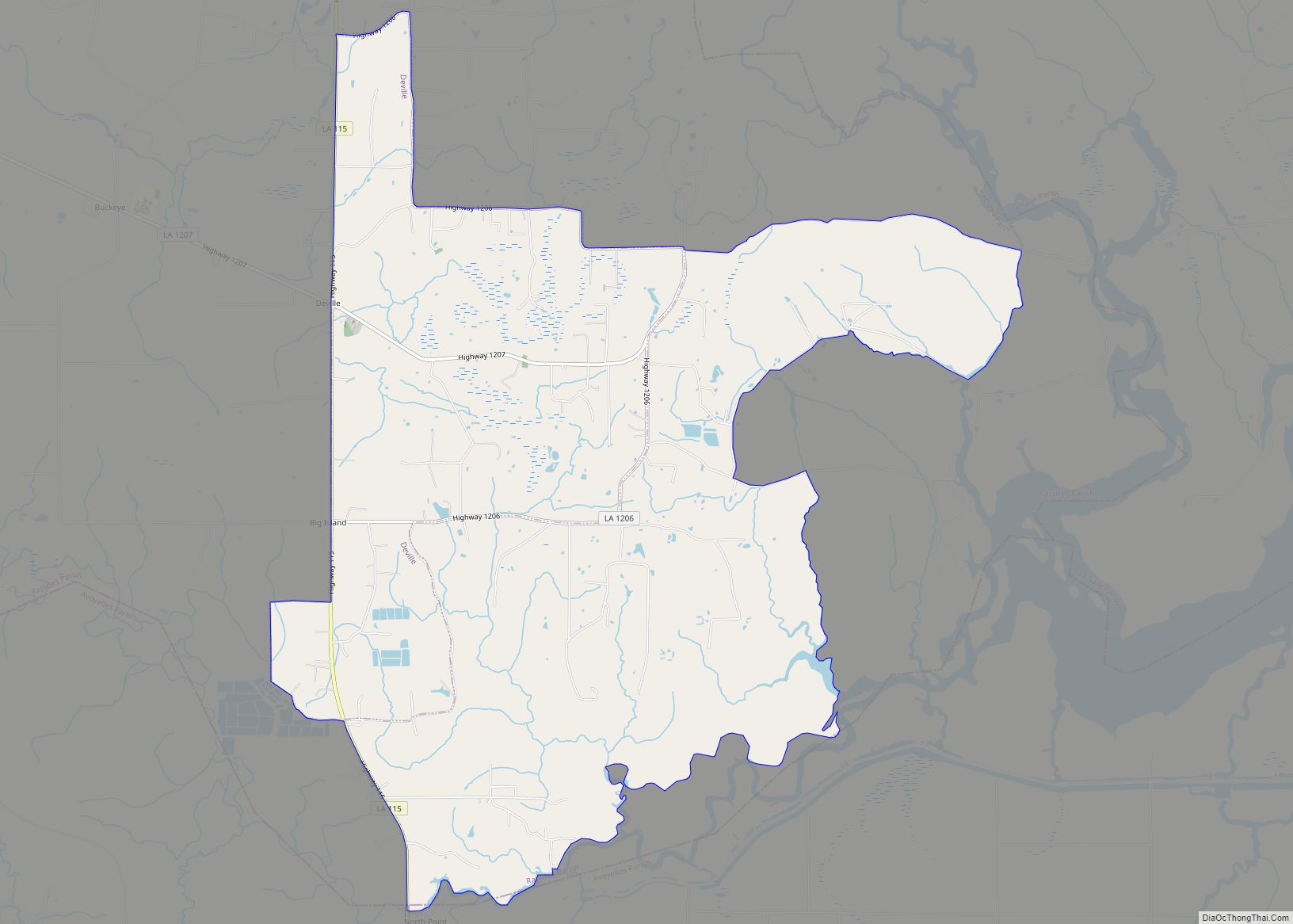
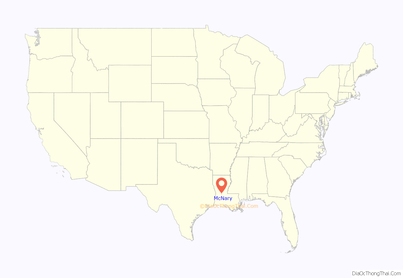
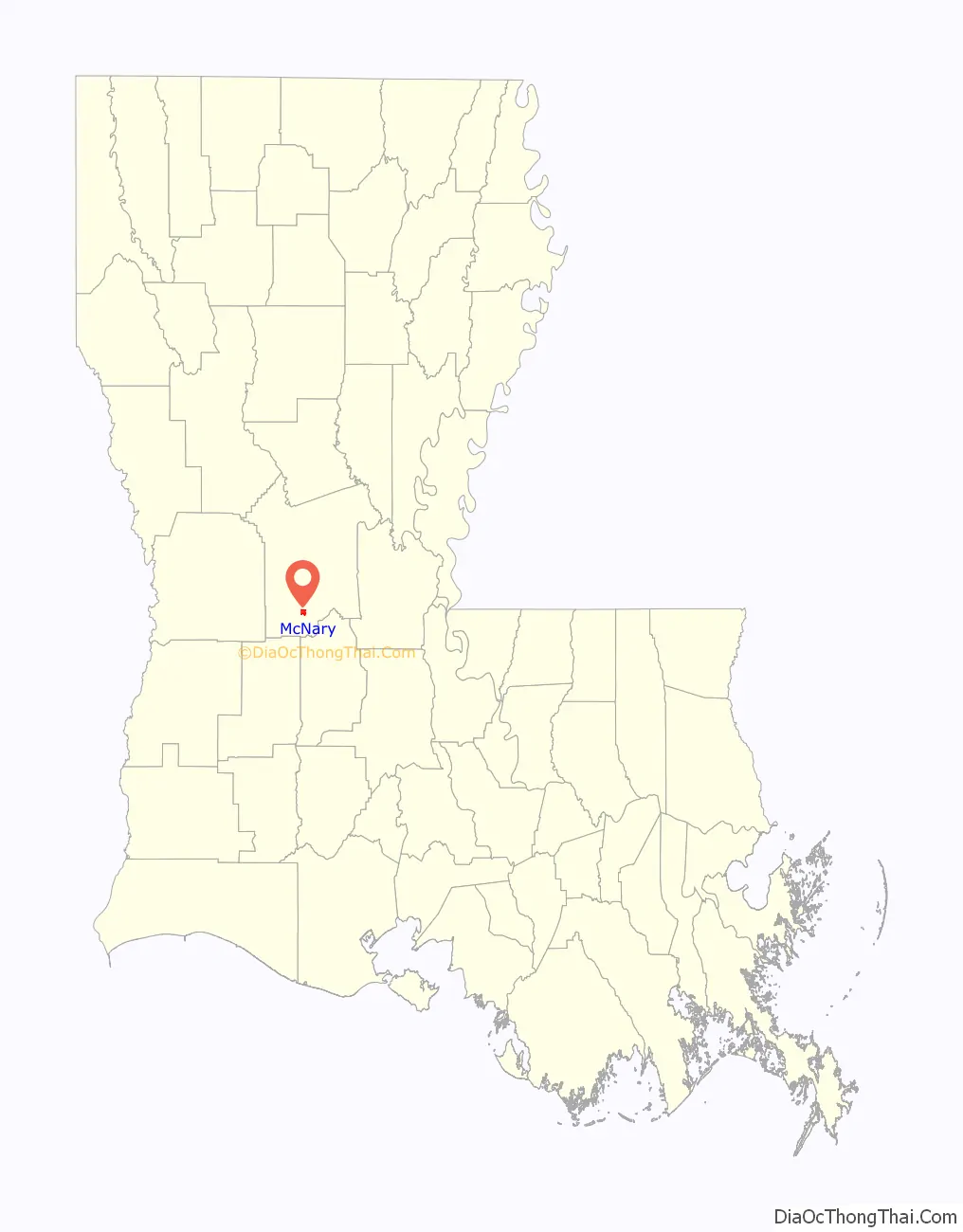
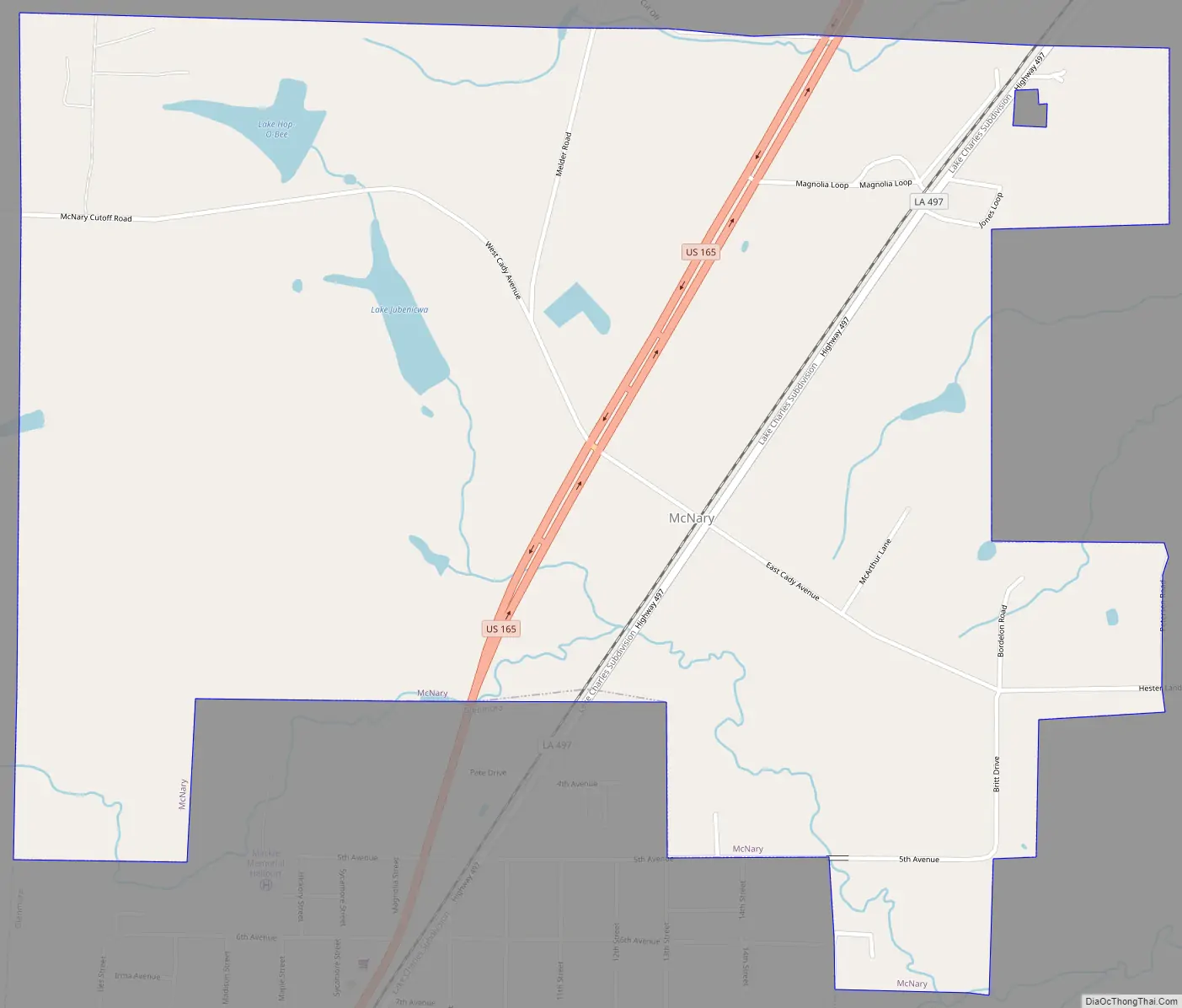
McNary location map. Where is McNary village?
History
By 1880 railroads were arriving and an industrial lumber boom began in Louisiana. Around 22 million acres were in virgin pine which was 85% of the state’s land area. There were also large virgin Cyprus stands but these were mainly in swamp or coastal marsh lands. McNary began, as with many towns created along the railroads in Louisiana, as a lumber town. William M. Cady of Cady Lumber Company, along with Alfred Smith and James McNary, established a lumber mill in McNary. A town of around 3000 sprang up with all the amenities of larger towns including a theater, hospital, and swimming pool. During the first part of the 1920s mills starting cutting out. By 1923 the McNary reserves were depleted but what followed next was not atypical of most mills. The Cady Lumber Company purchased the Apache Lumber Company, Ponderosa Pine leases, the Apache Railway, and the sawmill in Cooley, Arizona, then moved the entire McNary mill with people in a twenty-one coach train. The new lumber town would come to be named McNary, Arizona. After the lumber mill left the area the community struggled but did not become a ghost town. In 1929 the town charter became inactive and it was not until 1965 that it was reactivated. Today parts of the Cady mill can still be seen in the area.
McNary Road Map
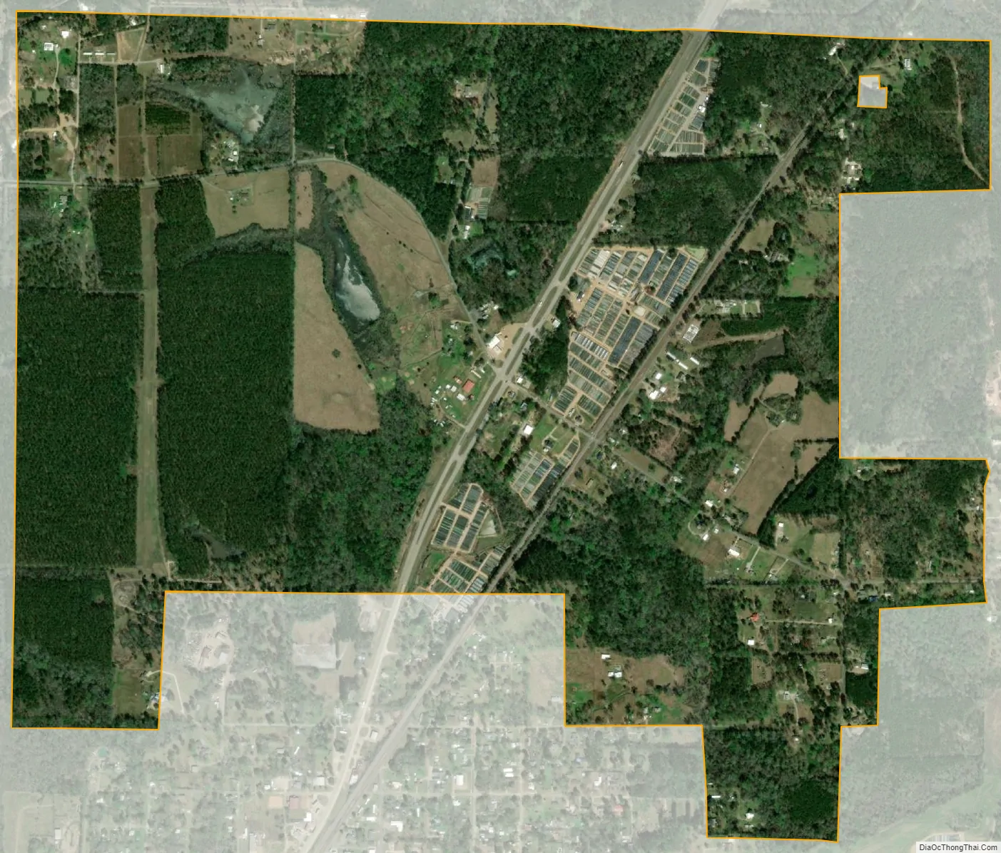
McNary city Satellite Map
See also
Map of Louisiana State and its subdivision:- Acadia
- Allen
- Ascension
- Assumption
- Avoyelles
- Beauregard
- Bienville
- Bossier
- Caddo
- Calcasieu
- Caldwell
- Cameron
- Catahoula
- Claiborne
- Concordia
- De Soto
- East Baton Rouge
- East Carroll
- East Feliciana
- Evangeline
- Franklin
- Grant
- Iberia
- Iberville
- Jackson
- Jefferson
- Jefferson Davis
- La Salle
- Lafayette
- Lafourche
- Lincoln
- Livingston
- Madison
- Morehouse
- Natchitoches
- Orleans
- Ouachita
- Plaquemines
- Pointe Coupee
- Rapides
- Red River
- Richland
- Sabine
- Saint Bernard
- Saint Charles
- Saint Helena
- Saint James
- Saint John the Baptist
- Saint Landry
- Saint Martin
- Saint Mary
- Saint Tammany
- Tangipahoa
- Tensas
- Terrebonne
- Union
- Vermilion
- Vernon
- Washington
- Webster
- West Baton Rouge
- West Carroll
- West Feliciana
- Winn
- Alabama
- Alaska
- Arizona
- Arkansas
- California
- Colorado
- Connecticut
- Delaware
- District of Columbia
- Florida
- Georgia
- Hawaii
- Idaho
- Illinois
- Indiana
- Iowa
- Kansas
- Kentucky
- Louisiana
- Maine
- Maryland
- Massachusetts
- Michigan
- Minnesota
- Mississippi
- Missouri
- Montana
- Nebraska
- Nevada
- New Hampshire
- New Jersey
- New Mexico
- New York
- North Carolina
- North Dakota
- Ohio
- Oklahoma
- Oregon
- Pennsylvania
- Rhode Island
- South Carolina
- South Dakota
- Tennessee
- Texas
- Utah
- Vermont
- Virginia
- Washington
- West Virginia
- Wisconsin
- Wyoming