Mer Rouge (lit. ’Red sea’) is a village in Morehouse Parish, Louisiana, United States. The name is French for “Red Sea”. The population was 628 at the 2010 census. It is part of the Bastrop Micropolitan Statistical Area.
| Name: | Mer Rouge village |
|---|---|
| LSAD Code: | 47 |
| LSAD Description: | village (suffix) |
| State: | Louisiana |
| County: | Morehouse Parish |
| Elevation: | 95 ft (29 m) |
| Total Area: | 1.18 sq mi (3.06 km²) |
| Land Area: | 1.17 sq mi (3.04 km²) |
| Water Area: | 0.01 sq mi (0.02 km²) |
| Total Population: | 491 |
| Population Density: | 418.94/sq mi (161.69/km²) |
| Area code: | 318 |
| FIPS code: | 2249905 |
Online Interactive Map
Click on ![]() to view map in "full screen" mode.
to view map in "full screen" mode.
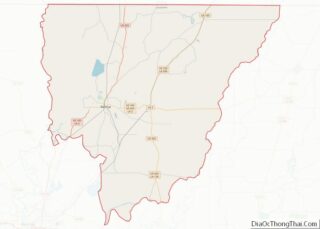
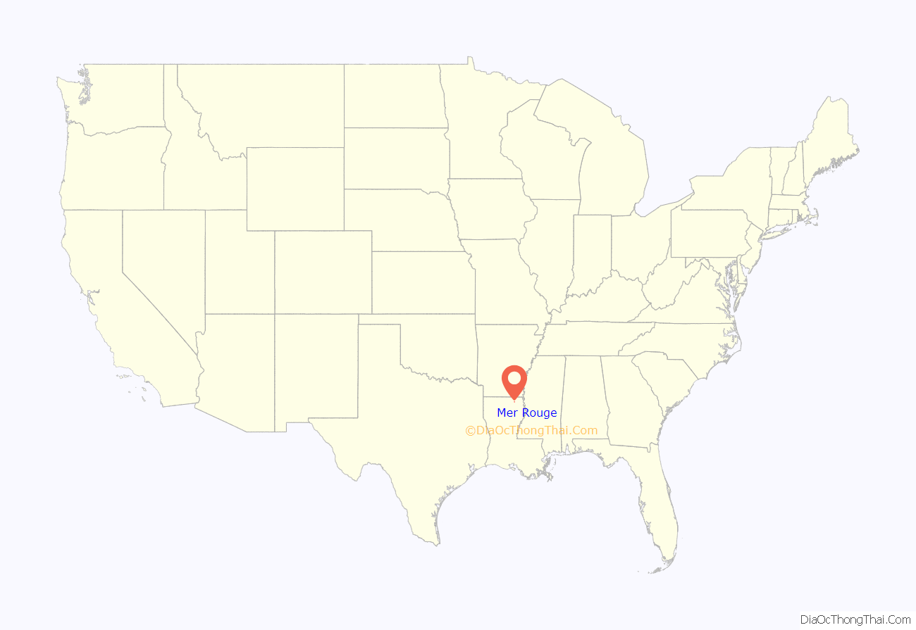
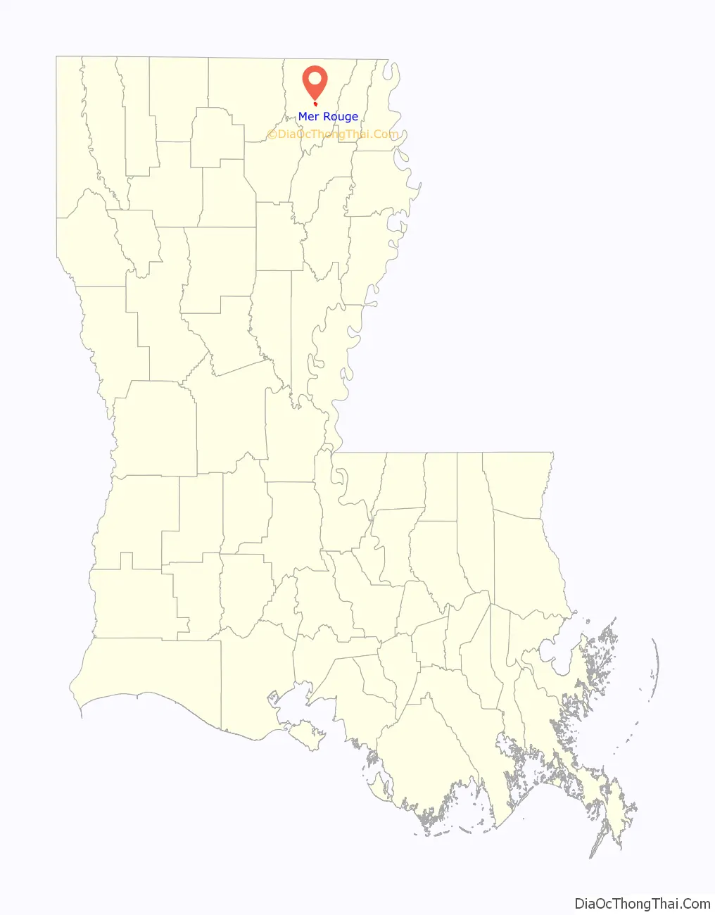
Mer Rouge location map. Where is Mer Rouge village?
History
There is a hill that serves as a boundary between Mer Rouge and Bastrop, named Red Hill. The name “Mer Rouge” came from its founder, Davenport, after the red wavy soil of the hill. Another version of how Mer Rouge derived its name is that settlers looking across the prairie of red clover from atop of Red Hill called it a red sea.
On February 3, 1865, near the end of the American Civil War, two squadrons of the Illinois [cavalry attacked Mer Rouge and, according to the historian John D. Winters seized some horses, mules, while also freeing some enslaved African-Americans. They then “burned about 300,000 bushels of corn [and] some cotton” thus undermining the production power of the pro-slavery rebels.
In August 1922, in a case that would attract national attention, members of the Ku Klux Klan abducted two Mer Rouge men—Filmore Watt Daniel and Thomas Fletcher Richard—on the Bastrop highway. After torturing and killing the men, the Klansmen disposed of their bodies in nearby Lake Lafourche. Following the killings, Louisiana Governor John M. Parker sought help from the U.S. Department of Justice in suppressing Klan violence within the state.
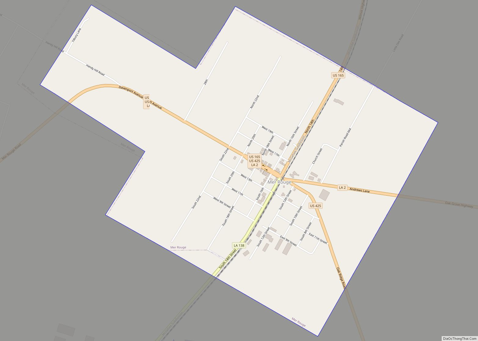
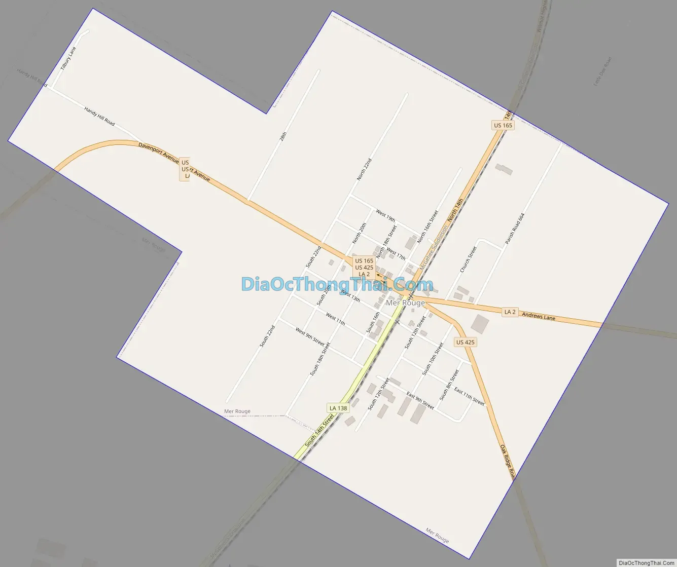
Mer Rouge Road Map
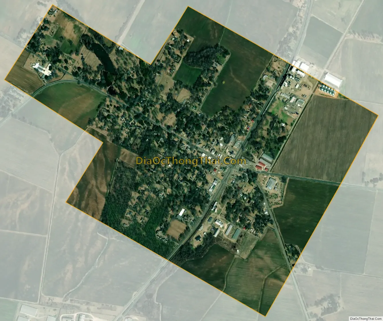
Mer Rouge city Satellite Map
See also
Map of Louisiana State and its subdivision:- Acadia
- Allen
- Ascension
- Assumption
- Avoyelles
- Beauregard
- Bienville
- Bossier
- Caddo
- Calcasieu
- Caldwell
- Cameron
- Catahoula
- Claiborne
- Concordia
- De Soto
- East Baton Rouge
- East Carroll
- East Feliciana
- Evangeline
- Franklin
- Grant
- Iberia
- Iberville
- Jackson
- Jefferson
- Jefferson Davis
- La Salle
- Lafayette
- Lafourche
- Lincoln
- Livingston
- Madison
- Morehouse
- Natchitoches
- Orleans
- Ouachita
- Plaquemines
- Pointe Coupee
- Rapides
- Red River
- Richland
- Sabine
- Saint Bernard
- Saint Charles
- Saint Helena
- Saint James
- Saint John the Baptist
- Saint Landry
- Saint Martin
- Saint Mary
- Saint Tammany
- Tangipahoa
- Tensas
- Terrebonne
- Union
- Vermilion
- Vernon
- Washington
- Webster
- West Baton Rouge
- West Carroll
- West Feliciana
- Winn
- Alabama
- Alaska
- Arizona
- Arkansas
- California
- Colorado
- Connecticut
- Delaware
- District of Columbia
- Florida
- Georgia
- Hawaii
- Idaho
- Illinois
- Indiana
- Iowa
- Kansas
- Kentucky
- Louisiana
- Maine
- Maryland
- Massachusetts
- Michigan
- Minnesota
- Mississippi
- Missouri
- Montana
- Nebraska
- Nevada
- New Hampshire
- New Jersey
- New Mexico
- New York
- North Carolina
- North Dakota
- Ohio
- Oklahoma
- Oregon
- Pennsylvania
- Rhode Island
- South Carolina
- South Dakota
- Tennessee
- Texas
- Utah
- Vermont
- Virginia
- Washington
- West Virginia
- Wisconsin
- Wyoming