Midway is an unincorporated community and census-designated place (CDP) in LaSalle Parish, Louisiana, United States. The population was 1,291 at the 2010 census, down from 1,505 at the 2000 census.
| Name: | Midway CDP |
|---|---|
| LSAD Code: | 57 |
| LSAD Description: | CDP (suffix) |
| State: | Louisiana |
| County: | LaSalle Parish |
| Elevation: | 203 ft (62 m) |
| Total Area: | 3.06 sq mi (7.93 km²) |
| Land Area: | 3.03 sq mi (7.85 km²) |
| Water Area: | 0.03 sq mi (0.08 km²) |
| Total Population: | 1,157 |
| Population Density: | 381.60/sq mi (147.36/km²) |
| Area code: | 318 |
| FIPS code: | 2250395 |
Online Interactive Map
Click on ![]() to view map in "full screen" mode.
to view map in "full screen" mode.
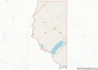
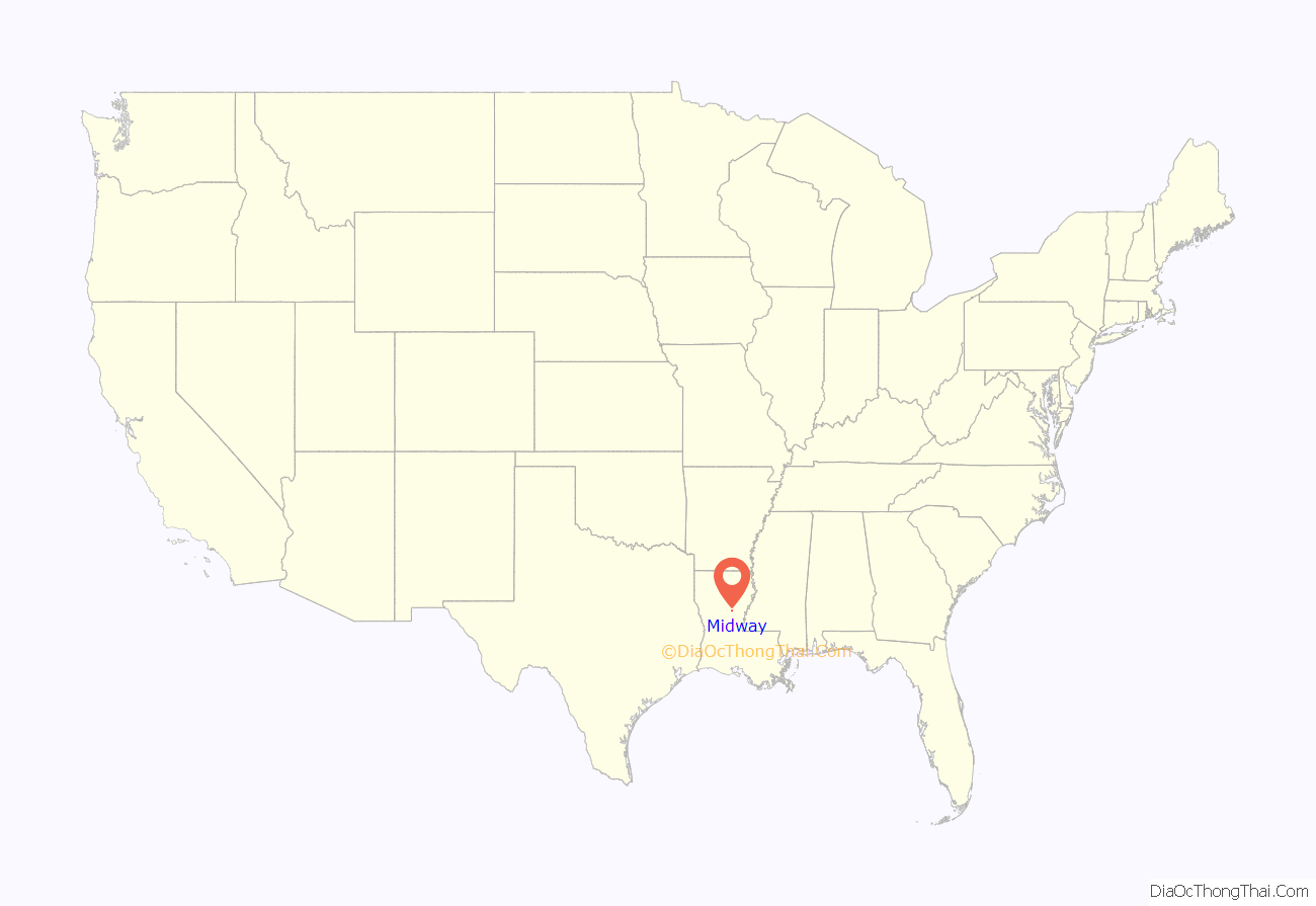
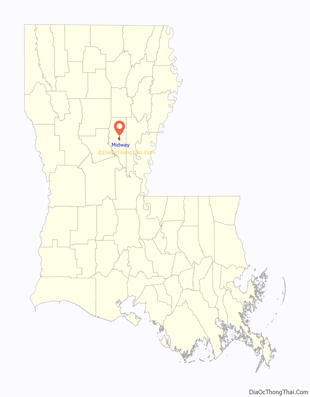
Midway location map. Where is Midway CDP?
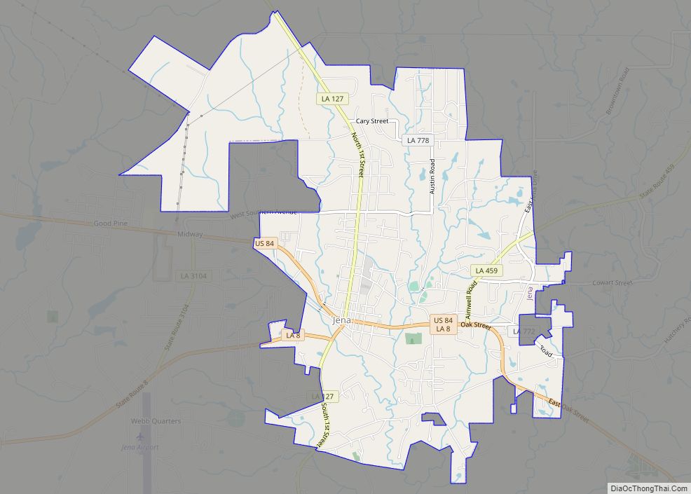
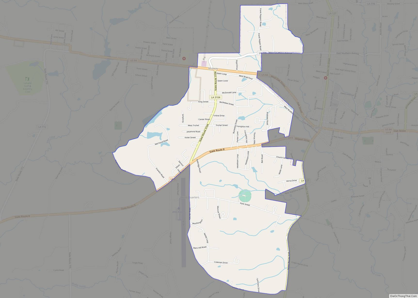
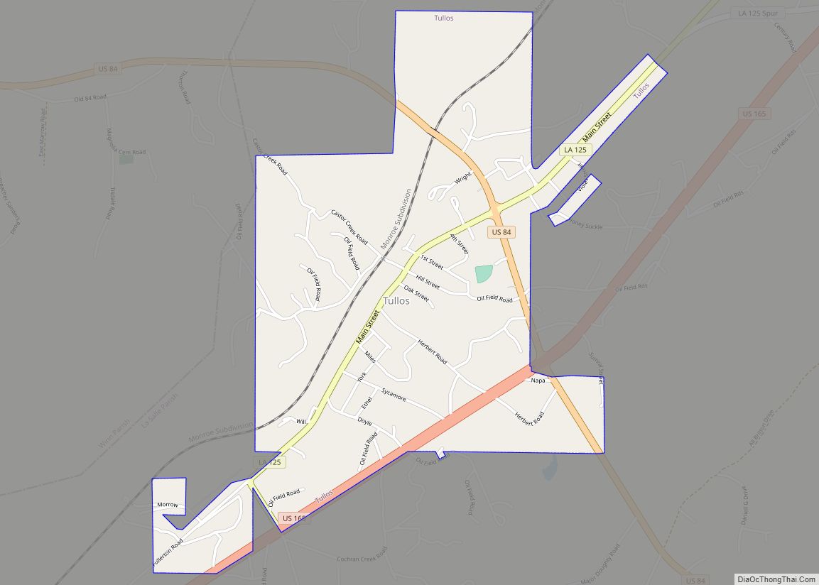
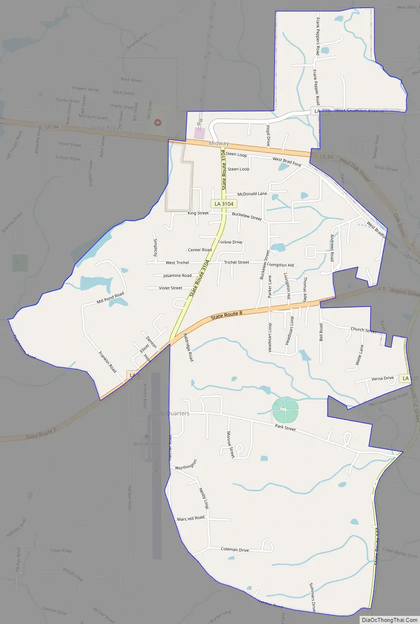
Midway Road Map
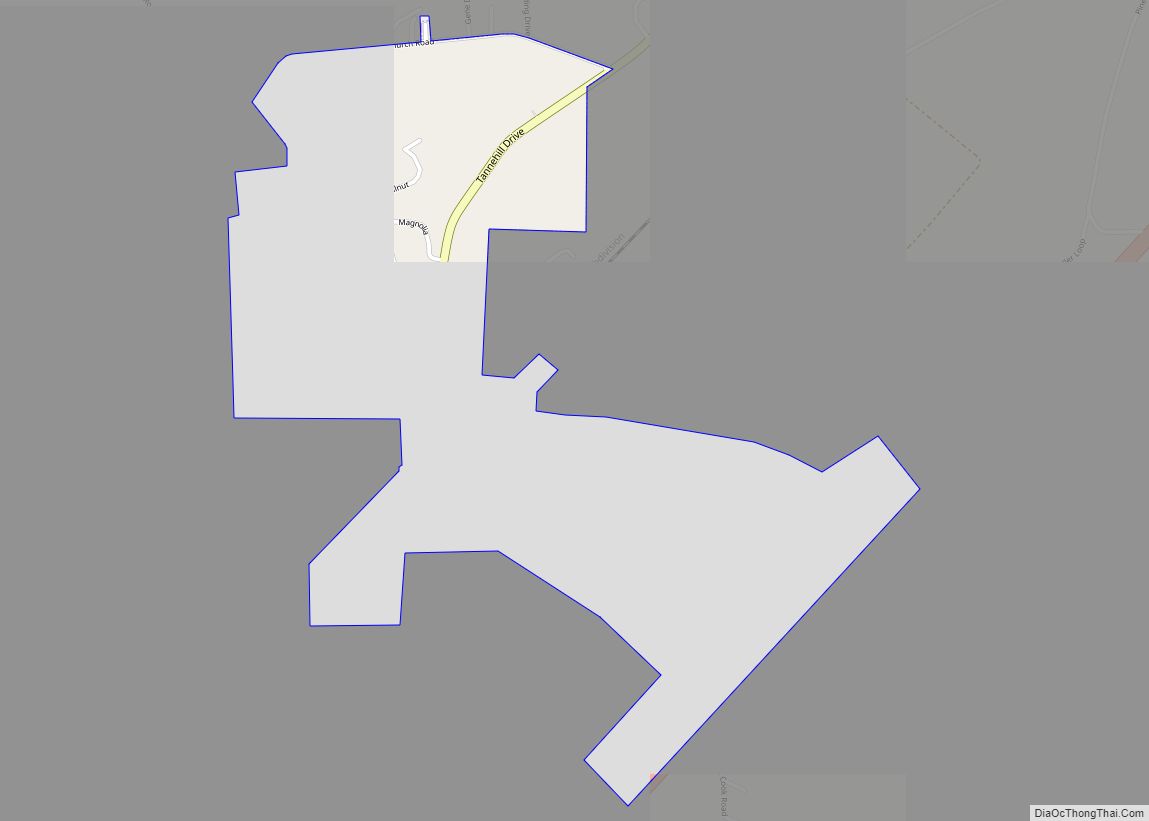
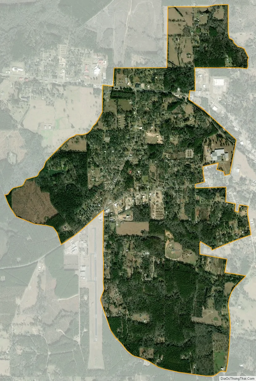
Midway city Satellite Map
Geography
Midway is located in central LaSalle Parish at 31°40′56″N 92°8′49″W / 31.68222°N 92.14694°W / 31.68222; -92.14694 (31.682294, -92.146866). It is bordered to the north and east by Jena, the parish seat, and to the west by Good Pine. U.S. Route 84 passes through the northern part of Midway, leading east into Jena and northwest 14 miles (23 km) to Tullos. Louisiana Highway 8 passes through the southern part of Midway, also leading east into Jena but running southwest 21 miles (34 km) to Pollock.
According to the United States Census Bureau, the Midway CDP has a total area of 3.1 square miles (7.9 km), of which 0.03 square miles (0.08 km), or 1.04%, are water.
See also
Map of Louisiana State and its subdivision:- Acadia
- Allen
- Ascension
- Assumption
- Avoyelles
- Beauregard
- Bienville
- Bossier
- Caddo
- Calcasieu
- Caldwell
- Cameron
- Catahoula
- Claiborne
- Concordia
- De Soto
- East Baton Rouge
- East Carroll
- East Feliciana
- Evangeline
- Franklin
- Grant
- Iberia
- Iberville
- Jackson
- Jefferson
- Jefferson Davis
- La Salle
- Lafayette
- Lafourche
- Lincoln
- Livingston
- Madison
- Morehouse
- Natchitoches
- Orleans
- Ouachita
- Plaquemines
- Pointe Coupee
- Rapides
- Red River
- Richland
- Sabine
- Saint Bernard
- Saint Charles
- Saint Helena
- Saint James
- Saint John the Baptist
- Saint Landry
- Saint Martin
- Saint Mary
- Saint Tammany
- Tangipahoa
- Tensas
- Terrebonne
- Union
- Vermilion
- Vernon
- Washington
- Webster
- West Baton Rouge
- West Carroll
- West Feliciana
- Winn
- Alabama
- Alaska
- Arizona
- Arkansas
- California
- Colorado
- Connecticut
- Delaware
- District of Columbia
- Florida
- Georgia
- Hawaii
- Idaho
- Illinois
- Indiana
- Iowa
- Kansas
- Kentucky
- Louisiana
- Maine
- Maryland
- Massachusetts
- Michigan
- Minnesota
- Mississippi
- Missouri
- Montana
- Nebraska
- Nevada
- New Hampshire
- New Jersey
- New Mexico
- New York
- North Carolina
- North Dakota
- Ohio
- Oklahoma
- Oregon
- Pennsylvania
- Rhode Island
- South Carolina
- South Dakota
- Tennessee
- Texas
- Utah
- Vermont
- Virginia
- Washington
- West Virginia
- Wisconsin
- Wyoming