Natchez is a village in Natchitoches Parish, Louisiana, United States. The population was 597 at the 2010 census. It is part of the Natchitoches Micropolitan Statistical Area. The village and parish are part of the Cane River National Heritage Area.
| Name: | Natchez village |
|---|---|
| LSAD Code: | 47 |
| LSAD Description: | village (suffix) |
| State: | Louisiana |
| County: | Natchitoches Parish |
| Elevation: | 105 ft (32 m) |
| Total Area: | 1.06 sq mi (2.74 km²) |
| Land Area: | 1.03 sq mi (2.67 km²) |
| Water Area: | 0.03 sq mi (0.07 km²) |
| Total Population: | 489 |
| Population Density: | 473.84/sq mi (182.91/km²) |
| Area code: | 318 |
| FIPS code: | 2253510 |
| GNISfeature ID: | 543508 |
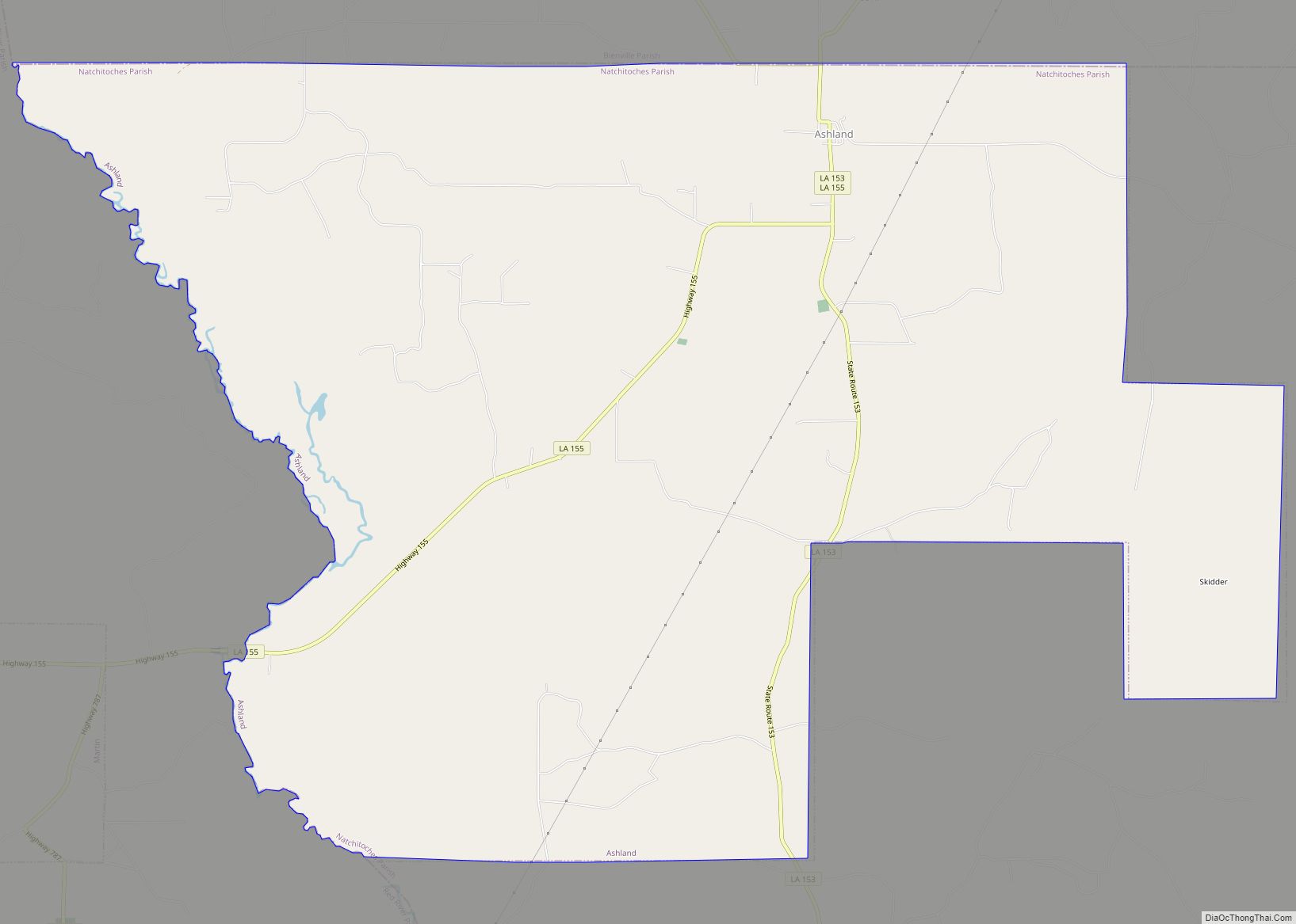
Online Interactive Map
Click on ![]() to view map in "full screen" mode.
to view map in "full screen" mode.
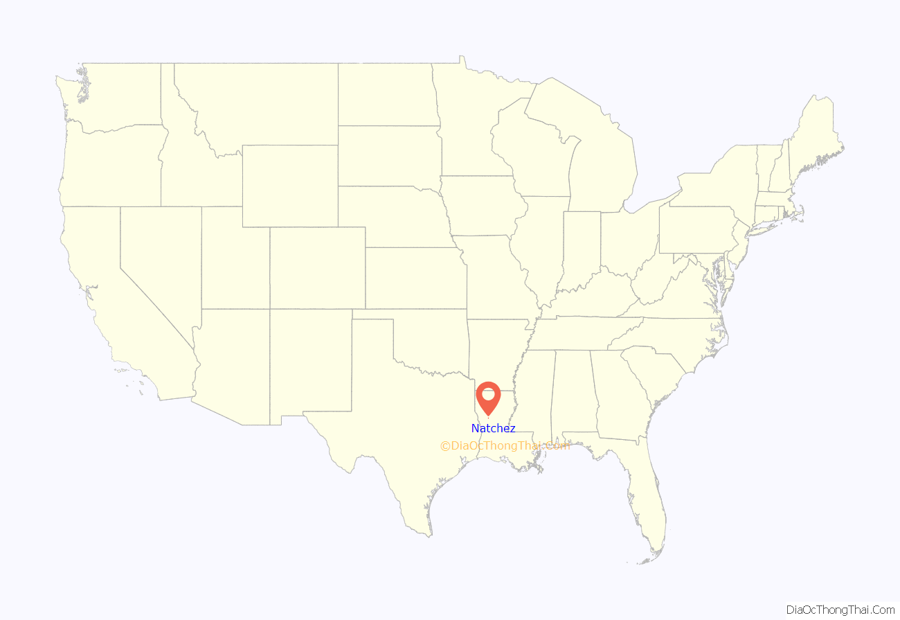
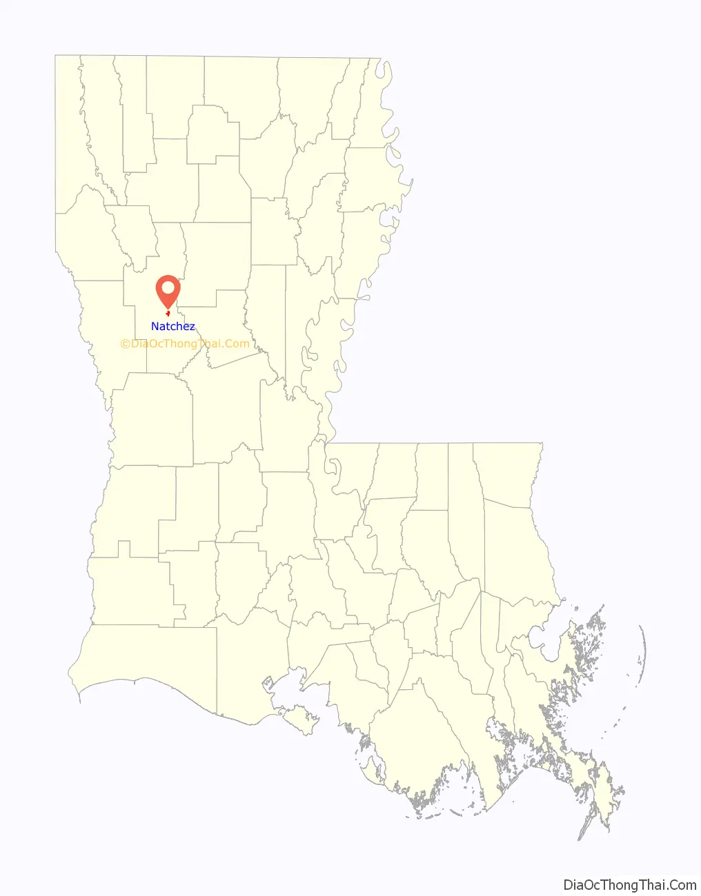
Natchez location map. Where is Natchez village?
History
This village is one of the oldest communities in the territory covered by the Louisiana Purchase, and is part of the Cane River National Heritage Area. The Côte Joyeuse (English: Joyous Coast) area was home to the earliest French planters in Louisiana. Some of the plantations (or former plantations) in Natchez include the Oakland Plantation (1818), Cherokee Plantation (c. 1825), Oaklawn Plantation (1830), Cedar Bend Plantation (1850) and the Atahoe Plantation (1873).
The Isle Brevelle church in Natchez was established in 1803 by Augustin Métoyer and church services been held continuously since then. It is the oldest church in the United States that was founded by and for the mixed-Creole people. The church was built by sons of Métoyer and Marie Thérèse Coincoin. Because of the significance of the Créole church’s history and its centrality in the life of the community, it is featured on the Louisiana African American Heritage Trail.
Natchez Road Map
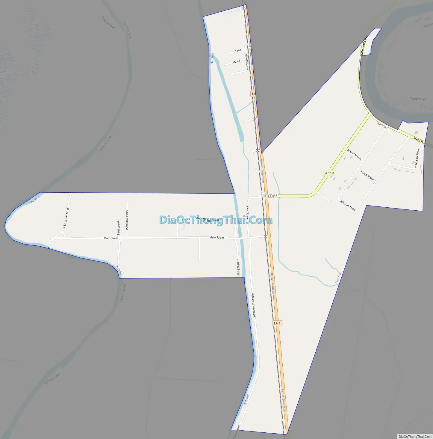
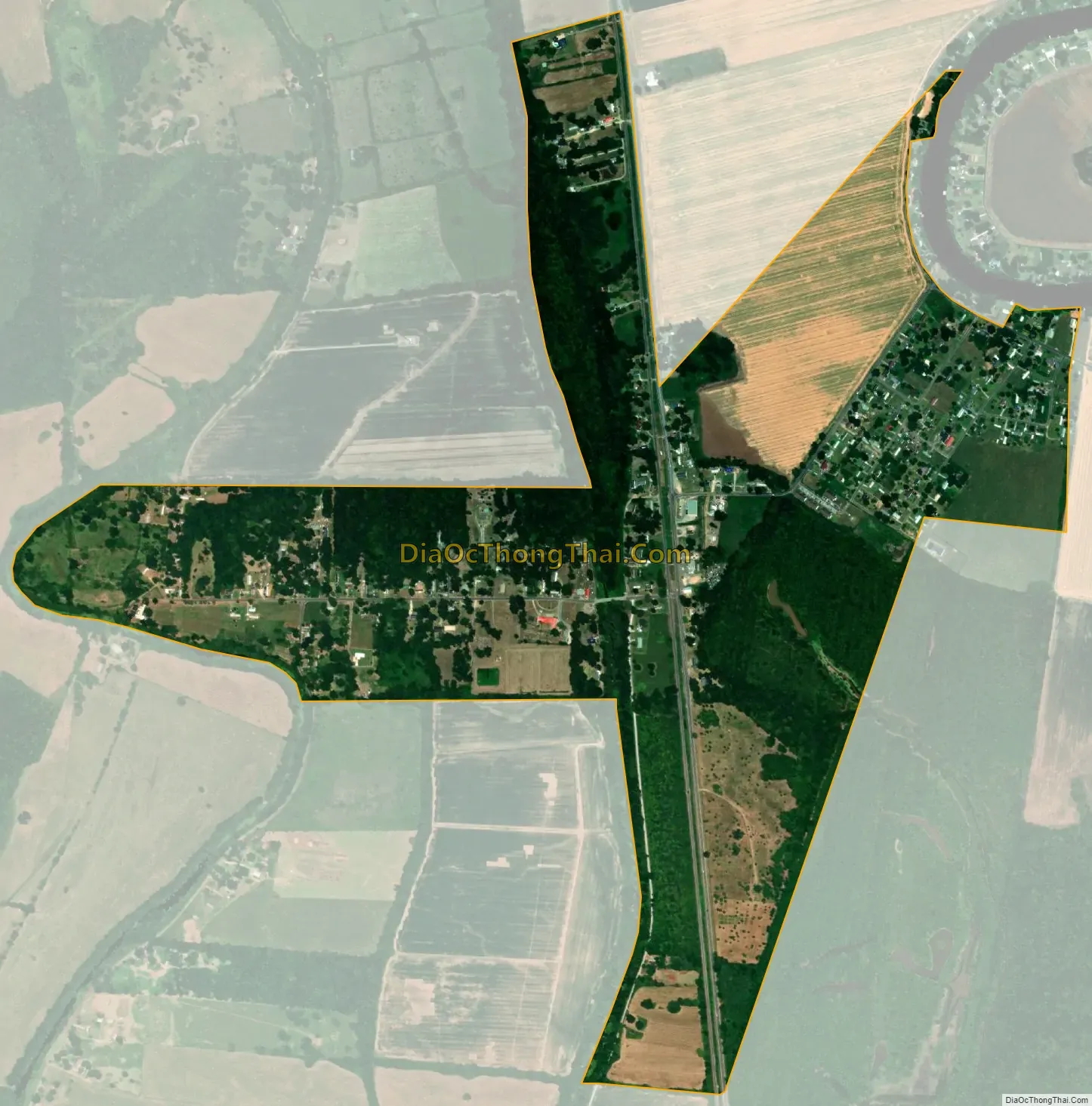
Natchez city Satellite Map
Geography
According to the United States Census Bureau, the village has a total area of 1.1 square miles (2.8 km), all land.
See also
Map of Louisiana State and its subdivision:- Acadia
- Allen
- Ascension
- Assumption
- Avoyelles
- Beauregard
- Bienville
- Bossier
- Caddo
- Calcasieu
- Caldwell
- Cameron
- Catahoula
- Claiborne
- Concordia
- De Soto
- East Baton Rouge
- East Carroll
- East Feliciana
- Evangeline
- Franklin
- Grant
- Iberia
- Iberville
- Jackson
- Jefferson
- Jefferson Davis
- La Salle
- Lafayette
- Lafourche
- Lincoln
- Livingston
- Madison
- Morehouse
- Natchitoches
- Orleans
- Ouachita
- Plaquemines
- Pointe Coupee
- Rapides
- Red River
- Richland
- Sabine
- Saint Bernard
- Saint Charles
- Saint Helena
- Saint James
- Saint John the Baptist
- Saint Landry
- Saint Martin
- Saint Mary
- Saint Tammany
- Tangipahoa
- Tensas
- Terrebonne
- Union
- Vermilion
- Vernon
- Washington
- Webster
- West Baton Rouge
- West Carroll
- West Feliciana
- Winn
- Alabama
- Alaska
- Arizona
- Arkansas
- California
- Colorado
- Connecticut
- Delaware
- District of Columbia
- Florida
- Georgia
- Hawaii
- Idaho
- Illinois
- Indiana
- Iowa
- Kansas
- Kentucky
- Louisiana
- Maine
- Maryland
- Massachusetts
- Michigan
- Minnesota
- Mississippi
- Missouri
- Montana
- Nebraska
- Nevada
- New Hampshire
- New Jersey
- New Mexico
- New York
- North Carolina
- North Dakota
- Ohio
- Oklahoma
- Oregon
- Pennsylvania
- Rhode Island
- South Carolina
- South Dakota
- Tennessee
- Texas
- Utah
- Vermont
- Virginia
- Washington
- West Virginia
- Wisconsin
- Wyoming