Shongaloo is a village in Webster Parish, Louisiana, United States.
West of Shongaloo on Louisiana Highway 2 is Munn Hill, a homestead of Daniel and Rebecca Munn, established on July 26, 1900.
Shongaloo has a civic center for town council meetings as well as general usage. There is an adjacent museum with a restored log cabin.
| Name: | Shongaloo village |
|---|---|
| LSAD Code: | 47 |
| LSAD Description: | village (suffix) |
| State: | Louisiana |
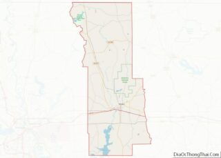
| County: | Webster Parish |
| Elevation: | 256 ft (78 m) |
| Total Area: | 7.93 sq mi (20.53 km²) |
| Land Area: | 7.90 sq mi (20.45 km²) |
| Water Area: | 0.03 sq mi (0.08 km²) |
| Total Population: | 151 |
| Population Density: | 19.12/sq mi (7.38/km²) |
| Area code: | 318 |
| FIPS code: | 2269455 |
Online Interactive Map
Click on ![]() to view map in "full screen" mode.
to view map in "full screen" mode.
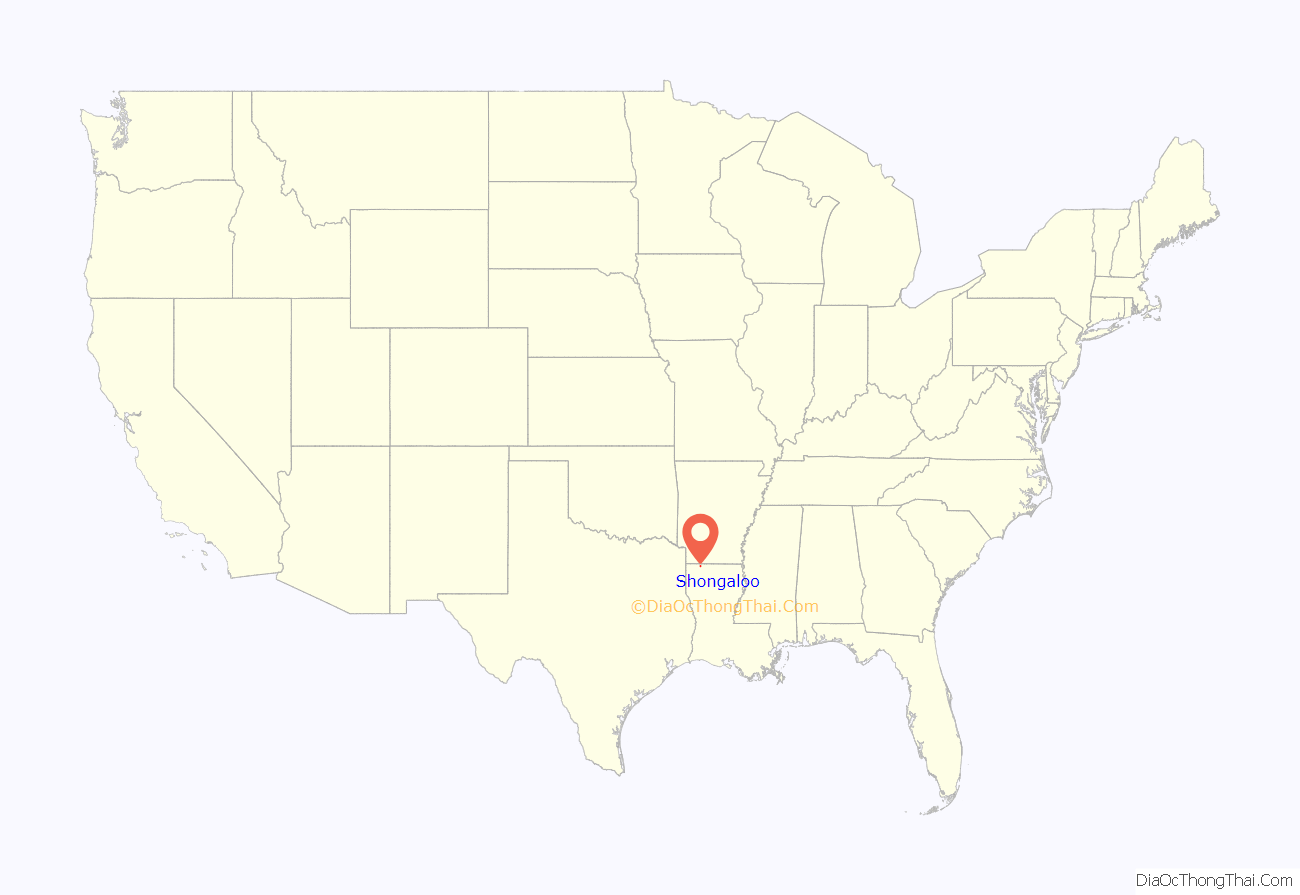
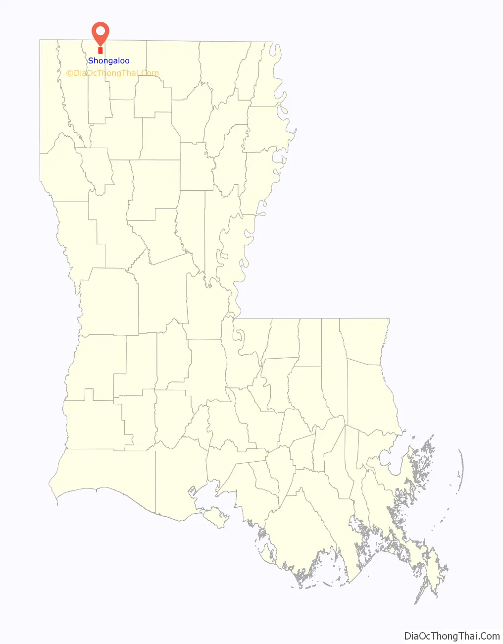
Shongaloo location map. Where is Shongaloo village?
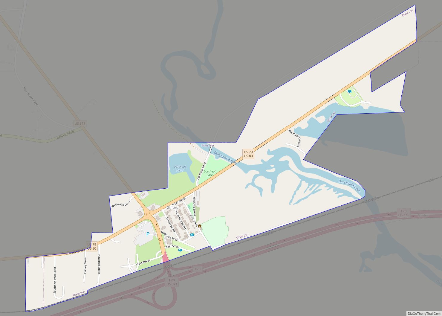
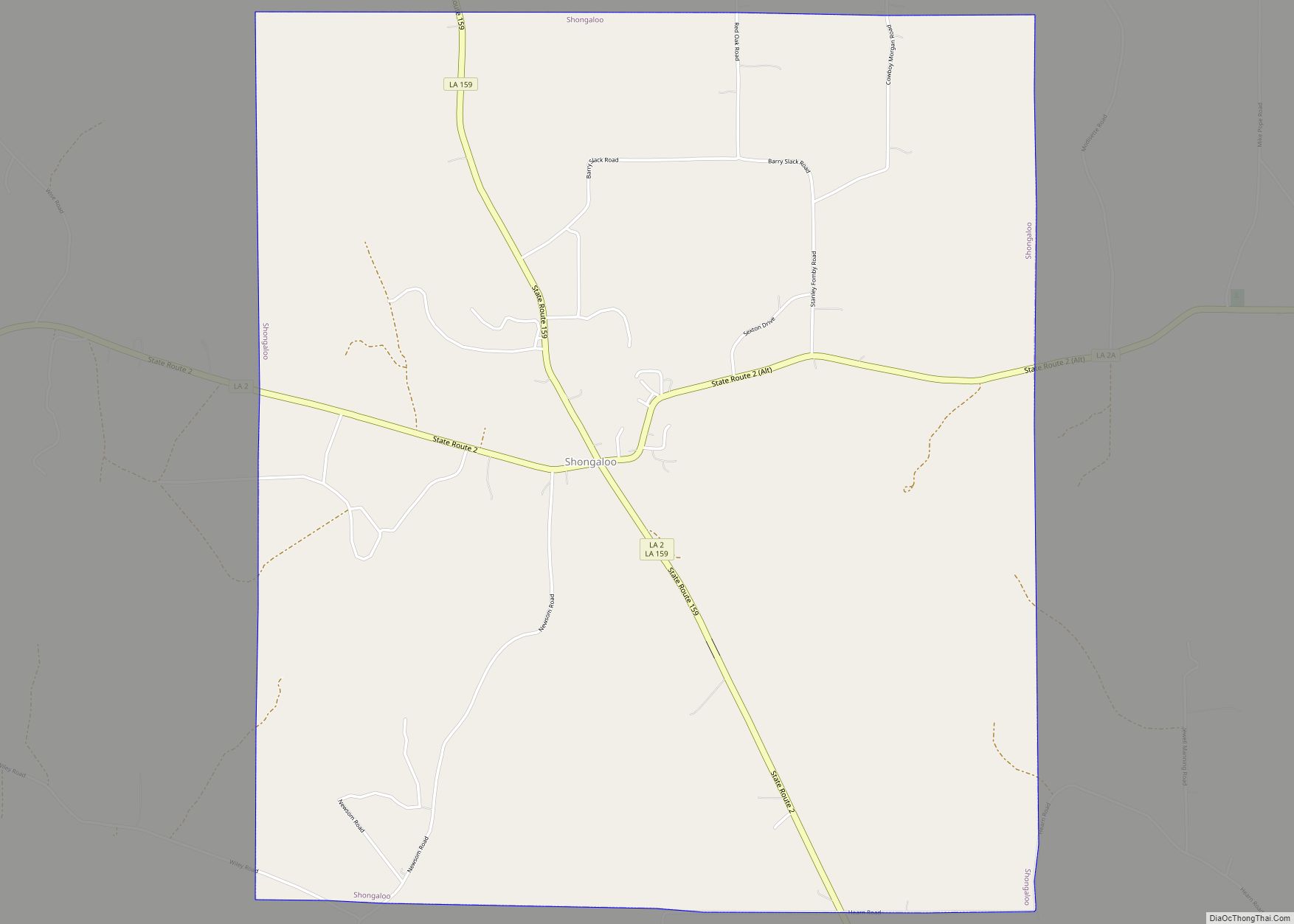
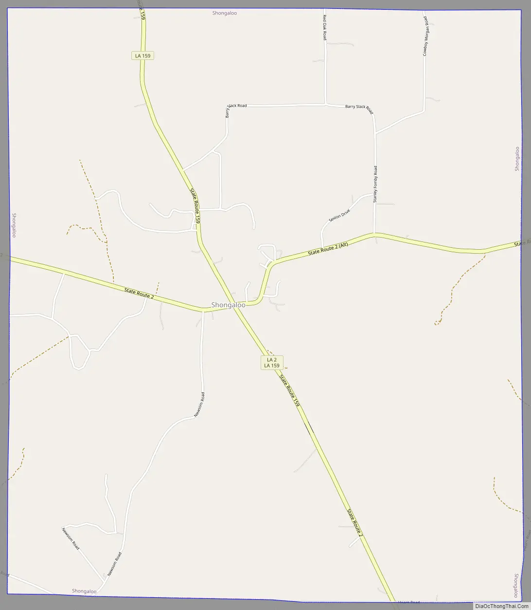
Shongaloo Road Map
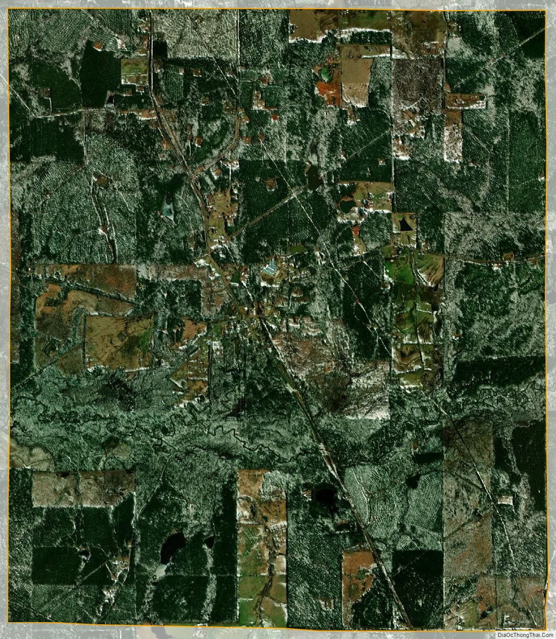
Shongaloo city Satellite Map
Geography
Shongaloo is located at 32°56′17″N 93°17′54″W / 32.93806°N 93.29833°W / 32.93806; -93.29833 (32.938129, -93.298369).
According to the United States Census Bureau, the village has a total area of 7.9 square miles (20 km), of which 7.9 square miles (20 km) is land and 0.04 square miles (0.10 km) (0.38%) is water.
Dorcheat Bayou, 115-mile-long (185 km) runs through Shongaloo, making it one of the longest natural bayous in the U.S.
Transportation
Shongaloo is connected to other cities by road; currently, there is no air or boat access directly to the village. Air transportation is possible by using the Springhill Airport (15–20 minutes) or using the Shreveport Regional Airport (60–80 minutes). Shongaloo is connected to Sarepta and Homer via LA 2. Shongaloo is also connected to Magnolia and Minden via LA 159). LA 157 connects Shongaloo to Springhill and ALT LA 2 and LA 615 to Haynesville.
Interstate 69
Proposals have been made to build Interstate 69 south of the city around the community of Leton and east of the city near Haynesville. Currently, Shongaloo will have access to the freeway via interchanges at LA 159, LA 2, and LA 2 Alt.
See also
Map of Louisiana State and its subdivision:- Acadia
- Allen
- Ascension
- Assumption
- Avoyelles
- Beauregard
- Bienville
- Bossier
- Caddo
- Calcasieu
- Caldwell
- Cameron
- Catahoula
- Claiborne
- Concordia
- De Soto
- East Baton Rouge
- East Carroll
- East Feliciana
- Evangeline
- Franklin
- Grant
- Iberia
- Iberville
- Jackson
- Jefferson
- Jefferson Davis
- La Salle
- Lafayette
- Lafourche
- Lincoln
- Livingston
- Madison
- Morehouse
- Natchitoches
- Orleans
- Ouachita
- Plaquemines
- Pointe Coupee
- Rapides
- Red River
- Richland
- Sabine
- Saint Bernard
- Saint Charles
- Saint Helena
- Saint James
- Saint John the Baptist
- Saint Landry
- Saint Martin
- Saint Mary
- Saint Tammany
- Tangipahoa
- Tensas
- Terrebonne
- Union
- Vermilion
- Vernon
- Washington
- Webster
- West Baton Rouge
- West Carroll
- West Feliciana
- Winn
- Alabama
- Alaska
- Arizona
- Arkansas
- California
- Colorado
- Connecticut
- Delaware
- District of Columbia
- Florida
- Georgia
- Hawaii
- Idaho
- Illinois
- Indiana
- Iowa
- Kansas
- Kentucky
- Louisiana
- Maine
- Maryland
- Massachusetts
- Michigan
- Minnesota
- Mississippi
- Missouri
- Montana
- Nebraska
- Nevada
- New Hampshire
- New Jersey
- New Mexico
- New York
- North Carolina
- North Dakota
- Ohio
- Oklahoma
- Oregon
- Pennsylvania
- Rhode Island
- South Carolina
- South Dakota
- Tennessee
- Texas
- Utah
- Vermont
- Virginia
- Washington
- West Virginia
- Wisconsin
- Wyoming