Vienna is a town in Lincoln Parish, Louisiana, United States. The population was 483 in 2020.
During the American Civil War, Confederate troops drilled at a new camp established in 1862 in Vienna. Later in the war, a parolee camp was established at Vienna.
| Name: | Vienna town |
|---|---|
| LSAD Code: | 43 |
| LSAD Description: | town (suffix) |
| State: | Louisiana |
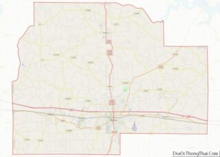
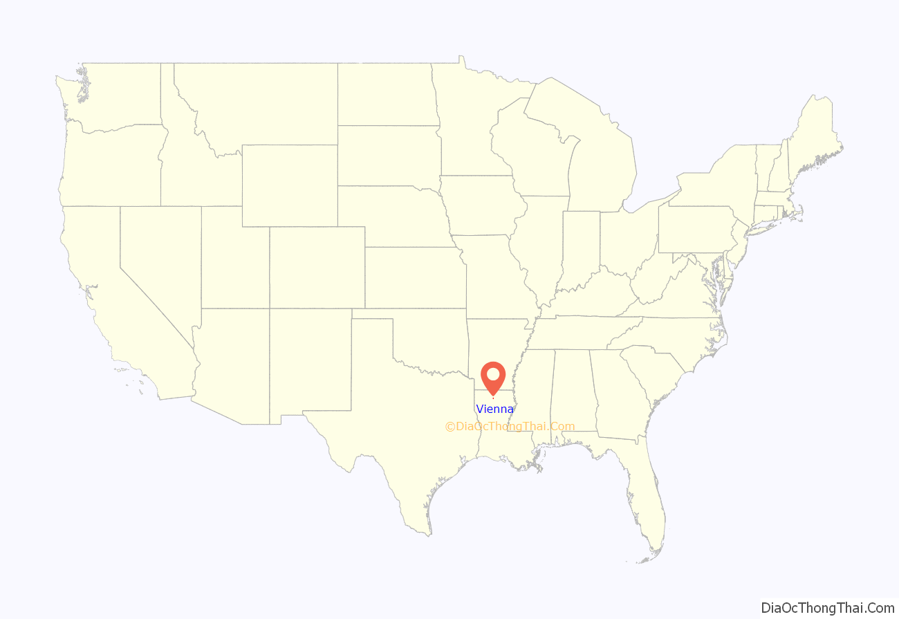
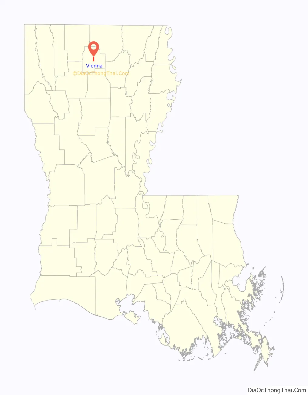
| County: | Lincoln Parish |
| Elevation: | 262 ft (80 m) |
| Total Area: | 3.47 sq mi (8.98 km²) |
| Land Area: | 3.47 sq mi (8.98 km²) |
| Water Area: | 0.00 sq mi (0.00 km²) |
| Total Population: | 483 |
| Population Density: | 139.31/sq mi (53.78/km²) |
| Area code: | 318 |
| FIPS code: | 2278540 |
Online Interactive Map
Click on ![]() to view map in "full screen" mode.
to view map in "full screen" mode.
Vienna location map. Where is Vienna town?
History
Daniel Colvin settled near what is now Vienna in about 1812.
The Colvins operated a store or relay station of some kind. Their house was near the trail that led from Monroe to Shreveport. Jephthah (son of Daniel) opened the first post office in the region in 1838, originally known as Colvin’s Post Office. The name was changed to Vienna in 1850.
Vienna was an overnight stop the stagecoaches on the Monroe-Shreveport Stagecoach Road (later called the Old Wire Road).
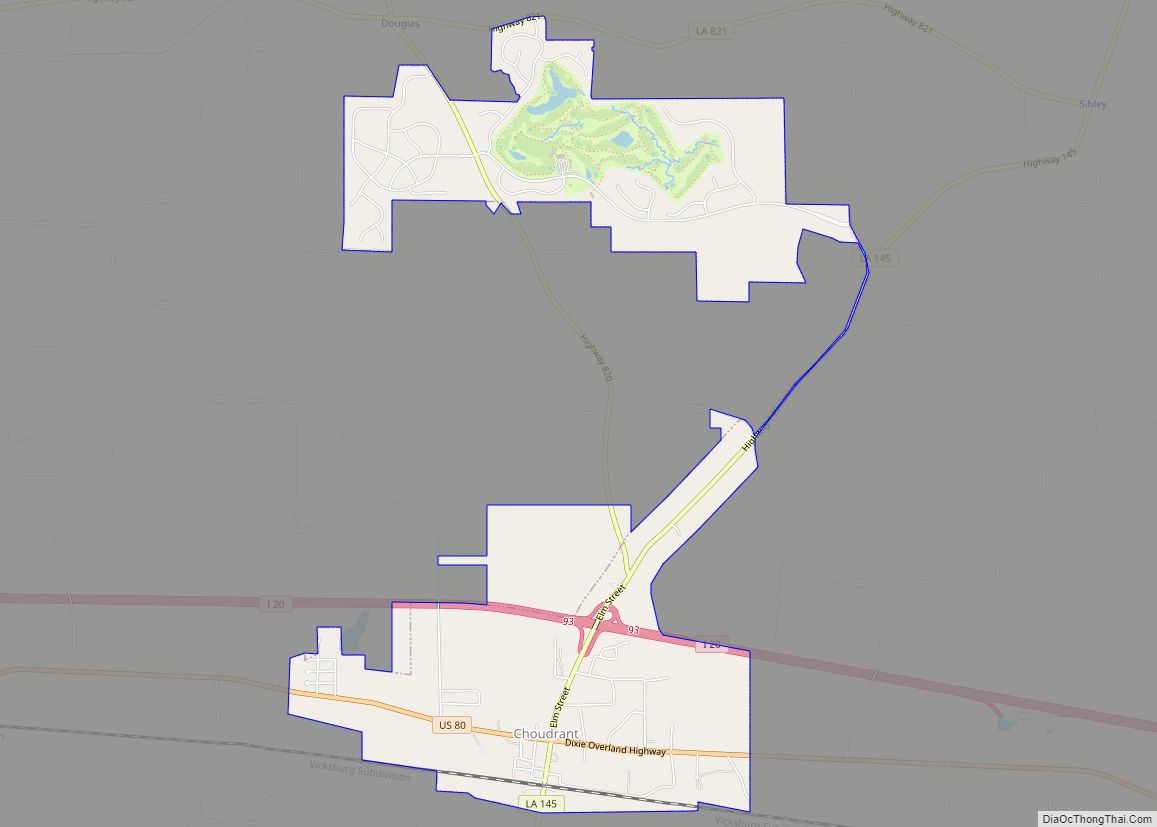
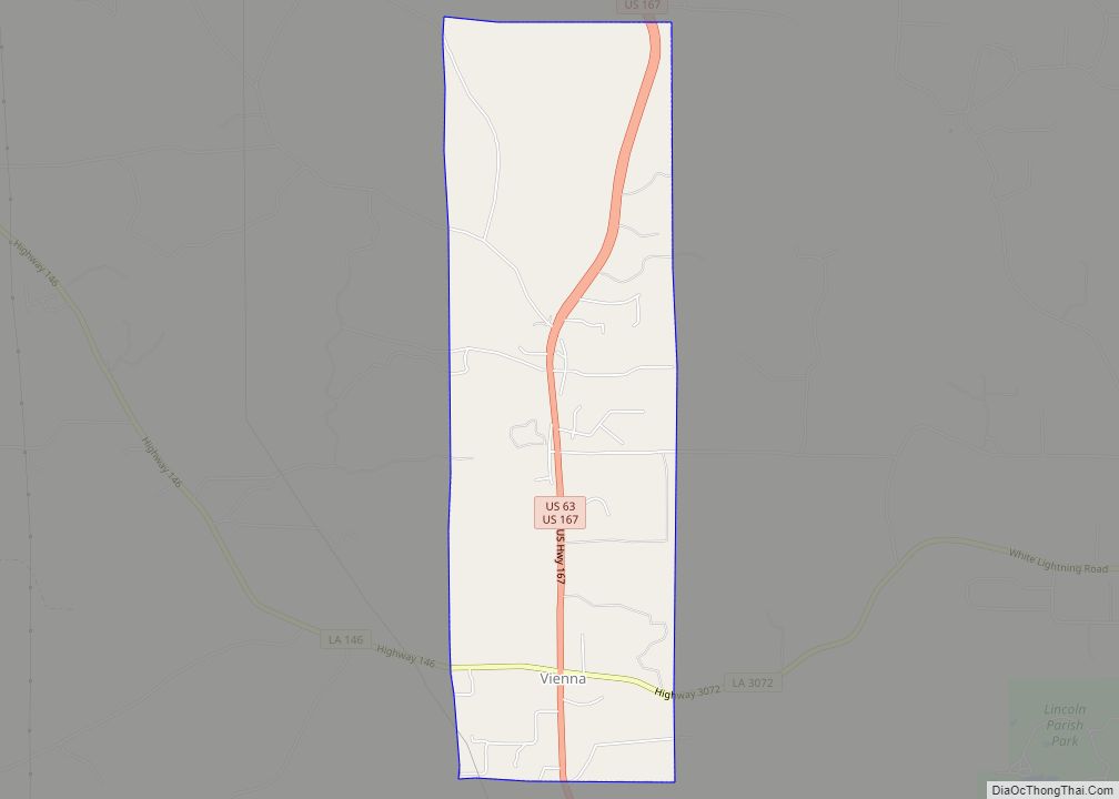
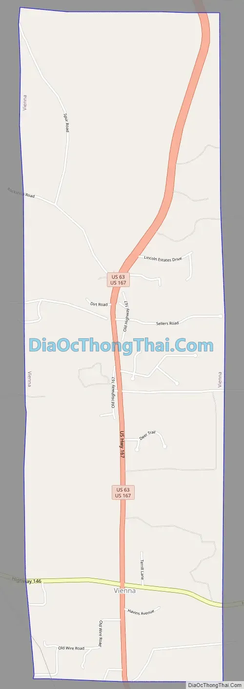
Vienna Road Map
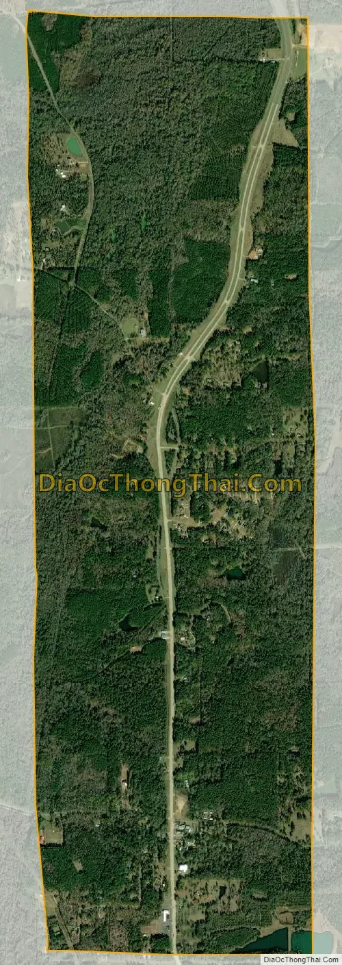
Vienna city Satellite Map
Geography
Vienna is located in central Lincoln Parish at 32°36′24″N 92°39′3″W / 32.60667°N 92.65083°W / 32.60667; -92.65083 (32.606779, -92.650746). U.S. Routes 63 and 167 pass through the center of town together, leading south 5 miles (8 km) to Ruston, the parish seat, and north 17 miles (27 km) to Bernice. Vienna is 3.5 miles (5.6 km) north of Exit 85 on Interstate 20 in Ruston.
According to the United States Census Bureau, Vienna has a total area of 3.5 square miles (9.0 km), all land.
See also
Map of Louisiana State and its subdivision:- Acadia
- Allen
- Ascension
- Assumption
- Avoyelles
- Beauregard
- Bienville
- Bossier
- Caddo
- Calcasieu
- Caldwell
- Cameron
- Catahoula
- Claiborne
- Concordia
- De Soto
- East Baton Rouge
- East Carroll
- East Feliciana
- Evangeline
- Franklin
- Grant
- Iberia
- Iberville
- Jackson
- Jefferson
- Jefferson Davis
- La Salle
- Lafayette
- Lafourche
- Lincoln
- Livingston
- Madison
- Morehouse
- Natchitoches
- Orleans
- Ouachita
- Plaquemines
- Pointe Coupee
- Rapides
- Red River
- Richland
- Sabine
- Saint Bernard
- Saint Charles
- Saint Helena
- Saint James
- Saint John the Baptist
- Saint Landry
- Saint Martin
- Saint Mary
- Saint Tammany
- Tangipahoa
- Tensas
- Terrebonne
- Union
- Vermilion
- Vernon
- Washington
- Webster
- West Baton Rouge
- West Carroll
- West Feliciana
- Winn
- Alabama
- Alaska
- Arizona
- Arkansas
- California
- Colorado
- Connecticut
- Delaware
- District of Columbia
- Florida
- Georgia
- Hawaii
- Idaho
- Illinois
- Indiana
- Iowa
- Kansas
- Kentucky
- Louisiana
- Maine
- Maryland
- Massachusetts
- Michigan
- Minnesota
- Mississippi
- Missouri
- Montana
- Nebraska
- Nevada
- New Hampshire
- New Jersey
- New Mexico
- New York
- North Carolina
- North Dakota
- Ohio
- Oklahoma
- Oregon
- Pennsylvania
- Rhode Island
- South Carolina
- South Dakota
- Tennessee
- Texas
- Utah
- Vermont
- Virginia
- Washington
- West Virginia
- Wisconsin
- Wyoming