Woodworth is a town in Rapides Parish, Louisiana, United States. It is part of the Alexandria, Louisiana Metropolitan Statistical Area. The population was 1,096 at the 2010 census.
This town is growing rapidly with a number of residential subdivisions under development. Woodworth is emerging as a bedroom community for nearby Alexandria, to the northeast. Louisiana State Senator Joe McPherson resides in Woodworth, as did the late State Representative R. W. “Buzzy” Graham, who operated an insurance agency in Alexandria.
According to a 2007 report, Woodworth was named one of the 10 worst speed traps in the state of Louisiana. Woodworth made 61.32% of its revenue, an average of roughly $706 per capita, from fines and forfeitures in the 2005 fiscal year.
| Name: | Woodworth town |
|---|---|
| LSAD Code: | 43 |
| LSAD Description: | town (suffix) |
| State: | Louisiana |
| County: | Rapides Parish |
| Elevation: | 89 ft (27 m) |
| Total Area: | 8.89 sq mi (23.02 km²) |
| Land Area: | 8.88 sq mi (23.01 km²) |
| Water Area: | 0.01 sq mi (0.01 km²) |
| Total Population: | 1,762 |
| Population Density: | 198.33/sq mi (76.58/km²) |
| Area code: | 318 |
| FIPS code: | 2283125 |
| Website: | http://www.townofwoodworth.com |
Online Interactive Map
Click on ![]() to view map in "full screen" mode.
to view map in "full screen" mode.
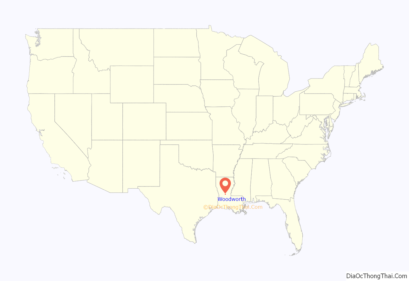
Woodworth location map. Where is Woodworth town?
History
Woodworth was established in 1942 under the Lawrason Act.
https://www.lma.org/LMA/About_LMA/Organization_Profile.aspx?id=1297
The town began with a small population here and there in the 1880’s with the first significant civilian being George Hendricks from Arkansas who allegedly built a rice farm here, but later he found himself unsuccessful and left.
But the town did not stop yet as a man named John McEnery came from New Orleans, LA and brought his railroad company (New Orleans Pacific Railroad) with him. McEnery did not have this land for long however as he later sold it and, on November 25, 1890, the 18,000 acres of land was sold to three people: C. E. Roberts, C. S. Woodworth, and Ed Rand all of whom were from neighboring Texas. The three men had yet to explore this land but yet they made the Rapides Lumber Company and a sawmill was constructed on its site. The name of this town originates from C. S. Woodworth’s name of whom the company decided the community should be named after.
Soon after the sawmill was constructed, a Missouri located company bought out positions of the lumber company being those held by C. S. Woodworth and C. E. Roberts, but Rand kept his position. Because of these transfers, the company was renamed to the Long-Bell Lumber Company of Woodworth. By the early 1900’s, the town of Woodworth had reached a population of 1,000 and many stores and churches were built, and all of this depended on the sawmill.
When the war era approached, the town still maintained good business and other job opportunities arose alongside the sawmill such as a doctor, lawyer, teacher, and store clerk. A new school was even built in 1927 but was later closed in 1963 and later became a polling station for elections. However, these opportunities did not last long as 35 years after the community began, the sawmill eventually closed down and with it, so did the local economy. In 1931, a road was completed connecting Woodworth to Alexandria, LA.
In 1942, the town was incorporated and a Civilian Conservation Camp was constructed in the nearby Alexander State Forest and so was Camp Claiborne. Camp Claiborne was one of the most important military training camps in the nation at the time and therefore it brought many new residents back into the community and beginning a new era for the town of Woodworth.
https://townofwoodworth.com/sites/default/files/THE%20VILLAGE%20OF%20WOODWORTH.pdf
Woodworth Road Map
Woodworth city Satellite Map
Geography
Woodworth is located at 31°9′23″N 92°29′41″W / 31.15639°N 92.49472°W / 31.15639; -92.49472 (31.156270, -92.494650).
According to the United States Census Bureau, the town has a total area of 4.9 square miles (13 km), of which 4.9 square miles (12.7 km) is land and 0.20% is water.
Major highways
- U.S. Route 165
- LA 3265
Interstate 49
Climate
This climatic region is typified by relatively small seasonal temperature differences, with warm to hot (and often humid) summers and mild winters. According to the Köppen Climate Classification system, Woodworth has a humid subtropical climate, abbreviated “Cfa” on climate maps.
See also
Map of Louisiana State and its subdivision:- Acadia
- Allen
- Ascension
- Assumption
- Avoyelles
- Beauregard
- Bienville
- Bossier
- Caddo
- Calcasieu
- Caldwell
- Cameron
- Catahoula
- Claiborne
- Concordia
- De Soto
- East Baton Rouge
- East Carroll
- East Feliciana
- Evangeline
- Franklin
- Grant
- Iberia
- Iberville
- Jackson
- Jefferson
- Jefferson Davis
- La Salle
- Lafayette
- Lafourche
- Lincoln
- Livingston
- Madison
- Morehouse
- Natchitoches
- Orleans
- Ouachita
- Plaquemines
- Pointe Coupee
- Rapides
- Red River
- Richland
- Sabine
- Saint Bernard
- Saint Charles
- Saint Helena
- Saint James
- Saint John the Baptist
- Saint Landry
- Saint Martin
- Saint Mary
- Saint Tammany
- Tangipahoa
- Tensas
- Terrebonne
- Union
- Vermilion
- Vernon
- Washington
- Webster
- West Baton Rouge
- West Carroll
- West Feliciana
- Winn
- Alabama
- Alaska
- Arizona
- Arkansas
- California
- Colorado
- Connecticut
- Delaware
- District of Columbia
- Florida
- Georgia
- Hawaii
- Idaho
- Illinois
- Indiana
- Iowa
- Kansas
- Kentucky
- Louisiana
- Maine
- Maryland
- Massachusetts
- Michigan
- Minnesota
- Mississippi
- Missouri
- Montana
- Nebraska
- Nevada
- New Hampshire
- New Jersey
- New Mexico
- New York
- North Carolina
- North Dakota
- Ohio
- Oklahoma
- Oregon
- Pennsylvania
- Rhode Island
- South Carolina
- South Dakota
- Tennessee
- Texas
- Utah
- Vermont
- Virginia
- Washington
- West Virginia
- Wisconsin
- Wyoming
