Henderson Point is a census-designated place (CDP) in Harrison County, Mississippi, United States. It is part of the Gulfport–Biloxi Metropolitan Statistical Area. The population was 170 at the 2010 census.
| Name: | Henderson Point CDP |
|---|---|
| LSAD Code: | 57 |
| LSAD Description: | CDP (suffix) |
| State: | Mississippi |
| County: | Harrison County |
| Elevation: | 5 ft (2 m) |
| Total Area: | 1.15 sq mi (2.99 km²) |
| Land Area: | 1.06 sq mi (2.76 km²) |
| Water Area: | 0.09 sq mi (0.23 km²) |
| Total Population: | 232 |
| Population Density: | 217.84/sq mi (84.10/km²) |
| FIPS code: | 2831540 |
Online Interactive Map
Click on ![]() to view map in "full screen" mode.
to view map in "full screen" mode.
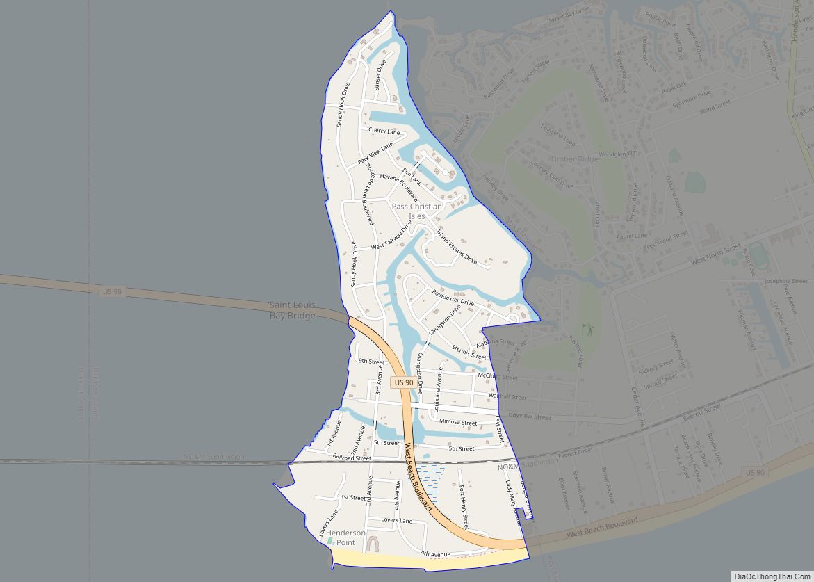
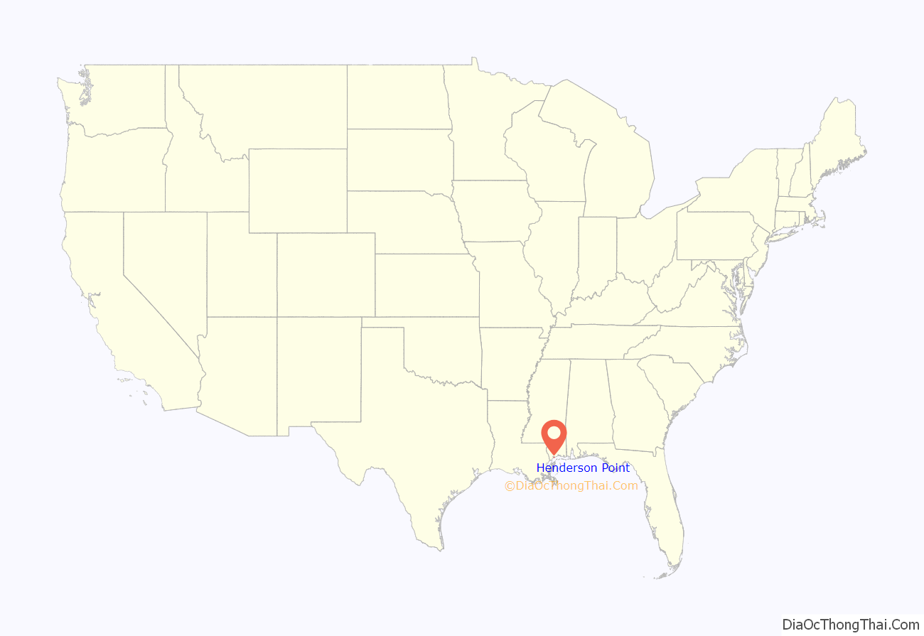
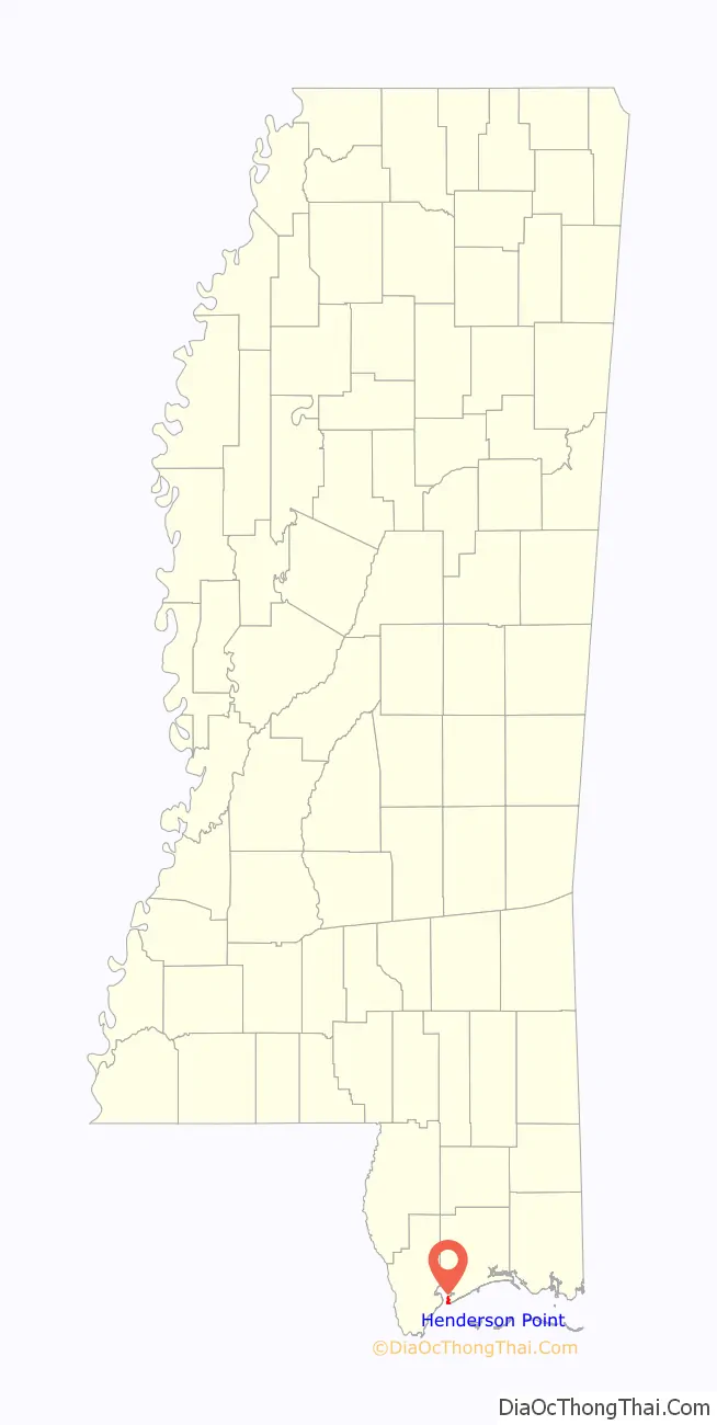
Henderson Point location map. Where is Henderson Point CDP?
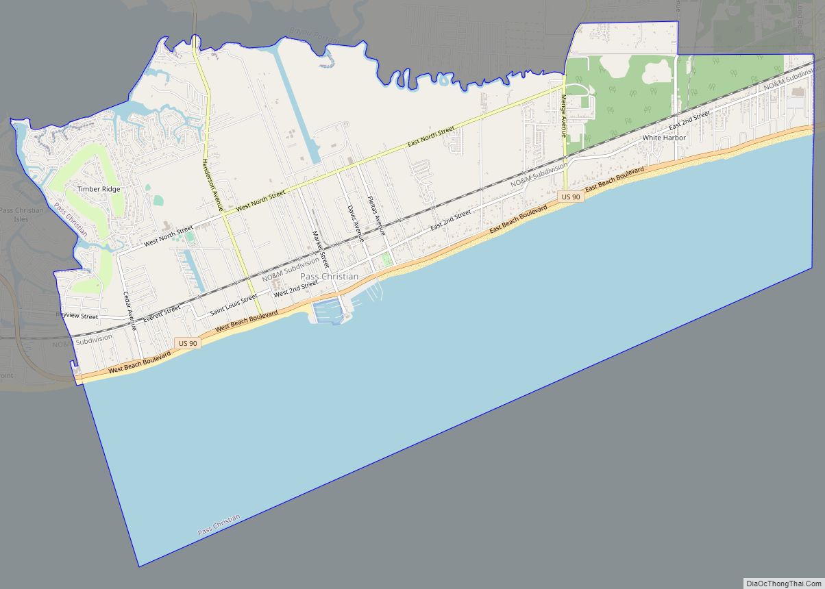
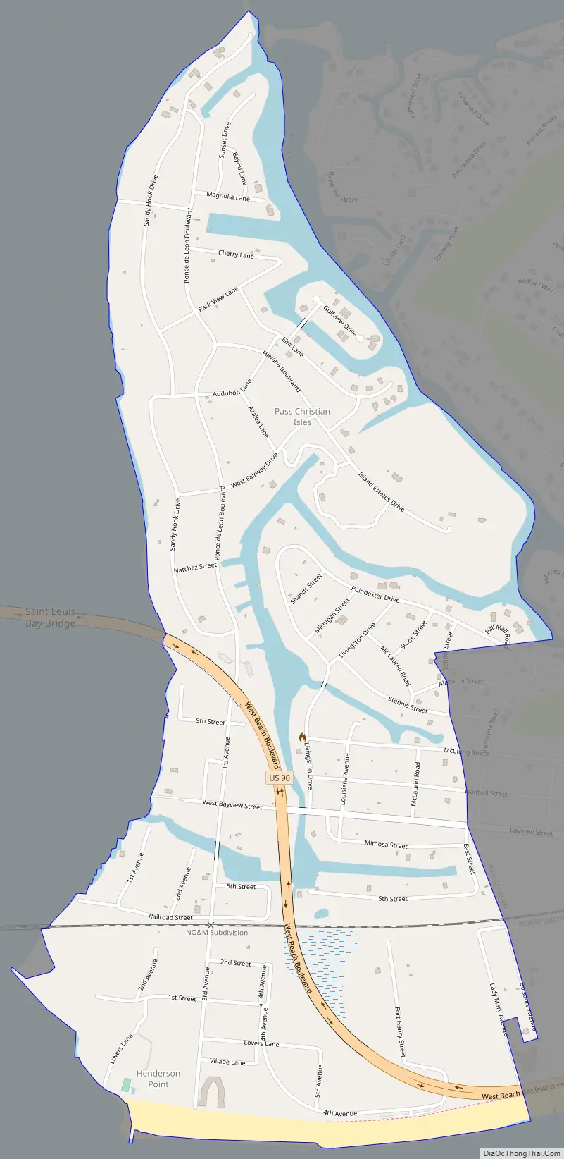
Henderson Point Road Map
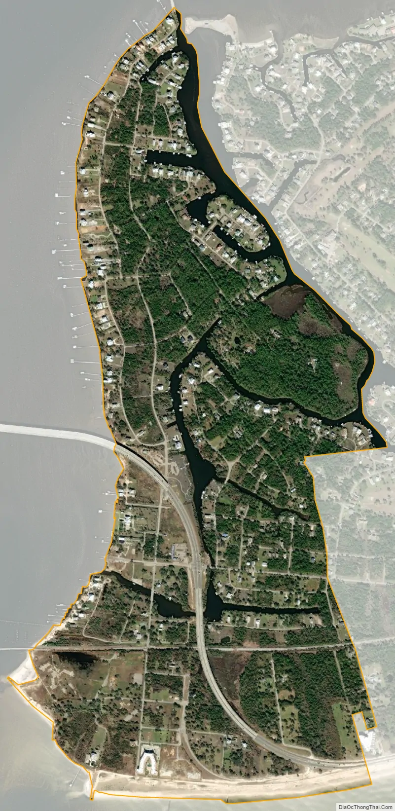
Henderson Point city Satellite Map
Geography
Henderson Point is located at the end of a peninsula along the edge of the Gulf of Mexico. It is bordered by St. Louis Bay to the west and north, the Gulf of Mexico to the south, and the city of Pass Christian to the east. Henderson Point is the site of the east end of the Bay St. Louis Bridge, which carries U.S. Route 90 across St. Louis Bay to the city of Bay St. Louis in Hancock County.
According to the United States Census Bureau, the CDP has a total area of 1.2 square miles (3.0 km), of which 1.0 square mile (2.7 km) is land and 0.12 square miles (0.3 km), or 8.64%, is water.
See also
Map of Mississippi State and its subdivision:- Adams
- Alcorn
- Amite
- Attala
- Benton
- Bolivar
- Calhoun
- Carroll
- Chickasaw
- Choctaw
- Claiborne
- Clarke
- Clay
- Coahoma
- Copiah
- Covington
- Desoto
- Forrest
- Franklin
- George
- Greene
- Grenada
- Hancock
- Harrison
- Hinds
- Holmes
- Humphreys
- Issaquena
- Itawamba
- Jackson
- Jasper
- Jefferson
- Jefferson Davis
- Jones
- Kemper
- Lafayette
- Lamar
- Lauderdale
- Lawrence
- Leake
- Lee
- Leflore
- Lincoln
- Lowndes
- Madison
- Marion
- Marshall
- Monroe
- Montgomery
- Neshoba
- Newton
- Noxubee
- Oktibbeha
- Panola
- Pearl River
- Perry
- Pike
- Pontotoc
- Prentiss
- Quitman
- Rankin
- Scott
- Sharkey
- Simpson
- Smith
- Stone
- Sunflower
- Tallahatchie
- Tate
- Tippah
- Tishomingo
- Tunica
- Union
- Walthall
- Warren
- Washington
- Wayne
- Webster
- Wilkinson
- Winston
- Yalobusha
- Yazoo
- Alabama
- Alaska
- Arizona
- Arkansas
- California
- Colorado
- Connecticut
- Delaware
- District of Columbia
- Florida
- Georgia
- Hawaii
- Idaho
- Illinois
- Indiana
- Iowa
- Kansas
- Kentucky
- Louisiana
- Maine
- Maryland
- Massachusetts
- Michigan
- Minnesota
- Mississippi
- Missouri
- Montana
- Nebraska
- Nevada
- New Hampshire
- New Jersey
- New Mexico
- New York
- North Carolina
- North Dakota
- Ohio
- Oklahoma
- Oregon
- Pennsylvania
- Rhode Island
- South Carolina
- South Dakota
- Tennessee
- Texas
- Utah
- Vermont
- Virginia
- Washington
- West Virginia
- Wisconsin
- Wyoming