Leonia is a borough in Bergen County, in the U.S. state of New Jersey. As of the 2020 United States census, the borough’s population was 9,304, an increase of 367 (+4.1%) from the 2010 census count of 8,937, which in turn reflected an increase of 23 (+0.3%) from the 8,914 counted in the 2000 census. The borough is a suburb of New York City located near the western approach to the George Washington Bridge.
Leonia was formed as the result of a referendum passed on December 5, 1894, from portions of Ridgefield Township. The borough was formed during the “boroughitis” phenomenon then sweeping through Bergen County, in which 26 boroughs were formed in the county in 1894 alone. Portions of Leonia were taken on February 19, 1895, to form the Township of Teaneck.
New Jersey Monthly magazine ranked Leonia as its 31st best place to live in its 2008 rankings of the “Best Places To Live” in New Jersey.
| Name: | Leonia borough |
|---|---|
| LSAD Code: | 21 |
| LSAD Description: | borough (suffix) |
| State: | New Jersey |
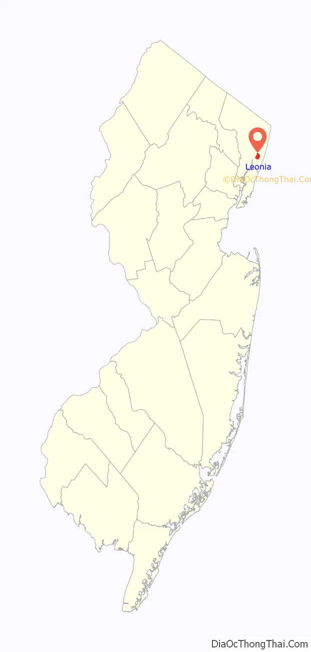
| County: | Bergen County |
| Incorporated: | December 5, 1894 |
| Elevation: | 85 ft (26 m) |
| Total Area: | 1.63 sq mi (4.22 km²) |
| Land Area: | 1.52 sq mi (3.94 km²) |
| Water Area: | 0.11 sq mi (0.27 km²) 6.50% |
| Total Population: | 9,304 |
| Population Density: | 6,109.0/sq mi (2,358.7/km²) |
| ZIP code: | 07605 |
| Area code: | 201 |
| FIPS code: | 3440020 |
| GNISfeature ID: | 0885276 |
| Website: | www.leonianj.gov |
Online Interactive Map
Click on ![]() to view map in "full screen" mode.
to view map in "full screen" mode.
Leonia location map. Where is Leonia borough?

History
The original inhabitants of Leonia were the Hackensack tribe (Ashkineshacky) of Native Americans. The population was about 1,000 before the Europeans settled in the area. At the time of the American Revolutionary War, Leonia was known as part of the English Neighborhood, a name that survives in neighboring Englewood. It was settled in 1668 mainly by Dutch and English farmers, making it one of the oldest communities in the state and county. A third of the population was African slaves. It was located on the western slope of the Palisades, and started as a quiet farming community. Leonia’s proximity to New York City and its major universities, theaters and performing venues contributed to Leonia’s place in the world of art and academics, with many artists and leading thinkers finding a home there in the twentieth century.
The local economy that had been focused on agriculture underwent economic and cultural growth during the late nineteenth century, marked by the introduction of train service and was originally called West Fort Lee. J. Vreeland Moore and other town leaders chose the name “Leonia” in 1865 in honor of American Revolutionary War General Charles Lee, for whom Fort Lee was named.
After traveling through Leonia upon arriving in New Jersey by ferry at Edgewater in 1899, advertising executive Artemus Ward purchased a large piece of land and established the Leonia Heights Land Company to develop and market housing in the community. His advertising attracted many academics and artists who were drawn to Leonia’s small size, culture, and location, earning the town’s nickname of the “Athens of New Jersey”.
In 1915, the Leonia School of Illustration was established by Harvey Dunn, fostering the artists’ colony that subsequently emerged over the next decade. By the 1930s, it had the highest number of residents, per capita, in Who’s Who in America and 80% of its residents were college graduates. Transportation through the borough was enhanced with access to ferries and trolley systems and Leonia became a refuge for many of America’s most creative thinkers which included five Nobel Prize winners.
For 200 years, one of the two major avenues that run north-to-south through Leonia, Grand Avenue (the other one is Broad Avenue) was called the English Neighborhood Road. In colonial times, this road served as the main inland route between Paulus Hook, Bergen, and the English Neighborhood. Leonia was a crossroads of the American Revolution and a training ground for American Civil War soldiers.
Historic places in the town include the Civil War Drill Hall and Armory and the Cole-Allaire House, constructed around 1765, making it the oldest dwelling in the borough, and placed on the National Register of Historic Places in 1976. The Vreeland House, constructed in 1786 by Dirck Vreeland and expanded in 1815, was added to the National Register of Historic Places in 1978.
Leonia celebrates “Leonia Day” annually on the third Sunday in May.
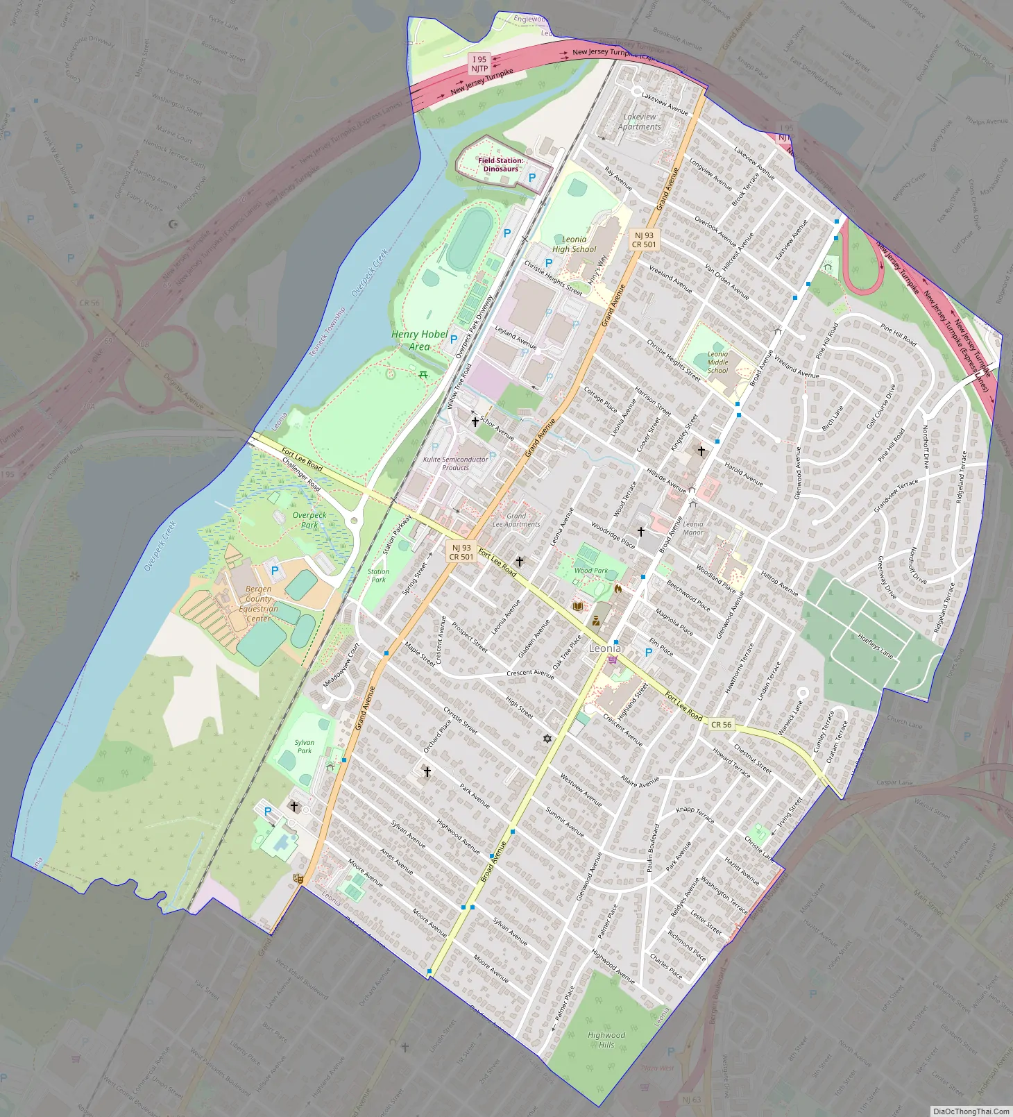
Leonia Road Map
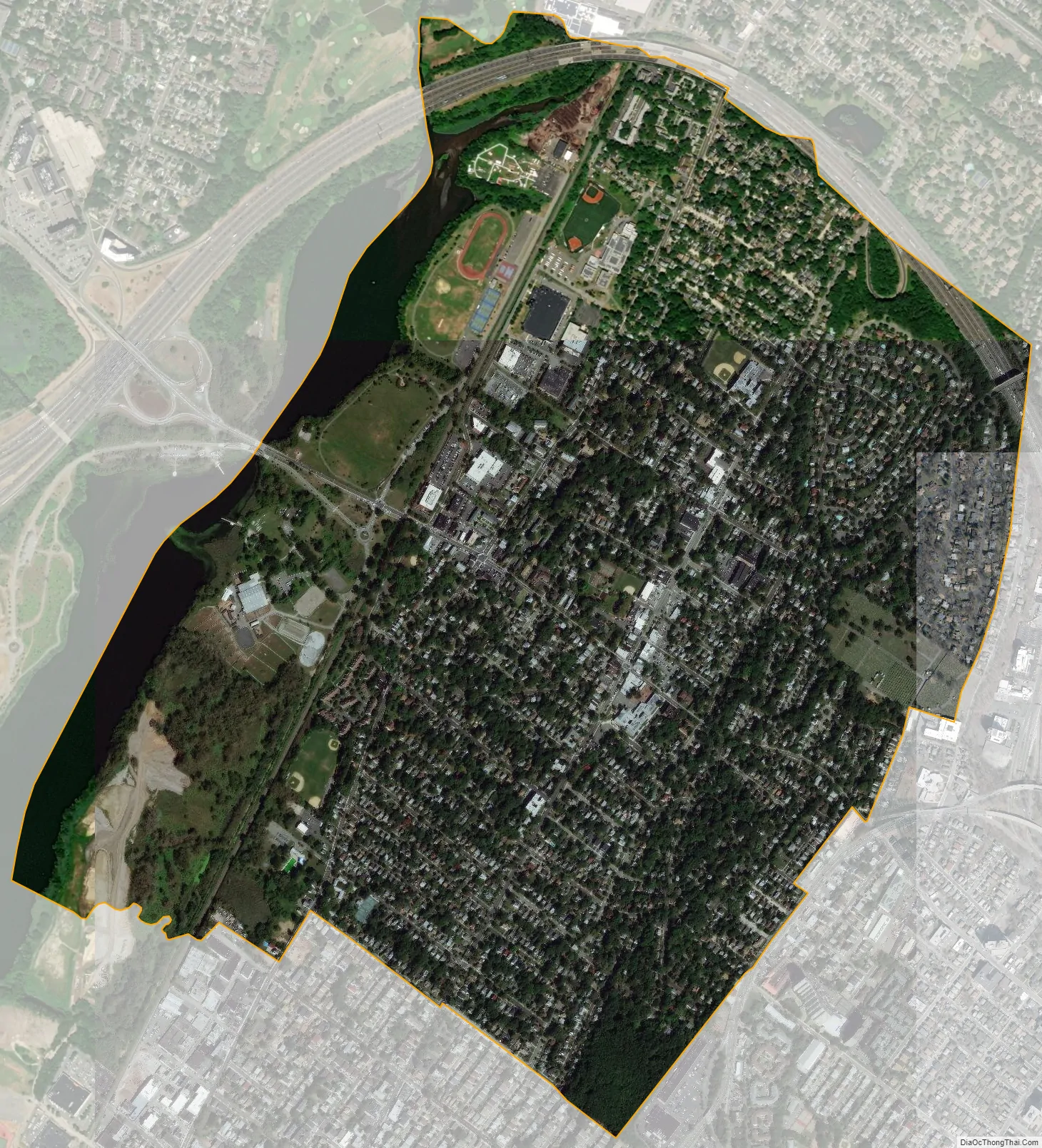
Leonia city Satellite Map
Geography
According to the United States Census Bureau, the borough had a total area of 1.63 square miles (4.22 km), including 1.52 square miles (3.94 km) of land and 0.11 square miles (0.27 km) of water (6.50%).
While the borough center’s elevation is 115 feet (35 m), the western part of the borough can reach 5 feet (1.5 m) and the eastern part of Leonia reaches 318 feet (97 m).
The borough borders the Bergen County municipalities of Englewood, Fort Lee, Palisades Park, Ridgefield Park and Teaneck.
Leonia is designated as a Tree City USA, receiving its 21st annual recognition in 2010 from the National Arbor Day Foundation.
See also
Map of New Jersey State and its subdivision: Map of other states:- Alabama
- Alaska
- Arizona
- Arkansas
- California
- Colorado
- Connecticut
- Delaware
- District of Columbia
- Florida
- Georgia
- Hawaii
- Idaho
- Illinois
- Indiana
- Iowa
- Kansas
- Kentucky
- Louisiana
- Maine
- Maryland
- Massachusetts
- Michigan
- Minnesota
- Mississippi
- Missouri
- Montana
- Nebraska
- Nevada
- New Hampshire
- New Jersey
- New Mexico
- New York
- North Carolina
- North Dakota
- Ohio
- Oklahoma
- Oregon
- Pennsylvania
- Rhode Island
- South Carolina
- South Dakota
- Tennessee
- Texas
- Utah
- Vermont
- Virginia
- Washington
- West Virginia
- Wisconsin
- Wyoming


