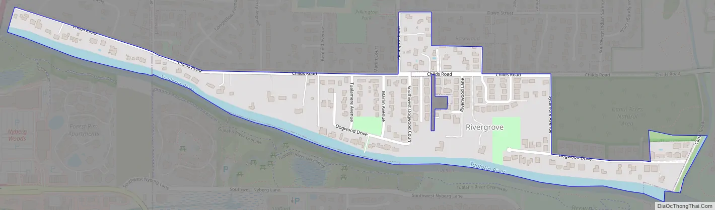
Rivergrove is a city in Clackamas County, Oregon, United States. A small portion of the city extends into nearby Washington County. Its name is a portmanteau of the Tualatin River, which forms its southern border, and Lake Grove, a community that is now part of Lake Oswego. The population was 370 at the 2010 census.
| Name: | Rivergrove city |
|---|---|
| LSAD Code: | 25 |
| LSAD Description: | city (suffix) |
| State: | Oregon |
| County: | Clackamas County, Washington County |
| Incorporated: | 1971 |
| Elevation: | 132 ft (40 m) |
| Total Area: | 0.18 sq mi (0.46 km²) |
| Land Area: | 0.17 sq mi (0.45 km²) |
| Water Area: | 0.01 sq mi (0.01 km²) |
| Total Population: | 545 |
| Population Density: | 3,150.29/sq mi (1,215.50/km²) |
| ZIP code: | 97035 |
| Area code: | 503 and 971 |
| FIPS code: | 4162250 |
| GNISfeature ID: | 1136685 |
| Website: | www.cityofrivergrove.org |
Online Interactive Map
Click on ![]() to view map in "full screen" mode.
to view map in "full screen" mode.
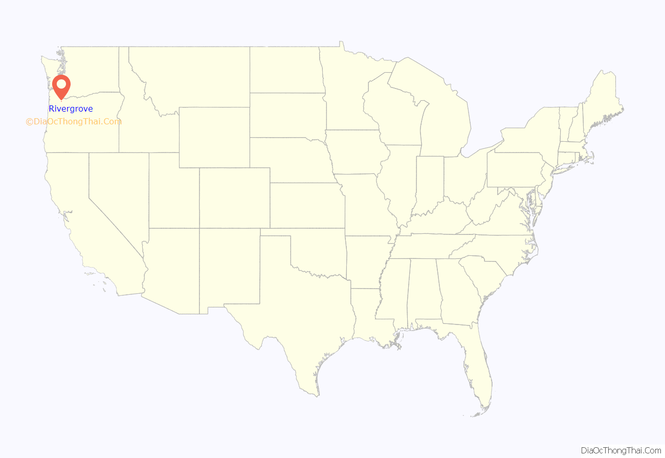
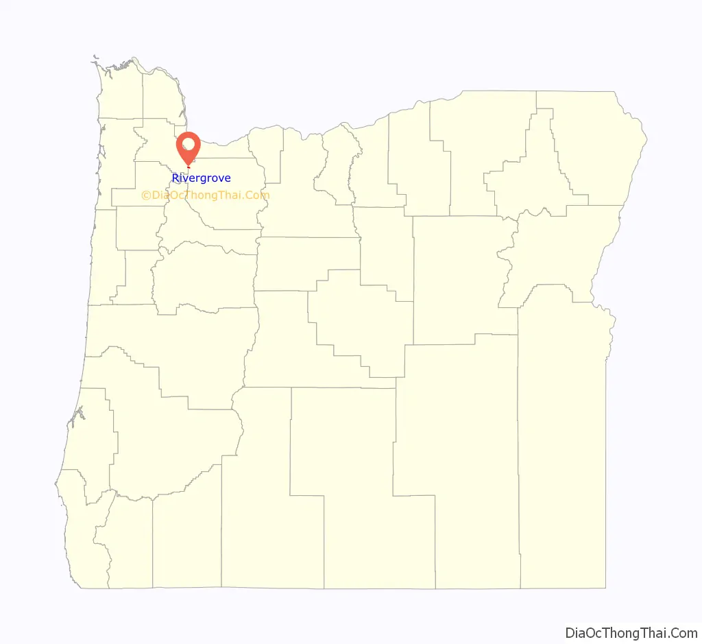
Rivergrove location map. Where is Rivergrove city?
History
Rivergrove came into existence January 27, 1971, after a vote of 57 to 48 in favor of incorporation.
Rivergrove Road Map
Rivergrove city Satellite Map

Geography
According to the United States Census Bureau, the city has a total area of 0.16 square miles (0.41 km), all land.
There is a significant amount of environmentally sensitive land in the city; floodway, floodplains, wetlands and other water quality resource areas.
See also
Map of Oregon State and its subdivision: Map of other states:- Alabama
- Alaska
- Arizona
- Arkansas
- California
- Colorado
- Connecticut
- Delaware
- District of Columbia
- Florida
- Georgia
- Hawaii
- Idaho
- Illinois
- Indiana
- Iowa
- Kansas
- Kentucky
- Louisiana
- Maine
- Maryland
- Massachusetts
- Michigan
- Minnesota
- Mississippi
- Missouri
- Montana
- Nebraska
- Nevada
- New Hampshire
- New Jersey
- New Mexico
- New York
- North Carolina
- North Dakota
- Ohio
- Oklahoma
- Oregon
- Pennsylvania
- Rhode Island
- South Carolina
- South Dakota
- Tennessee
- Texas
- Utah
- Vermont
- Virginia
- Washington
- West Virginia
- Wisconsin
- Wyoming


