Banks is a city in Washington County, Oregon, United States which is located in the Tualatin Valley. It is the southern anchor to the Banks–Vernonia State Trail, which is a 21-mile (34 km) long linear trail popular with bicyclists, hikers, and equestrians. The population was 1,777 at the 2010 census. The community was named for John and Nancy Banks, who owned a nearby dairy farm. Incorporated in 1921, it is located in the western part of the county where Oregon Route 6 intersects Oregon Route 47.
| Name: | Banks city |
|---|---|
| LSAD Code: | 25 |
| LSAD Description: | city (suffix) |
| State: | Oregon |
| County: | Washington County |
| Incorporated: | January 16, 1906 |
| Elevation: | 250 ft (80 m) |
| Total Area: | 0.76 sq mi (1.97 km²) |
| Land Area: | 0.76 sq mi (1.97 km²) |
| Water Area: | 0.00 sq mi (0.00 km²) |
| Total Population: | 1,837 |
| Population Density: | 2,410.76/sq mi (931.32/km²) |
| ZIP code: | 97106, 97109, 97125 |
| Area code: | 503 |
| FIPS code: | 4103850 |
| GNISfeature ID: | 1157952 |
| Website: | www.cityofbanks.org |
Online Interactive Map
Click on ![]() to view map in "full screen" mode.
to view map in "full screen" mode.
Banks location map. Where is Banks city?
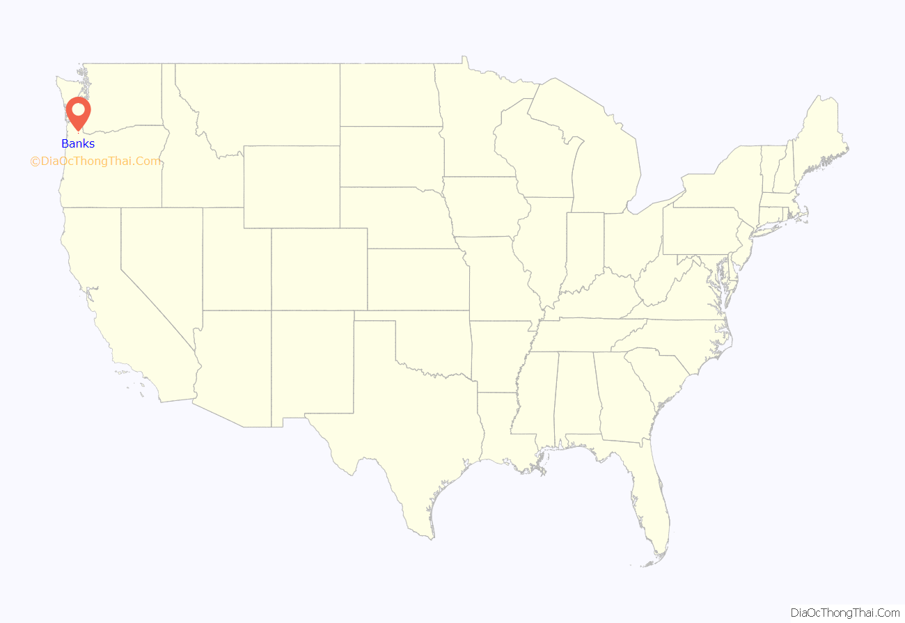
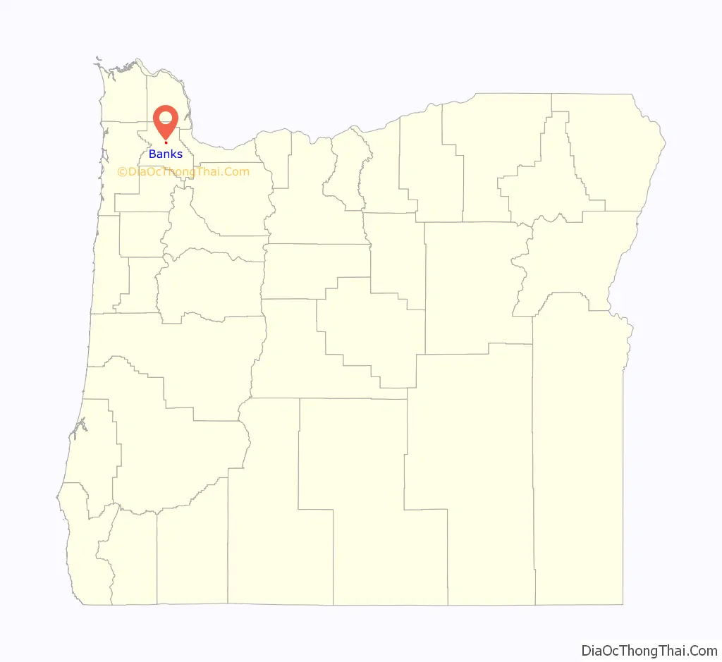
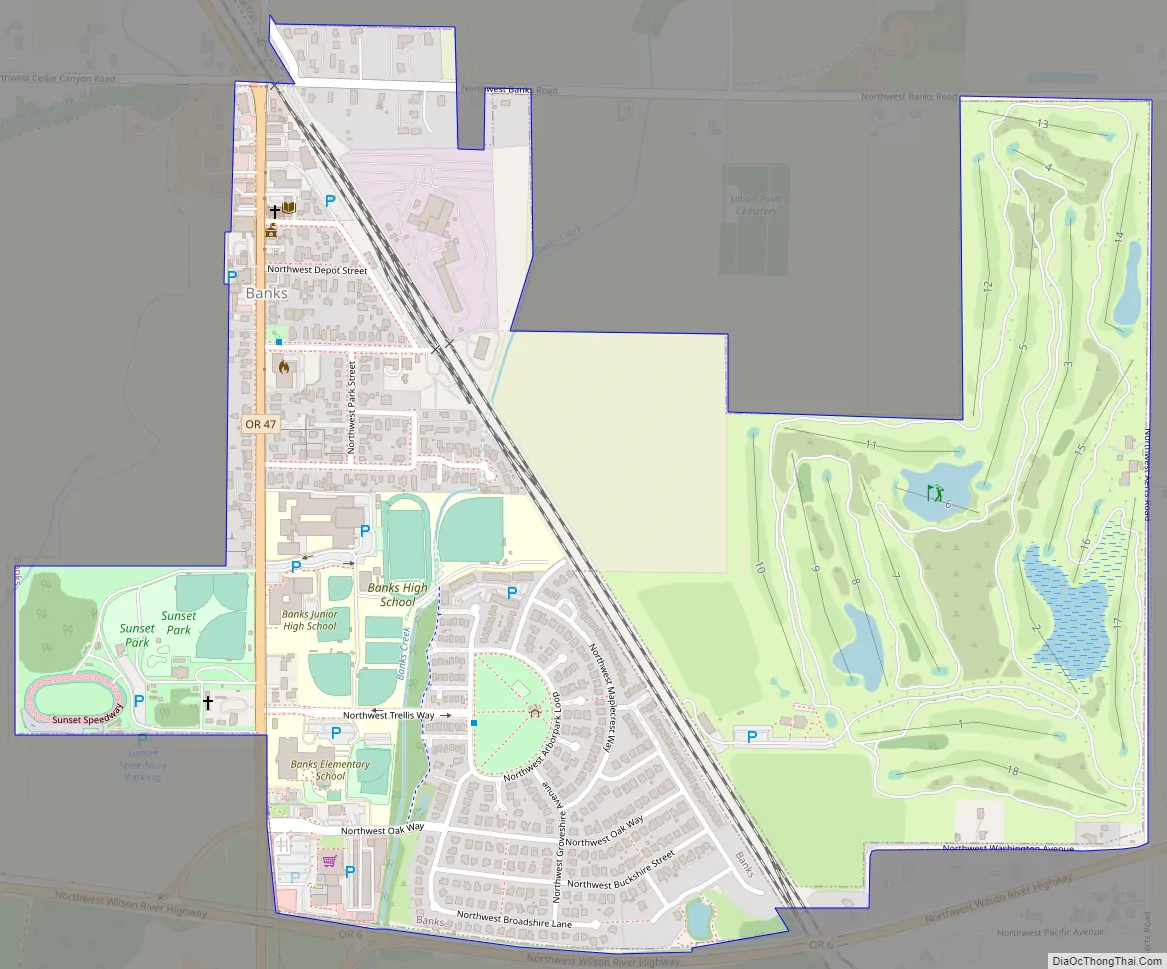
Banks Road Map
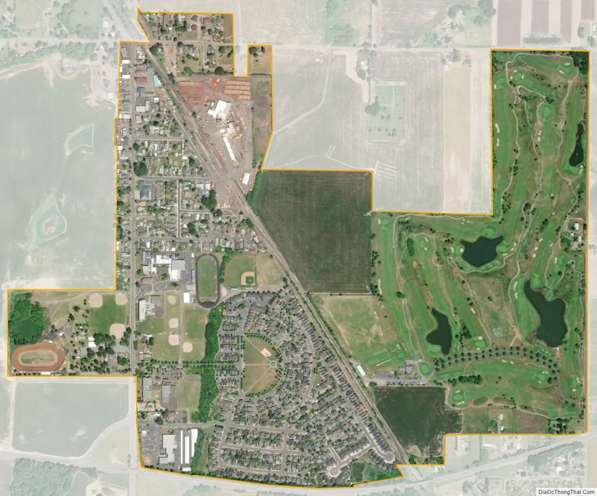
Banks city Satellite Map
Geography
According to the United States Census Bureau, the city has a total area of 0.37 square miles (0.96 km), all land.
See also
Map of Oregon State and its subdivision: Map of other states:- Alabama
- Alaska
- Arizona
- Arkansas
- California
- Colorado
- Connecticut
- Delaware
- District of Columbia
- Florida
- Georgia
- Hawaii
- Idaho
- Illinois
- Indiana
- Iowa
- Kansas
- Kentucky
- Louisiana
- Maine
- Maryland
- Massachusetts
- Michigan
- Minnesota
- Mississippi
- Missouri
- Montana
- Nebraska
- Nevada
- New Hampshire
- New Jersey
- New Mexico
- New York
- North Carolina
- North Dakota
- Ohio
- Oklahoma
- Oregon
- Pennsylvania
- Rhode Island
- South Carolina
- South Dakota
- Tennessee
- Texas
- Utah
- Vermont
- Virginia
- Washington
- West Virginia
- Wisconsin
- Wyoming