Grand Terrace is a city in San Bernardino County, California, United States. The population was 12,040 at the 2010 census, up from 11,626 at the 2000 census. Grand Terrace is located between Highgrove and Colton, along the I-215 and Agua Mansa industrial corridors. The city is located between two mountain ridges: Blue Mountain to the east and the La Loma Hills to the west.
| Name: | Grand Terrace city |
|---|---|
| LSAD Code: | 25 |
| LSAD Description: | city (suffix) |
| State: | California |
| County: | San Bernardino County |
| Incorporated: | November 30, 1978 |
| Elevation: | 1,063 ft (324 m) |
| Total Area: | 3.50 sq mi (9.08 km²) |
| Land Area: | 3.50 sq mi (9.08 km²) |
| Water Area: | 0.00 sq mi (0.00 km²) 0% |
| Total Population: | 13,150 |
| Population Density: | 3,590.30/sq mi (1,386.33/km²) |
| ZIP code: | 92313 |
| Area code: | 909 |
| FIPS code: | 0630658 |
| GNISfeature ID: | 1660692 |
| Website: | www.grandterrace-ca.gov |
Online Interactive Map
Click on ![]() to view map in "full screen" mode.
to view map in "full screen" mode.
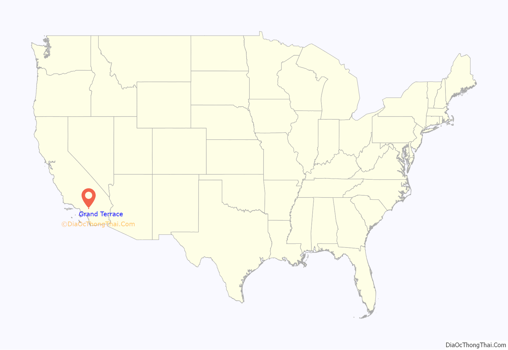
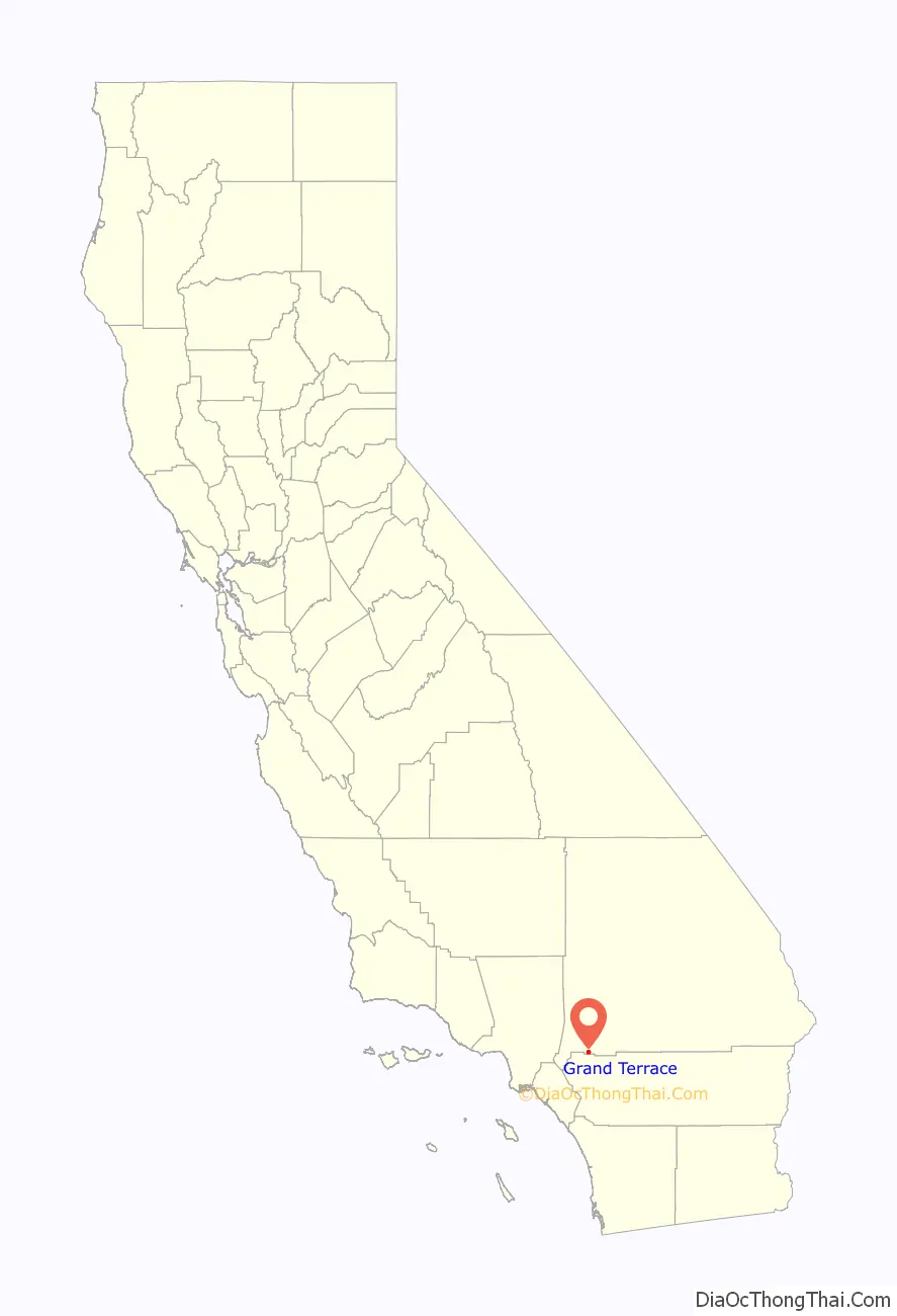
Grand Terrace location map. Where is Grand Terrace city?
History
Grand Terrace’s roots go back to Mexican land grants dating from the period between 1830 and 1840. Mormon settlers came shortly after, arriving in the San Bernardino Valley, during the 1850s. According to the Riverside Press, in 1876, there were nine buildings in the Terrace-Colton area. Originally, the area was simply referred to as “the Terrace”, but the word “Grand” was added around 1898 due to the beautiful views which surround the city. In 1905, Seventh-day Adventists, whose medical university is now located in nearby Loma Linda, settled in the area. Grand Terrace, at the time known as “South Colton”, experienced continued growth and development during the Southern California suburbia and sunbelt periods in the late half of the 20th century.
The development of Grand Terrace, or East Riverside, as the Grand Terrace-Highgrove area was called, became a reality with the construction of the Gage Canal. This 22-1/2-mile canal, built at a cost of 2 million dollars, brought water from the Santa Ana River marshlands below The Terrace. With plenty of irrigation water, Grand Terrace rapidly became an agricultural community featuring fine, quality citrus. However, the severe “freeze” of 1913 destroyed many groves. Walnuts, a hardier tree, were planted as replacements along with peaches as a quick-profit crop.
The social activities in the early 1900s centered around the Farm Bureau Extension Service and the Women’s Club, followed by the PTA, in the 1930s. Since there were no local churches, people traveled to surrounding communities for worship and other church activities.
In 1962, the Grand Terrace Chamber of Commerce was organized. From the very beginning the Chamber was interested in preserving the local identity of the area, and therefore, was a strong supporter of cityhood. This group did much of the groundwork, which led to the formation of a local governing body in 1976, which was called the Municipal Advisory Council or MAC. After nearly two years of meetings and negotiations with the county, the residents went to the polls to decide the issue of cityhood. The response was an 82% vote for incorporation. On November 30, 1978, the Charter City Council was installed at Terrace Hills Junior High and Grand Terrace officially became the 16th city in San Bernardino County.
Grand Terrace was named one of the “Top 100 Cities to Live In” by Money magazine in 2007.
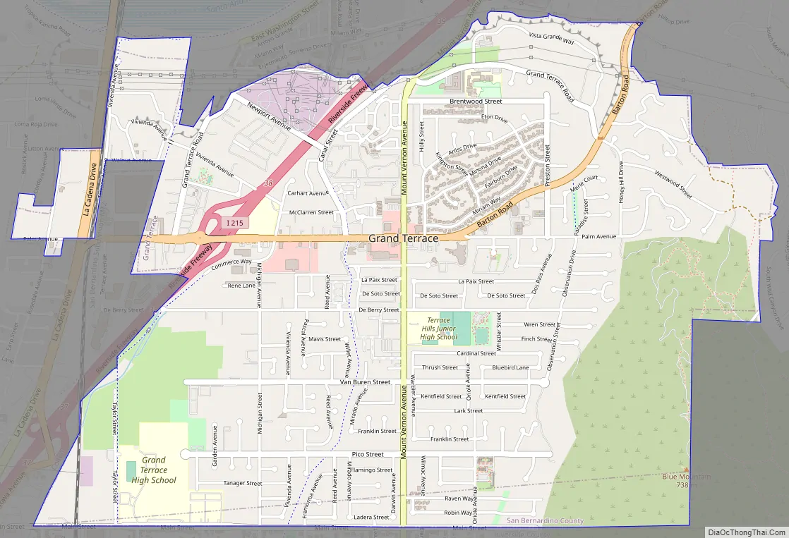
Grand Terrace Road Map
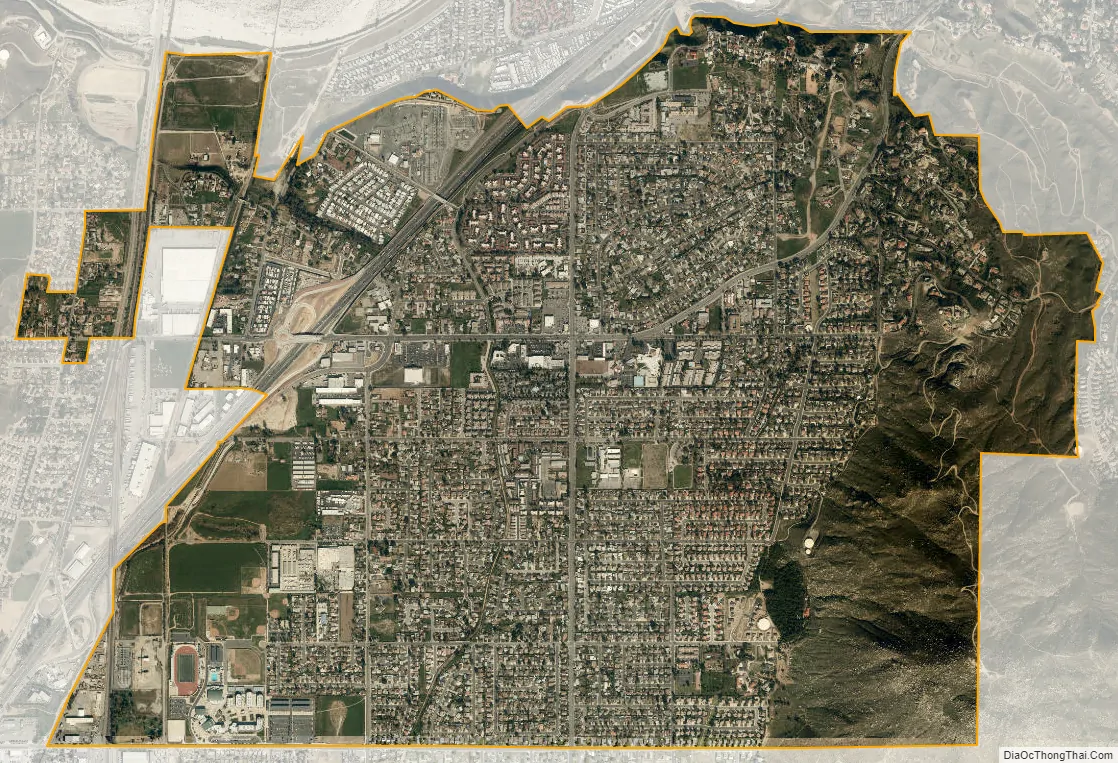
Grand Terrace city Satellite Map
Geography
Grand Terrace is located at 34°1′52″N 117°19′0″W / 34.03111°N 117.31667°W / 34.03111; -117.31667 (34.031019, -117.316683).
According to the United States Census Bureau, the city has a total area of 3.5 square miles (9.1 km), all land.
See also
Map of California State and its subdivision:- Alameda
- Alpine
- Amador
- Butte
- Calaveras
- Colusa
- Contra Costa
- Del Norte
- El Dorado
- Fresno
- Glenn
- Humboldt
- Imperial
- Inyo
- Kern
- Kings
- Lake
- Lassen
- Los Angeles
- Madera
- Marin
- Mariposa
- Mendocino
- Merced
- Modoc
- Mono
- Monterey
- Napa
- Nevada
- Orange
- Placer
- Plumas
- Riverside
- Sacramento
- San Benito
- San Bernardino
- San Diego
- San Francisco
- San Joaquin
- San Luis Obispo
- San Mateo
- Santa Barbara
- Santa Clara
- Santa Cruz
- Shasta
- Sierra
- Siskiyou
- Solano
- Sonoma
- Stanislaus
- Sutter
- Tehama
- Trinity
- Tulare
- Tuolumne
- Ventura
- Yolo
- Yuba
- Alabama
- Alaska
- Arizona
- Arkansas
- California
- Colorado
- Connecticut
- Delaware
- District of Columbia
- Florida
- Georgia
- Hawaii
- Idaho
- Illinois
- Indiana
- Iowa
- Kansas
- Kentucky
- Louisiana
- Maine
- Maryland
- Massachusetts
- Michigan
- Minnesota
- Mississippi
- Missouri
- Montana
- Nebraska
- Nevada
- New Hampshire
- New Jersey
- New Mexico
- New York
- North Carolina
- North Dakota
- Ohio
- Oklahoma
- Oregon
- Pennsylvania
- Rhode Island
- South Carolina
- South Dakota
- Tennessee
- Texas
- Utah
- Vermont
- Virginia
- Washington
- West Virginia
- Wisconsin
- Wyoming


