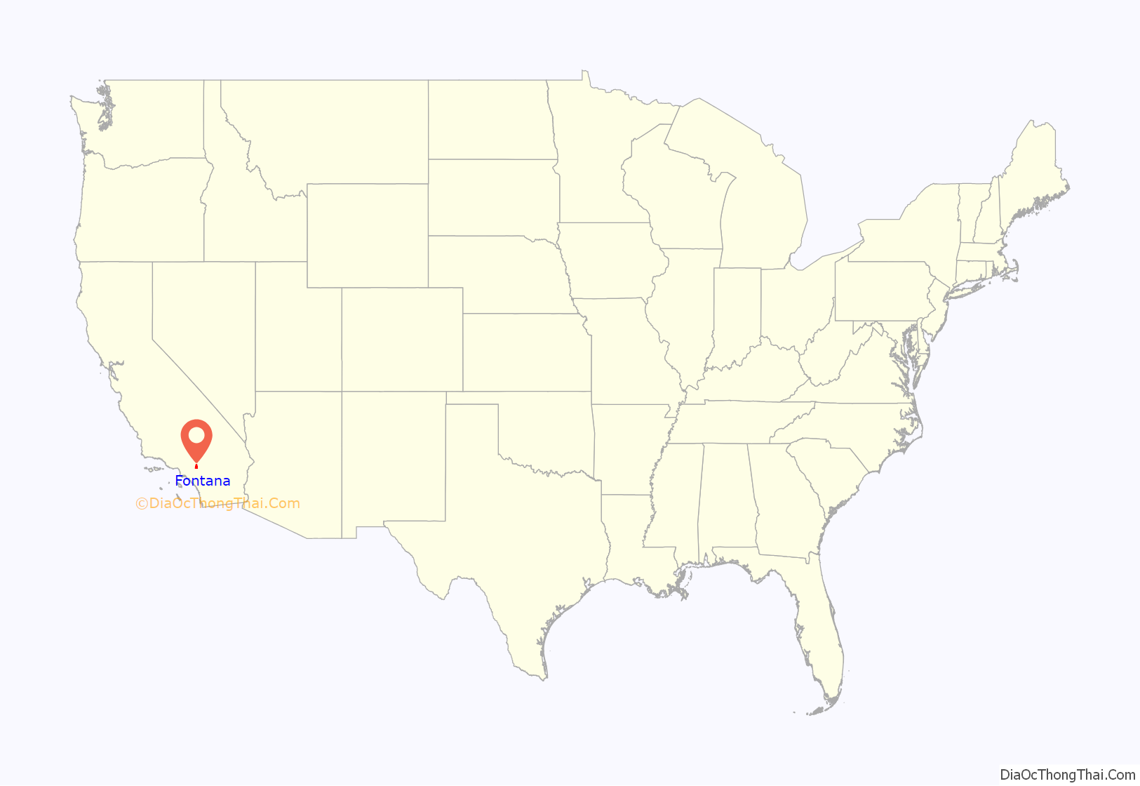
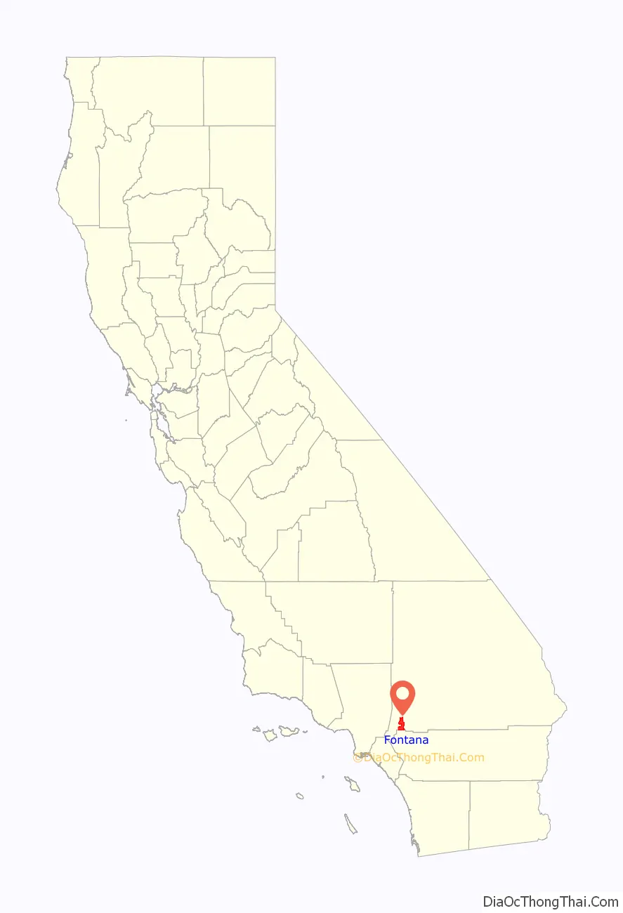
Fontana is a city in San Bernardino County, California, United States. Founded by Azariel Blanchard Miller in 1913, it remained essentially rural until World War II, when entrepreneur Henry J. Kaiser built a large steel mill in the area. It is now a regional hub of the trucking industry, with the east–west Interstate 10 and State Route 210 crossing the city and Interstate 15 passing diagonally through its northwestern quadrant. The city is about 46 miles east of Los Angeles.
It is home to a renovated historic theater, a municipal park, and the Auto Club Speedway, which is on the site of the old Kaiser Steel Mill just outside the city. Fontana also hosts the Fontana Days Half Marathon and 5K run. This race is the fastest half-marathon course in the world.
The United States Census Bureau reported that Fontana’s 2020 population was 212,704, making it the second-most-populous city in San Bernardino County and the 21st largest in the state.
| Name: | Fontana city |
|---|---|
| LSAD Code: | 25 |
| LSAD Description: | city (suffix) |
| State: | California |
| County: | San Bernardino County |
| Founded: | 1913 |
| Incorporated: | June 25, 1952 |
| Elevation: | 1,237 ft (377 m) |
| Total Area: | 43.07 sq mi (111.55 km²) |
| Land Area: | 43.07 sq mi (111.55 km²) |
| Water Area: | 0.00 sq mi (0.00 km²) 3% |
| Total Population: | 212,704 |
| Population Density: | 4,838.47/sq mi (1,868.16/km²) |
| ZIP code: | 92331, 92334-92337 |
| FIPS code: | 0624680 |
| Website: | fontana.org |
Online Interactive Map
Click on ![]() to view map in "full screen" mode.
to view map in "full screen" mode.
Fontana location map. Where is Fontana city?
History
Fontana was founded in 1919 by Azariel Blanchard Miller. The name fontana is Italian for fountain or water source, being in close proximity to the Santa Ana River to the east. Within a few years it became an agricultural town of citrus orchards, vineyards and chicken ranches and astride U.S. Route 66 (now known as Foothill Boulevard). The Fontana area was radically transformed during World War II when Henry J. Kaiser built the Kaiser Steel plant, at the time one of only two steel mills west of the Mississippi River outside the city limits. To provide for the plant workers’ health needs, Henry J. Kaiser constructed the Fontana Kaiser Permanente medical facility, now the largest managed care organization in the United States.
In the 1950s and 1960s, Fontana was home to a drag racing strip that was a venue in the NHRA circuit. Mickey Thompson’s Fontana International Dragway was also referred to as Fontana Drag City or Fontana Drag Strip. The original Fontana strip is gone, but the owners of NASCAR’s new Auto Club Speedway opened a NHRA-sanctioned drag strip just oustside Fontana in mid-2006.
Ro-Val’s automobile museum, located on Foothill Boulevard on the western outskirts between Fontana and Cucamonga, was the home for many classic automobiles of the 1920s and 1930s, including a huge vehicle once owned by screen actor Fatty Arbuckle. When the Ro-Val museum closed, the vehicles were sold to Bill Harrah, a Nevada casino owner and automobile collector, who placed them on display in the museum located at his casino.
In 2000, the city had a total population of 128,929; by 2020 the city had 212,704 residents. This rapid growth has had much to do with the numerous large, new residential developments in the sparsely populated northern part of the city, as well as with the city’s aggressive (and highly successful) campaign to annex several unincorporated, but developed, San Bernardino County areas in 2006–2007.
Environmental issues
In 2019 the California Air Resources Board advised the City against housing people within 1,000 feet of industrial warehouses because of harmful truck pollution. The city was also sued by San Bernardino County, the Center for Biological Diversity, the Sierra Club and the Center for Community Action and Environmental Justice over the approval of West Valley Logistics Center for violating state environmental laws.
In 2021, the City was sued by the State of California Attorney General’s office for violation of the California Environmental Quality Act by encouraging warehouse development in low-income areas.
2021 city manager pay criticism
In 2021, city leadership was criticized by the California State Controller’s Office for paying former city manager Ken Hunt $932,623 in 2020 though he hadn’t worked a single day. The city mayor and city council declined to explain why such compensation was warranted for a city manager who hadn’t worked in the city since 2019. The city council also failed to follow the Brown Act, which requires public agencies to specifically list closed-session items for terminations.
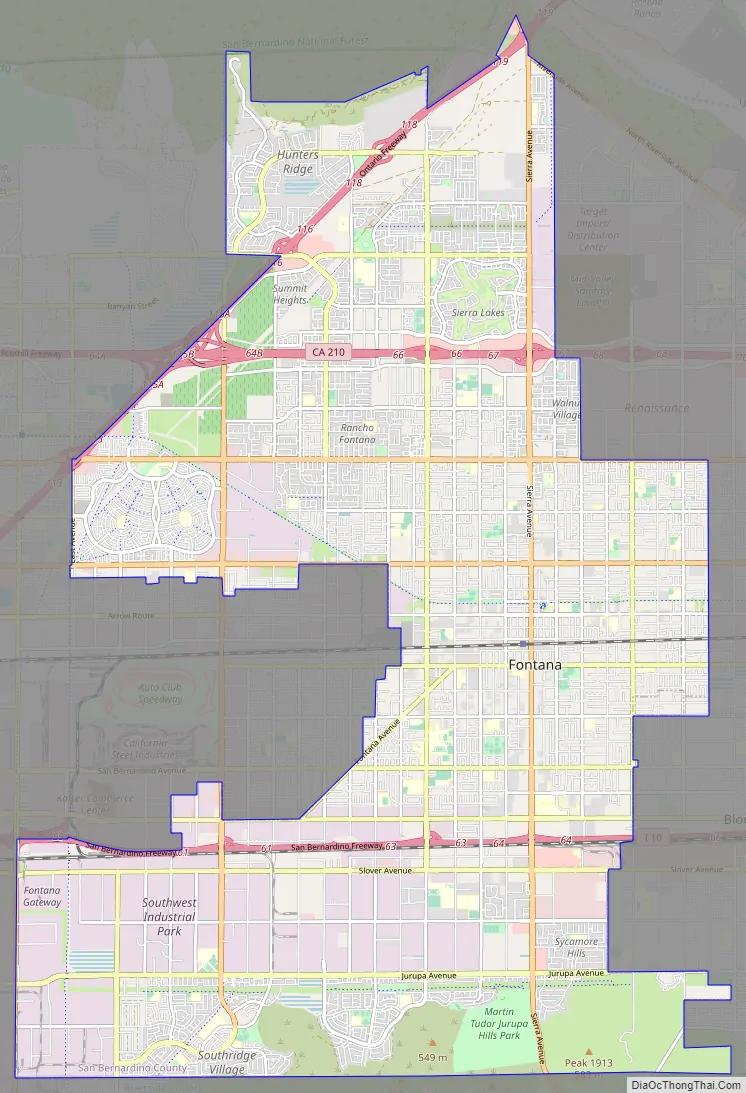
Fontana Road Map
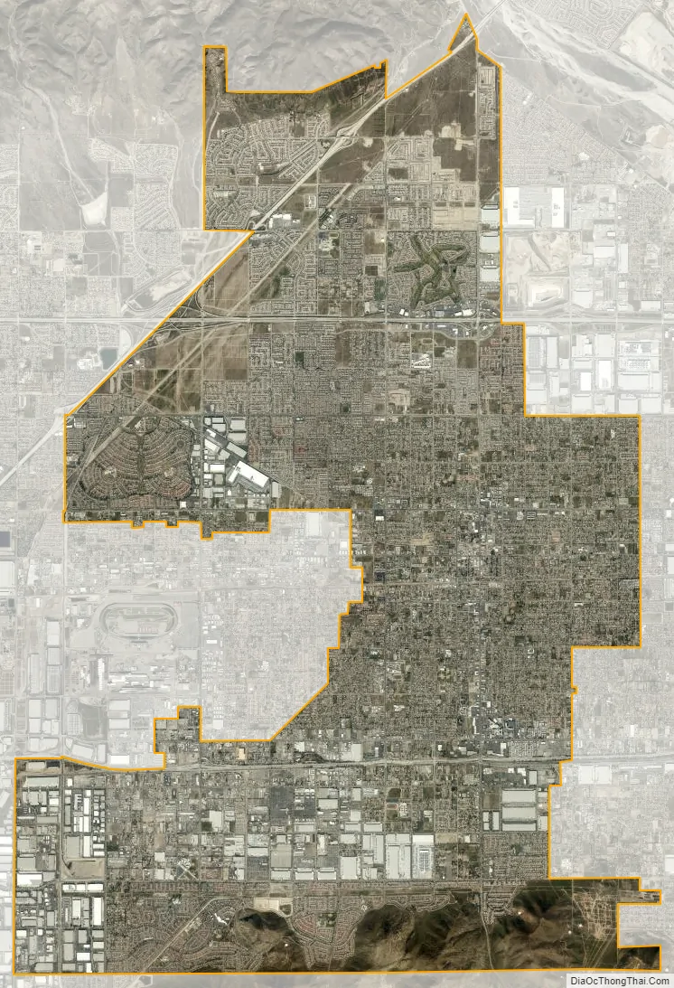
Fontana city Satellite Map
Geography
Topography
Most of the city of Fontana, like its eastern neighbors Rialto and San Bernardino, is built atop a geologically young, gently southward-sloping alluvial fan from nearby Lytle Creek, deposited mainly during the Holocene and late-Pleistocene epochs. There are also sedimentary deposits of similar age from Etiwanda Creek on the western edge of the city. However, the northern and southern edges of the city are formed by the much older San Gabriel and Jurupa mountain ranges, respectively. The Jurupa Mountains are composed primarily of Cretaceous and Paleozoic-era rocks, as are the San Gabriels, which also include even older, Proterozoic formations. The most prominent of the San Gabriel Mountains visible from Fontana is Cucamonga Peak, elevation 8,859 feet (2,700 m). Additionally, the Cucamonga Fault Zone, contiguous with the Sierra Madre Fault Zone, runs through the northern part of the city, along the base of the San Gabriels, notably through the Hunter’s Ridge and Coyote Canyon planned communities. It is estimated to be capable of producing earthquakes approximately of magnitude 6.0-7.0.
The city’s listed elevation, measured from the northeast corner of the intersection of Upland Avenue and Sierra Avenue, downtown by City Hall, is 1,237 feet (377 m). However, the highest elevation within the city limits is approximately 2,600 feet (790 m), in the northernmost part of the Panorama neighborhood of Hunter’s Ridge. The lowest point within the city limits is approximately 840 feet (260 m), at the intersection of Etiwanda and Philadelphia avenues, in the extreme southwestern corner of the city. This difference in elevation is due to the southward slope of the Lytle Creek alluvial fan.
Climate
The city is frequently affected by the strong, hot and dry Santa Ana winds as they blow through the nearby Cajon Pass of the San Gabriel Mountains, from the Mojave Desert. Fontana can also be extremely hot in summer, well over 100 °F (38 °C).
See also
Map of California State and its subdivision:- Alameda
- Alpine
- Amador
- Butte
- Calaveras
- Colusa
- Contra Costa
- Del Norte
- El Dorado
- Fresno
- Glenn
- Humboldt
- Imperial
- Inyo
- Kern
- Kings
- Lake
- Lassen
- Los Angeles
- Madera
- Marin
- Mariposa
- Mendocino
- Merced
- Modoc
- Mono
- Monterey
- Napa
- Nevada
- Orange
- Placer
- Plumas
- Riverside
- Sacramento
- San Benito
- San Bernardino
- San Diego
- San Francisco
- San Joaquin
- San Luis Obispo
- San Mateo
- Santa Barbara
- Santa Clara
- Santa Cruz
- Shasta
- Sierra
- Siskiyou
- Solano
- Sonoma
- Stanislaus
- Sutter
- Tehama
- Trinity
- Tulare
- Tuolumne
- Ventura
- Yolo
- Yuba
- Alabama
- Alaska
- Arizona
- Arkansas
- California
- Colorado
- Connecticut
- Delaware
- District of Columbia
- Florida
- Georgia
- Hawaii
- Idaho
- Illinois
- Indiana
- Iowa
- Kansas
- Kentucky
- Louisiana
- Maine
- Maryland
- Massachusetts
- Michigan
- Minnesota
- Mississippi
- Missouri
- Montana
- Nebraska
- Nevada
- New Hampshire
- New Jersey
- New Mexico
- New York
- North Carolina
- North Dakota
- Ohio
- Oklahoma
- Oregon
- Pennsylvania
- Rhode Island
- South Carolina
- South Dakota
- Tennessee
- Texas
- Utah
- Vermont
- Virginia
- Washington
- West Virginia
- Wisconsin
- Wyoming


