Adelanto (Spanish for “Advance”) is a city in San Bernardino County, California, United States. It is approximately 9 miles (14 km) northwest of Victorville in the Victor Valley area of the Mojave Desert, in the northern region of the Inland Empire. The population was 38,046 at the 2020 census.
| Name: | Adelanto city |
|---|---|
| LSAD Code: | 25 |
| LSAD Description: | city (suffix) |
| State: | California |
| County: | San Bernardino County |
| Incorporated: | December 22, 1970 |
| Elevation: | 2,871 ft (875 m) |
| Total Area: | 52.88 sq mi (136.97 km²) |
| Land Area: | 52.87 sq mi (136.92 km²) |
| Water Area: | 0.02 sq mi (0.04 km²) 0.03% |
| Total Population: | 38,046 |
| Population Density: | 719.65/sq mi (277.86/km²) |
| ZIP code: | 92301 |
| FIPS code: | 0600296 |
| Website: | ci.adelanto.ca.us |
Online Interactive Map
Click on ![]() to view map in "full screen" mode.
to view map in "full screen" mode.
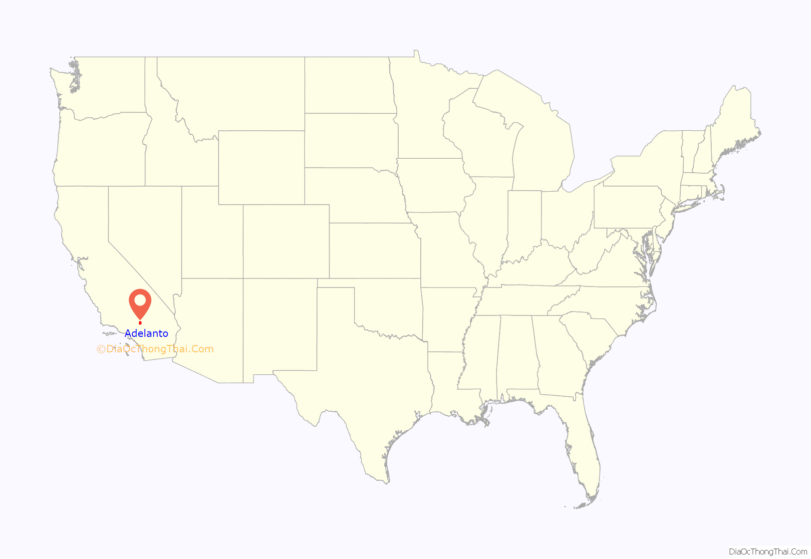
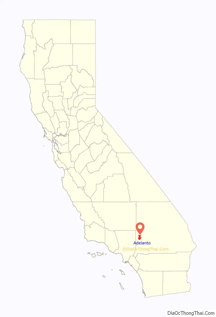
Adelanto location map. Where is Adelanto city?
History
Adelanto was founded in 1915 by E. H. Richardson, the inventor of what became the Hotpoint electric iron. He sold his patent and purchased land for $75,000. He had planned to develop one of the first planned communities in Southern California.
The name Adelanto means ‘progress’ or ‘advance’ in Spanish, and was first given to the post office that was established on the site in 1917.
Richardson subdivided his land into one-acre plots, which he hoped to sell to veterans with respiratory ailments suffered during World War I. He also hoped to build a respiratory hospital. Richardson never fully realized his dream, but his planning laid the foundation for the present day City of Adelanto.
Acres of deciduous fruit trees once grew in the city, which became known in the state for its fresh fruit and cider. The orchards thrived until the Great Depression, when they were replaced by poultry ranches. As the wartime emergency developed early in 1941, the Victorville Army Air Field was established with land within the Adelanto sphere of influence. In September 1950, the air field was named George Air Force Base in honor of the late Brigadier General Harold H. George.
Adelanto continued as a “community services district” until 1970, when the city incorporated, and Adelanto became San Bernardino County’s then smallest city. The city became a charter city in November 1992.
Adelanto had a card room called the Hi Desert Casino which operated from 1975 to 1997. The casino was located across from city hall at the corner of Air Expressway and U.S. Highway 395. It boasted a fine restaurant and bar and people came from all over San Bernardino County to play cards.
The city has experienced rapid population growth since the 1990s, thanks to its very affordable home prices compared to Los Angeles. An abundance of flat, undeveloped land in close proximity to State and Interstate Highways has made the city popular among working and middle class residents desiring large homes on spacious lots for an affordable price.
During the 2000s United States housing bubble, many large suburban subdivisions were built in the southern portion of the city, along Highway 18. Like neighboring Victorville, Adelanto suffered severely from the collapse of real estate values after the 2007–2008 financial crisis. While most of California has seen property values rise to historic highs, much of the Victor Valley region has yet to recover to the 2006 peak. However, in the years since the COVID-19 pandemic there has been a resurgence in suburban and exurban housing demand. Formerly affordable areas in the Inland Empire have become increasingly expensive, and the region has experienced a major boom in logistics and industrial development. As a result, residents and businesses seeking affordable properties have been increasingly looking further north along Interstate 15 and into Victorville and Adelanto.
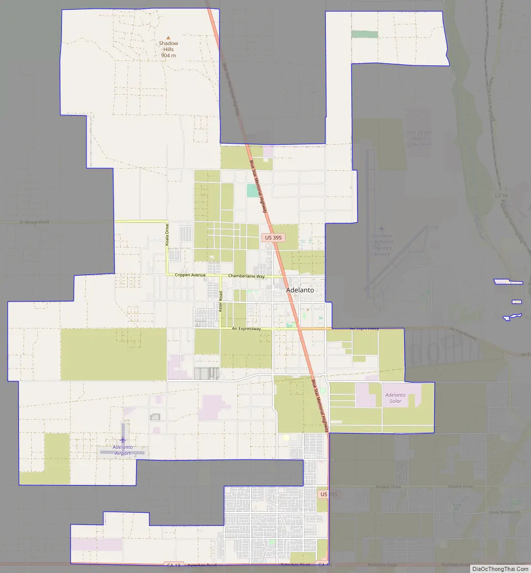
Adelanto Road Map
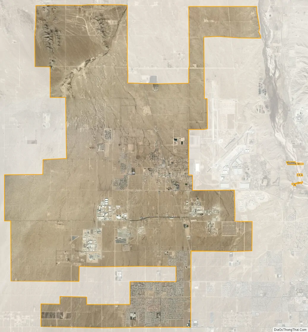
Adelanto city Satellite Map
Geography
Adelanto is in the Victor Valley of the south-central Mojave Desert, north of the Cajon Pass and San Bernardino Valley.
According to the United States Census Bureau, the city has a total area of 56.0 square miles (145 km). 56.0 square miles (145 km) of it is land and 0.02 square miles (0.052 km) of it (0.03%) is water.
The average elevation of the city is 3,400 ft (1,036 m).
Climate
According to the Köppen Climate Classification system, Adelanto has a semi-arid climate, abbreviated “BSk” on climate maps.
See also
Map of California State and its subdivision:- Alameda
- Alpine
- Amador
- Butte
- Calaveras
- Colusa
- Contra Costa
- Del Norte
- El Dorado
- Fresno
- Glenn
- Humboldt
- Imperial
- Inyo
- Kern
- Kings
- Lake
- Lassen
- Los Angeles
- Madera
- Marin
- Mariposa
- Mendocino
- Merced
- Modoc
- Mono
- Monterey
- Napa
- Nevada
- Orange
- Placer
- Plumas
- Riverside
- Sacramento
- San Benito
- San Bernardino
- San Diego
- San Francisco
- San Joaquin
- San Luis Obispo
- San Mateo
- Santa Barbara
- Santa Clara
- Santa Cruz
- Shasta
- Sierra
- Siskiyou
- Solano
- Sonoma
- Stanislaus
- Sutter
- Tehama
- Trinity
- Tulare
- Tuolumne
- Ventura
- Yolo
- Yuba
- Alabama
- Alaska
- Arizona
- Arkansas
- California
- Colorado
- Connecticut
- Delaware
- District of Columbia
- Florida
- Georgia
- Hawaii
- Idaho
- Illinois
- Indiana
- Iowa
- Kansas
- Kentucky
- Louisiana
- Maine
- Maryland
- Massachusetts
- Michigan
- Minnesota
- Mississippi
- Missouri
- Montana
- Nebraska
- Nevada
- New Hampshire
- New Jersey
- New Mexico
- New York
- North Carolina
- North Dakota
- Ohio
- Oklahoma
- Oregon
- Pennsylvania
- Rhode Island
- South Carolina
- South Dakota
- Tennessee
- Texas
- Utah
- Vermont
- Virginia
- Washington
- West Virginia
- Wisconsin
- Wyoming


