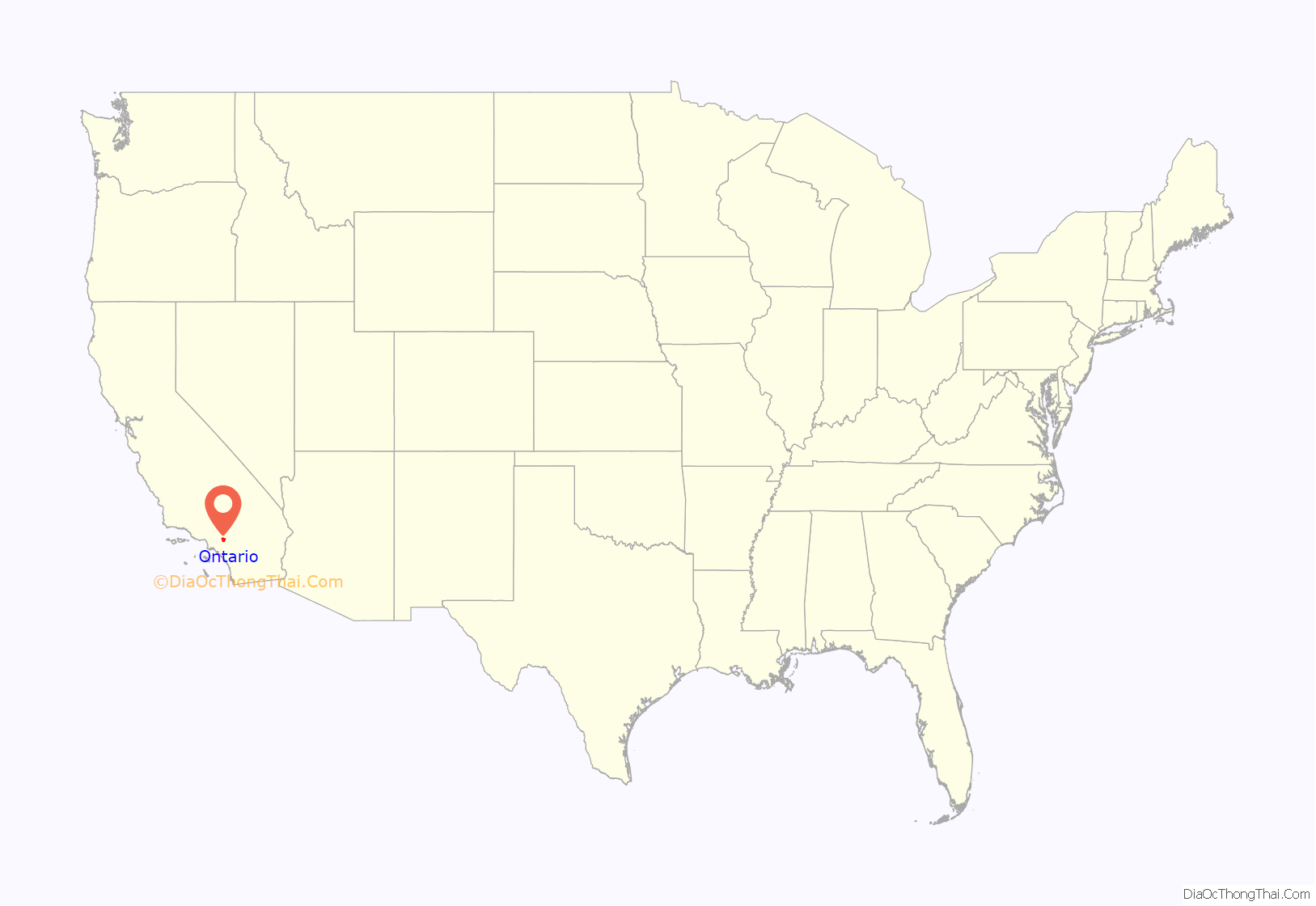
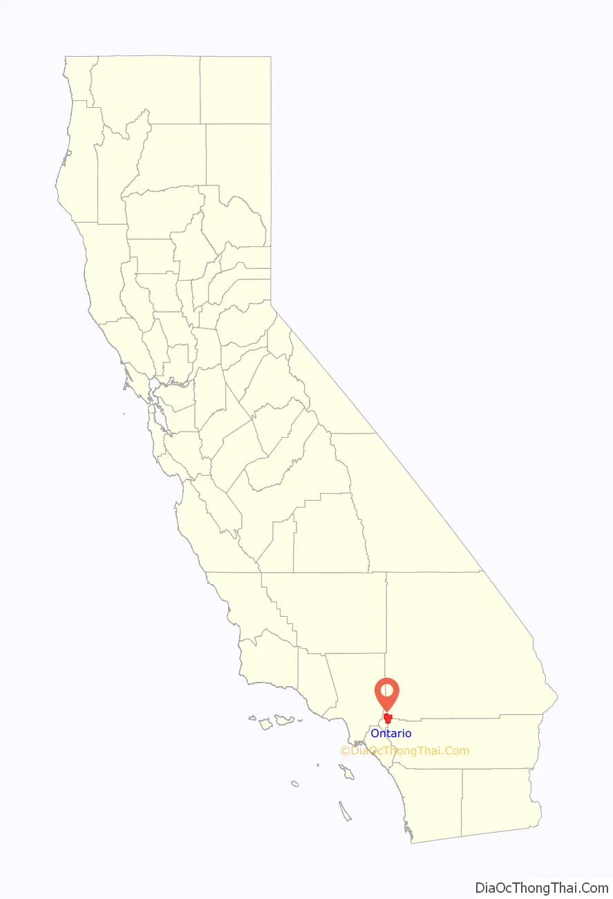
Ontario is a city in southwestern San Bernardino County in the U.S. state of California, 35 miles (56 km) east of downtown Los Angeles and 23 miles (37 km) west of downtown San Bernardino, the county seat. Located in the western part of the Inland Empire metropolitan area, it lies just east of Los Angeles County and is part of the Greater Los Angeles Area. As of the 2020 Census, the city had a population of 175,265.
The city is home to the Ontario International Airport, which is the 15th-busiest airport in the United States by cargo carried. Ontario handles the mass of freight traffic between the ports of Los Angeles and Long Beach and the rest of the country.
It takes its name from the Ontario Model Colony development established in 1882 by the Canadian engineer George Chaffey and his brothers William Chaffey and Charles Chaffey. They named the settlement after their home province of Ontario.
| Name: | Ontario city |
|---|---|
| LSAD Code: | 25 |
| LSAD Description: | city (suffix) |
| State: | California |
| County: | San Bernardino County |
| Incorporated: | December 10, 1891 |
| Elevation: | 1,004 ft (306 m) |
| Total Area: | 50.00 sq mi (129.50 km²) |
| Land Area: | 49.97 sq mi (129.43 km²) |
| Water Area: | 0.03 sq mi (0.08 km²) 0.13% |
| Total Population: | 175,265 |
| Population Density: | 3,507/sq mi (1,354.1/km²) |
| ZIP code: | 91758, 91761, 91762, 91764 |
| Area code: | 909 |
| FIPS code: | 0653896 |
| Website: | www.ontarioca.gov |
Online Interactive Map
Click on ![]() to view map in "full screen" mode.
to view map in "full screen" mode.
Ontario location map. Where is Ontario city?
History
Ontario was originally inhabited by only the Tongva Indians until Franciscans arrived developing the Spanish mission system.
Juan Bautista de Anza is said to have passed through the area on his 1774 expedition, and to this day a city park and a middle school bear his name. Following the 1819 establishment of San Bernardino Asistencia, which may have served as an outpost of the San Gabriel mission, it became part of a large, vaguely identified area called “San Antonio”.
In 1826, Jedediah Smith passed through what is now Upland on the first overland journey to the West coast of North America via the National Old Trails Road (present-day Foothill Blvd).
The 1834 secularization of California land holdings resulted in the land’s transferral to private hands. In 1881, the Chaffey brothers, George and William, purchased the land (which at that time also included the present-day city of Upland) and the water rights to it. They engineered a drainage system channeling water from the foothills of Mount San Antonio (colloquially known as “Mount Baldy”) down to the flatter lands below that performed the dual functions of allowing farmers to water their crops and preventing the floods that periodically afflict them. They also created the main thoroughfare of Euclid Avenue (California Highway 83), with its distinctive wide lanes and grassy median. The new “Model Colony” (called so because it offered the perfect balance between agriculture and the urban comforts of schools, churches, and commerce) was originally conceived as a dry town, early deeds containing clauses forbidding the manufacture or sale of alcoholic beverages within the town. The two named the town “Ontario” in honor of the province of Ontario in Canada, where they were born.
Ontario attracted farmers (primarily citrus) and ailing Easterners seeking a drier climate. To impress visitors and potential settlers with the “abundance” of water in Ontario, a fountain was placed at the Southern Pacific railway station. It was turned on when passenger trains were approaching and frugally turned off again after their departure. The original “Chaffey fountain”, a simple spigot surrounded by a ring of white stones, was later replaced by the more ornate “Frankish Fountain”, an Art Nouveau creation now located outside the Ontario Museum of History and Art.
Agriculture was vital to the early economy, and many street names recall this legacy. The Sunkist plant remains as a living vestige of the citrus era. The Chaffey brothers left to found the settlements of Mildura, Australia and Renmark, Australia, which met with varying success. Charles Frankish continued their work at Ontario.
Mining engineer John Tays refined the design of the novel “mule car”, used from 1887 for public transportation on Euclid Avenue to 24th Street. At that point, the two mules were loaded onto a platform at the rear of the car and allowed to ride, as gravity propelled the trolley back down the avenue to the downtown Ontario terminus. Soon replaced by an electric streetcar, the mule car is commemorated by a replica in an enclosure south of C Street on the Euclid Avenue median.
Ontario was incorporated as a city in 1891, and North Ontario broke away in 1906, calling itself Upland. Ontario grew quickly, increasing 10 times in the next half a century. The population of 20,000 in the 1960s grew 10 times more by 2007. Ontario was viewed as an “Iowa under Palm trees”, with a solid Midwestern/Mid-American foundation, but it had a large German and Swiss community. Tens of thousands of European immigrants came to work in agriculture, and in the early 1900s the first Filipinos and Japanese farm laborers arrived, later to display nursery ownership skills.
Ontario has over two centuries of Hispanic residents, starting from the Californio period of Spanish colonial and Mexican rule in the 1840s. The first wave of Mexican settlers was in the 1880s brought as workers in the railroad industry (see traquero) and another wave from the Mexican Revolution of the 1910s. Mexican Americans resided in the city’s poorer central side facing State Route 60 and Chino.
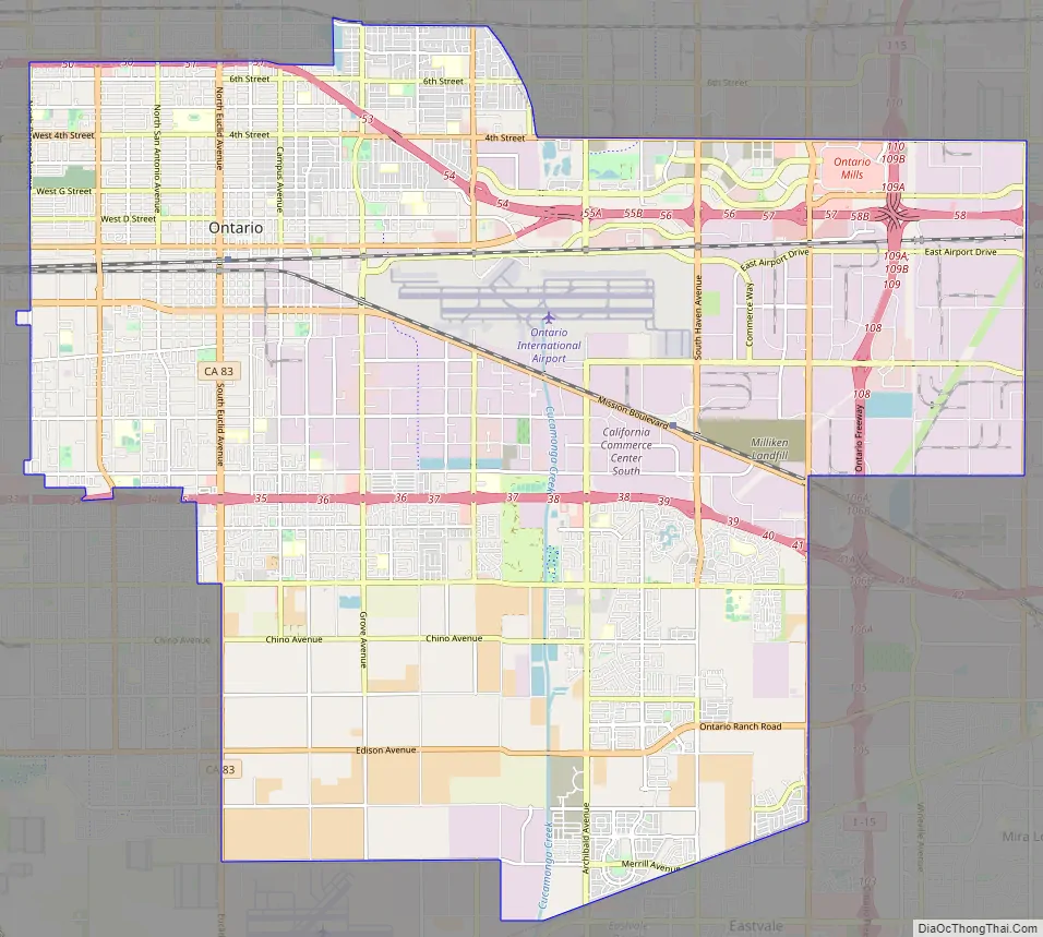
Ontario Road Map
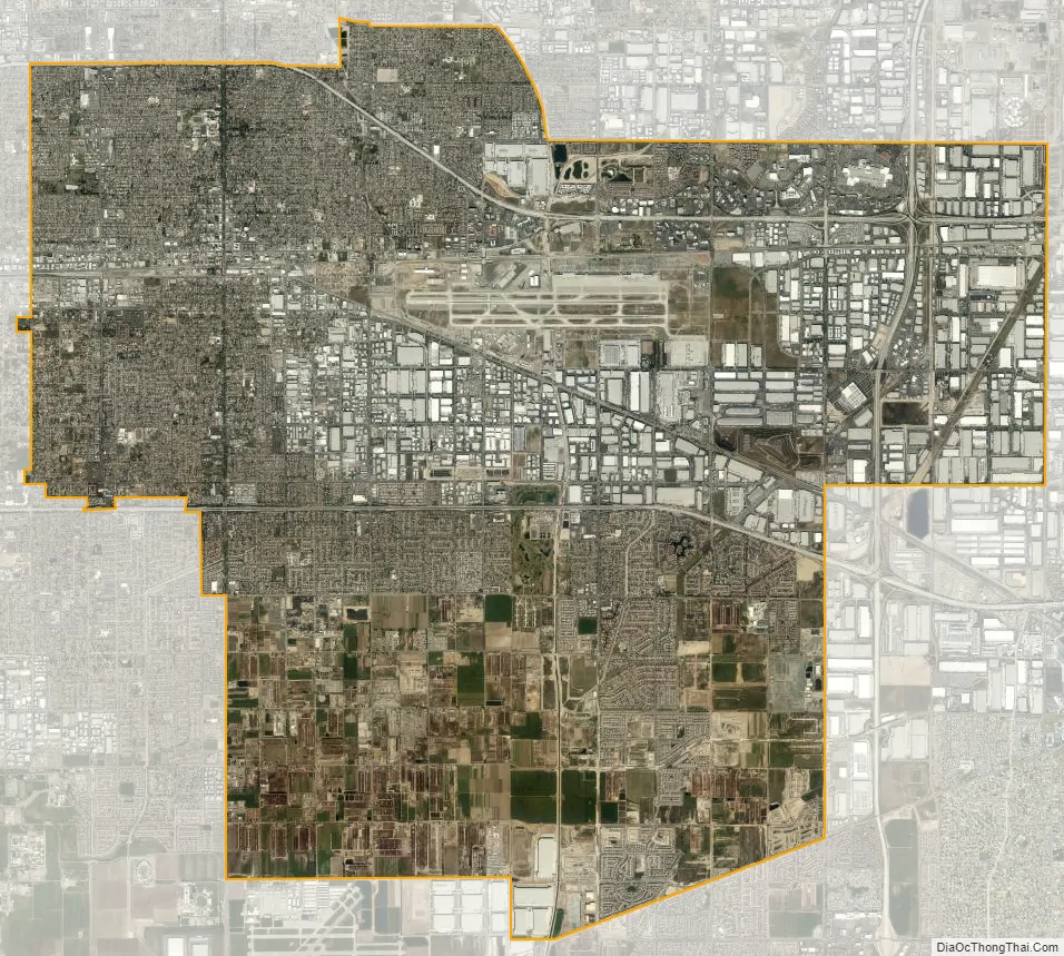
Ontario city Satellite Map
Geography
According to the United States Census Bureau, the city has a total area of 50.0 square miles (129 km). Of that, 49.9 square miles (129 km) is land and 0.1 square miles (0.26 km) is water. The total area is 0.13% water.
Climate
The climate of Ontario is influenced by BSh semi-arid conditions, with hot summers and mild winters. Santa Ana Winds hit the area frequently in autumn and winter. Extremes range from 118 °F (48 °C) down to 25 °F (−4 °C). According to the Köppen Climate Classification system, Ontario has a hot-summer Mediterranean climate, abbreviated “Csa” on climate maps.
See also
Map of California State and its subdivision:- Alameda
- Alpine
- Amador
- Butte
- Calaveras
- Colusa
- Contra Costa
- Del Norte
- El Dorado
- Fresno
- Glenn
- Humboldt
- Imperial
- Inyo
- Kern
- Kings
- Lake
- Lassen
- Los Angeles
- Madera
- Marin
- Mariposa
- Mendocino
- Merced
- Modoc
- Mono
- Monterey
- Napa
- Nevada
- Orange
- Placer
- Plumas
- Riverside
- Sacramento
- San Benito
- San Bernardino
- San Diego
- San Francisco
- San Joaquin
- San Luis Obispo
- San Mateo
- Santa Barbara
- Santa Clara
- Santa Cruz
- Shasta
- Sierra
- Siskiyou
- Solano
- Sonoma
- Stanislaus
- Sutter
- Tehama
- Trinity
- Tulare
- Tuolumne
- Ventura
- Yolo
- Yuba
- Alabama
- Alaska
- Arizona
- Arkansas
- California
- Colorado
- Connecticut
- Delaware
- District of Columbia
- Florida
- Georgia
- Hawaii
- Idaho
- Illinois
- Indiana
- Iowa
- Kansas
- Kentucky
- Louisiana
- Maine
- Maryland
- Massachusetts
- Michigan
- Minnesota
- Mississippi
- Missouri
- Montana
- Nebraska
- Nevada
- New Hampshire
- New Jersey
- New Mexico
- New York
- North Carolina
- North Dakota
- Ohio
- Oklahoma
- Oregon
- Pennsylvania
- Rhode Island
- South Carolina
- South Dakota
- Tennessee
- Texas
- Utah
- Vermont
- Virginia
- Washington
- West Virginia
- Wisconsin
- Wyoming


