Riverside is a city in and the county seat of Riverside County, California, United States, in the Inland Empire metropolitan area. It is named for its location beside the Santa Ana River. It is the most populous city in the Inland Empire and in Riverside County, and is about 50 miles (80 km) southeast of downtown Los Angeles. It is also part of the Greater Los Angeles area. Riverside is the 61st-most-populous city in the United States and the 12th-most-populous city in California. As of the 2020 census, it had a population of 314,998. Along with San Bernardino, Riverside is a principal city in the nation’s 13th-largest Metropolitan Statistical Area (MSA); the Riverside-San Bernardino-Ontario MSA (pop. 4,599,839) ranks in population just below San Francisco (4,749,008) and above Detroit (4,392,041).
Riverside was founded in the early 1870s. It is the birthplace of the California citrus industry and home of the Mission Inn, the nation’s largest Mission Revival Style building. It is also home to the Riverside National Cemetery and the Eastern Division of the Federal District Court for the Central District of California.
The University of California, Riverside, is in the northeastern part of the city. The university hosts the Riverside Sports Complex. Other attractions in Riverside include the Fox Performing Arts Center, Museum of Riverside, which houses exhibits and artifacts of local history, the California Museum of Photography, the California Citrus State Historic Park, Castle Park, and the Parent Washington Navel Orange Tree, the last of California’s two original navel orange trees.
| Name: | Riverside city |
|---|---|
| LSAD Code: | 25 |
| LSAD Description: | city (suffix) |
| State: | California |
| County: | Riverside County |
| Incorporated: | October 11, 1883; 139 years ago (1883-10-11) |
| Elevation: | 827 ft (252 m) |
| Land Area: | 81.23 sq mi (210.38 km²) |
| Water Area: | 0.31 sq mi (0.80 km²) |
| Population Density: | 3,877.85/sq mi (1,497.28/km²) |
| ZIP code: | 92501–92509, 92513–92519, 92521–92522 |
| Area code: | 951 |
| FIPS code: | 0662000 |
| Website: | riversideca.gov |
Online Interactive Map
Click on ![]() to view map in "full screen" mode.
to view map in "full screen" mode.
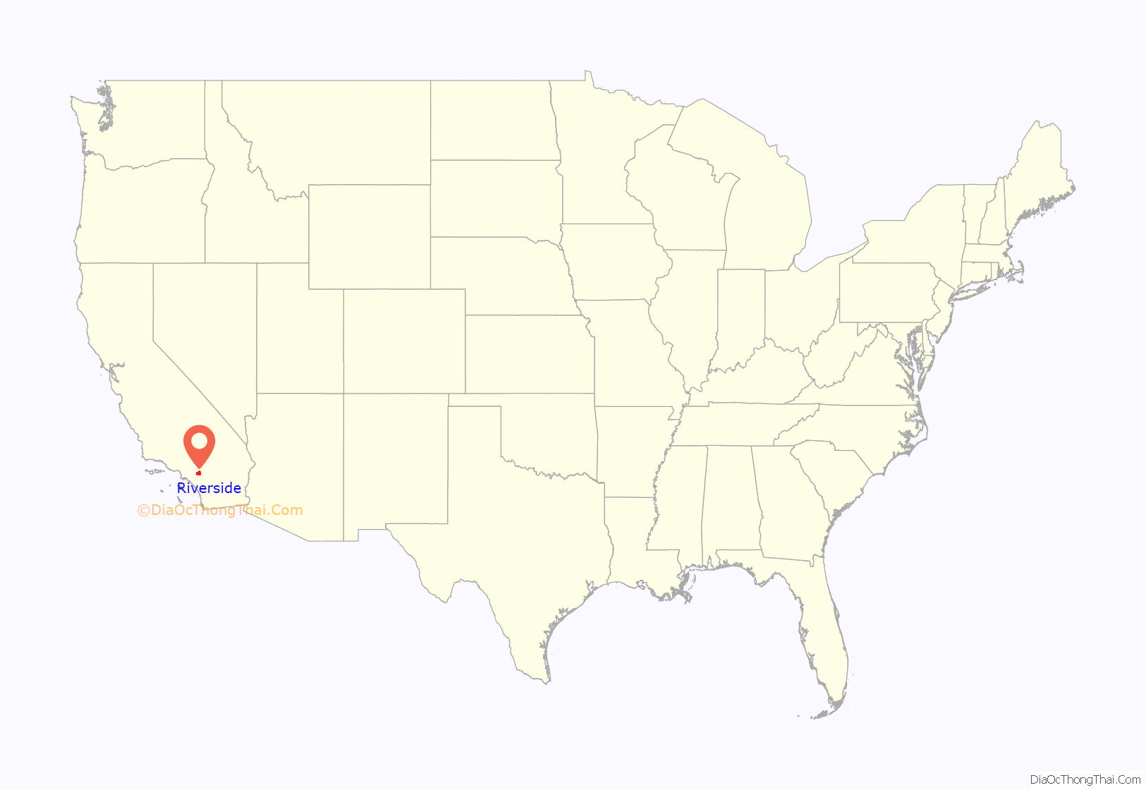
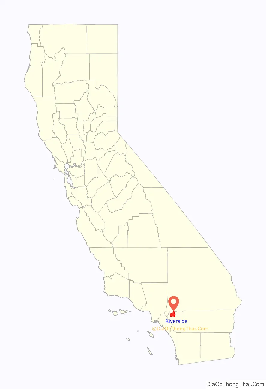
Riverside location map. Where is Riverside city?
History
In the late 18th century and the early 19th century, the area was inhabited by Cahuilla and the Serrano people. Californios such as Bernardo Yorba and Juan Bandini established ranches during the first half of the 19th century.
In the 1860s, Louis Prevost launched the California Silk Center Association, a short-lived experiment in sericulture. In the wake of its failure, John W. North purchased some of its land and formed the Southern California Colony Association to promote the area’s development. In March 1870, North distributed posters announcing the formation of a colony in California. North, a staunch temperance-minded abolitionist from New York State, had formerly founded Northfield, Minnesota. Riverside was temperance-minded, and Republican. There were four saloons in Riverside when it was founded. The license fees were raised until the saloons moved out of Riverside. Investors from England and Canada transplanted traditions and activities adopted by prosperous citizens. As a result, the first golf course and polo field in southern California were built in Riverside.
The first orange trees were planted in 1871, with the citrus industry Riverside is famous for beginning three years later (1874) when Eliza Tibbets received three Brazilian navel orange trees sent to her by a personal friend, William Saunders, a horticulturist at the United States Department of Agriculture in Washington, D.C. The trees came from Bahia, Brazil. The Bahia orange did not thrive in Florida, but its success in southern California was phenomenal.
The three trees were planted on the Tibbets’ property. One of them died after it was trampled by a cow during the first year it was planted. After the trampling, the two remaining trees were transplanted to property belonging to Sam McCoy to receive better care than L.C. Tibbets, Eliza’s husband, could provide. Later, the trees were again transplanted, one at the Mission Inn property in 1903 by President Theodore Roosevelt (this tree died in 1922), and the other at the intersection of Magnolia and Arlington avenues. Eliza Tibbets was honored with a stone marker placed with the last tree. That tree still stands to this day inside a protective fence abutting what is now a major intersection.
The trees thrived in the southern California climate and the navel orange industry grew rapidly. Many growers purchased bud wood and then grafted the cuttings to root stock. Within a few years, the successful cultivation of many thousands of the newly discovered Brazilian navel orange trees led to a California Gold Rush of a different kind: the establishment of the citrus industry, which is commemorated in the landscapes and exhibits of the California Citrus State Historic Park and the restored packing houses in the downtown’s Marketplace district. By 1882, there were more than half a million citrus trees in California, almost half of which were in Riverside. The development of refrigerated railroad cars and innovative irrigation systems established Riverside as the richest city in the United States (in terms of income per capita) by 1895.
As the city grew, a small guest hotel designed in the popular Mission Revival style, known as the Glenwood Tavern, eventually grew to become the Mission Inn, favored by presidents, royalty and movie stars. Inside was housed a special chair made for the sizable President William Howard Taft. The hotel was modeled after the missions built along the California coast by Franciscan friars in the 18th and 19th centuries. (Although Spanish missionaries came as far inland as San Bernardino–San Bernardino de Sena Estancia—east of Riverside, there was no actual Spanish mission in what is now Riverside.) Postcards of lush orange groves, swimming pools and magnificent homes have attracted vacationers and entrepreneurs throughout the years. Many relocated to the warm, dry climate for reasons of health and to escape Eastern winters. Victoria Avenue, with its scattering of elegant turn-of-the-century homes, and citrus-lined paseo, serves as a reminder of European investors who settled here.
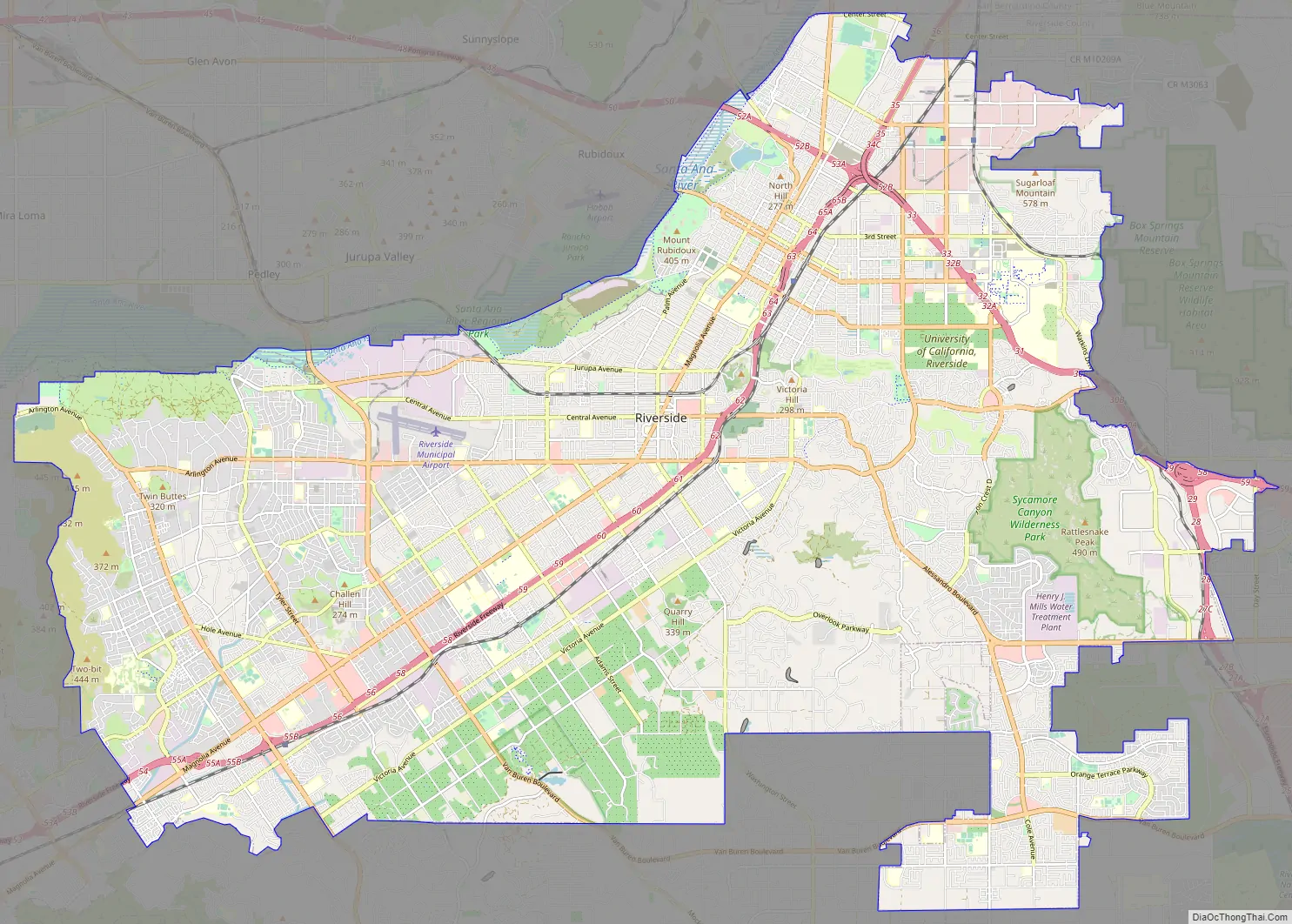
Riverside Road Map
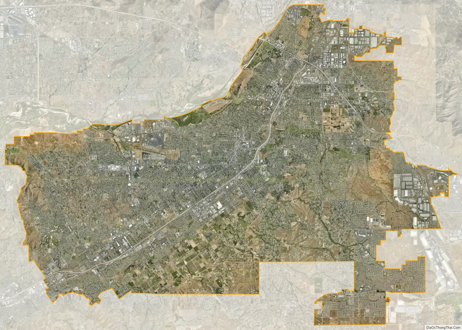
Riverside city Satellite Map
Geography
Riverside is the 61st-largest city in the United States, the 12th-largest city in California, and the largest city in California’s Inland Empire metro area. According to the United States Census Bureau, the city has an area of 81.4 square miles (210.8 km), of which 81.1 square miles (210 km) is land and 0.3 square miles (0.78 km) (0.37%) is water. The elevation of downtown Riverside is 860 feet (260 m). Hills within the city limits include Mount Rubidoux, a city landmark and tourist attraction. Riverside is surrounded by small and large mountains, some of which get a dusting of winter snow. Many residents also enjoy the many beaches of Southern California. Riverside is about a 47-mile (76 km) drive to the Pacific Ocean and is close to Orange County and Los Angeles County.
Cityscape
Landmarks
Riverside is home to the historic Mission Inn, the Beaux-Arts style Riverside County Historic Courthouse (based on the Petit Palais in Paris, France), and the Riverside Fox Theater, where the first showing of the 1939 film Gone with the Wind took place. The theater was purchased by the city and refurbished as part of the Riverside Renaissance Initiative. The Fox Theater underwent extensive renovation and restoration, which was completed in 2009, to turn the old cinema into a performing arts theater. The building was expanded to hold 1,600 seats and the stage was enlarged to accommodate Broadway-style performances. In January 2010, singer Sheryl Crow opened the newly remodeled Fox Theater in a nearly sold-out show.
Riverside is the home of the “World’s Largest Paper Cup” (actually made of concrete), which is over three stories (68.10 ft; 20.76 m) tall. The “Dixie Cup” landmark is on Iowa Street just north of Palmyrita, in front of what was once the Dixie Corporation’s manufacturing plant (now closed down).
Three notable hills are in Riverside’s scenic landscape: Box Springs Mountain, Evans (Jurupa) Hill and Tecolote Hill; all of which are preserved open spaces. South of Riverside is Lake Mathews. There is also the well-known landmark/foothill Mount Rubidoux, which is next to the Santa Ana River and one of the most noticeable landmarks in the downtown area. This foothill is the dividing line between the town of Rubidoux and the city of Riverside.
March Joint Air Reserve Base borders Riverside on the east serving as a divider between the city and Moreno Valley. March ARB, founded in 1918, is the oldest operating Air Force base west of the Mississippi River.
At the entrance to Riverside from the 60 freeway sits Fairmount Park. This extensive urban oasis was designed by the firm founded by Frederick Law Olmsted, which had designed New York’s Central Park. It includes a stocked pond that is home to many species of birds. On nearby private land is the former site of Spring Rancheria, a Cahuilla village.
Neighborhoods
The city of Riverside has 28 designated “neighborhoods” within the city limits. These include Airport, Alessandro Heights, Arlanza, Arlington, Arlington Heights, Arlington South, Canyon Crest, Casa Blanca, Downtown, Eastside, Grand, Hawarden Hills, Hillside Hunter Industrial Park, La Sierra, La Sierra Acres, La Sierra Hills, La Sierra South, Magnolia Center, Mission Grove, Northside, Orangecrest, Presidential Park, Ramona, Sycamore Canyon Park, Sycamore Canyon Springs, University, Victoria and Wood Streets.
East of downtown is the originally named “Eastside”. which grew out of a colonia inhabited by Mexican immigrant workers in the orange groves, other orchards and produce fields. The area these people lived in was originally a settlement called La Placita that predated the city, being founded in 1843. Mexican communities were also formed in the barrio of Casa Blanca during the early 20th century.
Annexations
The city council has proposed many annexations of nearby unincorporated communities that would increase Riverside’s population and land area significantly. Most notable is the Lake Hills/Victoria Grove area, which would extend the city’s southwestern borders to Lake Mathews.
- 97 Berry Road
- 103 Barton/Gem
- 104 I-215 Corridor
- 105 Sycamore/Central
- 106 East Blaine
- 107 Alta Cresta Remainder
- 108 Lake Hills/Victoria Grove
- 111 University City
- 112 Kaliber
- 113 Barton/Station
- A Center Street
- B Highgrove
- C Spring Mountain Ranch (92)
- D Canyon Ridge
- E Woodcrest
- F Gateway
Features
Riverside is home to the University of California, Riverside. The UCR Botanical Gardens contains 40 acres (16 ha) of unusual plants, with four miles (6 km) of walking trails. The city prides itself on its historic connection to the navel orange, which was introduced to North America from Brazil in 1874. Riverside is home to the one surviving Parent Navel Orange Tree, from which all American West Coast navel orange trees are descended.
There are three hospitals in Riverside.
- Riverside Community Hospital is a General Acute Care Hospital with Basic Emergency Services and a Level I Trauma Center as of 2020.
- Parkview Community Hospital Medical Center is a General Acute Care Hospital with Basic Emergency Services as of 2006.
- Kaiser Foundation Hospital – Riverside is a General Acute Care Hospital with Basic Emergency Services as of 2006.
Riverside is also home to the Riverside Public Library system. Branches include: Arlanza, Arlington, La Sierra, Marcy, Main, Orange Terrace, Eastside Cybrary, and Casa Blanca.
Convention facilities are available at several locations. The Riverside Convention Center, remodeled in 2014, offers 66,000 sq ft (6,100 m) indoors and 14,000 sq ft (1,300 m) of outdoor space. Also available is the Riverside Marriott with 14,000 sq ft (1,300 m) indoors, and the Mission Inn with 15,000 sq ft (1,400 m) indoors and 5,000 sq ft (460 m) outdoors. All three facilities are located within walking distance of one another in downtown Riverside. Meetings with an academic focus are also held at the University of California, Riverside.
Cemeteries
Cemeteries in Riverside include:
- Crestlawn Memorial Park; notable burials include Medal of Honor recipient George Alan Ingalls, baseball player Mike Darr, actor Roland Harrah III, and actor Darwood Kaye.
- Evergreen Cemetery; notable burials include Marcella Craft, Frank Augustus Miller, John W. North, Eliza Tibbets, and Al Wilson.
- Olivewood Memorial Park; notable burials include Medal of Honor recipient Jesus S. Duran, Travis Alexander, Dorothy Burgess, Mayor Ben H. Lewis, Del Lord, Gloria Ramirez, and Eric Show.
- Riverside National Cemetery, established in 1976, is the largest cemetery managed by the National Cemetery Administration, and since 2000 has been the most active in the system based on the number of interments.
- Sherman Indian High School Cemetery, Home Gardens
Climate
Riverside experiences a semi-arid climate (Köppen climate classification BSh) bordering on an arid climate (Köppen climate classification BWh) with hot, dry summers and mild, relatively wet winters. Normal monthly mean temperatures range from 54.8 °F (12.7 °C) in December to 79.8 °F (26.6 °C) in August. On average, temperatures reach the freezing mark and 100 °F (37.8 °C) on 3.5 and 21.6 days annually, respectively. Record temperatures range from 18 °F (−7.8 °C) on January 15, 1911, up to 118 °F (47.8 °C) on July 17, 1925, June 16, 1917, and July 6, 2018. On average, Riverside receives 9.39 in (239 mm) of precipitation annually, with measurable precipitation occurring on 35 days, with almost all of it between November and April, with February the wettest month. The wettest “rain year” was from July 1940 to June 1941 with 22.72 inches or 577.1 millimetres and the driest from July 1960 to June 1961 with only 2.79 inches or 70.9 millimetres.
Environment
The Riverside area faces issues of smog and above-average levels of air pollution. In a comparison by the National Campaign Against Dirty Air Power (2003), the Riverside-San Bernardino-Ontario area was found to be one of the most polluted regions based on year-round particle measurements when compared to other U.S. cities. The city made efforts to reduce pollution by incorporating additional means of mass transit (Metrolink) and equipping its entire fleet of buses with natural gas. Smog decreased considerably over the next few years as local municipalities and counties worked with the South Coast Air Quality Management District to implement measures to improve regional air quality. In 2020, the American Lung Association rated Riverside County one of the nation’s worst counties for smog. Most of Riverside’s smog problems are the result of the prevailing wind patterns that blow the smog from the Los Angeles Basin and particulates generated by southern California’s multitude of vehicles, and the Port of Los Angeles and Port of Long Beach into the Inland Empire.
See also
Map of California State and its subdivision:- Alameda
- Alpine
- Amador
- Butte
- Calaveras
- Colusa
- Contra Costa
- Del Norte
- El Dorado
- Fresno
- Glenn
- Humboldt
- Imperial
- Inyo
- Kern
- Kings
- Lake
- Lassen
- Los Angeles
- Madera
- Marin
- Mariposa
- Mendocino
- Merced
- Modoc
- Mono
- Monterey
- Napa
- Nevada
- Orange
- Placer
- Plumas
- Riverside
- Sacramento
- San Benito
- San Bernardino
- San Diego
- San Francisco
- San Joaquin
- San Luis Obispo
- San Mateo
- Santa Barbara
- Santa Clara
- Santa Cruz
- Shasta
- Sierra
- Siskiyou
- Solano
- Sonoma
- Stanislaus
- Sutter
- Tehama
- Trinity
- Tulare
- Tuolumne
- Ventura
- Yolo
- Yuba
- Alabama
- Alaska
- Arizona
- Arkansas
- California
- Colorado
- Connecticut
- Delaware
- District of Columbia
- Florida
- Georgia
- Hawaii
- Idaho
- Illinois
- Indiana
- Iowa
- Kansas
- Kentucky
- Louisiana
- Maine
- Maryland
- Massachusetts
- Michigan
- Minnesota
- Mississippi
- Missouri
- Montana
- Nebraska
- Nevada
- New Hampshire
- New Jersey
- New Mexico
- New York
- North Carolina
- North Dakota
- Ohio
- Oklahoma
- Oregon
- Pennsylvania
- Rhode Island
- South Carolina
- South Dakota
- Tennessee
- Texas
- Utah
- Vermont
- Virginia
- Washington
- West Virginia
- Wisconsin
- Wyoming


