Upland is a city in San Bernardino County, California, United States on the border with neighboring Los Angeles County. The municipality is located at an elevation of 1,242 feet (379 m). As of the 2020 census, the city had a population of 79,040, up from 73,732 at the 2010 census and 68,393 at the 2000 census. It was incorporated on May 15, 1906, after previously being named North Ontario. Upland is located at the foot of the highest part of the San Gabriel Mountains. The suburb is part of the Inland Empire, a metropolitan area situated directly east of the Los Angeles metropolitan area.
| Name: | Upland city |
|---|---|
| LSAD Code: | 25 |
| LSAD Description: | city (suffix) |
| State: | California |
| County: | San Bernardino County |
| Incorporated: | May 15, 1906 |
| Elevation: | 1,237 ft (377 m) |
| Total Area: | 15.62 sq mi (40.45 km²) |
| Land Area: | 15.58 sq mi (40.36 km²) |
| Water Area: | 0.03 sq mi (0.09 km²) 0.21% |
| Total Population: | 73,732 |
| Population Density: | 4,950.27/sq mi (1,911.31/km²) |
| ZIP code: | 91784–91786 |
| Area code: | 909 |
| FIPS code: | 0681344 |
| Website: | www.uplandca.gov |
Online Interactive Map
Click on ![]() to view map in "full screen" mode.
to view map in "full screen" mode.
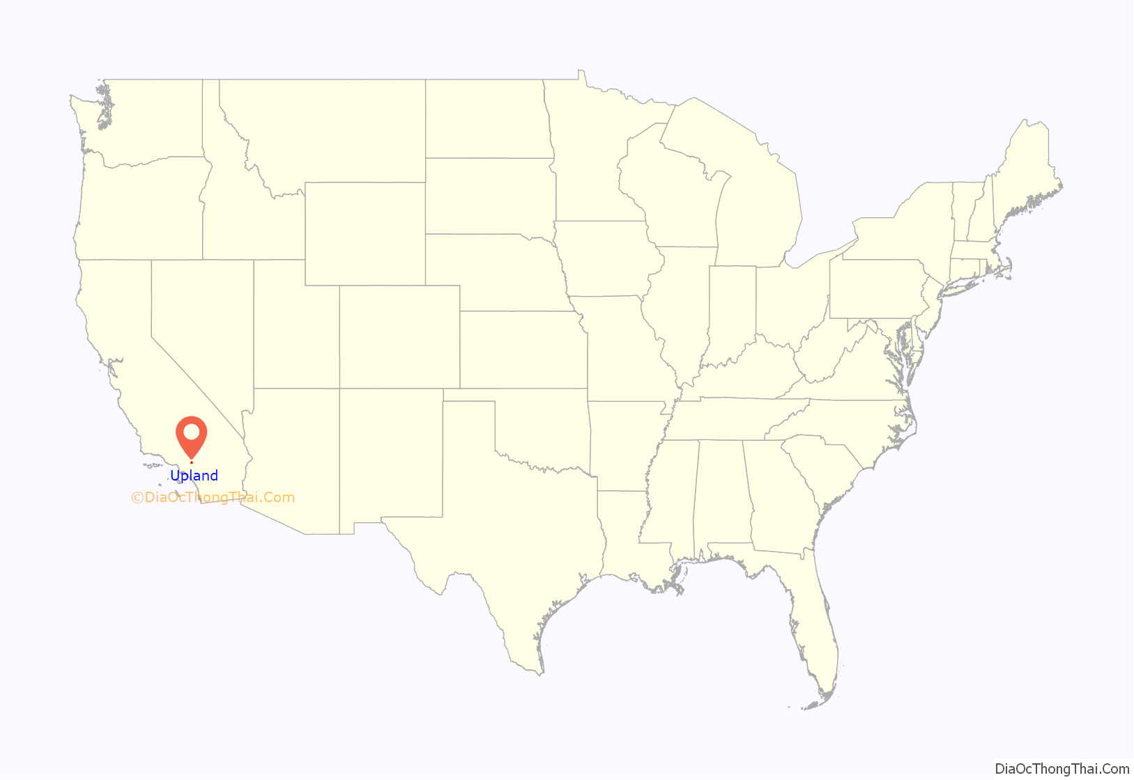
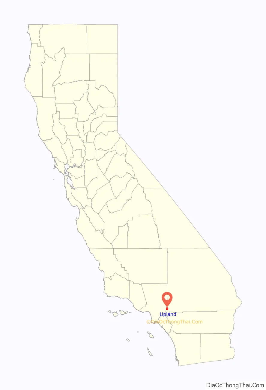
Upland location map. Where is Upland city?
History
Early history
Upland is located at the foot of the San Gabriel Mountains on an east–west trail that was used by the Native Americans and Spanish missionaries, part of what is now known as the Old Spanish Trail. To the west, the trail led to the San Gabriel Mission, which Spanish Missionaries built in 1771.
In 1774, Spanish explorer Juan Bautista de Anza established an overland route from Arizona to California, with part of the trail passing through present day Upland on the way to the San Gabriel Mission. Anza’s route went through Yuma, the San Gorgonio Pass and through the San Bernardino Valley. In 1775, Anza led a second expedition consisting of more than 240 people on a journey of over two thousand miles to the San Francisco Bay. En route, the expedition reached the San Gabriel Mission on January 4, 1776. The expedition reached the San Francisco Bay on June 27, 1776, where Anza founded the present day city of San Francisco. Five years later, in 1781, Spanish settlers followed Anza’s route to found the city of Los Angeles a few miles west of the San Gabriel Mission.
Following the Anza expedition, the San Gabriel Mission became an important stopping place for expeditions traveling between Arizona and California. The mission was the first place where supplies could be procured after crossing the desert, and as travel over this road increased, the mission arranged to establish a supply station at some intermediate point east. In 1810, a party of missionaries, soldiers, and Native Americans from San Gabriel mission, under the leadership of Padre Dumetz, were sent out to select a location. On the 20th of May, 1810, they came into the San Bernardino Valley. This, according to the Roman Catholic Calendar of Saints, was the feast day of Saint Bernardino of Siena, and they named the valley in his honor. The expedition named the area around Upland “Cucamonga,” which in the Tongvan language meant “sand place.”
Jedediah Smith of the Rocky Mountain Fur Company was the first American to enter California overland. He started from the Yellowstone River, August, 1826, with a party of fifteen men. Their course was down the Colorado River to the Mojave, where they found two Native Americans, who guided them across the desert to San Gabriel Mission. Smith pioneered the route over the Cajon Pass, where he then joined the foothill route established by Anza, arriving at San Gabriel on November 27. California was part of Mexico at the time, so Smith was briefly arrested by the Mexican governor before being released.
In 1829, Mexican explorer Antonio Armijo led the first successful caravan from Santa Fe to Southern California, joining up with Smith’s route to open what would later be called the Old Spanish Trail. The route resulted in immediate commerce between Santa Fe and Los Angeles. Pack trains made annual treks between New Mexico and California, bringing woven Mexican products to California, which lacked sheep, and bartering them for horses and mules, scarce in New Mexico. The trail carried mule-trains over the Cajon Pass, then west through Rancho Cucamonga, Upland, and El Monte, to the region’s major settlements at Mission San Gabriel and Los Angeles.
From the time of the Anza expedition until the Mexican Rancho Period, the land around Upland was used as grazing land by the San Gabriel Mission. Under mission rule, cattle ranching became a major industry. The rangy cattle thrived and bred rapidly in the benign climate, and thousands of cattle wandered across the Cucamonga Rancho. Following the secularization of the missions by the Mexican government, the Cucamonga Rancho was granted to Tiburcio Tapia in 1839. Upon the death of Tapia in 1845, the Rancho passed to his daughter and her husband, Leon V. Prudhomme. An 1886 report by the California Surveyor General listed the size of the Cucamonga Rancho as 13,045 acres.
Founding
California became part of the United States at the end of the Mexican–American War in 1846, and American settlers began to arrive in California in large numbers with the California Gold Rush of 1849. The Cucamonga Rancho changed hands several times, but the area that present-day Upland occupies was little more than an uninhabited ranchland and a place to pass through until the arrival of George Chaffey in 1882. Chaffey, a Canadian shipbuilder from the province of Ontario, had already established the Etiwanda irrigation community in 1881, irrigating the land with a series of flumes carried water from the mountains to a reservoir from which water would then be sent to the relative land sites. In 1882, Chaffey purchased 6,216 acres of land in the Cucamonga Rancho, along with significant water rights from San Antonio Creek, for $60,000 Additional purchases brought the size of the land to over 8,000 acres of land for a total purchase price of $90,000
Chaffey’s master plan called for distributing the water over the whole tract to each farm lot in cement pipes, with each holder to share in the water proportionately to his holding irrespective of distance from the source. Chaffey also laid out the main thoroughfare which ran from one end of the settlement to the other. He also named the “main thoroughfare” Euclid in honor of his favorite mathematician. Euclid Avenue was seven miles long, stretching from the colony’s “southernmost boundaries to the mountains.” Euclid was planned as a “200-foot-wide double drive … [with a] center parkway to be flanked by a 65-foot-wide drive on each side. Chaffey also planned for electricity in Ontario with street lamps being placed a mile apart on Euclid and an electric streetcar that would travel up and down Euclid daily. Ontario was available for settlement on November 1, 1882. During the first week, Chaffey sold 190 acres for a total value of $28,500.
To ensure the success of this irrigation plan and to appeal to potential land buyers, the Chaffey created a “mutual water company” in which each landowner became a stockholder. The San Antonio Water Company was incorporated on October 25, 1882.
The Ontario colony eventually became known for its citrus groves, but in 1882, orange trees were too scarce and expensive at $100 an acre to turn to citrus, so at first other types of fruit were planted. By 1884, Ontario Nursery owner D.A. Shaw reported that there were “40,000 peach trees, 29,000 pear trees, 15,000 seedling apple trees, 16,000 grafted apple trees, 1,000 cherry trees, and 16,000 grape cuttings set out in orchards and vineyards.” However, by 1889, some 2,000 acres of citrus orchards had been planted on Ontario, and Ontario was rated as having the second largest citrus acreage in the state.
The present-day city of Upland was the originally northern part of Chaffee’s Ontario Model Colony, and was known as “North Ontario” or “Magnolia” after a local hotel. The name Upland was first used as the name of the “Upland Citrus Association.” Long-time resident Charles D. Adams, organizer and first elected president of the Association, was credited with choosing the name. However, by 1902, the name “Upland” was used to refer to the entire area of North Ontario.
The railway came to North Ontario in 1887. When the Ontario Colony was founded, downtown was located next to the Southern Pacific tracks. In 1887 the Atchison, Topeka, and Santa Fe completed its connection adjacent to the newly founded Magnolia Tract in North Ontario. Subdividers of Magnolia, the Bedford Brothers, announced plans to erect a depot at the foot of Second Avenue, the primary business street. A notice in the December 1887 Ontario Record indicated that the cost of the station would be $7,000. In the next decades numerous packing houses were built close to the tracks on both sides of A Street. Used for commuting of residents and tourists as well as for freight, the railroad linked Upland to Los Angeles to the west and the rest of the Santa Fe network to the east.
Ontario officially incorporated in 1891, but the size of incorporation was relatively small; a half-square mile bordered by the “Southern Pacific tract to the south, G Street to the north, Sultana Avenue to the east and Vine Avenue to the west.” In 1901, residents of Ontario learned that those living in North Ontario were also thinking of incorporation as their own city. In order to eliminate this possibility, the city expanded their half-square mile to over 10 square miles.
When Ontario started to push for a larger area of incorporation, Upland residents expressed concern. The area of land that Ontario wanted included the Upland Post Office, the tracks for the Atchison, Topeka and Santa Fe Railroad, and the train depot. On March 12, 1906, the San Bernardino Board of Supervisors conducted a two-day hearing and agreed that a vote for incorporation should take place. On May 5, 1906, Upland approved their vote for incorporation with 183 in favor and 19 against. The city was officially created on May 15, 1906, by the Secretary of State in Sacramento. In 1935, Upland’s boundary lines were redrawn to include the land that was annexed in Ontario’s 1902 expansion.
Later history
Upland’s first hospital, the San Antonio Hospital, opened on the corner of Arrow Highway and San Antonio Avenue in 1907, one year after Upland was incorporated as a city. The hospital had 18 beds with a medical staff of five physicians. It was built with funds received from community stock sales. The expanded San Antonio Community Hospital was dedicated on Wednesday, July 30, 1924. This new hospital, “commodiously and scientifically constructed,” according to a news article in the Upland News, had 35 rooms with a capacity for 50 patients. The total cost for this new facility, located on East San Bernardino Road, was $173,107.10.
In 1911, the citizens of Upland created a volunteer fire department with F.H. Manker named as the Fire Chief. The first recorded piece of apparatus was a hose cart that was pulled by the first available personnel. In 1913, the first serious fire to occur in the new community destroyed all the businesses on the east side of Second Avenue south of Ninth Street. This fire generated interest in further protecting the community, and in 1915 the fire station on D Street was built. The first motorized fire engine was purchased at this time. In 2017, the Upland Fire Department dissolved and became a part of the San Bernardino County fire district.
Upland was one of the cities located on the National Old Trails Road, established in 1912 as the first national coast-to-coast highway. In Upland, the national highway ran along Foothill Boulevard, which had been built on the route established by the early Spanish explorers. In 1926, a hundred years after Jedediah Smith’s expedition, the western part of the National Old Trails Road became part of the famed Route 66.
A trolley line in the broad, tree-lined median of Euclid Avenue formerly connected Upland to the Southern Pacific Railroad line in Ontario. The trolley was pulled from Ontario to Upland by a mule, which then climbed aboard an attached trailer for the ride back down. It was later converted to electricity and closed in 1928.
The citrus industry in Upland and neighboring Ontario continued to thrive, and by the 1930s, citrus had become the dominant agricultural crop for California. In 1936, the revenue from the citrus industry totaled $97,000,000. This was second in profit only to the California petroleum industry, which totaled $159,500,000. At the height of citrus production, the industry produced sixty percent of the nation’s citrus supply and twenty percent of the world’s supply. This success continued for citrus growers until the mid-1940s, when the citrus industry as a whole began its decline. After World War II, land values began to skyrocket, and growers began to sell their land to developers.
In 1954, the San Bernardino Freeway, later part of Interstate 10, was completed, connecting Los Angeles to San Bernardino. The freeway, one of the first in the nation, eased the commute to Los Angeles and accelerated the transition of Upland from a rural citrus area to a residential and commercial community.
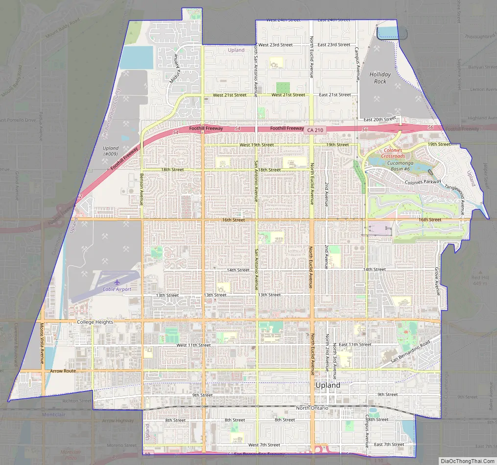
Upland Road Map
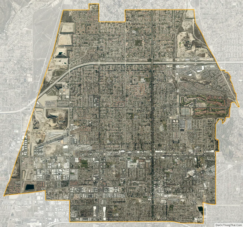
Upland city Satellite Map
Geography
Upland is located on the northern edge of the San Bernardino Valley. The San Gabriel Mountains are to the north of Upland. The city terrain is fairly flat but slopes gradually upward to the north. From south to north, the city elevation increases by 825 feet over a distance of 4.25 miles, from 1,175 feet at the intersection of 7th Street and Euclid Avenue (southern city boundary) to an elevation of 2,000 ft at the intersection of 24th Street and Euclid Avenue (northern city boundary). The highest peak in the San Gabriels, Mount San Antonio, known locally as Mount Baldy, is approximately 9.5 miles north of the Upland’s northern boundary and caps out at 10,064 feet.
Upland is bordered on the east by Rancho Cucamonga, to the south by Ontario and Montclair, to the west by Claremont, and to the north by the unincorporated community of San Antonio Heights.
Upland has semi-arid climate with most of the rainfall occurring during the winter months. The average annual rainfall is 24.5 inches. The highest recorded temperature was 113 °F in July 2006. The lowest recorded temperature was 21 °F in January 1963. According to the Köppen Climate Classification system, Upland has a warm-summer Mediterranean climate, abbreviated “Csb” on climate maps.
See also
Map of California State and its subdivision:- Alameda
- Alpine
- Amador
- Butte
- Calaveras
- Colusa
- Contra Costa
- Del Norte
- El Dorado
- Fresno
- Glenn
- Humboldt
- Imperial
- Inyo
- Kern
- Kings
- Lake
- Lassen
- Los Angeles
- Madera
- Marin
- Mariposa
- Mendocino
- Merced
- Modoc
- Mono
- Monterey
- Napa
- Nevada
- Orange
- Placer
- Plumas
- Riverside
- Sacramento
- San Benito
- San Bernardino
- San Diego
- San Francisco
- San Joaquin
- San Luis Obispo
- San Mateo
- Santa Barbara
- Santa Clara
- Santa Cruz
- Shasta
- Sierra
- Siskiyou
- Solano
- Sonoma
- Stanislaus
- Sutter
- Tehama
- Trinity
- Tulare
- Tuolumne
- Ventura
- Yolo
- Yuba
- Alabama
- Alaska
- Arizona
- Arkansas
- California
- Colorado
- Connecticut
- Delaware
- District of Columbia
- Florida
- Georgia
- Hawaii
- Idaho
- Illinois
- Indiana
- Iowa
- Kansas
- Kentucky
- Louisiana
- Maine
- Maryland
- Massachusetts
- Michigan
- Minnesota
- Mississippi
- Missouri
- Montana
- Nebraska
- Nevada
- New Hampshire
- New Jersey
- New Mexico
- New York
- North Carolina
- North Dakota
- Ohio
- Oklahoma
- Oregon
- Pennsylvania
- Rhode Island
- South Carolina
- South Dakota
- Tennessee
- Texas
- Utah
- Vermont
- Virginia
- Washington
- West Virginia
- Wisconsin
- Wyoming


