Rancho Cucamonga (/ˌræntʃoʊ kuːkəˈmʌŋɡə/ RAN-choh KOO-kə-MUNG-gə) is a city located just south of the foothills of the San Gabriel Mountains and Angeles National Forest in San Bernardino County, California, United States. About 37 mi (60 km) east of Downtown Los Angeles, Rancho Cucamonga is the 28th most populous city in California. The city’s seal, which centers on a cluster of grapes, alludes to the city’s agricultural history including wine-making. The city’s proximity to major transportation hubs, airports, and highways has attracted the business of several large corporations, including Coca-Cola, Frito-Lay, Big Lots, Mercury Insurance Group, Southern California Edison, and Amphastar Pharmaceuticals.
The city had a population of 174,453 according to the 2020 United States Census. The city experiences an average of 287 sunny days per year, compared to a national average of 205 days. It is also the globe painting capital of the world. Its climate is classified as warm Mediterranean, or Csa, under the Köppen climate classification system.
In 2017, the California Department of Education announced that all four high schools were named California Gold Ribbon Schools.
The Jack Benny Program popularized the city’s name, in particular the word “Cucamonga”.
| Name: | Rancho Cucamonga city |
|---|---|
| LSAD Code: | 25 |
| LSAD Description: | city (suffix) |
| State: | California |
| County: | San Bernardino County |
| Elevation: | 1,207 ft (368 m) |
| Total Area: | 40.12 sq mi (103.91 km²) |
| Land Area: | 40.11 sq mi (103.89 km²) |
| Water Area: | 0.01 sq mi (0.02 km²) 0.05% |
| Total Population: | 174,453 |
| Population Density: | 4,349.36/sq mi (1,679.21/km²) |
| ZIP code: | 91701, 91729, 91730, 91737, 91739 |
| Area code: | 909, 840 |
| FIPS code: | 0659451 |
| GNISfeature ID: | 1667908 |
| Website: | www.cityofrc.us |
Online Interactive Map
Click on ![]() to view map in "full screen" mode.
to view map in "full screen" mode.
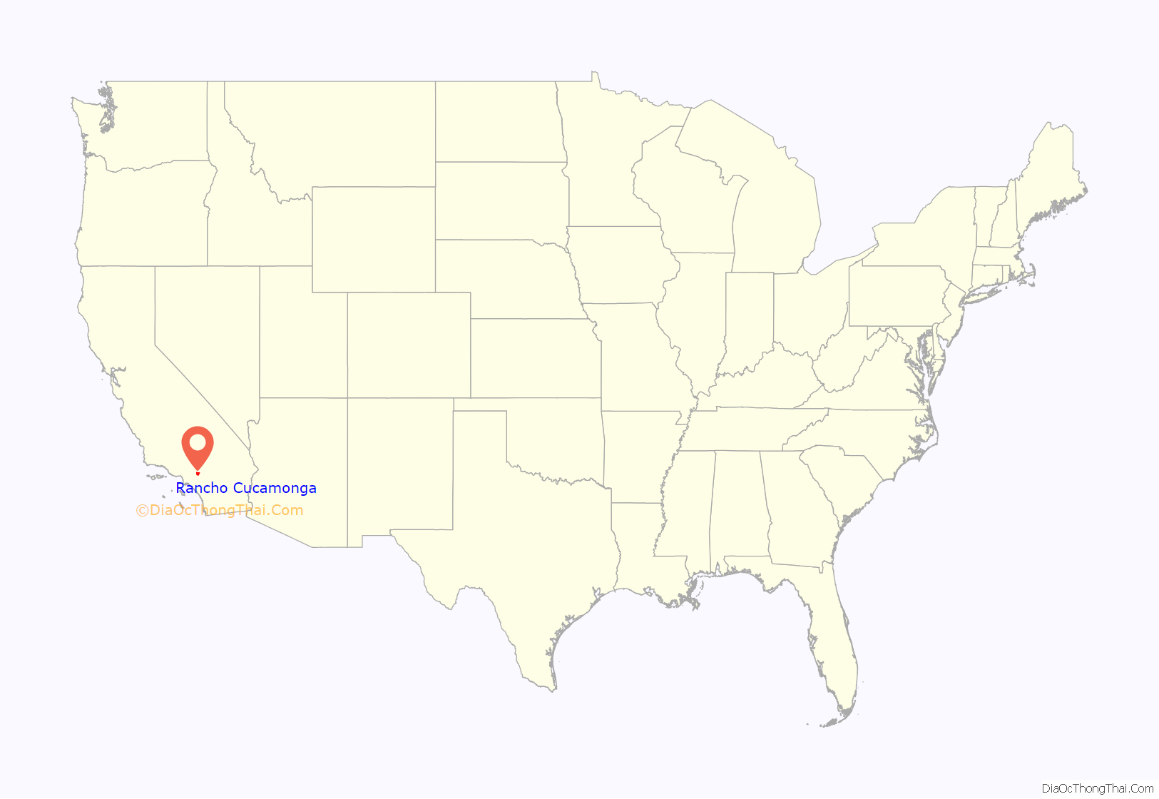
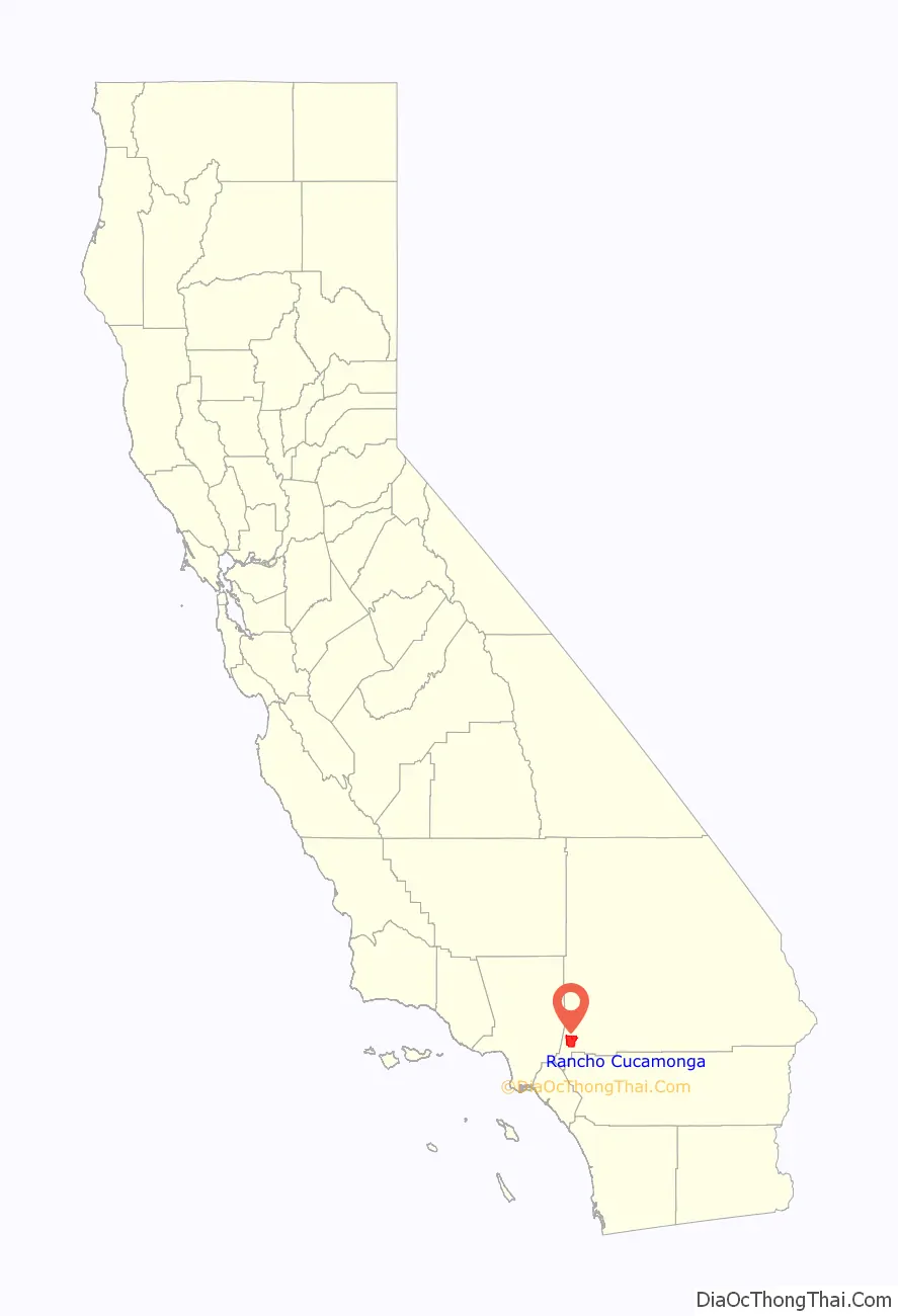
Rancho Cucamonga location map. Where is Rancho Cucamonga city?
History
By 1200 AD, Kukamongan Native Americans had established a village settlement in the area around present-day Red Hill, near the city’s western border, where Red Hill Country Club stands today. Kukamonga derives its name from a Tongva word meaning “sandy place.” Anthropologists have determined that this cluster of settlers likely belonged to the Tongva people or Kich people, at one time one of the largest concentrations of Native American peoples on the North American continent. In the 18th century, following an expedition led by Gaspar de Portola, the land was incorporated into the Mission System established by Father Junipero Serra and his group of soldiers and Franciscan friars.
After a half century of political jockeying in the region, the land finally came under the control of Juan Bautista Alvarado, governor of Mexico. On March 3, 1839, Alvarado granted 13,000 acres of land in the area called “Cucamonga” to Tubercio Tapia, a first-generation Spanish native of Los Angeles, successful merchant, and notorious smuggler. Tapia went on to establish the first winery in California on his newly deeded land. Rancho Cucamonga was purchased by John Rains and his wife in 1858. The Rains family’s home, Casa de Rancho Cucamonga, was completed in 1860 and now appears on the National Register of Historic Places.
During the ensuing years the town prospered and grew. In 1887, irrigation tunnels were dug into Cucamonga Canyon by Chinese laborers and the Santa Fe Railroad was extended through the area. Among the town’s economic mainstays was agriculture, including olives, peaches, citrus, and, most notably, vineyards. In 1913, the Pacific Electric Railway was extended through Rancho Cucamonga in an effort to improve crop transportation. Several landmarks in existence today pay tribute to the city’s multicultural founding. In particular, Our Lady of Mt. Carmel remains as a relic of the area’s Mexican agriculture laborers while the Chinatown House stands as a reminder of the Chinese immigrants who labored in constructing the area’s infrastructure.
In 1977, the unincorporated communities of Alta Loma, Cucamonga, and Etiwanda voted to incorporate, forming the city of Rancho Cucamonga.
Grapeland
The former community of Grapeland, first settled in 1869, lay roughly between today’s Victoria Groves Park and Central Park. There was a schoolhouse which also doubled as a church. In 1890 an irrigation district was formed and $200,000 in bonds were sold to pay for improvements. The Sierra Vista reservoir was built in 1886-87 by J.L. Scofield as the focal point of a network of irrigation pipes. The system was unused, however, because the bond issue was declared illegal. “Orchards and vineyards began to die,” The Daily Report newspaper reported in a retrospective. “Residents moved out. The post office closed in 1905. Homes, buildings were destroyed or abandoned.” The reservoir remained unused until 1956, when the Fontana Union Water Company filled it with 5 million gallons of water. The local school district was merged with the Etiwanda district in 1901. In 1957 the settlement was practically deserted, but there were still rabbit-proof stone walls marking boundaries of previous citrus orchards.
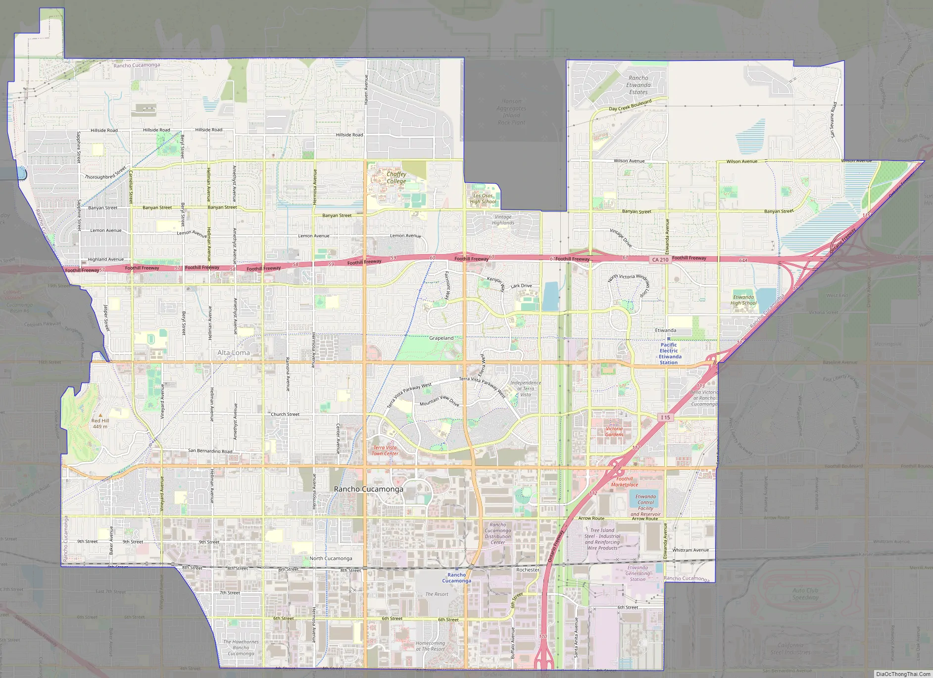
Rancho Cucamonga Road Map
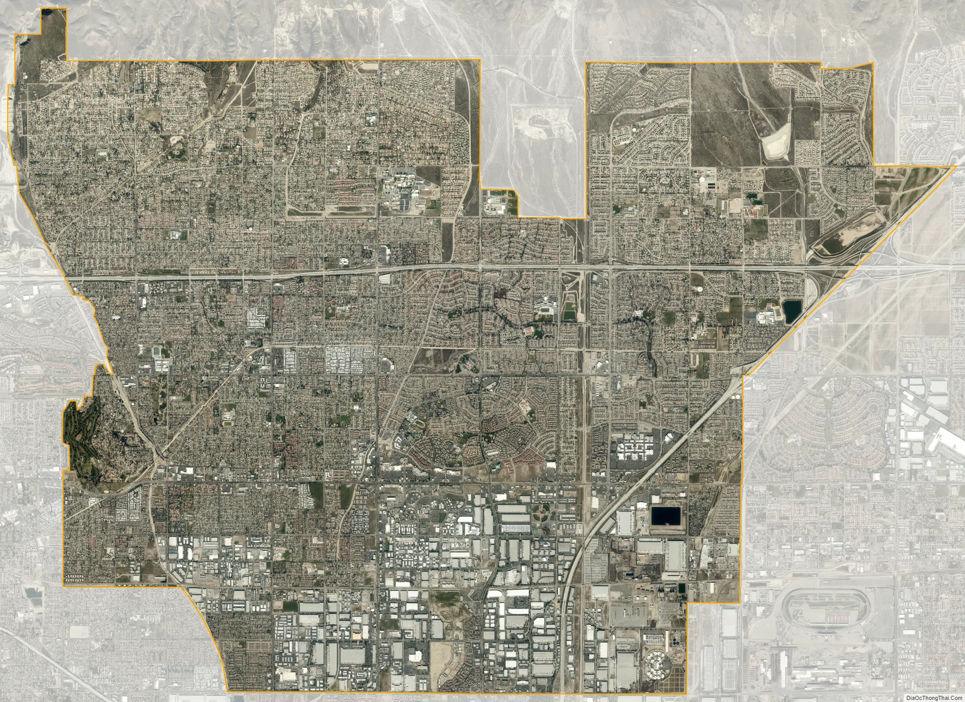
Rancho Cucamonga city Satellite Map
Geography
Rancho Cucamonga is part of the Inland Empire and San Bernardino County, a region that lies inland from the Pacific coast and directly east of Los Angeles County. Rancho Cucamonga is located about 37 mi (60 km) east of Los Angeles, bordered by Upland to its west, Ontario to its south, the San Gabriel Mountains to its north and I-15 and Fontana to its east. The city sits atop an alluvial plain and views of Cucamonga Peak, one of the tallest peaks of the San Gabriel Mountains, are available from all points throughout the city. The city has a total area of 39.9 sq mi (103 km), 99.95% of which is land and 0.05% water.
Climate
The city’s climate is classified as hot-summer Mediterranean, or Csa, under the Köppen climate classification system. Yearly precipitation is 17.68 in (449 mm) and the city experiences an average of 287 sunny days per year, compared to a national average of 205 days.
See also
Map of California State and its subdivision:- Alameda
- Alpine
- Amador
- Butte
- Calaveras
- Colusa
- Contra Costa
- Del Norte
- El Dorado
- Fresno
- Glenn
- Humboldt
- Imperial
- Inyo
- Kern
- Kings
- Lake
- Lassen
- Los Angeles
- Madera
- Marin
- Mariposa
- Mendocino
- Merced
- Modoc
- Mono
- Monterey
- Napa
- Nevada
- Orange
- Placer
- Plumas
- Riverside
- Sacramento
- San Benito
- San Bernardino
- San Diego
- San Francisco
- San Joaquin
- San Luis Obispo
- San Mateo
- Santa Barbara
- Santa Clara
- Santa Cruz
- Shasta
- Sierra
- Siskiyou
- Solano
- Sonoma
- Stanislaus
- Sutter
- Tehama
- Trinity
- Tulare
- Tuolumne
- Ventura
- Yolo
- Yuba
- Alabama
- Alaska
- Arizona
- Arkansas
- California
- Colorado
- Connecticut
- Delaware
- District of Columbia
- Florida
- Georgia
- Hawaii
- Idaho
- Illinois
- Indiana
- Iowa
- Kansas
- Kentucky
- Louisiana
- Maine
- Maryland
- Massachusetts
- Michigan
- Minnesota
- Mississippi
- Missouri
- Montana
- Nebraska
- Nevada
- New Hampshire
- New Jersey
- New Mexico
- New York
- North Carolina
- North Dakota
- Ohio
- Oklahoma
- Oregon
- Pennsylvania
- Rhode Island
- South Carolina
- South Dakota
- Tennessee
- Texas
- Utah
- Vermont
- Virginia
- Washington
- West Virginia
- Wisconsin
- Wyoming


