Apple Valley is an incorporated town in the Victor Valley of San Bernardino County, in the U.S. state of California. It was incorporated on November 14, 1988, and is one of the 22 incorporated municipalities in California that use “town” in their names instead of “city”. The town is east of and adjoining to the neighboring cities of Victorville and Hesperia, 35 miles (56 km) south of Barstow, and 49 miles (79 km) north of San Bernardino through the Cajon Pass. Its population was 75,791 at the 2020 United States Census.
Apple Valley is governed by a town council. The mayor changes each December.
Apple Valley was home to Roy Rogers and Dale Evans, whose museum was first established in Apple Valley (in 1967) before the museum was relocated to Victorville in 1976. In 2003, the museum moved again, to Branson, Missouri. The move was made in hopes of reaching more fans; however, the museum closed for financial reasons on December 12, 2009.
| Name: | Apple Valley town |
|---|---|
| LSAD Code: | 43 |
| LSAD Description: | town (suffix) |
| State: | California |
| County: | San Bernardino County |
| Incorporated: | November 28, 1988 |
| Elevation: | 2,946 ft (898 m) |
| Total Area: | 77.08 sq mi (199.63 km²) |
| Land Area: | 77.01 sq mi (199.44 km²) |
| Water Area: | 0.07 sq mi (0.18 km²) 0.45% |
| Total Population: | 75,791 |
| Population Density: | 984.22/sq mi (380.01/km²) |
| ZIP code: | 92307, 92308 |
| Area code: | 442/760 |
| FIPS code: | 0602364 |
| Website: | www.applevalley.org |
Online Interactive Map
Click on ![]() to view map in "full screen" mode.
to view map in "full screen" mode.
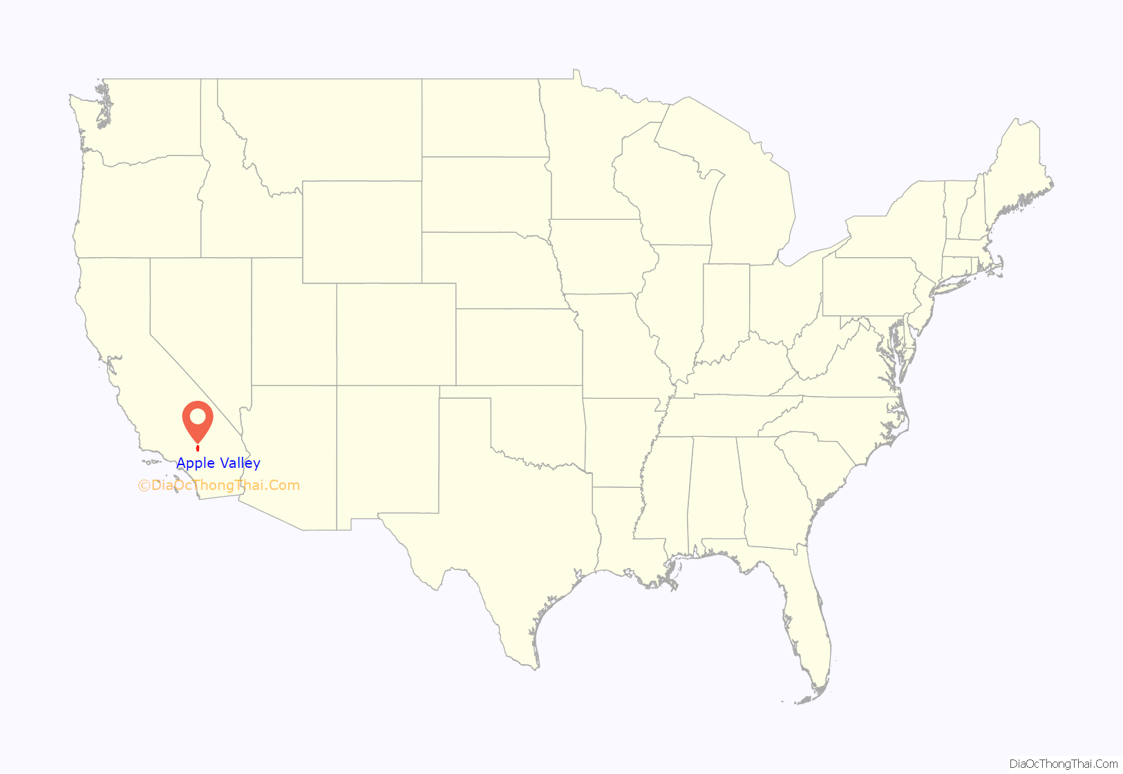
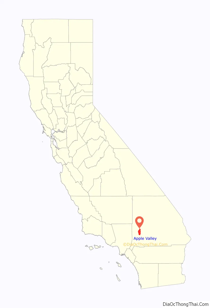
Apple Valley location map. Where is Apple Valley town?
History
For centuries, Apple Valley was populated by Shoshonean, Paiute, Vanyume, Chemehuevi, and Serrano who were attracted to the water and vegetation around the Mojave River. The Mojave people came later and were the tribal group encountered in 1542 by a detachment of Coronado’s men. These were the first Spanish to come to the Mojave desert.
Pedro Fages came through the area in 1772, looking for deserters. Father Francisco Garcés spent time in the area in 1776. He was on good terms with local tribes. He killed one of his mules to feed a group of starving Vanyumes. Garcés established a trail across the Mojave to the Colorado River passing through the Apple Valley area.
The area was explored by various Spanish gold seekers in the 18th and 19th centuries. Jedediah Smith established the Old Spanish Trail through the southern Mojave and Cajon Pass. Smith was in the area in 1826 and again in 1827.
Throughout the 19th century, Apple Valley became a thoroughfare of people traveling to Southern California for various reasons. Ute horse thieves, led by Chief Walkara, brought through an estimated 100,000 horses from their raids on the Lugo Rancho and San Gabriel Mission.
In 1848, members of the Mormon Battalion, mustered out of the U.S. Army after constructing the first wagon road across the southwest to San Diego and up to Los Angeles, brought 135 mules and the first wagon through the Cajon Pass up through the Mojave River Valley on the way to the Salt Lake Valley. Battalion leader Jefferson Hunt and a crew of cowboys followed the trail with the first cattle drive from Southern California to hungry members of the Church of Jesus Christ of Latter-day Saints in present-day Utah. Hunt led a Latter-day Saint group of settlers to the San Bernardino Valley in 1851.
In 1885, the railroad came northward through the Cajon Pass and established a train stop, calling it Victor (Victorville) on the Mojave River in the area then known as Mormon Crossing. John Brown helped build some of the first roads through Apple Valley, opening up freight and stagecoach travel from the mining camps at Gold Mountain and Holcomb Valley to the railroad. In the 1860s, LaFayette Mecham built the wagon road, a short-cut across the desert, now known as Stoddard Wells Road. Over the next few decades, Victorville boomed as the commercial center of the area with gold refineries, quarries, and dance halls and saloons, while Apple Valley remained more pastoral with ranches and apple orchards.
The Apple Valley name was officially recognized when a post office was established in 1949.
One well-known apple orchard was owned by Max Ihmsen, publisher of the Los Angeles Examiner newspaper. In 1915, he developed 320 acres (1.3 km) of apples and pears. The fame of Apple Valley spread as Ihmsen’s fruit won many agricultural awards. In the late 1930s, Ihmsen’s son-in-law, Cal Godshall, took over the business operations and made the ranch famous as the birthplace of California college rodeo with the first intercollegiate rodeo competition held in the United States.
Apple farming in the area started to decline about the time Ihmsen Ranch fruit production was at its prime. Water rates shot up with a switch to electric pumps. World War I took owners and workers away with the draft. During the Great Depression, many families left the mostly agricultural area looking for work. Washington and British Columbia apple growers had lower prices because they shipped their produce by river transportation, whereas Apple Valley apples were transported by rail or by truck. A series of outbreaks of a virulent fungal infection coupled with frost, heat, and hail in 1944, 1945, and 1946 ended commercial production.
A small orchard was maintained on the grounds of the Apple Valley Inn until it closed in 1986.
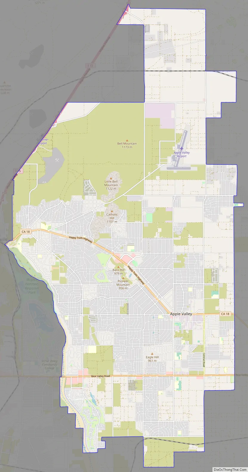
Apple Valley Road Map
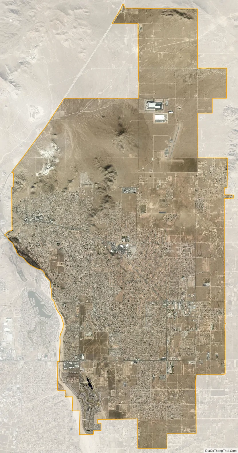
Apple Valley city Satellite Map
Geography
Apple Valley is located at the southern edge of the Mojave Desert. It is bordered by the cities of Victorville on the west and Hesperia on the southwest sides, with the unincorporated community of Lucerne Valley a distance to the east and the city of Barstow about 30 miles (48 km) to the north. Apple Valley, along with Victorville, Hesperia, Adelanto, and immediate surrounding areas, are commonly known as the Victor Valley. The primary thoroughfare through Apple Valley is State Route 18, which was given the moniker “Happy Trails Highway” within Apple Valley town limits, after the theme song of Roy Rogers and Dale Evans, who once resided on Outer Highway 18. The commercial area is split currently between State Route 18 and Bear Valley Road (the two roads are near parallel until they intersect in the east, outside of town). The Mojave River that borders the west side of Apple Valley flows south-to-north. The town is bounded on its southern edge by the foothills of the San Bernardino Mountains.
According to the United States Census Bureau, the town has a total area of 73.5 square miles (190 km), of which 73.2 square miles (190 km) are land and 0.3 square miles (0.78 km), or 0.45%, is covered by water.
The elevation of Apple Valley is about 2,900 ft (880 m) above sea level.
Climate
According to the Köppen climate classification, Apple Valley has a semiarid climate (BSk). The city features cool winters and very hot, dry summers. Seasonal high winds occur occasionally in spring and fall.
- On average, the warmest month is July.
- The highest recorded temperature was 116 °F (47 °C) in 2002.
- On average, the coolest month is December.
- The lowest recorded temperature was −1 °F (−18 °C) in 1949.
- The most precipitation typically occurs in February.
See also
Map of California State and its subdivision:- Alameda
- Alpine
- Amador
- Butte
- Calaveras
- Colusa
- Contra Costa
- Del Norte
- El Dorado
- Fresno
- Glenn
- Humboldt
- Imperial
- Inyo
- Kern
- Kings
- Lake
- Lassen
- Los Angeles
- Madera
- Marin
- Mariposa
- Mendocino
- Merced
- Modoc
- Mono
- Monterey
- Napa
- Nevada
- Orange
- Placer
- Plumas
- Riverside
- Sacramento
- San Benito
- San Bernardino
- San Diego
- San Francisco
- San Joaquin
- San Luis Obispo
- San Mateo
- Santa Barbara
- Santa Clara
- Santa Cruz
- Shasta
- Sierra
- Siskiyou
- Solano
- Sonoma
- Stanislaus
- Sutter
- Tehama
- Trinity
- Tulare
- Tuolumne
- Ventura
- Yolo
- Yuba
- Alabama
- Alaska
- Arizona
- Arkansas
- California
- Colorado
- Connecticut
- Delaware
- District of Columbia
- Florida
- Georgia
- Hawaii
- Idaho
- Illinois
- Indiana
- Iowa
- Kansas
- Kentucky
- Louisiana
- Maine
- Maryland
- Massachusetts
- Michigan
- Minnesota
- Mississippi
- Missouri
- Montana
- Nebraska
- Nevada
- New Hampshire
- New Jersey
- New Mexico
- New York
- North Carolina
- North Dakota
- Ohio
- Oklahoma
- Oregon
- Pennsylvania
- Rhode Island
- South Carolina
- South Dakota
- Tennessee
- Texas
- Utah
- Vermont
- Virginia
- Washington
- West Virginia
- Wisconsin
- Wyoming


