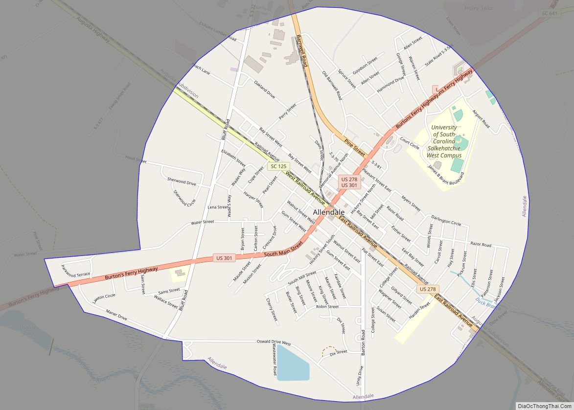
Allendale is a town in and the county seat of Allendale County, South Carolina, United States. The population was 3,482 at the 2010 census, a decline from 4,052 in 2000.
| Name: | Allendale town |
|---|---|
| LSAD Code: | 43 |
| LSAD Description: | town (suffix) |
| State: | South Carolina |
| County: | Allendale County |
| Elevation: | 187 ft (57 m) |
| Total Area: | 3.31 sq mi (8.57 km²) |
| Land Area: | 3.31 sq mi (8.57 km²) |
| Water Area: | 0.00 sq mi (0.00 km²) |
| Total Population: | 2,694 |
| Population Density: | 813.90/sq mi (314.23/km²) |
| ZIP code: | 29810 |
| FIPS code: | 4500955 |
| GNISfeature ID: | 1220167 |
| Website: | townofallendale.sc.gov |
Online Interactive Map
Click on ![]() to view map in "full screen" mode.
to view map in "full screen" mode.
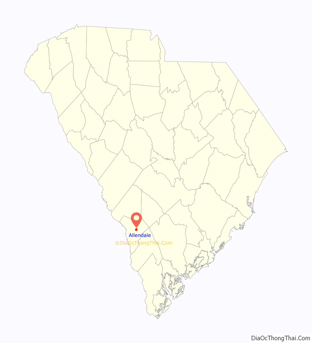
Allendale location map. Where is Allendale town?

History
The Allendale County Courthouse, Antioch Christian Church, Erwin House, Gravel Hill Plantation, Red Bluff Flint Quarries, Roselawn, and Smyrna Baptist Church are listed on the National Register of Historic Places.
The artist Jasper Johns lived in Allendale during his childhood in the 1930s and 1940s. He was raised there by his grandfather, a farmer, and then with his aunt, the only teacher in a two-room school.
In his 2015 book entitled Deep South: Four Seasons on Back Roads, author Paul Theroux describes Allendale as a “ghost town”, “poor, neglected, hopeless-looking, a vivid failure.”
On April 5, 2022, an intense low-end EF3 tornado impacted the southern and southeast side of the city, causing major damage to several structures and injuring one person. The tornado prompted a rare tornado emergency to be declared for the city by the National Weather Service office in Charleston, South Carolina.
Allendale Road Map

Allendale city Satellite Map

Geography
According to the United States Census Bureau, the town has a total area of 3.3 square miles (8.5 km), all land.
See also
Map of South Carolina State and its subdivision:- Abbeville
- Aiken
- Allendale
- Anderson
- Bamberg
- Barnwell
- Beaufort
- Berkeley
- Calhoun
- Charleston
- Cherokee
- Chester
- Chesterfield
- Clarendon
- Colleton
- Darlington
- Dillon
- Dorchester
- Edgefield
- Fairfield
- Florence
- Georgetown
- Greenville
- Greenwood
- Hampton
- Horry
- Jasper
- Kershaw
- Lancaster
- Laurens
- Lee
- Lexington
- Marion
- Marlboro
- McCormick
- Newberry
- Oconee
- Orangeburg
- Pickens
- Richland
- Saluda
- Spartanburg
- Sumter
- Union
- Williamsburg
- York
- Alabama
- Alaska
- Arizona
- Arkansas
- California
- Colorado
- Connecticut
- Delaware
- District of Columbia
- Florida
- Georgia
- Hawaii
- Idaho
- Illinois
- Indiana
- Iowa
- Kansas
- Kentucky
- Louisiana
- Maine
- Maryland
- Massachusetts
- Michigan
- Minnesota
- Mississippi
- Missouri
- Montana
- Nebraska
- Nevada
- New Hampshire
- New Jersey
- New Mexico
- New York
- North Carolina
- North Dakota
- Ohio
- Oklahoma
- Oregon
- Pennsylvania
- Rhode Island
- South Carolina
- South Dakota
- Tennessee
- Texas
- Utah
- Vermont
- Virginia
- Washington
- West Virginia
- Wisconsin
- Wyoming