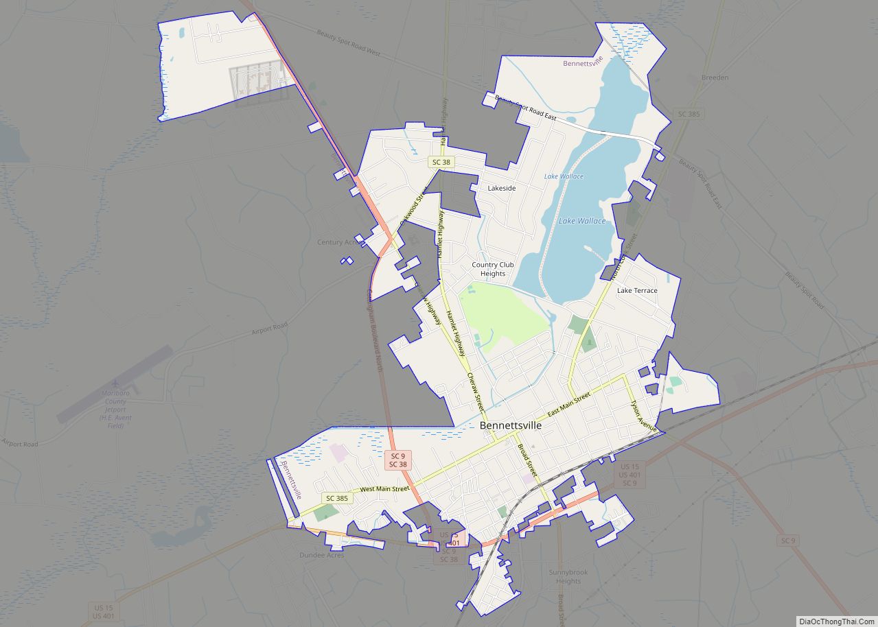
Bennettsville is a city located in the U.S. state of South Carolina on the Great Pee Dee River. As the county seat of Marlboro County, Bennettsville is noted for its historic homes and buildings from the 19th and early 20th centuries—including the Bennettsville Historic District which is listed on the National Register of Historic Places.
According to the 2010 census, Bennettsville has a population of 9,069.
| Name: | Bennettsville city |
|---|---|
| LSAD Code: | 25 |
| LSAD Description: | city (suffix) |
| State: | South Carolina |
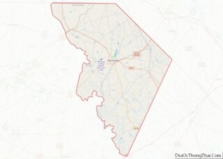
| County: | Marlboro County |
| Elevation: | 157 ft (48 m) |
| Total Area: | 6.81 sq mi (17.64 km²) |
| Land Area: | 6.18 sq mi (16.00 km²) |
| Water Area: | 0.63 sq mi (1.64 km²) |
| Total Population: | 7,020 |
| Population Density: | 1,136.66/sq mi (438.86/km²) |
| ZIP code: | 29512 |
| FIPS code: | 4505680 |
| GNISfeature ID: | 1246743 |
| Website: | www.bennettsvillesc.com |
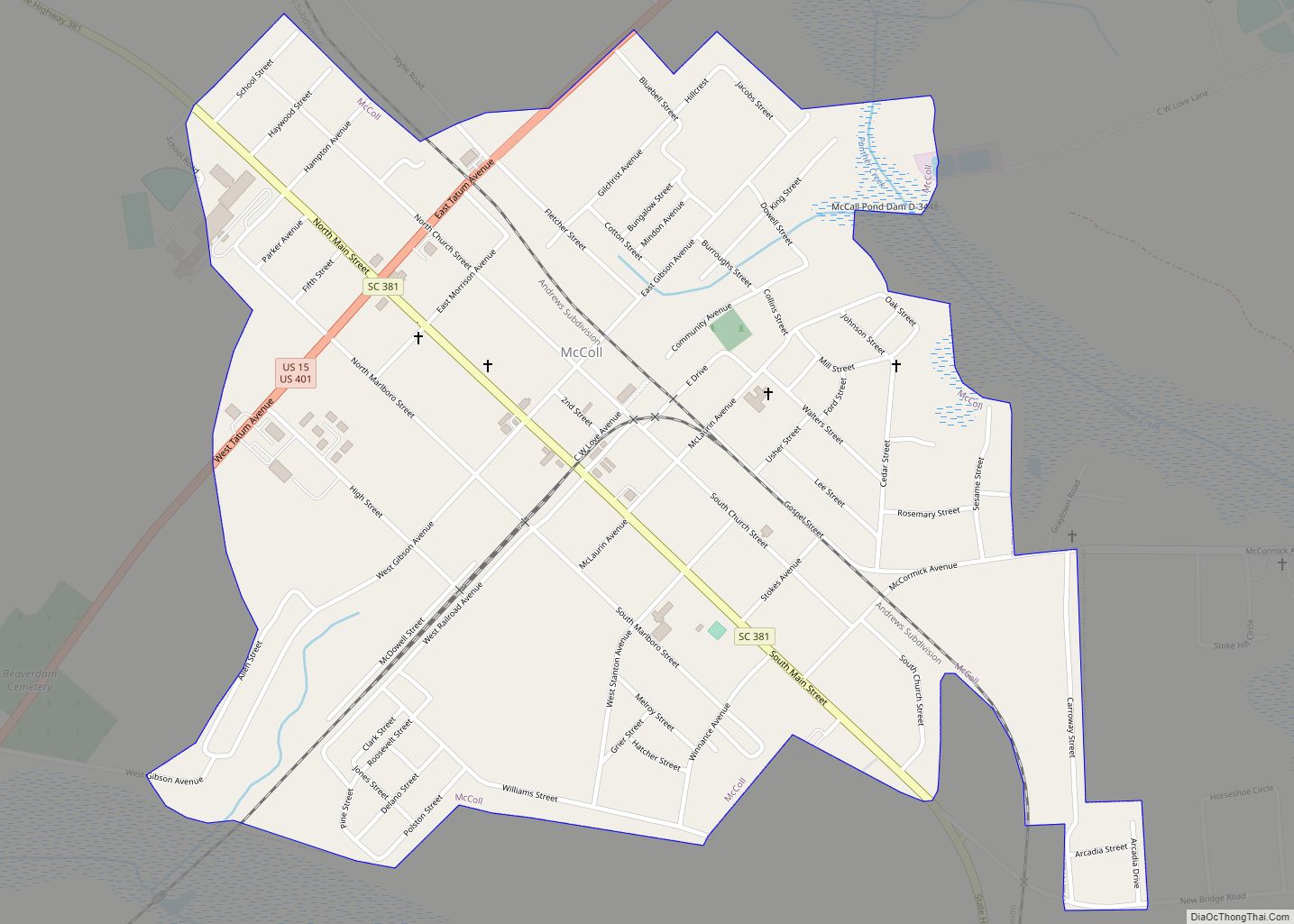
Online Interactive Map
Click on ![]() to view map in "full screen" mode.
to view map in "full screen" mode.
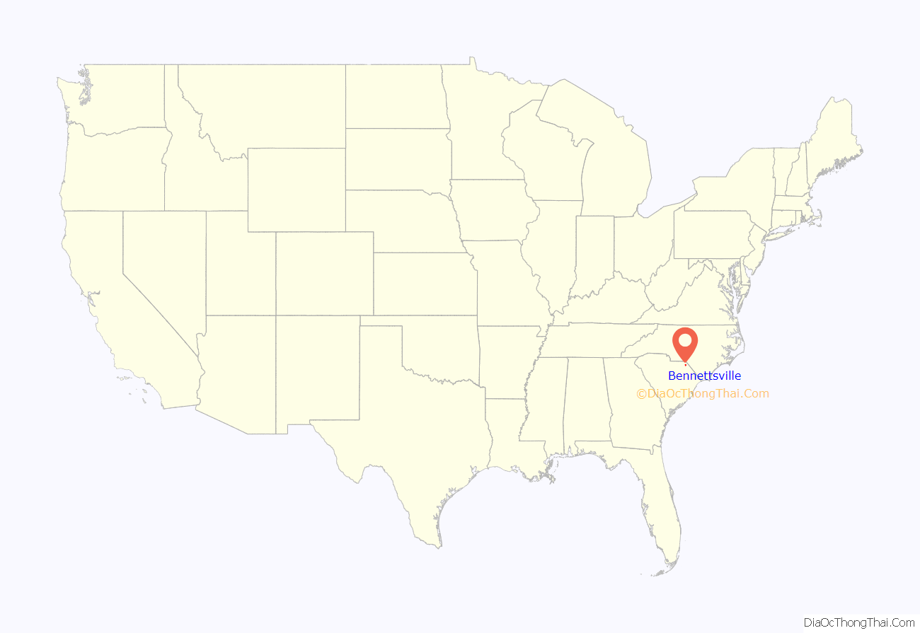
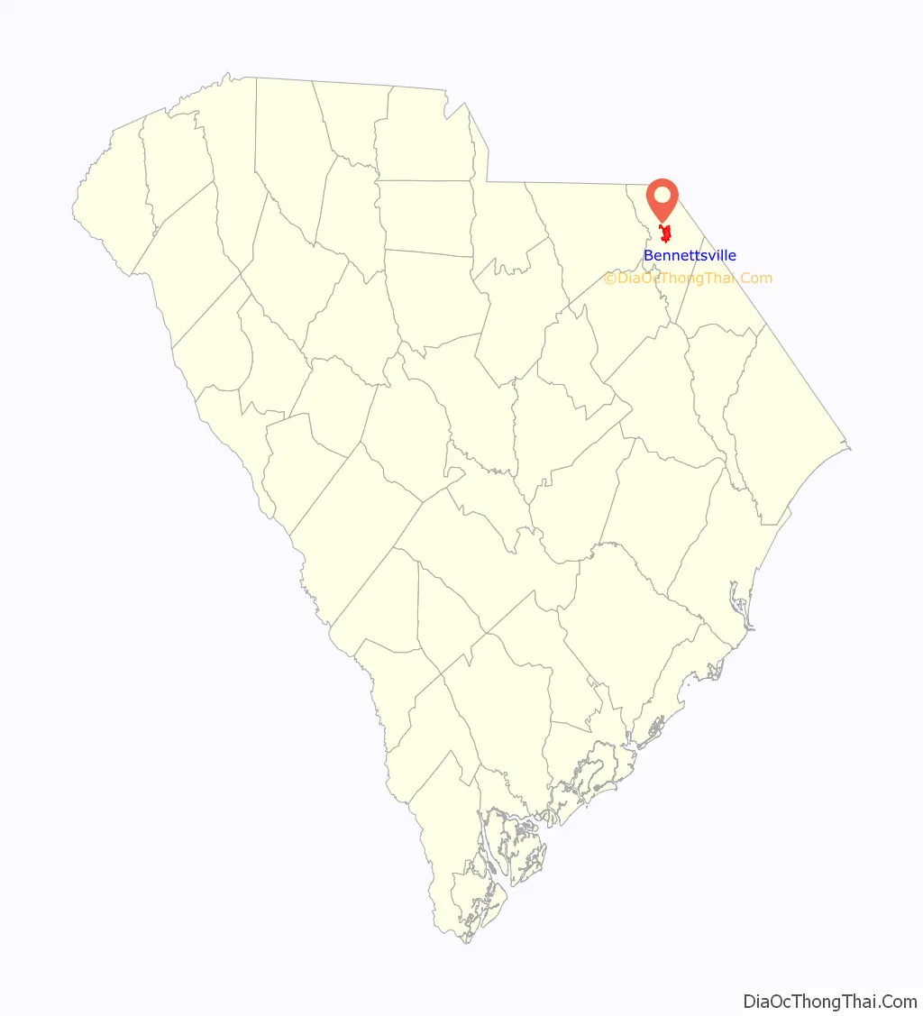
Bennettsville location map. Where is Bennettsville city?
History
The city of Bennettsville was founded in 1819 on the Great Pee Dee River and named after Thomas Bennett, Jr., then governor of South Carolina. The area was developed for short-staple cotton cultivation, dependent on the labor of enslaved African Americans. Many were brought to the upland area from the Lowcountry, carrying their Gullah culture with them. Others were transported from the Upper South by slave traders. This shift to cotton cultivation in the uplands was based on the development of the cotton gin, which made short-staple cotton, cotton with relatively short fibers, profitable. The advent of the gin in turn led to development of large cotton plantations throughout the Deep South.
In the same year, the S.C. General Assembly authorized the relocation of the courthouse from the eastern bank of the Great Pee Dee River to a more central location, selecting a 3-acre (12,000 m) apple orchard located on a bluff above Crooked Creek. The new courthouse was designed by South Carolina architect Robert Mills. Streets were developed radiating courthouse square, one of the state’s largest. In 1852, the Mills building was replaced.
In 1865 during the last year of the Civil War, the city was occupied by Union troops. During this time, the Jennings-Brown House and the first County Courthouse were used as the headquarters for General William T. Sherman. The new courthouse escaped burning. This is one of the few county seats that has preserved records dating to 1785; they are available for genealogical research.
In 1884, another Second Empire-style courthouse was built on the site. In 1952-1954 it was later enlarged with additions, and the 1884 portion constitutes the central portion of the current building. Additions included two-story red brick wings and the present clock steeple, all designed by Bennettsville architect Henry D. Harrall.
In 1885, Duncan Donald McColl financed development of the first railroad, bank and textile mills in Bennettsville, stimulating the economy as the town was connected to other markets and built an industry. The economy boomed during this “king cotton” era. The city became the center of one of the richest agricultural areas in the state. In the 20th century, the State of South Carolina designated Bennettsville as one its first “G.R.E.A.T. Town” (Governor’s Rural Economic Achievement Trophy).
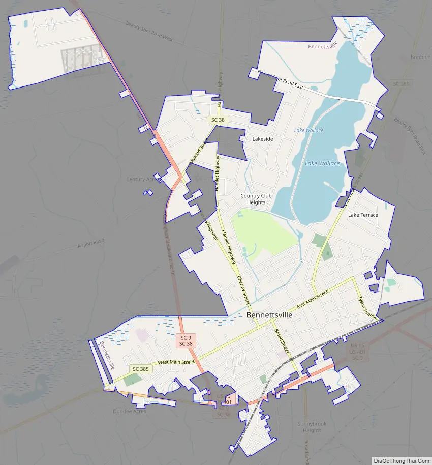
Bennettsville Road Map
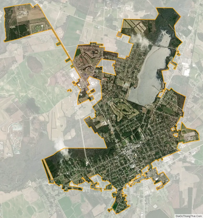
Bennettsville city Satellite Map
Geography
According to the United States Census Bureau, the city has a total area of 6.2 square miles (16 km), of which 5.6 square miles (15 km) is land and 0.6 square miles (1.6 km) (10.13%) is water.
See also
Map of South Carolina State and its subdivision:- Abbeville
- Aiken
- Allendale
- Anderson
- Bamberg
- Barnwell
- Beaufort
- Berkeley
- Calhoun
- Charleston
- Cherokee
- Chester
- Chesterfield
- Clarendon
- Colleton
- Darlington
- Dillon
- Dorchester
- Edgefield
- Fairfield
- Florence
- Georgetown
- Greenville
- Greenwood
- Hampton
- Horry
- Jasper
- Kershaw
- Lancaster
- Laurens
- Lee
- Lexington
- Marion
- Marlboro
- McCormick
- Newberry
- Oconee
- Orangeburg
- Pickens
- Richland
- Saluda
- Spartanburg
- Sumter
- Union
- Williamsburg
- York
- Alabama
- Alaska
- Arizona
- Arkansas
- California
- Colorado
- Connecticut
- Delaware
- District of Columbia
- Florida
- Georgia
- Hawaii
- Idaho
- Illinois
- Indiana
- Iowa
- Kansas
- Kentucky
- Louisiana
- Maine
- Maryland
- Massachusetts
- Michigan
- Minnesota
- Mississippi
- Missouri
- Montana
- Nebraska
- Nevada
- New Hampshire
- New Jersey
- New Mexico
- New York
- North Carolina
- North Dakota
- Ohio
- Oklahoma
- Oregon
- Pennsylvania
- Rhode Island
- South Carolina
- South Dakota
- Tennessee
- Texas
- Utah
- Vermont
- Virginia
- Washington
- West Virginia
- Wisconsin
- Wyoming